Tuesday, July 30, 2019

Sweetwater Mountains Area

One of the 40 rock rings I saw at peak 7826. How many did I miss?
Dry BM and the 50 foot rock circle.

The high lake near Dry BM in the Wovoka Wilderness as viewed from Bald Mtn.
Indian rock ring at Dry BM

Nugent Cabin
Big ruins at Silverado Canyon

The miners at the Kentuck Mine had a mountain paradise.


  • Highway 338 runs along the east side of the range. Large RVs can use pullouts at Sweetwater Summit at mp 9.8. and an airstrip is on the west side. Small rigs can camp at mp 16 and mp 19 has a large pullout. A casino at the state line on US 395 has gas, and Walker and Bridgeport also have gas but more than a dollar higher. A Family Dollar is on highway 208 about 3 miles east of US 395. The Sweetwater Mtns have light grazing but I didn't see any sign of cattle in the vast country on the east side of 338. Posted 2019.


  • ⦁ DESERT CREEK RD departs highway 338 at mp 25.8. I didn't ride it but I know it has fords. It meets the 2wd Riuse Rd. Posted 2019.
    ⦁ LOBDELL BENCHMARK el 8220 has a decent high clearance road to the top. Take highway 338 to mp 21.4 and turn on FR 42192. It's mtn bikeable for anyone who can handle nearly 3000 gain in 7 and a half miles. I saw no reg. OHVs can run south on trails that follow the high country to Nye Canyon. Posted 2019.
    ⦁ DESERT CREEK PEAK el 8958 has an old coot route up the easy canyon from O'banion Spring. Take highway 338 to mp 19.3 and turn on easy but narrow 4wd and go 2 and a half miles to a shady camp area at the end el 6700. Take a hand saw to trim branches. The road is mtn bikeable. A thicket blocks the canyon, so use the right bank to skirt around it for a fifth mile then it clears up. A game trail goes along the left bank at N38 36525, W119 17556 el 7000 then merges back to the creekbed. It's remarkably easy to keep going west up canyon to a fork el 7800. Stay right in the creekbed to 36526, 18880 el 8350 then go right thru a passage at 36555, 18979 el 8550 then on to a passage at 36580, 19014 el 8600 that leads shortly to the saddle el 8650 which is a third mile south of the summit. Weave less than a tenth mile to 36657, 19065 el 8750 then it's clear walking left of center for the last quarter mile to the summit. I ascended using the tedious north rim and descended the canyon, but the canyon is way better. Going up and down the canyon would be less than a 4 hour hike with 2300 gain, never steep. Light brush is not an issue with long pants. Hiking from the highway would add 2 hours. Posted 2019.
    ⦁ BALD MOUNTAIN, PINE GROVE HILLS HIGH POINT, WILEY BM  -  Take highway 338 to mp 13.6 and turn at the sign for Nye Canyon. Drive east on the floor for 3.9 miles to FR 42031 at a sign for Sand Canyon. Go left for a mile and a half to where it tops out then go left for .8 mile along shady camps and park el 7550. Walk north on an OHV trail for 300 feet then take an easy angle up to a plateau at N38 35822, W119 10352 el 7750. An Indian rock ring is at 35758, 10443 el 7800. Another is 100 feet to the west. The Wiley BM el 7908 is 600 feet to the south, no sign of hikers. The best ring I saw is at 35814, 10583 el 7750. It took me 25 minutes to get to the BM with nearly 400 gain. I went up on peak 8128 to the east and found more rings. One is on the way up at 36134, 09150 then one is on top at 36439, 08877. A possible one is at 36398, 08435 and another for sure is at 36261, 08190. I saw a lot of flat rocks standing on edge.That's a pristine plateau and I didn't cover a quarter of it. Return to Nye Canyon and go up a third mile to FR 42193 and follow that up Dead Ox Canyon and it tops out on a nice plateau then it's obvious how to drive within a third mile of the Pine Grove Hills HP, which is at 38202,  05794 el 8648. No reg, but there was one of a different sort on Rockland BM less than a mile to the north. That made me think there is a 4wd road up Rockland Canyon that's still passable. The roads running north to Lobdell BM are now OHV trails.  Return to Nye Canyon and take the other fork and it goes all the way up to el 9000+ next to Bald Mtn. One of the first eroded hills has a road bypassing on the right. At el 7800 is the end of easy 4wd. Only rock crawling jeeps and OHVs go beyond there for the remaining 3 and a half miles. It smooths out for the last 2 miles. The summit is at 32068, 06923 el 9544. 4wds no wider than jeeps still easily make these roads, but some are hard on paint. Posted 2019.
    ⦁ BALD MOUNTAIN WEST RIDGE - this is an easy route for hikers who prefer a natural setting. And there are darn few of us. Turn off highway 338 at Sweetwater Summit and go east on FR861 to the last fork at N38 31421, W119 10942 el 7050. If signs are down just stay left at forks to get there. Stay left at that fork for 2/3 mile to el 7200+ where the topo shows the road ends. It's easy 4wd to there with shady camps but OHVs can go another third mile on rocks to the end in a canyon on the SW side of peak 7511. I walked up canyon and found a rock ring on the right bank at 31905, 09960 el 7500. I went on up canyon until brush became a nuisance then went up the north slope at 31752, 09221 el 7950. I stayed on the high ground to 31832, 07362 el 9400 where I could see the summit a half mile away. On the return I wandered the flat at the rock ring and found several more, the best being at 31749, 10137 on the south side of peak 7511. It took 2 and a half hours to get to the summit with 2300 gain, mostly easy. I could do this in shorts but a few places are borderline. No sign of modern man except a few ancient cans. Mtn bikes could would work on these roads. Posted 2020.
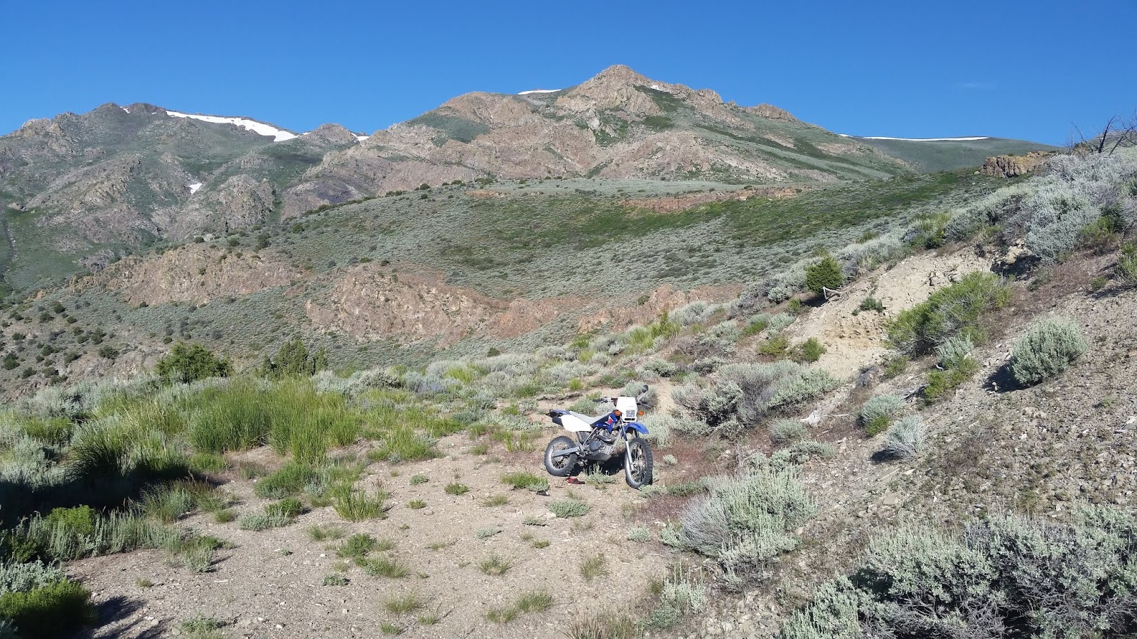
    ⦁ PEAK 7826 is at the south end of Bald Mtn. It was an Indian hotspot. I counted 40 rock rings around it. I went in on the jeep road from Long Doctor Spring and walked up the easy canyon on the north side and on to the north saddle el 7650. I saw two rings there then went up to the NW slope and saw a bunch there. Two rings are tucked in a rugged area on the south side at N38 2920, W119 09580 el 7700. More are on the south ridge with a good one at 28995, 09375. Another good one is at 28749, 09312 and another 400 feet past that. Near the end of the ridge is one at 28463, 09259 and one 200 feet SE of that. Two more good ones are at 28383, 0925 and then I turned back north and cut over to the next ridge west. I saw several along the way but the only good one is at 28867, 09555. I retraced back to the north saddle el 7650 then dropped NW to the saddle east of peak 7487 and found two rings there. I spent 5 hours with 2000 gain according to the peakbagger app I was using. Good forest, no brush. Posted 2020.
    ⦁ MIDDLE SISTER, WILD HORSE MOUNTAIN are easy peaks for anyone with a jeep.  Take highway 338 to mp 12.3 and turn on the bumpy, 2wd Riuse Rd. Go a little over 7 miles on that then go south on 4wd FR 22482 reading N38 35144, W119 19559. I saw 2 SUVs coming out. The first mile along Jackass Creek has rubbly patches then smoothes out at a small clearing el 7100. For DON BENCHMARK el 7942, I went up the ridge from the clearing by way of point 7619 and came down the next one to the east which is less cluttered. To go up that one, start up at 34434, 19679 el 7150 and soon it's best to stay low to the right of center until that ridge merges with the other one at el 7600 then weave on thru the pinyons to the survey junk at 34327, 18765. 2 hours, 900 gain, some light brush. I followed the road on up Jackass Creek to 32006, 22463 then turned right on a grassy road that soon joined a more used road that tops out at el 8300 north of WILD HORSE MTN summit. I walked thru light brush to a clearing east of the summit and circled to survey junk at 31713, 23563 el 8690, no sign of hikers. I then followed the road east and it merged back with the main road and on to a fork at 30576, 21204. A bad spot just before that can be passed on the left. I went left at the fork down to Desert Creek where a cowboy was parked in a pickup. Then I stayed on the road going down along the creek and it took me into Coyote Creek to el 8700 where the road goes to hell. I hiked on up the road and it tops out on the west ridge of Middle Sister next to peak 9135. It's a bald ridge then nice forest to the summit at 30468, 17714 el 10854. That took 3 hours with 2100 gain. It can be done in shorts. The cowboy told me he drove in from the west on the Riuse Rd then turned off at Upper Risue Canyon Spring. I rode a cycle in but could have drove a jeep the whole way, but that will change. I didn't check the road on to Lobdell Lake. The topo shows all the roads. Posted 2019.
    ⦁ MYSTERY PITS - these are off the Riuse Rd and took a lot of work to make. If the Indians did it, it's the first of their kind I've seen. Take highway 338 to mp 12.3 and turn on the bumpy, 2wd Riuse Rd. Go about 4.3 miles on that then go right on FR22502 and drive a across a lake bed. The pits are on the far side in the trees at N38 34506, W119 16898 el 7150. A rocky OHV trail keeps going to an upper lake el 7400 with more bear poop than I've ever seen. It was a poop-a-thon. Posted 2019.
    ⦁ MOUNT PATTERSON EAST APPROACH - a trail in Sweetwater Canyon makes for the most enjoyable hike to the peak for poor people who don't have a rig they can drive to the summit. The trail is close to what the USGS topo shows. Turn off highway 338 at mp 9.9 and follow the main road into the canyon. The first good camp is at N38 28721, W119 15189 el 7450. It's easy 4wd that far but gets harder, though nothing serious, to the well kept Nugent Cabin at 27977, 16349 el 8100+. 4wds and cycles can go another quarter mile and park at 27932, 16584 el 8300 where the road turns into a soft OHV trail. It's a half mile to the end of the OHV trail where the foot trail starts at el 8800. It switches up and goes on to the only stream crossing at 27145, 17367 el 9300 where there is a good forest for a basecamp.I don't filter the stream water because it rises a short way up canyon and nothing is around to pollute it. The trail fades but I found it again at 27049, 17474 el 9400 then it enters another forest with cabin ruins. I picked it up again at 26859, 17887 el 9800 then it fades at el 10000 near the Angelo Mission Mine but isn't needed anymore. It's obvious how to go on up to the head of the canyon and use a road segment for the final stretch to the ridgetop to the left of peak 10970. But it's hard to get on the road segment. I had to cut steps. It's better to follow along under the road and top out where the road does. Then a jeep road goes to the summit at 26199, 18312 el 11673. 5 hours, 3400 gain, rarely steep. I wore shorts but a pocket saw would be handy to trim scrub. I saw a car at the mouth of the canyon. Starting there would add about 3 easy miles each way.  The road is mostly mtn bikeable. If the cabin is available then that's just icing on the cake. I doubt there is a weekend all summer when the cabin is vacant. This is the second best canyon in the range. I was only planning a hike to the mine then saw how it easy it was to go on up to the peak. ALTERNATE DESCENT - in 2020 I used the east ridge for the descent. I walked off the summit following the main road that is still in use. It drops along the south side of the ridge and ends just before peak 10831 where a rough section blocked the miners' bulldozer. But a game trail makes it easy to drop to the saddle next to peak 10831. I could see that it would be easy to drop north from the saddle and follow a scenic fork of Sweetwater Canyon back to the trail, but I stayed on the ridge and came to peak 10943. I went halfway up that then cut along the right side and came to peak 10958. I went level along the left side of that one. The ground was just right, not too soft, not too hard. I hit the north ridge of that peak at 26579, 16603 then went down to 27096, 16467 el 10050 and on down the ridge to the final leg at 27638, 16685 el 8950. I crossed the creek next to the parking spot. That makes for a 6 hour hike but well worth it. It provides a colorful glimpse of what these high ridges looked like before the miners carved them up. No brush, no wading. I'll post a track on peakbagger.com. Posted August, 2019, 2020.
    ⦁ MOUNT PATTERSON TRAVERSE - in 2020 I went up Sweetwater Canyon to the peak then down Ferris Canyon. I left a cycle at the mouth of Silverado Canyon then rode another one up Sweetwater Canyon to el 8300. I repeated the hike to the peak that I did in 2019 then walked off the summit to a mine road in a fork of  Ferris at N38 26186, W119 17968 el 11300. I followed that down to a mega spring el 10150 on the main canyon floor which is where I ended my first hike into that canyon in 2019. Then I climbed up onto the high right bank at 25795, 17252 el 10100 and walked thru a rock field. I avoided drifting too far left where it's rougher. That lasted half a mile then I crossed to the left bank at 26011, 16568 el 9500 then in a tenth mile went back to the right bank. After another tenth mile or so I crossed again then up the right side of a gully at 26063, 16305 el 9500. I gained 300 feet to a cabin el 9800 at the Kentuck Mine then went up a few feet behind the cabin to a road. I followed that down canyon to a metal cabin where the road forks. I stayed on the high road which is still used by OHVs and followed it down to my cycle. That took a bit over 7 hours with 4000 gain, 700 of it being on the descent leg. Not much is steep. I wore shorts the whole way and the creeks were easily jumpable. The next day I walked for an hour up Sweetwater Canyon to retrieve the other cycle. The canyons are the main attractions as the summit plateau is covered with tire tracks. Posted August, 2020.
    ⦁ SOUTH SISTER el 11300+ - a loop can be done up the trail in Sweetwater Canyon then down a dirt bike trail on the east ridge. Turn off highway 338 at mp 9.9 and follow the main road into the canyon. Some shady camps are near the first crossing. Drive on to the end point of the hike at N38 28465, W119 15724 el 7700. A small camp is 200 feet more up the road. I started walking there on up the road to the end where the foot trail starts at el 8800. It switches up and goes on to the only stream crossing at 27145, 17367 el 9300. It fades but I found it again at 27049, 17474 el 9400 then it enters another forest with cabin ruins. I picked it up again at 26859, 17887 el 9800 then it fades at el 10000 near the Angelo Mission Mine but isn't needed anymore. It's obvious how to go on up to the head of the canyon and use a road segment for the final stretch to the ridgetop to the left of peak 10970. But it's hard to get on the road segment. I had to cut steps.  It's better to follow along under the road and top out where the road does.  Then I headed for 27392, 18547 el 11050 and leveled off just above a handy snow patch. I soon merged with a jeep road and went downhill then up to 27693, 18201 el 10850 where I left the road and walked an easy angle to the right to get on the ridgetop where the rest to the peak was in view. A dirt bike trail goes to the summit at 28975, 17996 then down the east ridge on rubble and scree. It's easy to walk but I wouldn't ride it. At 29088, 16689 el 9900 the trail goes down the final leg to a road el 9000. It's all chewed up along there from riders trying to go uphill. That's a lost cause. I walked the road to a T el 8950 and went right to the end then down a clearing to 28874, 16119 el 8850 where I started weaving to the left to get to the final ridge down at 28699, 15924 el 8500. That part was soft like going down a sand dune. That took 7 hours with a little over 4000 gain. I wore shorts but the final descent ridge was getting dicey. Posted August 4, 2020.
    ⦁ FERRIS CANYON is the best canyon in the range, 99.9 percent pristine. One way in is to drop down from the Kentuck Mine. Take highway 338 to mp 6.3 and turn on the Atchison Road and follow it straight out to Silverado Canyon. The road crosses the creek near the mouth then 50 feet after that is a road climbing up the south rim. 4wds and cycles have to park at N38 26837, W119 14083 el 7750 but OHVs can go on up. I walked up the rim to el 9150 where an unused road forks left, but it was unwalkable so I stayed on the main road to 26404, 15473 el 9750 where a left fork took me downhill to another fork. OHVs go left to a metal cabin, the barely walkable right fork goes on to the mine in a gorgeous stand of trees el 9800. One cabin remains standing in a wide gully. I dropped down the gully straight to the creek and got on the left bank el 9350 then went along and crossed back to the right bank then back to the left bank at 26020, 16602 el 9550 and then directly up to a higher level at 25927, 16715 el 9750. The creek was barely jumpable.  It was easy walking for just over a half mile to a mega spring at 25793, 17393 el 10150. Miners had a road coming down from the north rim which is the only human impact I saw in the upper canyon. They didn't miss anything. It looked easy to go up canyon to Patterson. I retraced back out and tried to stay on the south bank and avoid crossings but that backfired. That took 6 and a half hours with nearly 4000 gain, 700 of it on the return. I did the whole enchilada in shorts but almost used long pants along the creek. This is an easy hike with an OHV allowing for a start at el 9600 near the Tiger Mines. The OHV trail had hardly any erosion. Posted August, 2019.
    ⦁ SILVERADO PEAK el 10958 is what I call the one at the head of Silverado Canyon. The OHV trails on the rims of the canyon can be used. Take highway 338 to mp 6.3 and turn on the Atchison Road and follow it straight out to the mouth of the canyon where there are large ruins el 7600. It's easy 4wd that far then OHVs only up the north rim. I got a cycle to N38 27088, W119 15534 el 9000 where the trail turned steep and loose. I walked on up the main trail and stayed left at the next fork then right at the one after that to get on top of the rim. The trail faded at el 10200 then it was simple to go on up to the summit at 26513, 16603. Hikers who start at the mouth could descend the OHV trail on the south rim making for a good loop. The road along the north slope of the peak cannot be used to connect a loop. A gap at el 10000 shown on the topo is not a mistake. It has slid out there and only helicopters can get across. How many hikers have helicopters? Posted 2019.
    ⦁  DRY BENCHMARK el 8136 sits in an area of dry lakes 3 miles east of Bald Mountain. The lakes have rare plants so tread lightly. Camping is banned on them. One route is to come in from the SW. Take highway 338 to mp 2.7 and turn on the graded Sweetwater Rd. Go a mile and a third then go left thru a metal gate just before a bridge. Follow easy 4wd along the north bank of the river for 3/4 mile then go left for 2 and a half miles and park at point 6398.  There are no issues until the last mile where there is a sharp dip and more erosion. Jeeps easily make it thru to point 6398.  I walked the flats to the south canyon at N38 29218, W119 05091 el 6550 then had an easy stroll up canyon to a mini lake el 7300 with a rock circle 50 feet across at the west base of the peak. Then I walked half a mile NE to el 7250 where I had a view of the lower lake. Next, I turned SE to the north ridge of the BM. I found 2 possible Indian rock rings then a third which is a sure thing at 31515, 03283 el 7400. The others are at 31521, 03267 then one with big rocks around a tree at 31547, 03259. Then I went up to the BM at 31145, 03354 which had no sign of hikers then over to the south summit and found nothing. I descended to the mini lake but might have saved a little effort by heading straight down to good rock rings at 31025, 03796 el 7400 then 31053, 03837 el 7400. Then I found another possible ring with a view at 30896, 03773 el 7450.  I dropped back to the canyon and retraced out. It's a 5 or 6 hour hike with only 900 feet of noticeable gain. 99 percent can be done in shorts. The high lake to the west is the most scenic one and could be included, but would add an hour and 600 gain. BACKPACKERS VERSION - backpackers could start out using the Bald Mtn hike then drop to the high lake and go on thru one way.  I dropped off where the road barely dips below el 9000 about half a mile south of the summit. Then I went straight down for a third mile then curved to N38 31534, W119 06021 el 8250 then on to the bottom at 31444, 05648 el 7800. I easily weaved thru sagebrush to the lake then on to a passage at 31507, 04663 el 7800. I stayed along the right side of that in the trees to 31310, 04480 el 7900 where I dropped down to the left in a perfect pinyon forest. I hit bottom at the mini lake el 7300. This route needs long pants for light brush. Posted 2019.
    ⦁ RIUSE ROAD is a bumpy 2wd road running east/west across the range.  Turn off US 395 at mp MNO 114.7 and go 3 and a half miles to the end of pavement to a T. Go left on a graded road that soon becomes high clearance only. After about 8 miles on dirt there is a maze of forks. The right fork is how ranchers drive to Jackass Flat. Stay left thru a cattleguard on FR 42050 and in less than a mile the road will top out where FR 42152 goes left for a mile and a half to Pine Nut Benchmark reading N38 36650, W119 21915 el 7865. A spur road goes up the north ridge of it. Back on the main road, it drops down to Desert Creek where there are shady camps and goes on to highway 338 at mp  12.3. There are long sections of bumpy road where small rocks are embedded, but that doesn't stop large travel trailers being hauled in. Posted 2019.
    ⦁ LOBDELL LAKE el 9200 is the standard route for the Mount Patterson ascent. Take US 95 to mp MNO 91.6 and turn at a sign for Burcham Flat. Go 4 and a half miles on graded road to FR 32067 then it's nearly 7 miles to the lake on a packed dirt high clearance road. The road soon goes to hell beyond the lake and some people walk to the summit. PEAK 10452 is a peak with a gorgeous forest south of the lake. A road goes a mile from the lake to a closure el 9450 on Deep Creek. I walked a fifth mile up the closed road then up a ridge at N38 25651, W119 20786 el 9600. At el 10200  I curved toward the reg at 25184, 21173. That took 90 minutes with 1000 gain. There ought to be a law that says every forest has to be as good as this one. Shady camps are along FR 32067. The Burcham road goes on north for a dozen miles to Walker but is not good for cars even though it is maintained. It has shady camps along it. Posted 2019.

    • Mount Patterson on August 18, 2019. The couple on the left were married on the summit exactly 2 years earlier. The rest came from the Bay area and drove up the west side in a Lexus and 4runner. They drove down the east side.

    Trinity Range, Seven Troughs Range

    The vast plateau at Trinity Peak
    Tunnel Camp ghost town


  • Highway 399 goes from Lovelock to the crest of the Trinity Range then a good dirt road goes on to the Seven Troughs Range. Take Central Street north from town to signs for 399. Lovelock has a Safeway, Family Dollar and McDonalds. Posted 2019.

    • TRINIITY PEAK el 7337 is the high point of the range. Take highway 399 to mp PE 1 and then go another 250 feet west and turn on 4wd. Stay left at the first fork then right thereafter and the road goes up a little ridge and joins the 4wd road shown on the topo and soon gets too rocky. Hike up the ridge at N40 15153, W118 43985 el 5900 and it's easy all the way to the summit at 13937, 44724. It takes an hour to walk to the southern tip of the plateau at 12314, 44440 el 6800. Going to the peak and back is a 3 hour hike with 1500 gain, the side trip to the southern tip would add 2 hours with neglible gain. The terrain here is rocky soil with thin, stubby sagebrush. Burros have stunk up the lower elevations but the high plateau is nearly pristine. Posted 2019.
    • POKER BENCHMARK el 6959 is at the north end of the range along the crest road with plenty of good views. Take highway 399 to mp PE 6 and turn on a good dirt road and go a mile and a quarter then turn right on easy 4wd. The road runs to Poker Spring where there is a 200 foot stretch of muddy road that stops some drivers. My cycle didn't sink in it. Stay left at a fork there then go on to the BM at N40 23417, W118 32656. It has a witness BM mounted on a vertical surface. I can't recall seeing another one like that. With a 4wd, I would drive one way north to south on the crest road and then would be going downhill on that muddy section. There isn't much horse or cattle impact along this road. Peak 2148 meters is an air mile south of the BM and seems to be the highest point around. Posted 2019.
    • SEVEN TROUGHS MOUNTAIN el 7479 - the road from Vernon to Signal Peak only has minor erosion then it's easy up the east ridge. Take highway 399 to mp PE 6 and turn on a good dirt road and stay left at main forks to N40 25414, W118 47391. Turn there on easy 4wd at Vernon and stay left at main forks to a fork at 27145, 47625 el 5400. Go left up to the pass at almost 6000 feet then take a steep spur road to the end with parking at el 6100+. A short trail goes from there to a saddle el 6200 then go up along the left side of a rocky hill to get to the next saddle el 6250 then go up to el 7000 where there are 2 choices. One is to keep going up and over the south summit. The other is to stay low on a shelf and skirt under it. The low route is less steep. It starts at 27592, 48727 el 7000+ and goes along to 27957, 49100 el 7300 then you just go up to the ridgetop and go north a fifth mile to the reg. 3 hours, about 1500 gain. The road out of Seven Troughs Canyon to the pass is not eroded much but there is a sharp dip el 5200 in the creekbed that a jeep should be able to cross. Posted 2019.
    • SEVEN TROUGHS BENCHMARK has 3 routes. The easiest is the west route described on peakbagger.com but may have bad roads. Burnt Canyon is the route I used but that road only goes to el 5200 and takes a jeep or OHV to make the last mile. Cattle and horses have decimated that drainage system. Seven Troughs Canyon has the most potential of all the east side routes.  Take highway 399 to mp PE 6 and turn on a good dirt road and go about 5 miles then stay left at a main fork then stay right at main forks thereafter and it brings you to the mouth of the canyon. It's a high clearance road by that point then easy 4wd up into the canyon. The road will go up onto the left bank then back down to skirt a bad section of creekbed. I only went as far as the 5200 level but could see from a peak that cow trails could likely be used to get up canyon then slopes covered with stubby grass would make for easy walking to the summit. I found no register. Posted 2019.
    • SEVEN TROUGHS JEEP TOUR - with a jeep and a weekend to kill, a loop can be done to ruins and peaks. Follow the roads on the topo to the ghost town at Tunnel Camp then go into Seven Troughs Canyon and take a crack at hiking up it to  Seven Troughs BM then keep driving up the south rim to Signal Peak and do the  Seven Troughs Mtn hike then drive down to Vernon. The sharp dip in  Seven Troughs Canyon was the only obstacle in 2019.

    Wednesday, July 24, 2019

    What's wrong with this sign?

    There's plenty wrong with this sign. For one thing, it's marooned in Death Valley.
    I had a low slung Ford Pinto in the 80s. I graded a lot of dirt roads with that car.

    Sunday, July 21, 2019

    Carson-Iceberg Wilderness

    Wolf Creek Peak

  • ANTELOPE PEAK el 10241 has an easy route up the main NE ridge. Take US 395 to a sign for Mill Canyon Rd at mp MNO 109.3. Go a third mile on that road then stay right on the steep Golden Gate Rd which is maintained but has 2 shallow crossings. The road tops out in 6 miles then go left on a crude road for half a mile to the TH with shady camping but no restroom. Walk the trail for an hour then cross a meadow on the left. I left the trail reading 1.87 miles from the peak and got on an easy ridge at N38 29513, W119 33979  el 8400 and had no bog issues crossing the meadow. I went up that ridge staying right of center to avoid scrub and entered a stand of trees at el 8750. Just past there I weaved thru scrub for 200 feet and emerged at 29573, 33233 el 8950 then went up and turned right in a passage at 29508, 32920 el 9200. That led me to the ridgetop where I stayed left of center to pass brush then went on to 28967, 32609 el 9400 where pathways led me 150 feet thru the last scrub then the rest was obvious to the summit at 28215, 33368. That took 6 and a half hours with about 3000 gain. The trail at the start is the only steep part. Light brush in places was not a factor with long pants. Camps are along the road in and the best are on the rim about 4 miles in from 395.  The Mill Canyon road goes on 8 miles to a TH open to mtn bikes, but a fault crossing the road about halfway is a problem for cars. There are shady creekside camps up in there. Posted July, 2019.
     
    • MINERAL MOUNTAIN el 8964 is a long but easy hike using the south ridge. Start out the same as Antelope Peak and walk the trail and stay right at forks all the way to the south ridge at N38 30327, W119 36812 el 7800. Silver King Creek is a knee deep wade along the way. The ridge has light brush but the right side has less. At el 8200 the ridge steepens and I moved left to 30812, 37090 el 8350 to pass some bumps then went on to 31118, 37225 el 8500 then on to the reg at 31590, 37509. It was 70 feet west of the BM in a plastic jar that won't last. That took 7 and a half hours with about 3000 gain and nearly half the gain is on the return. All forks are signed. The creek would make a good basecamp for hikes to peaks and lakes. No mosquitoes were around there. Posted July, 2019.
    • HIGHLAND PEAK and SILVER PEAK can be climbed as a loop. Spot a car at the Noble Canyon TH at mp ALP 22.8 on highway 4. This is at a switchback at N38 34983,W119 47357 el 7200. Drive up to the PCT just east of Ebbetts Pass and hike it south to Noble Lake el 8900. A hiker trail goes up from the lake to a meadow just above. Aim for a faint trail at 31814,46220 that goes up to a saddle at 31782,45993 el 9400. Now the ridge goes parabolic. Use a hiker trail right of center. At 10500 the trail contours right then goes up a chute between cliffs to the top of a false summit at 32216,45523 el 10800. Now you have to cross a 300 foot deep saddle.Go down about halfway then move left of crags.Then the final push is on talus.Keep left of crags near the Highland summit el 10900+. Now drop down nearly a 1000 feet to the main saddle before Silver Peak.Decide here if you want to make the 2 hour side trip to Silver.Go up the ridge toward Silver but move right when the talus gets serious. Aim for a spot below a crag at 33840,45588 el 10700 where you can see the peak for the first time. Now drop a little over 100 feet to cross a saddle then stroll on up el 10700+.Go back to the main saddle beween the peaks and start down a ridge at 33063,46053 el 9600. You can go down at warp speed with no issues.Beware the ridge veers to the right around el 8500. Aim for 32865,46871 el 8100 then it's less than a fifth mile down to the trail.It takes an hour to stroll on down to the TH. 8 hours,4000+ gain for the whole enchilada. 6 hours,3000+ gain just to do Highland and skip Silver.If you die on this trip it will be on the shuttle. Another worthwhile hike is to go up Noble Canyon to Noble Lake then come back some and take the trail to Ebbetts Pass. Use a bike you stashed there to coast down to your car at Noble Canyon TH.
    • LAMASCUS BENCHMARK SE SUMMIT el 8090 has an easy 4wd road to el 7400 then an OHV trail the rest of the way. Go upstream on highway 4 from highway 89 for .8 mile then turn on the 4wd Silver Hill road aka FR 98. That's at mp ALP 30.9. There's only one main road to follow. In 3 miles it levels off then in another half mile it starts shrinking to an OHV trail with room to turn around. The summit is nearly a mile up the trail at N38 38871, W119 41052. I had a good VZ signal up there. Posted 2019.
    • TRYON PEAK el 9970 has an old road up the west side to 9000 feet. Take highway 4 to the sign for the paved Highland Lakes Rd. This is nearly a mile and a half west of Ebbetts Pass. Go 5 miles on the Highland road then turn left a short way to the Gardner Meadow TH. The last 4 miles is bumpy dirt road.Hike the trail less than a fifth mile then veer left to the old road at N38 29919, W119 47550. Stay on it thru 30111,47331 then cross the main creek and pick it up on the other side at 30340,47081. Hike the road on up to the 9000 foot level where it fades.You can go straight up the ridge or wuss out like I did and use a trail on the right at 30893, 47083. This trail connects to the PCT at the pass. From the pass, I went up a little then contoured right under the talus. I filled up at a spring at 31230, 47019 el 9400. Get at it from the right side. Keep going below the talus then you come to a ridge to go up. The reg is at 31317, 47277. 4 hours, 2000 gain. It would take 2 hours longer to use the PCT from Ebbetts Pass..
    • WOLF CREEK PEAK el 9911 is what I call the classic looking peak on the east rim of Wolf Creek in the Carson Iceberg Wilderness. The NW ridge out of Wolf Creek is brush free.Take highway 4 to the Wolf Creek road and follow signs to the TH with a restroom and dispersed camping. The road is tricky for cars. Walk the easy trail for 2 hours to a popular camp area with trees across the creek at N38 31533, W119 43259 el 7300. The trail stays on the right bank and small side creeks have logs and stones to cross on. Go up the NW ridge to a gully at 31481, 43179 el 7400 and go up that to the ridgetop el 7600 then follow the ridge to a cliff with talus at el 8750. Stay low in the trees and go right on game trails to 30808, 42862 el 8850 and resume going up the ridge. The summit is at 30614, 42462 with no sign of humanity. The last fifth mile is small talus. Carson Falls and the Bull Canyon falls are in view from the summit. That took me 8 hours. The gain on the trail is easy then going up and down the NW ridge was 4 hours with 2600 gain, some steep. Prepare to wade if logs are gone. Posted July, 2019.
    • BRYANT PEAK el 9221 is what I call the one in the Carson Iceberg Wilderness about 4 miles NW of Mineral Mtn. The High Trail can be used. Take highway 4 to the Wolf Creek road and follow signs to the TH  with a restroom and dispersed camping. The road is tricky for cars but one made it. Walk the trail for a fifth air mile to a signed fork and go right to el 7800 where it levels off and pick a route up. I left the trail at N38 34539, W119 40079 el 7800 and soon fallen trees were in the way so I stayed right around those and came back to 34357, 40125 el 8200 where I could see a rock field just ahead. I angled up to the right along the edge of that and topped out at el 8600 then had easy ground to 33854, 40265 el 8700 then went on to the last saddle on the rim at 33563, 40447 el 8750. The peak is just beyond at 33411, 41064. That took nearly 6 hours with 2700 gain and only 600 of it is steep. Some light brush above 8600 is not a factor with long pants. It's a nice forest most of the way. Backpackers would have water at a good stream on the trail reading 34787, 40383 el 7400 and a large camp area is a fifth mile before that. Posted July, 2019.

    Saturday, July 20, 2019

    Dallas Morning News Moonwalk 50th Anniversary

    I saved this when I was 13. I saw it at a neighbors house in Dallas.

    The Kennedy scandal started at about the same time. Note the cycle crashes. Even after 50 years I've never heard of anything like it.

    Wednesday, July 10, 2019

    East Range

    Radar Ranch

    Register left by the earliest peakbaggers at Eugene BM
    Tholen BM
  • A major truckstop is on I-80 at Mill City and is reached from exits 149 and 151. Highway 400 runs south from exit 149 for 17 miles providing access to dirt roads on the west side of the range. Posted 2019.
    • DUN GLEN PEAK, AULD LANG SYNE PEAK - take I-80 to exit 151 at Mill City and  go half a mile to a main fork. Stay left on the main road for a about 10 miles to a well el 5900. Go right and follow the main road to a switchback el 6850 then walk onto the main ridge and up to the reg on Auld Lang Syne Peak reading N40 44624, W117 52876 el 7388. 1 hour, 600 gain. The road goes up and ends at a private residence called the Radar Ranch, formerly a radar site at Auburn BM. It's for sale for $220,000. A 2wd might make the road to the ranch when dry. For Dun Glen, go back to the well and go east a tenth mile to the road shown on the topo. I rode it but it has rut issues. Another newer road runs up the crest from the pass but I didn't check it. I followed the road to el 6900 then contoured around to a perch at 48067, 53171 el 7100 where I could see the rest. The reg is at 48058, 53543 el 7440. 1 hour, 600 gain. These peaks have pleasant terrain. Posted 2019.
    • ORGAN PEAK el 7309 has an easy 4wd road up the south ridge to el 6400. take I-80 to exit 151 at Mill City and  go half a mile to a main fork. Stay right on the main road for a about 7.5 miles to a homemade cattleguard. Cross over and go a short way then go south on a grassy road for 3 miles to Rockhill Canyon. Then go 2 and a half miles up canyon to an obvious road switching up the north side. Follow it a mile and a half to el 6250 and then judge if your rig can make the last quarter mile  beyond there because the last switchback is very tight. From the end of the road, go up the ridge and aim for a slope at 38851, 51235 el 6950 and go up along there to pass a bump then the summit is at 39104, 50997. 70 minutes, 1000 gain. A more used road goes to the canyon from the south, likely off the Willow Creek road. Posted 2019.
    • THOLEN BENCHMARK el 8276 is at the head of Inskip Canyon. Turn off highway 400 at mp 13.9 and go a dozen miles on the main road to a fork in Willow Creek canyon at N40 34286, W117 53270. Go left on 4wd for a third mile to another fork. The right fork is likely the better road. It goes to el 7040 then you just hike up the ridge. I took the left fork which is a bad road and it took me to the crest el 7040 by way of Cherry Spring. Then I walked along the north side of peak 7388 to a saddle el 7200 then up to el 7600 where I cut under peak 7991 to a saddle at 32998, 54166 el 7750 where the rest was in view. There is a saddle el 7550 which is .8 mile before the summit. It's best to level off there and lose 50 feet or so along the right side to stay under rocks. The reg is at 32097, 54918. The BM was placed in 1938 then in 1958 an Inskip BM was placed. That took 3 and a half hours with nearly 2000 gain. A side trip to peak 7991 would add 250 feet. It has a reg and hikers call it Gem Peak. The spring was gushing cold water. PEAK 7081 is on the north rim of Willow Creek canyon. It has the best forest in the range, all juniper. At a pullout on the main road reading 36053, 55016 el 5650, routes up are in view. I went up an easy ridge at 36222, 54925 el 5800 and up to the summit at 36680, 55422. No sign of humanity. 2 hours,  nearly 1500 gain. Cars could make it to the mouth of the canyon where there are shady creekside camps, but beyond there requires high clearance or a mtn bike. Peakbagger.com has GPS tracks for Tholen. Posted 2019.
    • BARTOMES TABLE el 7739 is what I call the vast plateau east of Kyle Hot Springs. I planned to start at Bartomes Spring and walk to the high point then south to peak 7497 but the road in seems to be overgrown on the sat image. I didn't want to drive all the way around to that side of the range and find out the hard way so I shelved it for now. The plateau looks undisturbed on the sat image. Posted 2019.
    • GRANITE BENCHMARK el 8419 is the high point of the East Range. A loop can be done using the rims of Ladd Canyon. GPS tracks are posted on peakbagger.com for the west rim part of the loop. I used exit 112 on I-80 to get to the super graded road that runs thru McKinney Pass. Turn off it at N40 13001, W117 49731 and take a bad road to the mouth of the canyon, staying left at a fork along the way. There are two ways to start out. One is to go up a DIY road on the west rim which soon fizzles then just keep going up. The other is to walk the OHV trail in the canyon for a mile and a half then go up an easy ridge at 15665, 48865 el 6400 and top out on the west rim at a saddle el 6850. It's obvious how to go up the ridge then bend left to the reg at 16818, 49025. Then walk east on Cinnabar Ridge for a mile and a quarter to Granite Peak el 8330. A plane crash is along the way at 16832, 48344 el 8150. It missed clearing the crest by 30 feet, if that's what it was trying to do. From Granite Peak, it's obvious how to walk the east rim down and then either drop in near the exit point or keep walking the rim to the mouth. I was able to ride a cycle a mile and a half up the canyon and then had a 4 and a half hour hike with about 2500 gain, none of it very steep. The OHV trail is overgrowing and is the only part that needs long pants. There's a good stream in the canyon with no recent cattle. Posted 2019.
    • EUGENE MOUNTAINS HIGH POINT el 7582 - take I-80 to exit 149 at Mill City then go NW on bad pavement for nearly 8 miles to a mine gate then go right on good dirt for 3 miles to a main fork. Go left up Pole Canyon and stay on the main road. The first 4 miles is easy 4wd then it gets harder for the remaining 2 miles but no major erosion issues yet. The main road goes to the saddle el 7100 at the head of the canyon.then turn north for 800 feet to a trail forking left. I kept going another fifth mile and parked on a flat with petroglyphs el 7250. Then I dropped 100 feet to the trail at N40 49484, W118 10810 el 7150 and followed it to the last major saddle then up the ridge to the reg at 50148, 11108. 80 minutes, 500 gain. Petroglyphs are on the first rocks east of the parking area and a big panel is down the ridge as shown on the topo. Minor ones are on the ridge to Eugene Benchmark at 49028, 11125 el 7450. Posted 2019.

    Thursday, July 4, 2019

    Humboldt Range

    The crest trail running toward Wilson Peak


    Humboldt Canyon

    Star Peak as seen from the south. The white line straight down from the summit is a spring gushing out of rock.

    Wright BM


  • Highway 400 runs south along the east side of the range from exit 149 on I-80 for 17 miles to the turn for Unionville. A graded road continues on south then there is a main fork. Left goes south along the base to a paved road that circles around the southern tip of the range and on to I-80 at exit 112. But that road hasn't been graded in years. The right fork  is maintained and goes to pavement at Spring Valley Pass and that goes to exit 119. A large truckstop is at exit 149 and a smaller one at exit 129.

    • INDIAN PEAK el 8931 has easy access from Spring Valley Pass. Take I-80 to exit 119 then go east for nearly 10 miles on a paved road to a graded road on the left. Go a tenth mile on that to the pass then turn NW on 4wd. It's easy for a mile and a half to the second gate el 6750, but maybe not worth it to drive beyond there. I went up the ridge staying close to center until N40 21057, W118 10572 el 7900 where I leveled off on the left side using a faint trail then merged back onto the ridgetop at a minor saddle el 8100. Then I went up to a spotty game trail at 21544, 10655 el 8450 that skirts around the left side of peak 8734 and into the only major saddle el 8450. The reg is a tiny pill bottle at 22204, 10931. 4 and a half hours, 2300 gain. LONE MOUNTAIN el 6999 is an obvious short hike on the drive in. The reg is at 19647, 11769. Posted 2019.
    • WRIGHT CANYON has a good stream with rock formations and stands of aspen but no cattle making it one of the best canyons in the range.  Take I-80 to exit 119 then go east for half a mile to the Old Victory Highway. Go north for 4.1 miles and turn on easy 4wd. Follow that road to the mouth where there is a modern house but the road isn't blocked yet. Beyond there it's an OHV trail and anything wider than an ATV has trouble. The trail ends at a pond el 7100. Backpackers could set up then walk the north rim to the crest. Rocky Canyon is the next canyon north but is blocked by private land. Posted 2019.
    • BLACK CANYON has some remote cabin ruins in a gorge. Take I-80 to exit 138 and go south on the frontage road for 3.6 miles then turn on easy 4wd. Stay left at the next fork and go on up into the canyon where the road smooths out. At el 6250 the main road exits the canyon and goes to the Valerie Mine, but a jeep road follows the creek to the ruins. It took me half an hour to walk to the ruins el 7000. The road keeps going up to the north rim el 8000 and would provide a route to the high peaks. I wouldn't take a jeep past a turnaround at N40 32482, W118 12231 el 6550. ATVs might get all the way to the ruins. Posted 2019.
    • HUMBOLDT CANYON has a 4wd road with ruins. Take I-80 to exit 138 and go north on the frontage road for 1.4 miles to the end of pavement then turn and go into the canyon. At the ruins, the main road switches up the north rim to el 7700 on a bald ridge below Yana Point. This road has no major erosion problems yet. Posted 2019.
    • PRINCE ROYAL CANYON has an easy 4wd road. Take I-80 to exit 145 and go south a fifth mile on the frontage road to a house. Take the road on the south side of the house and it goes 6 miles to el 6700 in the canyon. There is a creek but no decent camps along it. A sheep herder had a trailer at the end. Posted 2019.
    • STAR PEAK el 9836 has an OHV trail to the top from the west side. The adventurous might prefer a loop hike out of Star Creek that goes over all 3 named peaks. Take highway 400 to mp 7.4 and go 5 miles on a decent road to a fork and park at a camp area el 6000 with meager shade. Cars could make the first 3 miles then backpack or mtn bike the rest.  The road from there along the creek is a bad OHV trail that is overgrown in half a mile. The road that crosses the creek and goes south up a side canyon is the one to start out on. I went up that to a fork at el 6850 then went right. The road switches back one time then ends el 7100. I went up the from there gaining 200 feet to the road on the topo running north under cliffs. That road soon goes downhill but an obvious pathway angles up to N40 32200, W118 09152 el 7550 where I could get around the cliffs and go up the NE ridge. There are no hidden dips in the ridge all the way to the summit at 31346, 10248. Then I walked the main ridge down on the OHV trail and that ends in a saddle el 9200 where some minor crags are in the way. I walked level along the right side of those and came thru a notch to the left side and had to drop a little to 32438, 10882 el 9150 and stayed low to a saddle el 9150. Then I stayed low along the right side of peak 9285 and could have stayed low all the way to Thunder Mtn but decided to go up to Van Zant Peak at 33421, 10522 el 9262. I kept going over Thunder Mtn el 9090 then down the NE ridge to el 8950 where I had an easy route down to a road at Sacred Point. I could have walked the road down but went down a ridge from the point. That took 8 hours with 4500 gain and not very steep. I had some patches of light brush at the start to nearly el 8000 then hardly any after that.  With a jeep I could have easily drove to the fork at 31862, 08918 el 6850 and had a 3 or 4 hour hike to the summit and back. I might have been able to drive to the fork at el 7255. I saw no reg on any summit. WEST SIDE ROAD -  take I-80 to exit 138 and go south on the frontage road for 4 miles to an S curve then turn left on 4wd into Eldrorado Canyon. The road follows the creek to a shady camp el 5700, the best camp I saw in the range, where 2 roads switch to the left. Take the second one and it's still in decent shape to a saddle el 7100. Beyond there, grades are steeper, turns are sharper and there is more erosion. The private land issue on this road seems to be at pipelines near the freeway, but likely doesn't apply to the road yet or else it would be gated. Posted 2019.
    • COYOTE CANYON has a major creek. Turn off highway 400 at mp 3.1 and go along a fence for a mile and a half then a better road merges in. I followed the main road another mile and a half to the first crossing but could see that it continues high up the south slopes of Star Peak. The John Brown fork doesn't have a turnaround for 4wds. Posted 2019.
    • UNIONVILLE PEAK el 9031 is what I call the one near that town. It has a decent route up the ridge between the main forks of Straight Canyon. Take highway 400 to the end of pavement then turn west to Unionville. Drive to the west end of town where there is a sunny, creekside camp el 5600. An OHV trail goes up canyon but I only made it a half mile on a cycle due to small branches hanging over the trail. Nearly a mile in is where the canyon forks. I went up the ridge between the forks at N40 27157, W118 09761 el 6250. At 27312, 11144 el 8500 I cut over to the crest on game trails and stayed low until the last saddle at 27876, 11087 el 8550. Hundreds of empty cans were there, some pop cans didn't look old. Several one gallon fuel cans and some one gallon glass jugs were nearby. The peak is a half mile to the north. I descended to what looked like an old trail at 27680, 10889 el 7950 then went on down to a mega spring at 27615, 10806 el 7700. I could see and hear that spring from the ridge. I could see the OHV trail el 7100  below and walked it back.  That took 6 hours with 3000 gain, no cattle. Starting at the sunny camp would add half an hour. Light brush requires long pants and if the OHV trails overgrow then long pants won't help. The east ridge has cliffs but I could see a possible route thru. The Congress Canyon road goes higher than the map shows but it's a crappy road and I turned back near the start. A sheep herder was on that. Posted 2019.
    • WILSON PEAK el 9020 is what I call the next one north of Wright Benchmark el 8882. An easy 4wd road goes to el 7200 out of Peru Canyon then a spotty game trail goes on up. Take highway 400 to the end of pavement then turn west to Unionville. Go 2.3 miles to a metal gate at the east end of town and go thru that and there's just one main road to a shady saddle el 6400. Go left for about a mile to another saddle el 6850 then stay left around a hill to the last saddle then take the high road to the end at a mine el 7200 with room to camp for two 4wds. The topo shows these roads. The route is in view, but walking straight to Fourth of July Flat means light brush, so go straight up from the mine to the left side of a little cliff then bend over to the flat and skirt above the brush. At the first crags, the route goes along the right side then back left above the crags then up to N40 24962, W118 10340 el 8100 where it cuts thru a brushy patch. Then it goes up to 24960, 10485 el 8350 where the trail is easy to follow nearly all the way to the crest at 24893, 10866 el 8800. The BM is 800 feet south and Wilson Peak is less than a mile north. A main game trail runs low on the west side of the crest. 3 and a half hours, 2200 gain. This is the easiest way to get on the crest south of Star Peak. The other road at the shady saddle el 6400 apparently goes down to Wilson Canyon and back to town, but I didn't ride it. Posted 2019.
    • BUFFALO MOUNTAIN el 8206 - I went up by way of Fisher Canyon but it takes an OHV to get in there and horses have trashed it and Troy Canyon. Consult peakbagger.com for another route that isn't lined with stinky horse shit. Posted 2019.
      Cabins at Black Canyon