 |
| Uncle Bob's cabin |
 |
| High peaks of the Big Maria Mtns |
 |
| Gary Scott Hogan memorial on Quien Sabe BM. |
- The Lovekin exit at Blythe accesses the west side of the Big Maria Mountains. It's a paved road that runs north and morphs into the Midland Road. Pavement ends about 20 miles north of town with places to park RVs including one LTVA. Smart And Final is the cheapest grocery in town. Take the 7th St. exit and go north just past the Albertsons and it's on the left. RVs can park on the east side along US 95 at a curve sign at mp RIV 22.7. Posted 2018.
- BIG MARIA MOUNTAINS HIGH POINT el 3381 - Take the Lovekin exit at Blythe. Go north about 14 miles on the paved road toward Midland to a 4wd power line road. Go north on this about 7 air miles and park near pole # 448 at N33 52627, W114 41664. Head up the wash to an easy ridge on the left at 52813, 40991. Go up the ridge then veer left to a saddle at 52667, 40622 el 2000+. Go across a shallow canyon then angle up the other side and continue up the ridge to the top at 52078, 40143 el nearly 3400. 3 hours, 2300 gain. The road has some nasty spots near pole #448 but you could still make the hike even if you get stopped. The road gets some maintenance. ORIGINAL BIG MARIA el 3379 is what hikers thought was the high point of the range until 1980. Keep going north on the power road and park at pole 43-7. You can go up the ridge at N33 53831, W114 41360 but it's easier to swing left into the wash and walk the right bench to a little ridge at 53560, 41072 that goes up to the main ridge. On the main ridge contour left at 53160, 40828 el 2600 to miss a bump. Contour left again at 53155, 40524 el 3050 to miss another big one. More small bumps follow, the last being the summit at 52698, 39798. 4 hrs, 2400 gain. The register had dates back to 1955. In 1980, new maps showed peak 3381 to the south as being 2 feet higher. Thus the higher peak became the new high point. There may be a cliff blocking the ridge between the two summits. It wouldn't be hard to kick 2+ feet of dirt off peak 3381 and make this the highest one again. PEAK 2449 is an easy one 2 miles SE of the high point. Turn off the power road at 50231, 42366 and drive nearly 2 miles east to the mouth of a canyon el 1200. The road was bladed right over an Indian trail. A ghost road goes on to the pass, but I like to use the Indian trail that branches off to the left in 3 different places. The first is at 50318, 40125 then 50193, 39493 and the last at 50260, 39052 goes shortly to the pass el 1750. Then a faint trail goes north up the easy ridge to the summit at 50729, 38989. 3 hours with 1250 gain. This is an oddball peak because it has smooth slopes. Posted 2019.
- WEST MARIA BENCHMARK el 2870 is a triple summit in the western Big Maria Mtns.The SW ridge is craggy but the canyon to the right of it goes. Turn off the Midland Rd at N33 50916, W114 46531. Keep going on 4wd to a point at 51971, 46543. The road goes around the point then is soon washed out on the bank of a wash at a fork. Walk the left fork and stay left at all forks until you reach a sharp wash. Cross over and go to a sheep trail at a minor saddle reading 52591, 46317. Keep going on the trail another 400 feet then go right up the main canyon to your right. Be sure to get on the left bank at 52786, 46063. Go up canyon then go left to a gully at 53040, 45911. The mouth of the gully has short vertical walls and is half blocked by a boulder. Go up the gully almost to the ridge top then turn right and stay right of crags and shortly it opens up and it's easy up the ridge to the BM and reg. 4 hours, 1900 gain. ALTERNATE - the RR grade has been converted to a road so now it's easy to drive or bike it to the north ridges. Updated 2021.
- EAGLE NEST PEAK is what I call an oddball peak in the western part of the Big Maria Mtns. It's geologically different than its neighbors. Take the Midland Rd to a 4wd road at N33 50373, W114 46190. Take that or one of the parallel tracks straight for 2 miles to a major canyon. It's smoother to get on a parallel track on the right .9 mile in from the pavement. Go a quarter mile on that to a rock pile on the right. Turn to the rock pile and cross the gully behind it and now you're on the final track to the canyon. The reading there is 51347, 45868. Hike up canyon using the lowest road segments on the left bank, stay off the right bank until 52490, 45311 where a game trail helps a little. At a fork reading 52673, 44888, go right to the next fork. Go right again and follow the gully to the ridge top. Now go right up the final summit block to the high point of the light colored rock reading 52495, 44752. It's easy to keep going to a higher dark peak. I wanted to return directly back down the obvious main canyon. From the dark peak I circled the head of the canyon to 52307, 44880 where I started down to the left. Not straight down, I switched back on a shelf for an easier grade and got to the rocky creekbed. I saw a baby rattler down near the mouth. At the bottom I turned right on a road along the base for a half mile back to the start. 4 hours, 1200 gain. Interesting hike. That rattler is all grown up now and just waiting for somebody to walk by. Posted 2015.
- TOSCO BENCHMARK el 2329 is the high peak in the south Big Maria Mtns. The NW canyon goes. Turn off the Midland Rd at N33 43002, W114 38563. Go 3 miles on easy 4wd and park next to a mega wash. Walk across the wash to a small flat on the other side reading 45472, 37654. Follow the high ground as it circles to a low ridge at 45569, 37179. Go up that and now you're on the rim of the NW canyon. Walk the rim until it gets rough then drop down to the right into the creekbed. Walk up canyon to a major fork at 45950,36311. Get on the bench between the forks and walk to 45980,35943 where you cross over to the right bank. Stay on the right bank for a quarter mile to a major fork then cross to the left bank. Go on up the left fork. It steepens and curves right. At 45722, 35547 near the top you come to 2 gullies. Take the left one to the ridge top then go left to the reg at 45630, 35505. 4 and a half hours, 1700 gain. There is some class 3 near the top but not scary. An Indian trail is just across the mega wash at the start. It cuts across the range to the intaglios. Posted 2015.
- TOSCO CANYON is what I call an easy canyon in the SW part of the Big Maria Mountains Wilderness. A loop can be done. Take the Midland Rd to a paved strip with a chain link fence reading N33 42550, W114 38015. Go left around the edge of the strip on a crude road then keep going 2 or 3 miles and park half a mile from the mouth of the canyon which reads 44421, 36575 el 750. Walk easy desert pavement to the mouth then go up canyon 3/4 air mile to a main fork reading 44982, 36223. Walk the bench between the forks until it fizzles then go on up the left fork to the head of the canyon then veer left a short way to a saddle at 45540, 36489 el 1100. Go down the other side on game trails to the main wash at the bottom. Go down the wash and exit on the right at 45464, 37061 el 850 and walk the rim to an Indian trail at 45341, 37342. Walk the trail and it soon fades in the wash but keep going to the road at 45094, 37252 and then it's less than a mile on that back to the start. The loop took me 2 hours and the gain was hardly noticeble. OHVs try to get in these canyons but are blocked by rocks. Posted 2016.
- INTAGLIO INDIAN TRAIL LOOP - a loop can be made using the trail that cuts across the range from the intaglios. Turn off the Midland Rd at N33 43002, W114 38563. Go 3.3 miles on easy 4wd and park next to a mega wash. Walk across the wash to the trail at 45571, 37724. Follow it east on the bank to where it drops into the wash and gets lost in the rocks. It resumes again at 46601, 37487 and climbs up a low ridge. It goes along the top of that then drops left and gets fuzzy. Along here somewhere is where the main trail over to the intaglios departs to the left, but bulldozers got it. Pick up a nearby spur trail at 46936, 37203 and soon it swings to the right along a side wash. It drops into that wash but you can stay high on a fainter trail. Either way, soon you'll come to a road crossing the wash. Go right on the road and it goes over a rise then down to the wash. The road crosses the wash and goes along the left bank, but the trail goes along the right bank for nearly a fifth mile then drops in at pothloles. I couldn't find it again after that. To make a loop, follow the road south from there for half a mile to a low saddle. Go thru and down the canyon. One useful game trail to use is at 46260, 36044 on the right bank. It goes past potholes then a trench blocks the way. Walk down the trench to the main wash and go 200 feet to a minor fall then a trail resumes on the right bank again. It cuts a corner then drops to the creekbed. Keep going and stay off the high banks then get on the right rim at 45785, 36813 and walk that down to the desert pavement then it's obvious back to the start. Under 4 hours, not steep. Updated 2021.
- INDIAN CAVE TRAIL - this trail is in the SE part of the Big Maria Mtns. Drive US 95 to a gravel road at mp RIV 14.4. If that road is locked, use a mtn bike or drive south a half mile to Villas Shores Rd and go west on 4wd to the power line road and come back on that to the gravel road. Another way is to come in at mp 15 and get on the power line road but then a dike is in the way. Go west around it to the gravel road. Take the gravel road for a mile and a half to the legal end at a barrier. Hike the road to where it bends thru a quarry. Shortcut the bend on an Indian trail at N33 46425, W114 32922. It goes along the left side of a gully, ignore the trail on the right side. The trail goes thru a saddle then across a rocky wash and you'll be back on the road again. Soon the road forks. Go right to get on an Indian trail at 46124, 33557. Follow the trail along the right bank for .26 air mile then drop to the creekbed down a gully. Go on up the bed for a quarter air mile to a washed out road on the left. Go up that to get on the left bank and walk the trail to a major fork in the wash reading 46348, 34399 el 850. It's a short walk on the trail up the left fork to the cave. The Indians didn't stop there. A loop can be done using a trail going up the canyon. At the major fork below the cave, go up the right fork to 46482, 34547 and get on the trail on the left bank. Big pools were along here from recent rains. The trail goes along nicely until a side wash cuts it off. Drop back to the creekbed at that point and go up a short way to the next side wash and get back on the left bank there. Next, a minor hill is in the way. The trail goes along the left side of it then back thru a low saddle behind it to get back to the main wash. Soon the canyon splits into 3 main forks. The trail goes up the right one. I crossed over to it at 46722, 35022 el 1000 where there was a 3 foot deep pool from recent rains. The trail goes up the right fork then fades where it enters a mini gorge. Soon it exits that and comes to a washed out road. Turn right on the road to a fork at 46966, 34970 el 1050 then go left up to a saddle el 1150 where you can look down a canyon that runs parallel to the one you came up. Get off the road there and walk a trail that runs down the ridge separating the two canyons. After nearly half a mile on that trail it's better to drop down to 46745, 34537 el 950 and walk the left bank. This canyon goes back to the start but gets too rocky. It's best to cut thru a saddle at 46447, 34242 el 900 which is right across from the cave. Then the left bank can be walked on out though it has some minor hills. That loop, from the TH back to TH, took me 4 hours with hardly anything steep. LOOP 2 - a second loop can be made, but harder. From the cave, go on up the canyon nearly half a mile to the first main side canyon on the left. Go up that to a saddle reading 45949, 34707 el 1400. Go down the other side using faint game trails left of the creekbed. It's easy to stay up on the left bank for half a mile until there is no more bank. Drop to the easy bed and stay in it down thru a mini gorge to a road at 45454, 33626 el 800. That road is soon gone but a trail on the left bank goes up to a saddle. A million trails are here but stay level on one to fork at 45777, 33824 and go left all the way down the ridge to the main wash you started in. A road is out in the middle that I used to walk back on. At one place the road is cut off, so I went to 46087, 33472 to safely get down to the bed and walked back to the quarry. 4 and a half hours for the loop and 500 feet of gain that you will notice. Just going to the cave and back would be 3 hours. There is an alternate way to return with one rappel. Stash gear near the quarry on the way in then on the way out get on a trail at 46313, 32744. Go thru a saddle then be on the correct trail at 46257, 32604. It goes along the base of peak 1038 then drops into the wash draining NE around the peak. There is one fall maybe 50 feet high with a good anchor. I got around it on the right on an exposed class 3 route. A road at the mouth goes back to Villas Shores Rd. OHVs can't get far in on these roads because floods have cut trenches. Posted 2016.
- UNCLE BOB'S CABIN is a mine cabin in the eastern Big Maria Mtns Wilderness. A loop hike can be done. Take US 95 to mp RIV 23.3. Turn up a wash on 4wd road 929. It goes up the wash a short way then up onto the left bank. Follow it for about 3 miles then go left for a third mile to a fork reading N33 52460, W114 34425. Turn west there and go half a mile thru a rocky area then it smooths out for a bit over a mile to the end el 900 on the high bank of a wash. I could see another road on the north side of the wash that might be better, but would add 15 minutes to the hike. Walk west up the bank and soon it's easy to drop down to the wash. Go up into the left fork and get on the left bank at 52415, 36755 el 950. A faint trail here marked by cairns looked like an Indian trail. It goes along the left bank then cuts over to the right bank and then the right bank ends and it's better to stay in the wash all the way up to a fork at 51428, 37847 el 1150. A tiny intermittent stream was flowing for the last quarter mile to that fork, from rains a week earlier. Go left at the fork and it soon smooths out and road remnants appear. One going steep up the right bank is useful. Keep going up canyon to a saddle on the left at 50382, 38000 el 1500. Stay in the creekbed until your GPS reads 500 feet from the saddle then go thru and turn right on a trail that circles down into the canyon on the other side. Right away there is a minor drop in the main creekbed. Use a trail on the right rim that goes out on a point then drops down the right side of the point. Next, get on the right bank at 50317, 37761 el 1250 and walk a trail for a quarter mile to another point then it drops down the left side. Then go down to a trail on the left bank at 50148, 37195 el 1100 and go a quarter mile then cross to an unused road on the right bank. That soon comes to a camp where the cabin is. 4wds come in that far but it's so rough that I wouldn't even if it was legal. Keep walking on the road to a trail on the left bank at 50455, 35895 el 850. Walk NW on that thru a saddle el 1000 then down a valley and get on the next trail at 51004, 35968 el 750. Then just follow the easy ground and cross a sharp wash at 51798, 35521 el 700 then on to the last wash at 52034, 35425 el 700. Now it's a mile up that to the start. That 9 mile loop took me 5 and a half hours. Not steep, but has some rocky sections. There are lot of undisturbed washes and desert pavement here. Posted 2016.
- UNCLE BOB'S PEAK el 2254 is what I call a peak that sits a mile and a half NW of Uncle Bob's cabin. A loop can be done. Take US 95 to mp RIV 17.3 and turn on road #908. Go 3 and a half miles on easy 4wd to where the road drops into a deep wash el 700. Only rock crawlers go beyond there. Mtn bikes could make the first 3 miles in from the highway. Walk up the canyon on the rough road for 1.4 air miles to the cabin el 1000. Keep going up canyon to a fork in the road and take the right fork crossing to the right bank and soon the road fades. Keep going on the bank and turn up a canyon at N33 50255, W114 37214 el 1200. Go up canyon on the right bank to the saddle el 1800 at the head. Now a game trail goes on toward the summit. Survey junk is on top. Next, walk 50 feet east from the summit cairn and go left down the first gully. The gully reads 51051, 37434 el 2250. Go down losing 300 feet then it's easy to move right and walk the ridge. Go down to el 1700 and turn right down another easy ridge to the valley floor where a scenic moonscape awaits. Then it's easy to walk the left bank then back to the right bank and then down a point to the creekbed. Walk the bed a short way then an obvious trail goes up on the left bank. That ends then it's back in the bed to the next trail on the left at 51259, 36307 el 800. Go .13 air mile on that to a deep gully where there is an option to cross over to the right bank. I prefer that because the left bank soon has tire tracks. Get on the right bank and take a trail at 51149, 36050 el 800 that goes a little higher then come back to the wash on a trail at 51155, 35616 el 700. Go down the wash for a fifth air mile then take a trail going up onto the right bank. Stay on the far right bank to another trail at 51055, 35059 el 600. Go up that trail to skirt a couple of sharp side washes. The last trail is at 50902, 34742 el 600. Go SW on that on the left bank of a wash for a third mile and then climb up to the left and walk the top for the last quarter mile back to the start. That loop took me nearly 5 hours. The only gain that mattered was the 1000 feet up the peak. I thought I would be stumbling on rocks all day, but it wasn't bad at all. Posted 2017..
- MARIE BENCHMARK el 2575 is a jagged twin summit overlooking the main Indian corridor thru the Big Maria Mtns. Turn off the Midland Rd at N33 43002, W114 38563. Go 5 miles on easy 4wd and park at a dip in the road el 1050. A mine trail leaves the road right there reading 47186, 37535. Follow it across 2 washes into a third wash which is the canyon running west of the peak. The trail climbs high along the left bank and then you'll merge with old roads which end at el 1400. Those roads have no legal access. It's easy to keep going up along the left bank then right bank. At 47953, 37593 el 1900 start up along the left side of a drainage. After a distance of 500 feet veer right on easy ground to the west summit at 47900, 37337. A reg dates back to 1932. The BM is lower and .4 mile east, but crags and a saddle are in the way. Walk to a viewpoint at 48012, 37220 where you can see a route across the saddle and up the other side in a chute left of center. At the top of the chute it's easy walking on a level shelf right of center. Where that shelf starts downhill, cross back over left of center. A cairn was there so some maniac was there ahead of me. Walk low along the left side and it's obvious how to get to the survey junk at 47992, 36910. I couldn't find a BM. Now go down the north slope to a minor saddle at 48122, 37012 el 1900 where crags are in the way. Walk down the ridge right of center on an easy shelf to get past the crags then stay on the ridge to the bottom. Looking back up, you won't believe you traversed that mess. Circle right on roads around the base of the peak. Use the Indian trail at 47717, 36317 to shortcut the road. It drops into a wash and goes down the bed a tenth mile then exits left at some big dead trees. Soon it merges with the road. Stay on the road in the wash to a side wash at 47057, 37263 and it's a third mile back to the start. 5 hours, about 2000 gain, easy class 3. Just doing the west summit and back would be 3 hours and 1600 gain. Posted 2016.
- BLACK POINT has a 4wd road up to towers. Leave US 95 just south of mp RIV 12. In a half mile is a flat where the BLM fenced off geoglyphs, but bulldozers got there first. These designs are best seen on the satellite image. A BM is on top south of the towers. Posted 2016.
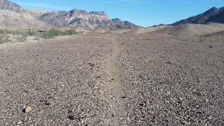
- QUIEN SABE BENCHMARK el 2258 is in an isolated NE corner of the Big Maria Mountains Wilderness. The SE ridge is easy. Take US 95 to mp RIV 23.3. Turn up a wash on 4wd road 929. It goes up the wash a short way then up onto the left bank. Follow it to road 927 reading N33 53448, W114 34328. Turn right on 927 for half a mile to the next fork and go left. In half a mile an Indian trail can be seen dropping off to the left and on toward a pass, but then to what? Stay on the road to the legal end on the SE ridge at el 1100. Hike the ridge to the BM at 54965, 36849. The last fifth mile looks rocky but easy paths go thru. A shiny chrome memorial is on the summit for Gary Scott Hogan. 2 hours, 1200 gain. Posted 2018.

1996 map 

Indian trail heading toward Marie BM


