Sunday, June 23, 2019

West Humboldt Range


Dry lake at the south end of the range
Humbolt BM and one of the lakes
  • A good, hard packed dirt road runs along the west side of the range. Take Airport Rd which passes over the interstate at the north end of Lovelock. Go east from the interstate for 2.1 miles then turn south and the road goes a dozen miles to a T. Right goes back to town, left goes to Lovelock Cave. I could have drove a car on that road. Lovelock has a Safeway and Family Dollar. It's a good looking town. Posted 2019.
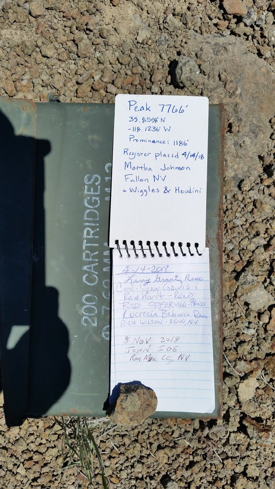
    • WEST HUMBOLDT RANGE HIGH POINT e 6381 - an easy 4wd road goes up Muttlebury Canyon. Use Airport Road which crosses over I-80 at the north end of Lovelock. Go east from I-80 for 2.1 miles to a main fork. Go right for 3 miles to Muttlebury Canyon road at N40 08804, W118 23987. Don't get tricked by another road just before it. Go east into the canyon about 3.2 miles where a steep road el 5000 forks to the right out of the canyon and connects to the upper road. I didn't think it was worth using that steep road so I walked the wash on the south side of it reading 09274, 20839. In a third air mile a faint road forks to the right and soon joins the upper road. Then I walked nearly to the end of that road just before a repeater then cut under a rocky hill to get on the crest then up to the reg at 06960, 20136. That took 3 and a half hours with about 1500 gain and hardly any steep. The reg was placed in 1997 by M&L and had 9 entries since. That's low for an easy range high point with easy access. WILDHORSE BENCHMARK el 6194 - keep going south on the main road to a 4-way at 06819, 24458. Then go toward the peak on easy 4wd for a bit over 4 miles to the end in a canyon. Hike up the north rim reading 03996, 22360 el 5100 and then at el 5850 or so veer right to a saddle el 5950 on the crest. It's a stroll on up to the reg at 03345, 21950. Then walk west 700 feet and there's a view down a good descent ridge. 90 minutes, 1200 gain, not steep. There are no cattle or horses here. Posted 2019.
    • GYPSUM BENCHMARK el 6309 - the Muttlebury Canyon road mentioned above goes on to the BM, but gets ultra steep. An easy 4wd road goes to el 5700 from Coal Canyon. Take I-80 to exit 112 and go 3.2 miles on pavement into the canyon. Turn south and go 3 and a half miles to a where the road tops out at a maze of forks. That's the last turnaround, so walk the high fork reading 11349, 20327  to the end in a fifth mile then keep going to the main ridge and follow the steep road to the reg at 11257, 21251. It's a 90 minute hike. The road ends a fifth mile past the peak at a clever looking rig that might be a tiny cell tower. A good pipe spring is nearly 3 miles in from the Coal Canyon road with no cow shit in sight. Posted 2019.
    • HUMBOLT BENCHMARK el 5261 is along the road to Lovelock Cave. Take the road on the east side of McDonalds in Lovelock and follow signs to the cave. At a T, the road turns to graded dirt then crosses the river and then comes to 3 forks. Stay far right to a faint track at N40 00331, W118 30277 then go nearly half a mile to the end of that. Walk to the main north canyon at N40 00027, W118 29834 el 4050 and go up the left rim to N39 59901, W118 29413 4450 then drop in to get above falls. Now there is one 4 foot fall to go up then it's smooth sailing to the west saddle el 4850. The summit is at N39 59358, W118 29088. I followed the west rim back down to the falls. 2 and a half hours, 1300 gain. This is the best peak I climbed in the range. The cave is another 5 miles down the road. Posted 2019.
    •  DRY LAKES - lakes that are in view from Humbolt BM make an easy hike. At the 3 forks mentioned above, take the middle one over Wildhorse Pass and on to a faint mine road at N39 56542, W118 30886. Go 2/3 mile on that and park at the base el 4200 of peak 4798. Then walk east on a road along the base for 2/3 air mile then go up to the next level and cut thru a saddle at 57599, 29951 el 4400 to get to the first lake. Then go to 57787, 29926 el 4350 and drop into a drainage and go up that to 57863, 30566 el 4400 where the second lake soon comes into view. Then walk on to the west base of peak 4798 where a faint road leads back to the start. I spent 3 hours here but part of that was a side trip to the top of the peak. Posted 2019.
    • BLUFF BENCHMARK el 6311 is a twin summit at the north end of the range. Take I-80 to exit 119 then go SE on a paved road for about 2.8 miles then turn right on a good road and keep going SE along power lines for 1.1 miles to a fork. Go right on a decent road for 3 and a half miles to the end el 5900. The north summit is just up the slope at N40 15965, W118 15612 el 6344. The BM is a 15 minute walk to the south. 70 minutes, 600 gain. The north summit had a reg. Posted 2019.

    Monday, June 3, 2019

    Stillwater Range

    Job Peak as seen from the south 

    • The west side road (WSR) starts out east of Fallon as highway 116. Pavement lasts for 12 miles then it's a wide, rarely graded road and goes nearly 50 miles to pavement again at N40 03617, W118 11223 where it swings west around the Buena Vista Hills. Then it's another 6 miles to a fork. Left goes paved for 13 miles to I-80 at exit 112. Right is paved for nearly 9 miles then it's a super graded road for about 24 miles to McKinney Pass. I started on highway 116 and towed a camp trailer for 40 miles as far as Fondaway Canyon and had a Verizon signal, but then damage from May floods was making it too slow. I made a U-turn and came back in at exit 112 on I-80. Fallon has a Walmart at the west end. Lovelock has a Safeway and Family Dollar. Posted 2019.
    • TABLE MOUNTAIN el 8312 has a jeep road to el 6000 in West Lee Canyon. Turn off the WSR at N39 36248, W118 22048 and stay right at forks for about 3 miles to a gate el 4700. Stay left at the next fork and soon there is a bad hill el 4800. Jeeps have no trouble with that then it gets easier to a flat area el 5800. It's not worth going beyond there. I walked on up the road from there and it shrinks to a steep OHV track that ends at a stream el 6500. I climbed up the left slope on a trail reading 33807, 18461 el 6500 and got on the ridge and followed it up to 33459, 18173 el 7150 where a trail skirts along the east side of peak 7318. I kept going on cow trails past some small trees at 33180, 18147 el 7300 then up to a constructed trail at 33009, 18337 el 7550 then picked it up again at 32971, 18409 el 7650. It takes an easy angle up to the plateau el 7850 then it's less than a mile to the summit at 32483, 17939 where a can had no book. It needs a jar too. 4 and a half hours, 2500 gain and hardly any is steep. The canyon had a good flow and a camp area with some shade at the bad hill el 4800. Posted 2019.
    • MOUNT LINCOLN el 8569 has an easy route out of Pete Canyon on pleasant ridges. A loop can be done to Job Peak. Turn off the WSR at N39 36248, W118 22048 and stay left at forks until a creekbed crossing at 35562, 17073 el 5234. Use the road on the east bank of the creekbed and it's good for a mile then it dips into the creekbed at el 5800 and is chewed up for a tenth mile. Jeeps can get thru and in less than half a mile is a main fork el 6034 in the canyon. OHVs can go left up Middle Fork to el 6800. I took the right fork into South Fork, which is good but has a sharp dip, and parked at the end el 6300 in nearly half a mile. I walked up canyon on cow trails then up the smooth east rim at 34161, 15419 el 6600 and on up to the crest. An antelope came down to el 7800 to greet me. A faint trail runs on the crest. At a third mile before the peak, it swings east around a steep section then goes up and crosses back to the west side about a tenth mile north of the summit. The reg is at 32964, 15783. I then walked north on the crest and the trail faded away on the east side of peak 8089 but it's not needed to go on to Job. I descended off the crest at 34451, 14617 next to peak 8121 and followed the main ridge down. Just doing Lincoln would be a 4 hour hike with a little over 2300 gain. With Job it comes to 6 hours and the last 700 feet up that peak goes parabolic. It would add nearly a mile each way if starting where the road goes bad at el 5800. There was a lot of water running in this canyon. The trail was likely a CCC project, but I couldn't see it south of Lincoln. Posted 2019.
    • JOB PEAK el 8700 is the high point of the Stillwater Range. A man made trail along the crest can be used from the north. It is visible on google earth. There is an upper TH and a lower TH, I only used the upper. Turn off the WSR  onto the Poco Canyon road reading N39 38400, W118 20893. Go up that easy 4wd road and keep right at forks for nearly 6 miles until you reach a fork way up canyon reading 36653, 15659 el 5650 (the best shady camp is a third mile before the fork). Left goes to the upper TH, right goes to the lower. Look straight up the right fork then up to the high crags. Right below the crags the trail can be seen going up and left. Drive the right fork for a mile on easy 4wd to the last camp spot at a corral. Then go another tenth mile to the end el 6400. Walk across a gully to a juniper at 36468, 14572. The trail is right behind it. It goes up and starts switching. One faint switch is at 36616, 14527 el 6700 where it goes left and straight over to the main ridge el 6800 where it is visible from the road below. I stopped here and was less than half a mile from the upper TH.  Now the upper TH road is bad and is now for OHVs only. Right away is a steep hill with a narrow bypass on the left. After that there are eroded sections, but no big obstacles.  The road ends at a good camp spot el 7300 next to a fence. The trail starts up to the left of a crag and is hard to see at first, but it crosses the fence at 36774, 14111. Or just walk over to the fence then go up along it to the trail. The trail goes along the east side of the crest and crosses a saddle el 7500. Two trails can be seen across the saddle, take the high one switching up. The trail will get faint at el 7900 where it goes left around a crag. It stays at the 7900 level until you need to leave it and climb a little to a viewpoint at 35690, 13819 el 8050. Now you can see the rest of the route. Just keep walking on the easy ground on  the east side below the crest, and gradually gaining. Stay on the east side. The reg is at 34983, 14128. The last 300 feet is the only steep part, and game trails zigzag up that. 4 hours, 1500 gain from the upper TH. A top notch hike. These trails need to be adopted by someone. Are there any hikers in this part of the state? BIG BOX CANYON - this is easy to get at for anyone with the means to get on the crest road. On the crest about a half mile north of the upper Job Peak TH there is a road going SE into the canyon. The reading there is 37198, 14082 el 7050. In half a mile there is a cabin where the creek rises out of the ground. The cabin is intact but messy. The road ends a fifth mile past the cabin where I could see a good viewpoint on the north rim 3/4 mile away. I walked to that and could see a grassy slope into the gorge. I went down to the creek and shortly came to the main fall. I stayed high on bedrock on the right and found an easy gully down to falls in a side canyon then it was a short walk to the base of the main fall. I took a chance and climbed a wide ledge up along that fall. It starts out tricky but then it's class 2 to the top end where it narrows down to one foot wide. It took a couple of steps to get past that but it has good holds. That shortcut paid off big time and is worth it even if you fall and die. I followed the creek back to the start. That took 3 hours with 1000 feet of gain, mostly not steep. There is some light brush. Backpackers could use the lower TH in Poco Canyon to get in, but there are no shade trees around the cabin. 4wds have been driving in on a crest road from the Job Canyons, but there are ultra steep grades on the crest and some flood damage in West Job but I didn't check East Job. Posted 2019.
    • LAMBING PEAK el 7200+ is what I call the peak at the head of Lambing Canyon. A 4wd road going over the crest to the south makes it easy, when passable. Turn off the WSR onto the Poco Canyon road reading N39 38400, W118 20893. Go up that good road and keep right at forks for nearly 2 miles then go left at a main fork that goes into West Job Canyon. At el 5500 the road forks. The fork that goes up the south rim was chewed up by recent floods and I couldn't get traction, but a 4 wheeler might make it. I expect that popular road to get fixed, but meanwhile a 3 hour loop hike can be done. Keep driving in the canyon bottom for another .4 mile to a sunny camp with a stream el 5700. Walk along the stream then go up the north rim next to a lone cottonwood at 38700, 15144 el 5950. Keep going up to 39038, 14669 el 6850 where a saddle el 6800 on the crest is in view. Cut over to it then go up a steep jeep road almost to where it tops out then angle around to the right to a saddle at 39323, 14265 el 7000. Then it's easy to the reg at 39676, 14412 placed by the Henneys a month earlier. They beat the floods. Walk back on the road on the south and drop down to the start. 3 hours, 1100 noticeable gain. These are pleasant ridges. A few cows grazed here years ago and horses haven't found it yet. An OHV trail runs south on the crest then down Poco Canyon. Posted 2019.
    • SILVER HILL el 7300+ has an OHV trail to el 5450 on the west ridge. Turn off the WSR at N39 41675, W118 18708 and drive into Cox Canyon then take the first left that's still in use, not the one on the topo. That's gone. Drive to a fork at 41628, 16479 el 4800. I wouldn't take a 4wd past there but OHVs can take the left fork up to a saddle el 5450. It's a pleasant ridge from there to a saddle at 42200, 15175 el 6750 then a plush pj forest to another saddle at 42247,14738 el 7100. It's another quarter mile to the reg. Placed in 1993, the Henneys signed it in 2019 and that's it. That's a long drought, but likely because it's only a hill. That took me 3 hours with 1900 gain.  4wds will have an extra hour of hiking. A decent road goes on up Cox Canyon past rock cabin ruins to el 5600 with pinyons and a stream. Horses haven't found it yet. Posted 2019.
    • COX BENCHMARK el 4453 is the tiniest peak in the range. Turn off the WSR at N39 44615, W118 16895 and go half a mile then turn right on an eroded road that goes to the peak. It's 5 minutes and 100 feet to the top. Posted 2019.
    • MILL CANYON has a high clearance road to the mouth where there is a stream and cabin. Turn off the WSR at N39 45550, W118 16302. Horses have decimated the area. Posted 2019.
    • HOT BENCHMARK el 7578 has a jeep road to el 6100 on the NW ridge. Turn off the WSR at N39 47225, W118 15418 and there's just one road to follow. At 46704, 13868 el 5100 some rocks have slid into the road but one man can move them. The road ends at the Shady BM then it's a nice pj forest up the ridge to a minor saddle at 45573, 12657 el 7400. The reg is another tenth mile beyond that in a plastic jar that won't last. 2 and a half hours, 1500 gain. The jeep road has little erosion but that won't last. Shady Run Canyon would be another way to climb this peak. Posted 2019.
    • SHADY RUN CANYON has a stream and cottonwoods and has largely recovered from horses. Turn off the WSR at N39 47717, W118 15113 and drive on easy 4wd to the end at the mouth. A faint trail runs up the canyon. The trees end in a third mile and I was able to easily walk to the 5000 level where I could see it getting easier to climb up to the rim and go on to Hot BM. That would be a good hike if horses don't return. Posted 2019.
    • FONDAWAY PEAK el 7444 is what I call the peak on the north side of Fondaway Canyon. A jeep road goes to el 5700 at the SE ridge. Turn off the WSR at N39 48487, W118 14702 and drive up into the canyon for about 4 miles to where it opens up then stay left at forks to the end. The route is obvious until el 6600 where there are 2 choices. I went up the wide gully ahead but had to traverse a risky slope. It's better to stay left to 48700, 10816 el 6650 then go up to the main ridge. Then walk level along the west side to a gully at 48833, 10833 and go up and the rest is obvious to the summit at 49093, 10687. 3 hours, 1800 gain. This is one of the better looking peaks. Rigs wider than a jeep might have trouble on these roads. Posted 2019.
    • SHAMROCK PEAK el 6537 is what I call the rugged peak on the south rim of Shamrock Canyon. Turn off the WSR at N39 50066, W118 14479 and go a mile on 4wd to where the road goes bad el 4150. Walk to the ridge straight ahead and go up to el 5800 then stay left around boulders then get right back on top and go up to a sheep trail on the right at 49624, 11918 el 6150. Go on up into the crags and there are pathways thru with a couple of class 3 spots to get to the summit at 49530, 11932. 3 and a half hours, 2400 gain. The ridge has no hidden dips. Sheep tracks cover this route. Posted 2019.
    • WHITE CLOUD CANYON has a major stream and a miner trail. Turn off the WSR at N39 51181, W118 14231 and drive to the mouth el 4300 on easy 4wd then hike up the south rim to 50860, 12890 el 4500 where the trail first show up. It runs along the slope to 50918, 12628 el 4600 where it starts dropping down to the creek about a half mile from the mouth. I was able to go upstream a quarter mile then it got too brushy. There is some light brush and shallow wading. This trail needs someone to adopt it. Are there any hikers in this part of the state? Posted 2019.
    • CLOUD BENCHMARK el 7512 has a smooth ATV trail to a saddle el 5450 on the north rim of White Cloud Canyon. Turn off the WSR at N39 52876, W118 13710 and go about 2 miles on easy 4wd to a fork at 52151, 11952 el 4500 where 4wds are stopped. ATVs and cycles can go up the right fork thru a short patch of tamarisk then take the next right fork and the road can be seen climbing up. It tops out on the rim which is where I started hiking. Peak 5950 is in the way right out of the gate. It's best to go nearly to the top then cut around the right side and shave off 50 feet or so to get to the saddle el 5800 behind it. The next bump on the ridge is peak 6558 and I had to go over that one. Next comes a good game trail at 51416, 09605 el 6600 which skirts along the right side of peak 6664 and into a saddle behind it. Cattle trails run from there all the way to the summit at 50472, 09369. I wasn't expecting that. Next, I dropped down to the west ridge at 50530, 09546 el 7100 and walked low along the right side to get past fallen trees then got on top and on to 50628, 09949 el 6850. From that point any ridge would work. I went down steep dirt then moved left to a ridge at 50587, 10015 el 6700 and easily went down that to 50449, 10403 el 6100 where I turned NW to get to the bottom. I followed an intermittent stream down the canyon to the road that goes back up to the start. First I went downstream for half a mile to cottonwoods and a collapsed building. Water was flowing out of a tunnel just past that. I returned to the road but should have gone up a drainage at 51149, 11241 to get to the rim. That took 6 hours with a little over 2000 gain to the peak then another 400 to climb out of the canyon. It would be about 5 hours if I had returned the same way. Hikers with only 4wd rigs would have an extra 1000 gain and likely a 7 hour hike. It's easy terrain. Posted 2019.
    • EAGLE SPRINGS PEAK el 7766 is what I call the one high on the east rim of Mississippi Canyon. Jeeps can make it up Copper Kettle Canyon to el 5100, OHVs make it to 6100. Turn off the WSR at a silly gate reading N39 58092, W118 12252 and go a bit over a mile to a 4-way. Turn south for 3 miles to a fork at a crossing. Go right to 54065, 07676 el 5100 which is as far as I would take a jeep then I would hike the north ridge. A rocky stretch along the jeep road only lasts a fifth mile. OHVs can keep going a bit more to a sign for the Steam Shovel OHV Trail. It shows on the topo as a pack trail. Follow it to el 6100 then start hiking the easy NE ridge at 53652, 05765 el 6100. A useful cow trail at 53099, 06258 el 6800 dodges a lot of fallen trees. The next useful trail is at 52809, 06753 el 7100 and it skirts the left side of peak 7217. Then go on to 52155, 07122 el 7400 to skirt the left side of peak 7448 then on to the summit at 51592, 07409. An ammo can had been placed a year earlier by a Reno party. That took 4 hours with nearly 2000 gain, all easy. It's a nice forest but pristine it ain't. Remnants of a crest trail can be seen along this hike that likely went as far as Cloud BM. EAGLE BENCHMARK el 7615 - keep going on the OHV trail and park a third mile before the peak. It's 500 gain to the summit at 51850, 03959 with dramatic views sitting 4000+ feet above the valley floor. There was easy access to this peak until the Anderson Ranch blocked the main road in from the north. A fortune was spent building that road. But I could see on the sat image that an OHV trail connects from the main road to White Rock Canyon. Then there's a way out to Kitten Springs because I rode in that way earlier. Hikers don't have OHVs but the east ridge from Dixie Valley looks feasible as an alternate. Posted 2019.
    • TABLE MOUNTAIN el 7700+ is the second such named peak in the range. A long, easy hike can be done from the Kitten Springs Rd. Turn off the WSR at N40 06542, W117 58631 and go 6 miles on easy 4wd to Kitten Springs Canyon where a stream is crossing the road. The grave of Alexander Brown is on the right. Keep going a mile and a half to a hairpin turn el 6100 then hike up into a saddle at 02482, 55878 el 6400. Go up the ridge to el 7000 then bend left to a cow trail at 02000, 56877 el 7100. Walk that then veer off to the north rim at 01530, 57049 el 7200 which is where the best part starts. Stroll along the rim taking in the views until a steep 150 foot drop at el 7350. Ranchers built a trail down that then it runs on the north side of a fence and at 00575, 59303 el 7250 it angles down to the SE saddle el 7050 of Cornish Peak. That's the easiest way to do that peak. There is a spring a tenth mile down that trail. Keep going to the county line marker at 00143, 59885 el 7600 which is just a wooden stake. They're cheap. It's another mile to the high point. That took me 7 and a half hours and the 1000 moderate gain to get on the plateau was the only part that wasn't easy. The side trip to Cornish took an extra 90 minutes and requires long pants. The survey pole at the Stillwater benchmark was still standing from 1953. Cattle graze at the head of Cottonwood Canyon but impact is light elsewhere. Horses haven't found this yet. Posted 2019.
    • BOLIVIA is a mine site SE of Table Mtn.  Turn off the WSR at N40 06542, W117 58631 and go 6 miles on easy 4wd to Kitten Springs Canyon. Keep going over a divide and down to a T at Cottonwood Creek el 5000, a large stream. Left goes a mile down the creek to shady camps then the road is harder to the end in a little over a mile. Buildings along there have collapsed. Back at the T, the other road goes up along the creek then peels away and after about 3 miles from the T is a fork el 5900. Left ends soon at mines, the right fork is a jeep road that drops down a burn area to Bell Mare Canyon, which had a good small stream, then goes up to the crest and exits the burn area then tops out at el 7150 next to peak 7228. It's a short hike to Table Mtn high point and to Cotton Benchmark at N39 58446, W118 01950 el 7823. Along the way on the crest is a possible Indian rock ring at N39 58693, W118 01716 el 7500.  Jeeps make it to peak 7228 but beyond there are a few short sections of ruts that are tricky for all 4 wheelers. The road goes on to the White Rock Canyon watershed then over the crest to the Anderson Ranch, but they have blocked it there. Posted 2019.
    •  GAMBLE PEAK el 7651 is what I call the next major peak NE of Table Mtn. A good road goes to el 6000 on the north ridge. Turn off the WSR at N40 09109, W117 55773 and go 7 and a half miles to a main fork. Go left for a mile then go south on a crude road for a quarter mile to the end el 6100 on the north ridge. Go up the center of the ridge over point 7163 then into a saddle el 7050 and on up to the summit at 02939, 50343. It's a third mile from there to the north end where I found what I was looking for, an Indian rock ring at 03160, 50142. Another is at 03136, 50203. That took 3 hours with 1800 gain. Some is steep but zigzagable. It's the best forest I saw in the range. FENCEMAKER el 7283 - stay on the main road another 3 miles to the towers then go past them another quarter mile to a shady tent site el 6800. Just walk on the center of the crest to 06612, 49843 el 7100 then to 07021, 49753 el 7000 then to the peak at 07438, 49947. It doesn't pay to skirt the bumps on the crest because they're too long with too many fallen trees. That took 3 and a half hours with hardly anything steep. Posted 2019.
    • GRANITE BENCHMARK el 8419, the high point of the East Range, is the first major peak north of the Stillwater Range. A loop can be done using the rims of Ladd Canyon. GPS tracks are posted on peakbagger.com for the west rim part of the loop. Turn off the WSR at N40 13001, W117 49731 and take a bad road to the mouth, staying left at a fork along the way. There are two ways to start out. One is to go up a DIY road on the west rim which soon fizzles then just keep going up. The other is to walk the OHV trail in the canyon for a mile and a half then go up an easy ridge at 15665, 48865 el 6400 and top out on the west rim at a saddle el 6850. It's obvious how to go up the ridge then bend left to the reg at 16818, 49025. Then walk east on Cinnabar Ridge for a mile and a quarter to Granite Peak el 8330. A plane crash is along the way at 16832, 48344 el 8150. It missed clearing the crest by 30 feet, if that's what it was trying to do. From Granite Peak, it's obvious how to walk the east rim down and then either drop in near the exit point or keep walking the rim to the mouth. I was able to ride a cycle a mile and a half up the canyon and then had a 4 and a half hour hike with about 2500 gain, none of it very steep. The OHV trail is overgrowing and is the only part that needs long pants. There's a good stream in the canyon with no recent cattle. Posted 2019.

      Indian rock ring on Gamble Peak

      Eagle Springs Peak. Somebody lugged an ammo box up there.
      Fat lizard smoking a cigar.
      Creek in Pete Canyon and the easy ridge to the crest.

      Falls in Big Box Canyon

      Table Mtn at the north end of the range.