Saturday, December 25, 2010

Billie Jean James 1943-2010


She was a poet who loved all things beautiful. And one of the friendliest people I ever knew. May she be with her son in the next world. "Far have I traveled, and much have I seen, dark distant mountains with valleys of green".

Friday, December 17, 2010

Forgotten Trails, Crossman Peak trail


      Drive to the Corn Spring BLM camground in the Chuckwalla Mtns off I-10.   There is a trail from Corn Spring to the Skipper Mine and on to PILOT PEAK. Drive to the cabin about a half mile past the campground. Turn left on a 4wd road. Go about a mile keeping left at forks and park at a wash bottom. Hike about a fifth mile to a saddle at N33 37002, W115 20693 to pick up the trail. If walking the road, pick up the trail sooner at 37264, 20708. The trail goes thru the saddle into the canyon beyond. It goes along  the bottom a short way then climbs up on the left. Soon a rock dated 1904 appears on the trail. Keep right at a fork at Egg Head Rock at 36434, 21339. About a quarter air mile past the rock is where the trail crosses to the right side of the main wash. Just below are seasonal pools. After crossing to the right side of the wash,  get on the correct fork  at 36279, 21684. Follow it to the mine at 36067, 21792. The Skipper Mine road comes in here but only safe for bikes. To climb PILOT PEAK, from the Skipper Mine, go behind the mine to the old trail  and take it up the center then right side of the canyon. It gets easier to follow and then crosses to the left side at 35699, 21902 and switches back. Stay on it to 35443, 21783 el 3800. Leave the trail here and climb the right slope. Near the top start angling right toward the peak to hit a minor saddle. It's a short walk to the peak 35315, 22013 el 4200. 3 hrs, 1500 gain from the mine. 5 hrs, 2300 gain from the TH. The mine that the trail ends at is a boring shallow hole. The peak has the oldest register I've ever seen.                                                                         

  • For FLAT TOP el 10600, the highest peak in the OQUIRRH MOUNTAINS near Salt Lake, drive to Ophir and go thru town then go .7 mile from the end of the pavement and turn right on 4wd. In a mile and a half is a main fork. Left goes to HALLS BASIN. It's the easiest way but private. Go right at the main fork for a mile and quarter to the divide. Go left at the divide on a short road and park at the end el 8200. The trail angles slightly up to the left toward a tree. Soon is a hidden switchback at N40 21220, W112 12964  that takes you back to the right. Go on up the trail and it takes you left of a peak and into a 9000 ft saddle. Follow the trail as it goes out of the saddle on the right. It gently climbs passing waypoint 21422, 12368. Then it dips 100 ft into a small aspen thicket. Look for it on the other side at 21410, 12085. It's climbing again then turns back to the left at 21414, 11973 and goes to a 9600 ft saddle at 21534, 12143. Now turn right and climb the ridge using game trails slightly left of center to avoid brush and rock. At 21619, 11736 cut left on a good game trail and drop a little to a saddle at 21695, 11688 el 10200. Follow a trail left of center to the peak 22358, 11333. An 1888 date and 1898 date are on top. Just before the top is a good 1939 date at 22072, 11642. 2700 ft gain, 5 hrs. Take long pants.

  • For WOOLSEY PEAK in Az, take old US 80 south from Arlington to the signed Agua Caliente Rd at mp 25.2. Turn west and just before a gate go right on graded dirt. Many big camps along here. Follow the graded road for about 5 miles to a cattleguard. Just past this make a left at N33 15289, W112 53338  onto a primitive road with some 4wd spots. Go about a mile to a well. Veer left around the well then go left at a fork behind the well. Go to another fork at 13267, 54556 and keep right. Keep heading south to Woolsey Well. Park at the well and hike up a nearby ridge at 10257, 55780 to get on the flats. Then head for a ridge over 2 miles away at 09392, 53386. Go up the ridge keeping left of a crag. Higher up the ridge are remnants of a trail that ends at a cleared spot. Go on up to the main ridge then left to the top. 6 hrs, 2300 gain. Thick cholla at the summit area. ALT: Hard core 4 wheelers can get over a mile closer. Before woolsey well, go left at 11451, 55050. Drive just over a mile then go right. Go left at forks thereafter and park at the end of the road at 10115, 54618. There is one bad spot near the end of the road. Hike south on the flats along the base for about a mile and a half to the ridge mentioned above.
  • For MOKELUMNE PEAK el 9300 in Ca, turnoff 88 west of mp AMA 52 and go across the Bear River Res Dam. There will be one fork of paved roads not counting campgrounds etc. Go left at the paved fork to a good dirt road signed Tanglefoot TH at N38 31550, W120 12554. This is about 10 miles in from 88. Go left on this road for about 4 miles to the TH at 31402, 10408 el 6600. Hike up the trail to a T. Go right then the trail drops down into the 500 ft deep Tanglefoot Canyon. It goes up the other side where it crosses a little stream. This may be the only water late in the season. Keep going past a lake and then a lot of fallen trees. Stay on the trail above 8000 ft then go right to a point at 32330, 07292 which is less than 300 ft from the trail. From this point, just stay in the big trees below the manzanita and walk the easy ground to a saddle 32328, 06725 el 8500. Now go right up the easy ridge to the top at 32291, 05667. Only the last 200 ft on talus is steep, the rest easy. 9 hrs, 3700 gain. ALT:camp at the lake at 31438, 08627 el 7100. Plan on 3 hrs to the lake. It had a lot of clear water on Aug 1.

Monday, December 13, 2010

Death Valley Petroglyphs


Linda and Wolf examine a panel. Dry Bone Canyon in the bottom photo.

Charcoal Cave


Images in charcoal are all over the ceiling of a cave near Grand Gulch.

Sunday, December 12, 2010

Bishop Petroglyphs


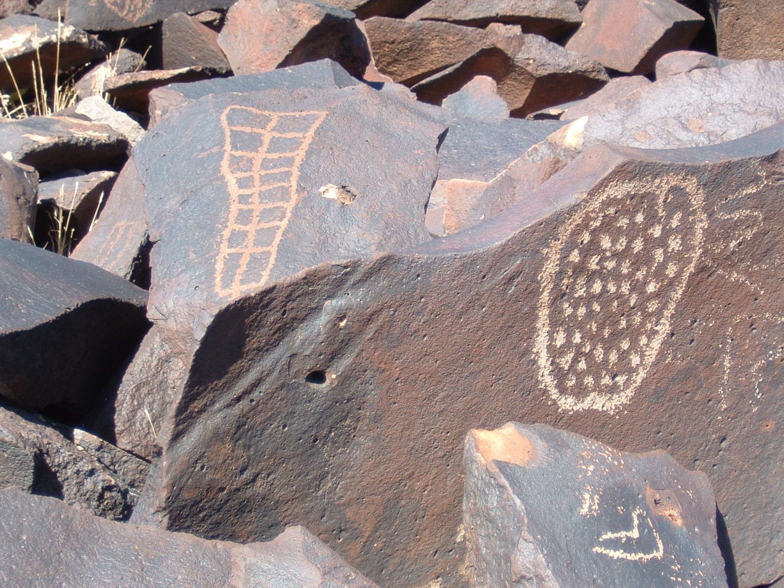
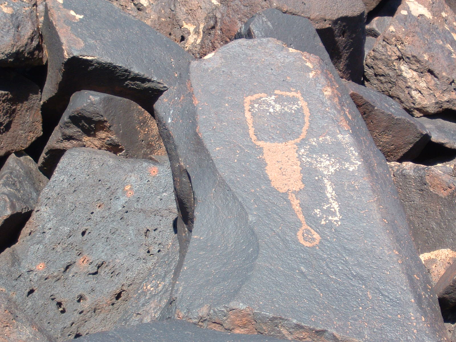
The Fish Slough petroglyphs, Chalfant petroglyphs, Red Canyon petroglyphs and Chidago Canyon petroglyphs are pretty good and you can drive to them. These sites are public, so here are fuel efficient directions so you won't be running all over like a headless chicken.


For the PETROGLYPHS LOOP, take highway 6 north for 17 miles and turn left at milepost MNO 8.6. Drive the dirt road to a wooden fence at the wash. The last half mile is not graded but most cars would make it. Good panels are left and right, but the best is right at another fence. This is the CHALFANT SITE. Now get back on 6 and go north 2.2 miles to the Chidago Canyon Rd. Turn left and go 3 and a half miles to the RED CANYON SITE. It's at the junction with the Fish Slough Rd. The best panels are at the north end. Take Fish Slough Rd south for 5 and a half miles to the CHIDAGO SITE. It's on the left with wooden fence. The last site is 4 more miles down the the road on the right at a wooden fence. Keep going south then follow pavement out past a gravel plant back to town. All roads are graded except that last half mile at the Chalfant site. This is about a 50 mile loop. An electric car could make it. Posted 2019.
CHIDAGO CANYON NARROWS - an easy loop hike can be done 2 miles west of the Fish Slough Rd. Go about 4 miles south from the Red Canyon site and turn on easy 4wd at N37 35485, W118 25488. Go 2 miles and park near the rim then walk to 35396, 27660 el 4800 and drop to the creekbed. It's not too hard to walk up canyon. A couple of 5 foot falls have to be climbed. The first is tricky for a solo hiker then the second is easy. At the narrowest part I came to a 7 foot high chokestone and had to back up for 5 minutes then climb up easy bedrock at 36070, 28863 to bypass it on the north side. I decided to keep going up to just below the main rim and walked a game trail on the inner rim to get back to the start. At 35627, 28306 I got up on the main rim. That took 2 hours with 400 feet of noticeable gain. I wore shorts but should have used hiker gaiters to keep stickers out of my socks. Green mileposts that I used in the past have been removed from US 6 so now it's strictly the county mileposts. Posted 2019.
13 moons is not a public site.
I don't know the name but this isn't public either.
Sky Rock is not a public site.

Chidago Canyon narrows

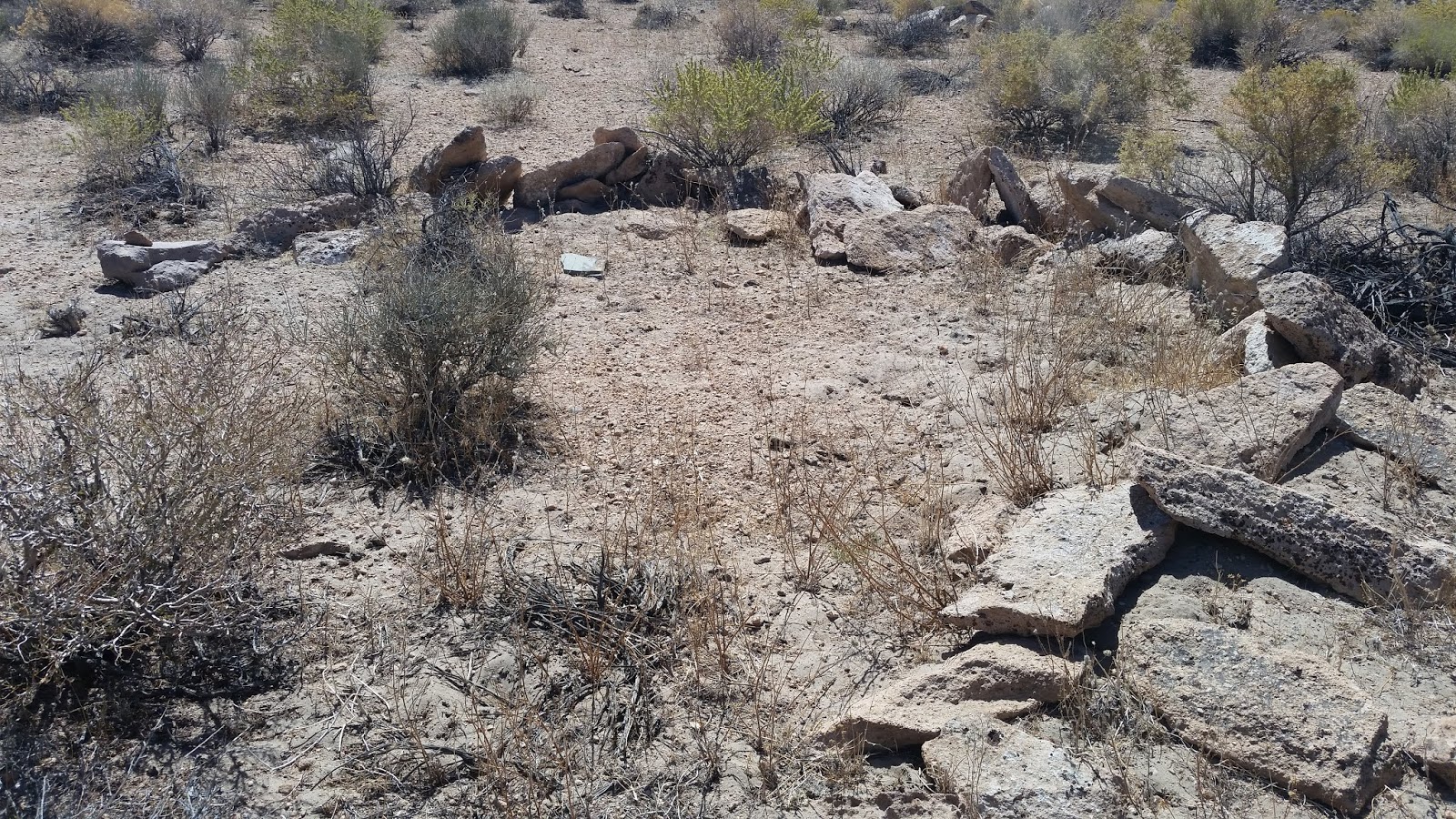
Rock ring at Chidago Canyon narrows

Thursday, December 9, 2010

All American Man Panel

The All American Man is in the Salt Creek drainage at Canyonlands NP. An all day hike.

red,white and blue panel


One of the great panels at Grand Gulch.