Lower High Rock Canyon.
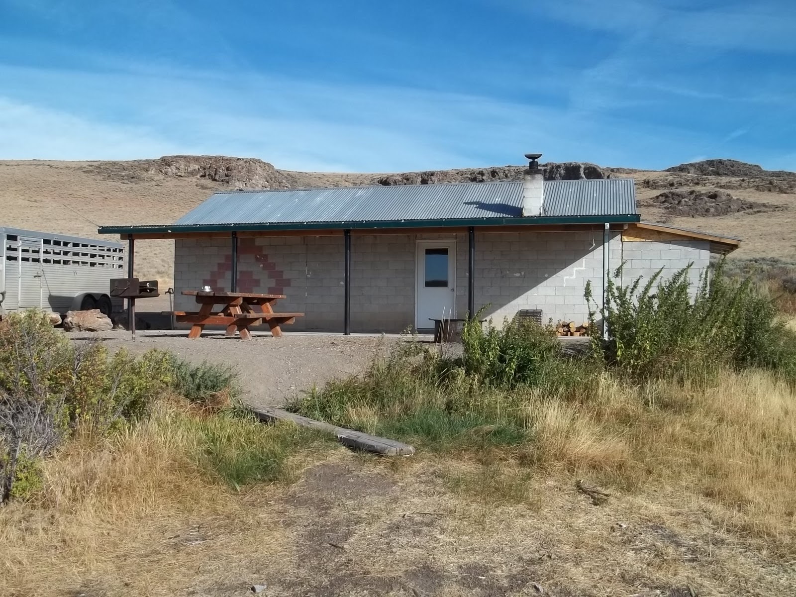
The cabin at upper High Rock Canyon was built by Tennessee Ernie Ford.

ADAM PEAK el 8600 is the high point of the Osgood Mountains. An OHV track goes up the east side to el 6900, jeeps might get to 6600. Take Nv 789 north from Golconda for 15 miles to the end of pavement. A gravel road reading N41 04537, W117 16549 goes NW from here for 2 miles to a big mine. Veer north from there on an easy 4wd road to Felix Canyon. Turn left there reading 07824, 16534 and go on to another fork at 08194, 17423 el 6100. It's easy 4wd to here. Both roads go to the ridgetop. Left is for OHVs only, but right is wider and 4wds might get to the ridgetop at el 6600. Don't drive it if you can't back down it. I rode the left fork to the ridgetop at el 6900. From there, I hiked up the ridge and went thru a break in cliffs at 08729, 17999 el 7300. Then I kept going up the center of the ridge to el 7800 then angled to the right to waypoint 08563, 18300 to pass a bump. I leveled off here to get to the saddle behind the bump. The rest of the route is visible here. Some minor crags are easily passed on the right. The reg is at 09644, 18330. 4 hours, 1800 gain. This is a top notch ridge walk. No cattle, no horses, scant brush. The crest looks pristine. The grassy OHV track continues into upper Granite Creek losing 300 feet. OHVs can get as high as 7300, then the brushy remainder of the road can be walked as high as 7800 on the slope of the peak. This makes for a shorter hike, just more brush. The big mine makes a good camp. They left machinery behind. Posted 2014.
- CATNIP MOUNTAIN el 7294 is the high point of Sheldon NWR. That's saying a lot because the refuge is nearly a thousand square miles. Use Nv 34A to get to West Rock Spring camp at N41 53931, W119 21942. Drive thru camp on easy 4wd and keep right at a meadow in about half a mile. Go on up to the summit ridge and the road goes west of the summit and starts to drop over the south side. But then there's a fork that takes you back along the summit ridge north of the summit to a horse trail at 51048, 23079. It's a quarter mile stroll to the Cat BM at 50938, 23355. The road soon fizzles east of the horse trail. A mtn bike would help on this road. The Catnip BM is on the east end of the mountain and is about 20 feet lower. Leave Nv 34A at 53531, 18283 on a 4wd road and keep left at the next fork. The rest is obvious to the BM at 51628, 20912. No reg at either BM. Nv 34A goes on to the west entrance. Right where the road starts to drop off the plateau is a smooth 4wd road on the south side that goes for nearly 2 miles up to the look out on Bald Mountain el nearly 7200.
- DONNELLY PEAK el 8500, aka Division Peak, is the high point of the Calico Mountains. An easy 4wd road goes to el 7300. Take county road 34 north from Gerlach for 40 miles or so to BLM road 2053 at N41 08431, W119 22231. Go half a mile to a 4 way then go right toward the peak. The only tricky fork is near the peak. You'll see a left fork going to a spring at the base of the peak. But stay right on the main road and it goes up a canyon SW of the peak. At 6750 the road comes to a spring el 6750 with cold water coming out of a pipe. Here the road switches back left and goes onto the plateau where one last fork awaits. The right fork is steep and goes to el 7350 with a tiny turnaround. The left fork goes to el 7250 with a large camp area. From either one, hike up the easy slope to the lip of a bowl at 05566, 16030 el 7750. Now it's easy to move right onto an easy ridge to the BM at 05854, 15738. If there was a reg in the mess of rocks, I couldn't find it. 2 hours, 1300 gain. This hike is shamefully easy. Consider taking an anvil to make it a challenge. Road 2053 goes on south back to 34, but it's too rubbly to be of any use. Posted 2013. SOUTH DONNELLY el 7700 is harder. Take county 34 from Gerlach for 28 miles to BLM rd 2053 reading N40 58713, W119 20507. It's an easy, narrow 4wd road for 6 miles to Cane Spring (keep right at a fork a mile and a half in ). Near the spring, look for a very rocky track on a bench at N41 01681, W119 16391 el 4850. Hike the road or drive if it isn't posted closed. In over a mile the track angles off in the wrong direction, so leave it and head across the bench to the mouth of a canyon at N41 02693, W119 14663 el 5800. Go up the canyon a third mile to a main fork. The ridge between the forks is what you climb to get on the main ridge then go right to the summit at N41 02006, W119 13564. A block before the summit has a trail around the right side. No reg that I could find. 6 hours, 3000 gain, less if driving the rocky track. Posted 2013.
- DOUBLE H MOUNTAINS have a 10 mile 4wd road to the high point. From Orovada, go west on the paved Kings River Rd. At mp 9.3, turn at the sign for Pesticide Dump Rd. Stay on the main road, keeping right at any tricky forks. The road goes up the north rim of Moonshine Canyon. About 7 and a half miles in from pavement is a fork at a gate reading N41 38011, W118 02004 el 6100. Take the right fork thru the gate and go 2 miles to the main high rim of the range. A faint track goes left for half a mile to where google earth says the high point is at about 39077, 03684. I found nothing but a good view. This is a good cycle ride, 4wds will be slowed by some ruts. I should have gone back to the gate then south along the rim. That looks good on the map. Posted 2014.
- DRY MOUNTAIN el 6500 has a 4wd road up the NW slope to the north base el 6000. Use graded road 48 running along the south side of the Black Rock Desert. Turn south on a 4wd road at N40 44593, W119 10187. Go about 3 miles to the first fork then go right and follow that road all the way. The road is mostly packed sand. The only issue is one short steep hill where the road climbs out of the wash. I was surprised my 125 went up it without digging in. The peak is covered with game trails. One useful trail is at 40120, 05261. It goes up the west side to the 6200 level then you just go straight up the steep slope. The Western BM is at 39985, 05225. The reg says this is the Pahsupp Range but I can't find that on maps. 1 hour, 600 gain. Posted 2014.
-
-
- DUFFER PEAK el 9400 is the high point of the Pine Forest Range. There is route from Blue Lakes late in the season when water is low. Turn off Nv 140 at the sign for Blue Lakes at mp HU 51.3. It's 18 miles to Onion Valley Reservoir. The first 16 miles is easy 4wd then comes a mile of harder road. At the reservoir, turn left at the sign for Blue Lakes and go a mile and a half to the TH el 7800. There are campsites here and a restroom. Hike the main trail to a faint trail at N41 40914, W118 43027 and use that to get to a smaller lake. Walk the right side of the lake to a pond then go up a wide path thru the trees at 40855, 43164. The path seems to fizzle but you can get thru on the right. Now walk thru clearings to a veiwpoint on a rim at 40779, 43251 el 8100. Now you can see the target saddle across the basin at 40515, 43583 el 8300. The obvious route is to walk level to the left on the rim but soon there is a dip full of aspen. You can get thru by going down to the left then go up the other side to the right and hit cow trails that go to the saddle. It's easy from the saddle across Outlaw Meadow to a cow trail at 40145, 43774 that goes thru aspen to Hidden Meadow at the base of the peak. Now go left up the canyon. Another cow trail is on the left side at 40001, 43675. It's easy up the canyon. A meadow is at the 8600 level where I saw the only springs, but they are risky. Keep going up canyon until it tops out at Bare Pass el 9000. Now the peak is up above you. Go up the steep slope to the reg at 39460,43921. The final chute is a few feet to the right of the reg. 5 hours, nearly 2000 gain but only the last 400 feet is steep. There is almost no brush on this route, just some trees to weave thru. I tried the standard west route but ran into a brush wasteland and got discouraged. Blue Lakes is definitely the prettier route. The first shady camp on the drive in is at mile 13. The reservoir has a shady free campground. There is another 4wd road in from the west. Turn off Nv 140 at a sign for Knott Creek at mp HU 75.6. Go south about 10 miles on graded road to a sign for Blue Lakes. Go left past a restroom on a good road for 5 miles to another sign. Go left again on 4wd for 4 miles to the reservoir then go left to the Blue Lakes road at the north end. Posted July 2014.
- FOX MOUNTAIN el 8200 is in the north end of the Granite Range. An easy 4wd goes 12 miles to the top starting at mp WA 106.5 on Nv 447. Posted 2013.
- GRANITE PEAK el 8970 and Granite BM are right out of Gerlach. Take paved County Rd 34 for 21.7 miles to a 4wd road on the left. This is a mile after the pavement ends reading N40 53300, W119 20620. Follow a fence for 2.5 miles on the 4wd road to a fork at a hill. Both go, but right is smoother. It goes over the hill and joins the left fork. Stay on the main road to a creekside camp area with aspens at 51472, 27263 el 6300. Numerous forks here go to campsites, but stay right on the main road and it makes a U turn and starts up over a ridge then drops into a valley. Stay on the main road to a fork at 51598, 28329 el 6600. There is a good dry aspen camp here. Go left at the fork and the road goes onto the crest and effectively ends where the road is blocked by a tractor and locked gate at 49485, 25526 el 7600. But right before that is a fork at 50291, 25693 el 7650. Go right at that fork to the end at el 8200 right at the base of the peak with the Granite BM. It's a simple hike to the BM at 48854, 25838. The map shows the BM is lower than Granite Peak to the south. There is an old man made trail skirting around the right side of the BM peak. It starts right at the same place you park for the BM hike. It goes along at the 8200 level to a low rock wall. I lost it here, but picked it up again as it was dropping 100 feet to a drainage at 48780, 26306. It goes up the drainage to a saddle at 48444, 25993 el 8450. Then it goes level a short way to another saddle where you can see the peak. Here you have to drop down 400 feet into the meadow at the foot of Granite Peak then pick your own route up to the tower at 47374, 25836. 4 hours, 2000 gain. Take long pants and tick spray. There are some cairns on the trail but more are needed. The road on the crest is mostly smooth, but some steep spots may require a locker. I went north to Crutcher Canyon then down that to the power line road, but coming down canyon had a lot of rubbly sections. You have to go south on the power line road to get around a ranch. It might be feasible to go on north on the crest to Fox Mountain. It has a good road down to Nv 447. The Granite Range is more useful for 4wd/OHV touring than hiking. Posted 2013. It's worth it to look at the tractor someone sacrificed to block the road.
- HAYS CANYON PEAK el 7900 has a 2wd/4wd road to the top. It's 19+ miles. Go west from Eagleville on county road 38. It's a good road for nearly 13 miles to the crest el 7100. Turn south along the crest and stay on the main road. The first 4 miles are easy 4wd then the road splits at N41 16428, W119 54450 el 7300 and very shortly "unsplits". The right fork is smoother. Soon after that is a fork to the right heading toward the peak. Take that fork and after a short rocky section the road smooths out for the last 2 miles. The reg is at 16400, 56057. Serious 4 wheelers will have no trouble. Good aspen campsites are near the split in the road. Mtn bikes would work starting at the mouth of Hays Canyon, but it's steep to the crest. Some 2wds might make it to the crest then ride from there. I found an expensive gadget on the summit. If it's yours, send a note and I'll get it back to you. Posted 2013.
- HIGH ROCK CANYON is the route of the historic Applegate Trail. The north entranc e has the only decent camps. Go out on the graded Nevada 8A about 35 miles east of Cedarville. Turn at the sign for Stevens Camp at N41N 36071, W119 35612. Follow this wide graded road for 12 miles to the camp. There is a well kept public cabin, restroom and a creek. From there the road is 4wd although there are only half a dozen 4wd spots in the canyon and they are not difficult. Expect to get some Nevada pinstriping. The canyon is treeless and there were only 2 water crossings in October, but one was knee deep when I was there in June 2013. Post Office Cave is in the lower end at 20144, 20611. Some inscriptions are right before it. It's about 20 miles from Stevens to the mouth. From there, you can loop back on the west rim. Turn right at the mouth and go 2 miles then right again and start climbing. Keep right at the first fork at springs. Go left at the second fork and proceed to a third fork at 18307, 30018. Go right here then on to Nevada 34. Go right on 34 for just over 2 miles then right. Now just keep right at each main fork and it takes you back to the canyon just below Stevens Camp.This loop is a good way to tour the volcanic tablelands. Many springs dot the area but all are trashed by wild horses. Mountain bikes would work in the canyon. The upper canyon has some rubbly spots but mostly it's smooth and firm. There is no need to take a bike more than about 15 miles down canyon to where it opens up at 19525, 19959. The FLY CANYON POTHOLES are about 3 and a half miles below the mouth of High Rock Canyon. The main road exits the mouth then curves over into Fly Canyon. The road begins to veer away from the canyon at a cattleguard. Park there and walk the rim for a fifth mile to a break in the cliffs at 19261, 15599. Go down there to the first pothole then if you get past some brush there are more. There is another exit at the last pothole about a fifth mile downstream from where you got in. Short, easy hike. Posted 2013.
- JUNIPER PEAK el 7200 is the high point of the Truckee Range. A 4wd road goes up the north ridge to el 5500. Take Nv 447 to mp WA 15.6 at Nixon. Turn at the sign for Hollywood Rd and go east 1.1 miles then go left for a few feet to a cattleguard. Now there are 3 forks. Take the middle one that goes up a hill. Stay on the main road as it turns south then goes east thru a gap. At about 6 and a half miles in from pavement you come to 3 forks reading N39 48340, W119 15743. Take the middle one for a mile and a half to power lines. Go right for a third mile then left for 2 and a half miles and park on the north ridge reading 49420, 12721 el 5500. Hike up the wide gentle ridge for a half mile to the first of 2 minor bumps. Keep to the left to avoid the highest part. Then cross the saddle and over the left side of the next bump. Now the ridge gets steep and looks like pure rocks. But it's not so bad. The rocks are stable and usually have paths thru them. At el 7000 is a level spot and the last little bump is in front of you. And it's the ugliest rocky mess of them all. Walk level to the left and stay low below the big rocks for a fifth mile and you'll walk right onto the summit plateau behind the bump. The County BM and reg are at 47730, 10996. 4 hours, 2000 gain. This is a tedious hike because of all the rocks but they aren't loose. The road in was being graded that day, but the last 2 and a half miles will always be 4wd but not difficult. Posted 2014.
- KING LEAR PEAK el 8924 is a prominent peak in the Jackson Mountains. Use the graded Bottle Creek Rd running the length of the range on the east side. Just west of mp HU 25 on Nv 140 is a sign for the road. It's paved the first 4 or 5 miles. When the pavement ends keep going south about 22 miles to the sign for Trout Creek Rd reading N41 08746, W118 25170. Now go west on that good road for 3.8 miles to a 4wd road on the left reading 11602, 27322. Go half a mile on that to a fork. Both roads end near the ridge of ascent at Big Cedar Creek. The right fork is more used but has serious ruts. The left fork gets closer and more than 100 feet higher. I went left. If you go left, ignore any right forks along the way. Near the end of the road is a minor gully with a broken down bridge. The road seems to end but actually goes up the hill and down the other side then gets too brushy even for cycles. It's about el 5700 where you park. Hike up the ridge at 11747, 31748. It's easy going until some crags are in the way at el 7300. Go around below the crags on the right side then come back up when it's safe. The ridge levels off around el 7600 and you can look up to your left and see two high crags and the rest of the route. The left one is Lear. The steep wide gully between the crags is the way up. Keep going on the ridge as it circles left toward the gully. At the last minor saddle on the ridge is where you cut over to the gully. It's a quarter mile on brushy cow/game trails. This is the only place where long pants are needed. Aim for a spring on bedrock in the gully at 12359, 32995 el 7900. The spring looked risky but I filled up anyway. I put some Kool-aid in and shook real hard to kill the bugs. From the spring, it's a brush free creekbed and sheep trails up to the high saddle el 8600 next to the peak. Now look at the summit block and you see there is only one way to go. Up to the right on a ledge then it makes a U turn back up to the left and tops out 100 feet from the reg. The reg is at 12147, 33282. A couple of spots on the summit block are easy class 3. 6 hours, 3300 gain. The nameless high point of the range is nearby and easy. Take the Trout Creek Rd to the crest then turn north on a good road that goes to a mine area with a million forks. Go to 2 metal buildings at N41 18465, W118 25608 el 7300. Now look south at the nearest fork only a few feet away. Go up that fork on easy 4wd. The last turnaround before a very steep section is at 18814, 25437 el 7850. The road beyond there looked like 4wds still go up it, but they must have good traction. The road ends at el 8500. The peak is half a mile away, but there is crag in the way. There is a convenient trail at 18849, 24683 el 8600 that goes left around the crag then it's a stroll to the summit at 18475, 24530. No reg. A 2 hour hike or less. A little stream is just north of the 2 metal buildings and would make a good camp. The second fork south of the 2 metal buildings goes to a shaft el 7900 with rails. That road soon ends at el 8100. Posted 2014.
-
- KUMIVA PEAK el 8237 is the highest in the Selenite Range. Go south from Gerlach on 447 to a good dirt road at mp WA 59. Real men can park in about 3 miles and go right up the steep west ridge. But there's a wuss route. Drive in from 447 for about 4.2 miles to a short road on the right. Park at N40 25946, W119 15912 el 6100 then walk to the end of the road. Get on a trail on the right side and go up the draw to an open area. Aim for another trail at 25676, 15566 and angle up on that to a draw where you can go up to a saddle at 25515, 15636. From the saddle, go right around a bump to another saddle. Next, the ridge begins to climb so angle up to the right to get to a draw at 24978, 15465. Go up the easy draw and it will curve to the right and put you on the rim of the next draw with the peak in front of you. Follow a cow trail into the draw and then it goes up along the left side of the creekbed. When the trail crosses to the right just start climbing toward the north ridge. The north ridge has the least brush. The summit is at 24367, 15790 with a BM named Cowel. 3 1/2 hours, 2300 gain. Long pants are needed because of so much light brush. Posted 2013.LUXOR PEAK el 7420 is nearby and has a 4wd road to the 7000 level. Keep going on the main dirt road for a half mile to where it tops out at a 4 way reading N40 26287, W119 15771 el 6300. The crest road goes left, but there are a couple of downhill bad spots then a spring within the first mile. After that the road comes to a T at a gate in a canyon. Go left then the rest is obvious. There is another bad spot at a spring el 6400 near Luxor, but you can hike from there. Then on the drive out, just take the first left to get back down. For an easier road, stay on the main dirt road past the crest road then down a mile and a half to a gate at the bottom. Go thru then left on a good road running north for a mile and a half to a road cutting back to a ranch. Right here is a steep 4wd road reading 28179, 15112 running up the mountain. It joins the crest road where you go right and soon there is another fork where you stay left to bypass a bad spot. Shortly after that is the el 6400 spring with the bad spot that might stop some. The road goes on to top out on the ridge a quarter mile east of the peak. The reg and Gypsum BM are at 29363, 17010. There is some light brush but it thins out on the west side of the ridge. All the roads here are mostly packed sand. The crest road goes by scenic granite crags. I rode in on it then came back on the low road. Posted 2014.
- PAH-RUM PEAK el 7600 is the high point of the Fox Range. Take Nv 447 to a sign for Empire Farms at mp PE 60.4. Go west toward the farms on a partly paved road for 6.5 miles. Look to your left and you'll see a dirt road that has been running next to the pavement. It starts to veer away from the pavement and that's where you want to get on it and go 2 miles toward the peak to a private gate. The good road ends here. Go left on easy 4wd and follow the fence for 1.1 miles to a 4 way. Go left for 1.2 miles to Rattlesnake Canyon. The reading here is N40 24146, W119 28677 el 4200. Go up that for nearly 3 miles to a main fork. Straight ahead in less than a mile is private land where the steep route starts. For the wuss route, go left at the main fork. The road shortly goes over a saddle then in another fifth mile is a fork. The right fork is the main road, but washed out. Use the left fork to bypass. Once back on the main road, go another .8 mile to the next fork which is Trail Canyon. Go up that brushy road for a third mile to the end at a tiny turnaround reading 22634, 32288 el 5200. Hike up canyon on cow trails. The first place to climb up is "jeep ridge" on the right at 22675, 33014 el 5500. I followed jeep tracks down this on the return, but I wanted something easier for the ascent. So I stayed in the canyon to a risky pipe spring at 22568, 33440 el 5800. Here there is a good trail going left. Soon it splinters into many cow trails, but keep going up and west to get on the ridgetop at 22343, 33616 el 6300. Now just walk horse trails up the gentle south rim of Trail Canyon all the way to a road on the main crest el 6700. The road goes most of the way to the reg at 23428, 34515. I came back down the north rim of Trail Canyon on the jeep tracks. I didn't see how it got around the sharp gullies near the start. It must have come up the road from the reservation, but wanted a shortcut back down. It was a wild, rocky ride crashing thru 5 foot high sagebrush. The road up Wild Horse Canyon on the west side is private. It was a 3 and a half hour hike, 2400 gain, rarely steep. There are trails of a sort most of the way up. If you hike/bike from the washout el 4900, it will add a bit over a mile each way. Mtn bikes would work on these roads. Posted 2014.
- The PETERSEN MOUNTAIN NATURAL AREA is north of Reno on 395. To climb the high point, take 395 north for 10 miles from the jct of 395 and California 70. Turn east on the paved Red Rock Road and go 10 miles to a dirt road at N39 48424, W119 55898. Go west on the dirt road and keep right at a fork in a fifth mile. Keep right again about a mile and a half in from the pavement then head for the TH at 46186, 57009 el 6000. Most 2wds could make this in 2011. The trail goes to the spring just up the slope then fades in the weeds. Go left around the spring then pick up the trail again in the gully behind the spring. Go up to a dam at 6700 then go a little further up the gully and look for the barely detectable jeep road. Make sure to be on it at 46305, 57831 el 7000. Follow it on up past a spring then it levels off in a shallow valley. The faint road follows valleys with young aspen and takes you near the summit at 47760, 58567 el 7800+. 3 hours, 2000 gain. Take long pants due to tall weeds. The Red Rock Road runs along the eastern base of the mountain. The southern end can be accessed close to Reno off 395. This would be a lot shorter drive for those coming from the south. At the northern end of Red Rock Road you can turn on Rodeo Drive and go up a steep jeep road to nearly 6000. The BLM has designated a road here that is for foot and horse travel only but it's overgrown.
- POODLE MOUNTAIN el 6800 is the high point of the Buffalo Hills. A 4wd road with rocky, rubbly sections is the only headache. Go to mp WA 98.2 on NV 447 and turn west. Stay on the main road then keep right at a fork about a half mile in from 447. The only other tricky fork is at N40 51690, W119 39232. Keep right here and follow the main road into the large valley containing the peak. An obvious fork heads along the west side of the peak. I parked a mile away from the peak and had an hour and a half long hike and 1000 gain, not steep. The reg is at 48605, 38900. It was placed 9 years earlier and hadn't been signed since. No wonder, considering the road conditions. This peak is best suited to OHVs. Posted 2013.
- SELENITE PEAK el 7100 overlooks Gerlach. Go south from town on 447 to the Jungo Rd at mp WA 71.9. Follow this good road east for 13 miles to BLM rd 2084 reading N40 44256, W119 10701. Go south for 6 miles to an easy, narrow 4wd road at 39382, 10683. Go toward the peak for 4 and a half miles to a metal tank el 5300, keeping left at forks. The road goes another quarter mile past the tank to a trail, but turnaround is tight. Hike the trail toward the spring which is at the highest vegetation. The water is coming over a rock ledge. Keep going up canyon and look for a cow trail going left at 36994, 15307. If you lose it, it's easy to spot ahead at 36771, 15298 el 6250. The trail goes along below the rocks to a minor saddle el 6450. Then it drops 50 feet into the head of a canyon. The least steep route is to head up the canyon to the saddle north of the peak, then go up to the reg at 36354, 15971. 3 hours, 1800 gain. The Trego hot spring is near the RR tracks at 46308, 07017. The pool is 100 yards long. There is no shade and the train blows the horn. OLD RAZORBACK MOUNTAIN el 5600 is next to the spring and makes a good evening hike. Posted 2013.
- SONOMA PEAK el 9400 has a jeep road running along the crest from the north. The road starts at a good free campground with shade trees. Several peaks can be done using the campground as a base. From the main drag in Winnemucca, turn south on Hanson St or Highland St. Both end at Water Canyon Rd then you follow that a few miles to the campground. At the upper end where the graded road ends, 4wd roads climb the left slope. Take the far left one and run the crest to a fork at N40 52986, W117 37331 el 8700. Go left here and it gets you close to the peak. It's a one hour hike and less than 1000 gain to the reg at N40 51635, W117 36426. This road is for hardcore 4 wheelers only because of steep grades. I'll never ride a 2 wheeler on it again. One of the locals told me he drives his Toyota 4runner on the road, no locker or equivalent. WINNEMUCCA MOUNTAIN el 6730 has a paved road to the top. Go north from town on US 95 for 3.7 miles past I-80 then turn left at a sign for the landfill. It's 6 and a half miles to the towers. BLUE MOUNTAIN el 7300+ stands alone. Take US 95 under I-80 and go north a quarter mile to the semi paved Jungo Rd. It's 17 miles west to the P and J Ranch where most hikers get access. A wuss route for OHVs starts one mile before that. Turn off the Jungo Rd at power lines reading N40 56518, W118 01505. Go 2 miles along the lines then go left at a fork. Keep going to another fork at N40 59946, W118 02640. Keep right here then stay left at any tricky forks after that and park at O'donell Spring at the end of the road reading N40 59542, W118 04309 el 5900. It's an easy ridge up to the reg at N40 59224, W118 04983. 2 hours, 1400 gain. I rode in on a dualsport cycle. 4wds will have to use the standard route. The owner of the P and J Ranch said it's OK to drive across his land as of 2014 in case you have to go in that way. It's the right fork right after the ranch building that gets you closest to the ridge I went up. BLOODY RUN PEAK el 7900 is north of town. Take US 95 for about 11 miles north of I-80 to a sign for Sand Pass Rd. Go west on that for half a mile then turn right on a gravel road and go north 2 miles to an easy 4wd road on the left. Go west to a fork at N41 10315, W117 43172. Go left into Pauite Canyon. Some hikers park at the 5200 level where the road climbs the right slope, but I went on to the end of the road on the rim of a basin el 5800. From there several routes are visible. I went up along the right side of the basin to a saddle just north of the peak, but there was a lot of tall grass. The route I would do next time is up the NE ridge as follows: walk level from the end of the road along the right side of the basin and eventually cut over to the left using a break in a brush line at N41 10645, W117 45291 el 6000. Now keep going a short way to the obvious mine road then cross it and go up the ridge staying left of the main rocks. The ridge goes parabolic, but if you get bogged down in rocks, you can move to the right side below the rocks which is how I came down. Aim for a minor saddle at N41 10343, W117 45796 el 7350 then go on up to the reg at N41 10291, W117 46018. 4 hours, 2200 gain. A memorial to Cody T Louk 1984-2006 was on top. He may have been a disabled young man and hunter. Posted 2014.
- TOHAKUM PEAK el 8182 is the high point of the Lake Range on the Pyramid Lake Indian Reservation. Take Nv 447 to major power lines at mp WA 53 about 20 miles south of Gerlach. The highway follows the county line so some mileposts are PE and others WA. Follow the powerlines west over the range on easy, bumpy 4wd road. At 3.8 miles from pavement you come to a 4 way. Go south for 1.3 miles to a fork. Keep right and stay on the main road going south along the east side of the valley. The road will take you into the wide San Emidio Canyon then shortly you come to the reservation boundary where a sign says to get a permit. Now it's another 7 and a half miles to the end of the road at the saddle el 6800 west of the peak. The only issue with the road is it's trying to overgrow for the last 5 miles. Climbing straight up the ridge from the saddle is too brushy. But there is a draw to the left of the ridge and the left side of it is OK. From the parking area at the saddle, follow a faint track NE a short way until it fades out at a foundation. Then head for a clearing at N40 11021, W119 27623 el 7000 which puts you on the left side of the draw. Go up and soon you can move left onto a ridge. Go up that ridge then angle right of a crag on the crest and enter a broad saddle el 7900 about a fifth mile north of the summit. If you get on the crest more than a fifth mile north of the summit you'll have to deal with that nasty crag. The reg is at 10770, 27323. 2 and a half hours, 1400 gain. There is enough light brush to justify wearing long pants. There are ranch ruins about 2 miles inside the res boundary with shade trees. The creekbed there had stagnant looking water in June. The power line road over the range is too steep for mtn bikes, but the remaining 15 miles is not steep and is firm. Cars might get into the valley using the paved Empire Farms Rd at mp PE 60.5 on 447. I didn't check this route. Posted 2013. Floods that hit shortly after I was there may have changed road conditions. The highway was closed.
-
-
-