|
| Chance BM |

 |
| Indian trail running past Devils Hole Peak connecting Death Valley to the Spring Mtns. |
This area of rugged little peaks is named on the USGS 5K map. Bell Vista Rd goes west from highway 160 at mp NY 13.8 and cuts thru the area and on to Death Valley Junction. It's paved but no mileposts. Ash Meadows NWR borders the west side. Sheep infest the peaks supplied with water by at least 4 guzzlers. Posted 2018.- DEVILS HOLE PEAK el 4355 is what I call the rugged peak south of Rocky BM that is likely the high point of the range. A loop can be done up the west ridge and down the north. Turn off Bell Vista Rd at N36 18418, W116 11907 and follow a gravel road for 4 and a half miles to an easy 4wd road at 21744, 14545. Go 2 and a half miles on that to a wash el 2800 forking south. An Indian trail runs along that road. Walk up the wash then thru a low saddle and into the next canyon then up to a saddle at 22010, 11842 el 3100+. Now it's easy to follow sheep trails up the ridge to the reg at 21924, 11149. A guzzler is in view in the north canyon. To get down the north ridge, I retraced 150 feet from the summit to a gully then went a few feet down that then angled to the right to get on the ridge. I went on and descended a slope at 22356, 11277 el 3800. Soon I came to a fall then moved left on a shelf to get in the next gully and went down to an obvious trail exiting to the right to get back on the ridge. It was simple to walk the ridge past peak 3533 and down to the start. 3 and a half hours, 1600 gain. The north ridge has a couple of easy class 3 spots. A lot of dramatic cliffs are here. The road goes on another 8 miles to highway 160 at mp NY 22.8. Posted 2018.
- PEAK 4112 is south of Devils Hole Peak. A good loop hike uses the west canyons. Turn off Bell Vista Rd at N36 18418, W116 11907 and follow a gravel road for 2.8 miles to an easy 4wd road at 20331, 13672. Go east for 2.2 miles then walk a fifth mile to a canyon at 20723, 11470 el 2720. DON'T try to drive to it and make a big eyesore. It won't help on this loop anyway. Go up canyon and climb to the top of the left rim at 20330, 10970 el 3120 where the descent canyon is in view just below. Go up the rim to a sheep trail cutting left at 20216, 10639 el 3450. Walk that past a guzzler and on to a trail at 20141, 10333 el 3800 that goes up to the summit ridge then stroll to the reg at 20303, 10182. Placed by Vitz in 2007, no one signed in until 2018. For the return, walk west a short way to a sister summit and go along the right side of that on sheep trails and keep going west down the ridge to a saddle el 3620. Then drop left to the creekbed and walk down canyon and out. That's a pretty canyon. 2 and a half hours with 1100 noticeable gain. Posted 2018.
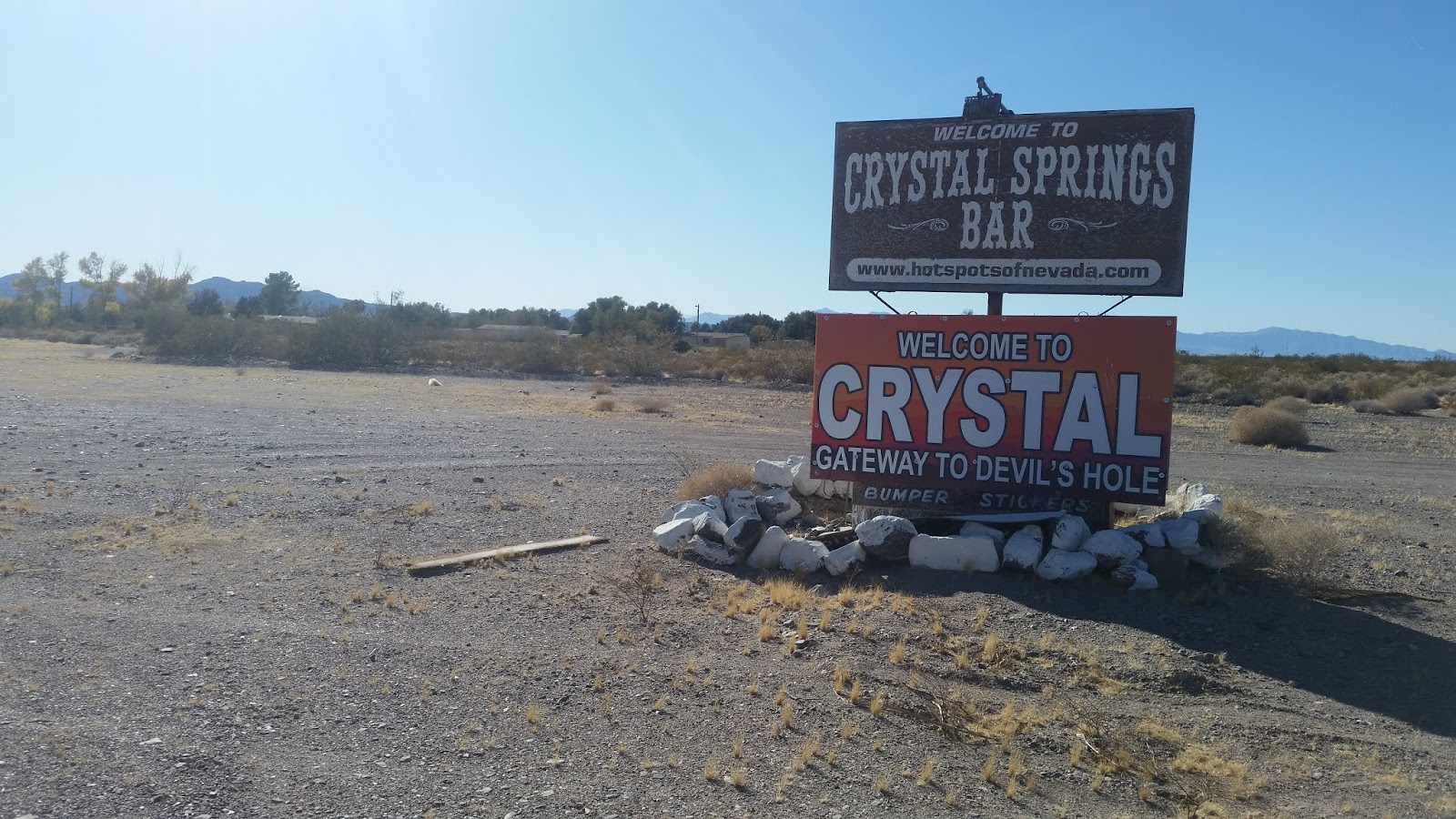
- ROCKY BENCHMARK el 4144 is at the north end of the range. Loop hikes can be done using the NW canyon. Take Bell Vista Rd to N36 20866, W116 18100 and follow the graded road east past Devils Hole for a couple miles and on out of the refuge on the graded road to a view of a lake bed. At that point, turn right on a crude road and follow that for 1.7 miles to N36 26988, W116 14392 then turn south and go about 3 miles to a narrows el 3050 at the end of the road in the NW canyon. Stay right at one main fork in the canyon on the drive in. A tricky 8 foot fall is the first obstacle. Use a ledge on the left then the next fall has a cave. Go left above the cave then get back in the creekbed and go a quarter air mile to a main fork. The left fork is soon blocked by a high fall. Take the right fork past 2 guzzlers and follow it up to the end at a saddle el 3900. Then go left to a reg at 24008, 12808. There is another reg a fifth mile SE that might be higher. For a loop back, there is a main sheep trail in view a half mile north of the BM that is cutting thru a saddle. Walk to that then go left on it for a fifth mile where easy slopes lead back to the creekbed downstream from the guzzlers. That took me 2 hours, 45 minutes with 1200 gain, never steep. It would be hard to hike here and not see sheep. I saw a herd near the summit. One I saw on the drive in seemed to be heading for the brothels at Crystal. There must be some good looking girl sheep there. I followed the crude road on to Crystal and it's easy when dry. The brothels have a sign there that says " Gateway to Devils Hole". Some people might take that the wrong way. All roads easy 4wd. Posted 2018.
- ROCKY BENCHMARK LOOP 2 - another loop can be done using the NW and NE canyons. Take Bell Vista Rd to N36 20866, W116 18100 and follow the graded road east past Devils Hole for a couple miles and on out of the refuge on the graded road to a view of a lake bed. At that point, turn right on a crude road and follow that for 1.7 miles to N36 26988, W116 14392 then turn south and go about 1.8 miles to a fork in the canyon. Go left for half a mile and park el 2850. Trying to drive closer won't help on this loop. Walk up the canyon to the main saddle at 24543, 13296 el 3500. Then go left to a main trail at 24483, 13148 el 3600. Walk that for a fifth mile then drop to the creekbed and go up to the main saddle at 24146, 12730 el 3900 where routes into the descent canyon are in view. I went up the ridge to the second reg at 23912, 12691 el 4100+. I could see routes down from there but chose to stay on the ridge. About 350 feet past the reg is a tricky class 3 chute. Then it's easy on down the ridge to 24182, 12232 el 3350 where I dropped to the creekbed. It opens up after a couple of interesting narrows then it's easy to walk the flats to a drainage at 25284, 13169 el 2600. Go up that to the lower saddle. A trail is on the left for the final approach then it's a short walk back to the start. That took 4 hours with 1300 gain, not steep. All roads easy 4wd. Mtn bikes could make all but the last mile. Posted 2018.
- TRUMP BENCHMARK, HIGH PEAK el 4037 sits at the south end of the range on the east side of Stewart Lake. A loop can be done using the north canyon. Take Bell Vista Rd out of Pahrump to an easy 4wd road at N36 16303, W116 07160. Go south for a mile and park within a third mile of a canyon mouth which is at 15499, 07680 el 2950. Go up canyon a short way to a fall and pass it on the right. Next you come to a fork at 15349, 07714. Go up the right arm to a fall and pass it on the right. Keep going up the canyon to a saddle on the main ridge at 15289, 08131 el 3800. Now go left up the ridge to 15115, 08100 el 4000 where you can see the summit 400 feet away. A complete horse skeleton was on this last stretch. No reg. From there, it's obvious how to walk SE down the high ridge on sheep trails and drop back down to the main canyon. I circled as far as the first major peak el 3700 then strolled west down an easy ridge to the creekbed. It takes 2 hours with 1200 gain to go up and return the same way. The loop I did took 3 hours. 2 wds will have a 3 hour hike minimum. Mtn bikes would work part way in. Posted 2017.
- CHANCE BENCHMARK el 4862 is at the south end of the Last Chance Range and is the best hike around Pahrump. Take Bell Vista Rd to Corbin at N36 15827, W116 05686. Go north on Corbin to a T then left to Cabo. Go right and park at the end of Cabo. 4wds can get 3/4 mile closer. At the T, you'll see a weird house on a hill in front of you. Use a road along the east side of their fence. In a mile and a quarter you'll be within a half mile of the ascent gully which is at 17588,05937. Go up the gully to the ridgetop and go up the ridge until you hit cliffs you can't climb at el 3900. Then go left on a skimpy game trail along the base of the cliffs. Aim for a wide gully at 18192, 05462 el 4100. Go up the gully to get back on the ridgetop. As the gully opens up, it's easier to go right to a viewpoint on a neck then on up the ridge to the summit at 18495, 05485. Stay on the center of the ridge for this last part. There is a gully to go up at el 4600 then some minor class 3 but easy to deal with. For a loop back, go north on the easy crest for .55 air mile to a minor saddle. Then go left down a ridge for a quarter mile to the descent point at 19107, 05538 el 4500. At the descent point, drop left down a gully. Soon you reach a cliff band. Move right just a little to get in an easy chute then it's clear sailing into the black canyon below that drains back to the flats. The hardest obstacle in this canyon is a 10 foot class 3 fall. Or as an alternate, from the bottom of the cliff follow an obvious sheep trail to the west rim of the canyon and on to the Giesler guzzler at 18960, 06047 el 4050. Then walk left of center down the rim on trails. The trails will fade but just stay on the rim all the way down to the wash then walk the flats back. 4 hours, 2000 gain. Some class 3 but not dangerous for the experienced. Near the descent point one year I came down on 9 reclining sheep. It was a Mexican standoff until I finally moved and they took off. I saw one sheep there in 2018.
- LAST CHANCE RANGE TRAVERSE - this route goes up the crest from the south end and over Chance BM then on to the high peak 4985 then down the east canyon. A few easy class 3 spots is as tricky as it gets. Take highway 160 to mp NY 17.5 and turn on Leslie St. Go about 2 miles to Mountain View then go north a bit over a mile to a T. Go right a few feet then turn left and park on what the BLM map shows as public land. Then go back to Leslie and turn right and go 3 miles to a gas station. Turn right there on Bell Vista and go 2.5 miles to Corbin. Go north on Corbin to a T then left to Cabo. Go right and park at the end of Cabo el 2700. Walk the flats to the ascent gully which is at N36 17588, W116 05937 el 2900. Go up the gully to the ridgetop and go up the ridge until you hit cliffs you can't climb at el 3900. Then go left on a skimpy game trail along the base of the cliffs. Aim for a wide gully at 18192, 05462 el 4100. Go up the gully to get back on the ridgetop. As the gully opens up, it's easier to go right to a viewpoint on a neck then on up the ridge to the summit at 18495, 05485. Stay on the center of the ridge for this last part. There is a gully to go up at el 4600 then some minor class 3 but easy to deal with. Keep going using sheep trails on the crest and it will drop below el 4400. The Giesler guzzler is in view on a west ridge. Then at 19498 04968 el 4350 ( 300 feet or so before that works too ), drop off the crest and directly down to the west to a shelf el 4100 next to the N on the topo. A sheep trail runs on that shelf on top of a bright layer. Walk it to the south gully of peak 4985 and go up that to 20039, 05015 el 4700. Then go directly up a short way and it levels off then it's a short stroll to the peak where sheep were patiently waiting for me. The descent route is posted on peakbagger.com as a GPS track. They saved me the trouble of scouting it. Retrace from the peak a few feet then drop to 20118, 05003 el 4850 where you're looking down a gully. Go down it until a fall near the bottom then angle to the right and walk on down to a major saddle. Then go east down the canyon to the flats. Be on the lookout for a right bend in the canyon near el 3600 where it enters a rough narrows. It's easier to walk the right bank around that. 6 hours with about 3000 gain. Using a bike for the shuttle would be 10 easy miles but there's no bike lane. I started hiking at 16639, 05992 and ended at 19357, 02981. Posted 2018. I put a track on peakbagger in 2025.

The sign at Crystal where brothels are located. They didn't think that through. 
Giesler guzzler and Chance BM

Sheep near Last Chance high point. They all seem to be unemployed and so they just lounge around all day chewing on the vegetation. It's a good life.