Clipper Mountains Wilderness
 |
| Hummingbird Spring |
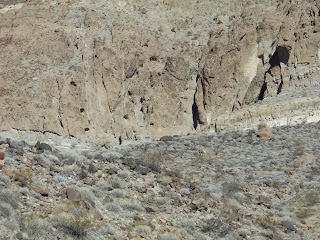 |
| Spot the sheep |
 |
| Hummingbird Peak |
 |
| Castle Dome |
 |
| Fake Rock Spring |
 |
| Bonanza Spring |
HUMMINGBIRD PEAK el 3600+ is what I call a rugged peak a mile west of Hummingbird Spring. Take the Essex Rd from Essex for a mile and a half NW to some power lines. Turn SW on an easy 4wd road and go a mile and a half then turn NW and go nearly 4 miles to the end of the road el 2200. Walk up the road remnants for half a mile to the spring. It's in the wash at N34 45200, W115 20642 el 2300. A tub has water with a lot of algae but clear water drips fast out of it. Continue south on the road over a low ridge to the next big wash and a mine camp. Walk up the pleasant wash then climb out at 45204, 21266 el 2550 and walk the high ground toward a main saddle to the right of the peak. A couple of sheep were hanging around here. Soon you have to go back into the wash but get out again at 45437, 21421 el 2700 and follow along the drainage up to the main saddle at 45627, 21602 el 3050. Now just go left up the ridge to the summit at 45491, 21952. 4 hours, 1600 gain, not very steep. Roads to the TH are mtn bikeable. Posted Nov, 2016, 2019.- CLIP BENCHMARK el 4500+ and CASTLE DOME el 3280 can be hiked from the Tom Reed mine. Clip BM is the high point and Castle Dome is a mess of crags and spires and also the only named peak in the range. Drive west from Essex on Route 66 for 6 miles to gas road #203. Take that for 3 and a quarter miles to road #149. Take that for a bit over 2 miles to the mine. About half way to the mine the real road will climb up onto the right bank. It's easy 4wd as far as the mine. Just past the mine, the road makes a hard right and gets tougher. I parked about a mile beyond the mine, near the wilderness boundary and walked a tenth mile to an Indian trail at N34 42413, W115 23675. You can save some 4 wheeling and just use the Indian trail described below that merges with the one I used. Walk the flats to an obvious gap to the right of Castle Dome. A developed spring, which I call Fake Rock Spring, is in the gap at 42953, 23045. Two troughs had water, one inside a plastic rock. That could make for a base camp. Keep going then an obvious class 2 route goes up Castle Dome, just left of guzzler tanks. Trails go to the guzzler, the Marvin Wood Big Game Guzzler. Then it's simple to go up bedrock to the left. For a wuss route, circle around the east side of the Dome to 43929, 22605 el 2700 where the easy route up the NE ridge is in view. At el 2950 some minor crags are in the way but a sheep trail goes low along the right side. The summit is at 43720, 22736. For Clip BM, drop back down the NE ridge and walk up the main valley. When it shrinks to a deep channel, get on the left bank and walk to a sheep trail at 44326, 23307 el 3150. Walk that down across the channel and be on the trail on the other side at 44392, 23315 el 3200. The trail goes high along the right slope of the canyon and gets fuzzy at one spot. Pick it up again at 44525, 23348 el 3400 and then it soon crosses to the other side and goes up the obvious slopes to the high saddle el 3900. From the saddle, the sheep go left around the first crag then back up to center. Then they stay left of center to 44807, 23596 el 4150 where they go low around the right side of the final crag and then up to the plateau where it's an easy stroll to the reg at 45246, 23013. And they do all that without a GPS! On the return, I cut thru a low gap to a trail at 43968, 23225 el 2900 then walked that down to a main wash. Soon that wash had a trail on the left bank. Finally, I left that wash at 43374, 23048 for the home stretch back. The hike to Clip and back took 6 hours, 10 minutes with less than 2000 feet of noticeable gain. The side trip to Castle Dome takes half an hour with nearly 600 gain. This is one of the best hikes in the Mojave. The gas road goes on and meets the Bonanza Spring road in another mile. Posted Nov, 2016.
- INDIAN TRAIL - a trail connects Bonanza Spring to Fake Rock Spring then on along the south side of Castle Dome. It can be picked up on the far side of a low ridge along road #149 at N34 41812, W115 23562. It might be best to use a mine trail going over the ridge. Then it goes to 41940, 23466 then 42159, 23414 then 42517, 23377 and on to the spring at 42953, 23045. It goes past the spring to 43126, 22959 then 43201, 22911 then close to Castle Dome at 43286, 22729 Posted 2018, 2019.
- TOM REED PEAK el 4100 is what I call the twin peak NW of the Tom Reed mine. Drive west from Essex on Route 66 for 6 miles to gas road #203. Take that for 3 and a quarter miles to road #149. Take that for a bit over 2 miles to the mine. About half way to the mine the real road will climb up onto the right bank. It's easy 4wd as far as the mine then there are some tricky spots and finally a washout el 2450 about 3/4 mile past the mine. From there, walk the low ground to a gap at N34 42673, W115 24748 el 2600. Go thru to the next big wash to the north. Go up that to a fork at 43156, 25458 el 2800 and keep right. The wash will enter a narrows with a seep at 43423, 25928 el 2950 where tadpoles were hanging on in a pint of water (that had several gallons in 2020). Go on up the wash to a fork el 3250 which is .43 mile before the peak. Take the right fork then go up into a saddle on the right rim at 43952, 26435 el 3600 then follow the ridge up to the peak at 44054, 26764. 4 and a half hours, 1700 gain. Half the gain is in easy washes. Posted March, 2017.
- INDIAN PEAK el 3854 is what I call the peak a mile and a half east of Van BM. The Indians likely passed thru the north saddle to connect to the Granite Mtns. Drive west from Essex on Route 66 for 6 miles to gas road #203. Take that for 3 and a quarter miles to road #149. Take that for a bit over 2 miles to the mine. About half way to the mine the real road will climb up onto the right bank. It's easy 4wd as far as the mine then there are some tricky spots and finally a washout el 2450 about 3/4 mile past the mine. From there, walk the low ground to a gap at N34 42673, W115 24748 el 2600. Go thru to the next big wash to the north. Go up that to a fork at 43156, 25458 el 2800 and keep right. The wash will enter a narrows with a seep. Keep going until in the wash until directly under a trail at 43497, 26407 el 3250. Go up a steep slope to it and follow it to a saddle with a rock outrcrop. The trail resumes on top of the outcrop and goes into the main saddle el 3380. Then follow a trail up the ridge and to the right into the last saddle. Then it's a matter of going directly up to a cairn on the summit at 43189, 26759. For a loop back, retrace down 50 feet and walk the high main ridge to 43043, 26326 el 3450. A sheep trail goes left from there along a cliff base to a smooth ridge down to the washes you came up. A hole in the sand at 43126, 25590 el 2800 had water and appeared to have been dug out by sheep. That took 4 hours, 13 minutes with about 1000 noticeable gain. The only place I saw an Indian trail for sure is at the mine reading 42122, 24072 but they had to be going over that saddle el 3380. The washes are so easy they didn't need a trail. Posted 2020.
- CLIP BENCHMARK via WW2 road - In 2006, I parked in a south side pullout on I-40 at N34 46846, W115 26253. I walked to the old rd at 46402, 26162 and followed it to the summit ridge then left to the reg. This road, shown on the topo, is the easiest route but dull and risks a ticket. Posted 2016.
- VAN BENCHMARK el 4000 is the high peak in the west part of the range. From Essex, drive west on Route 66 for a bit over 9 miles to a sign for Danby Rd. Turn north and go 2 and a half miles on easy 4wd to gas road #203. Turn left for .9 mile to road #142. That's the road you want but the first part is a mess. But there's a way around. As the topo shows, it goes west and dips back south toward the gas road. So stay on the gas road for another 1.3 air miles to a hill bypass. Drive that to the northern tip of the hill, then keep going on the road for another 100 feet to line up with the washes. Then drive across the flat for a tenth mile to a wash at N34 40684, W115 26318. Drive the wash to a tricky fork at a dark knoll. Take the right fork and it rubs against the west edge of the knoll then goes on to road #142 reading 41027, 26339. The road runs west then into a canyon where it soon goes onto the left bank and over into the next major wash. Follow it up to where it forks left out of the wash at 42231, 27690 el 2600. Park there and walk the road into another wash and stay in the wash to a left fork at 42718, 27854 el 2750. Go up the left fork and soon the peak is in view. Walk the obvious main wash to the base of the peak and stay in it as it swings toward the main east saddle. Get on the left bank at 43127, 28095 el 3000. I stayed on the left all the way to the saddle but found another route with better footing. For that route, just stay on the left bank to another bank at 43278, 27978 el 3150. Walk that then climb up to the right on bedrock at 43360, 28002 el 3300. It's easy to go on to the main east saddle el 3500 then go up the ridge on sheep trails. At 43490, 28187 el 3850 is where some minor crags get in the way. I went over but the sheep route stays low on the right side for 200 feet then climbs back up behind the crags. The remaining sheep route to the BM is obvious. The BM is at 43495, 28361. On the return, I retraced down the bedrock then went SE thru a major saddle and walked down a smooth ridge. 3 hours, 1400 gain. The rock and soil are colorful here. I don't know where sheep are getting water. None of this is in the wilderness. The last 3 miles of road are for serious 4 wheelers only. It would only add a couple of hours to walk from the gas road. Some maps show a road going directly in from the gas road, but it's hard to see on the sat image. Posted 2016, 2019. WASH LOOP - an easy hike can be done along the road to Van BM. Start on high ground at 41536, 27161 and follow it to a main canyon in view ahead. Go up the colorful canyon past a couple of minor class 3 falls to a fork at 42400, 26771. Go left and a fall blocks progress but just climb over the left rim to another wash and follow that to a saddle at 42544, 26897. Then it's all downhill back to the start. 100 minutes with hardly any strain and mostly smooth washes. Posted 2020.
- BONANZA SPRING has been restored by the BLM. From Essex, go a bit over 9 miles west on Route 66 to a sign for Danby Rd. Turn NW on easy 4wd for a bit over 3 miles to the spring. There is also a gas road about 6 miles from Essex that can be used. Tables and a nature trail have been set up. INDIAN TRAILS go north from the spring and can be used for an easy loop hike around peak 869. From the upper parking area, walk 200 feet up an old road then go right on a trail down to a thicket. Walk along the edge to the Indian trail at N34 41151, W115 24305. It goes up to the east rim and splits. One goes north but I took the one going east and it fades in a small wash that feeds into a huge wash. Go up the small wash and stay in the main channel to the north trail at 41482, 24187. Walk it a tenth mile thru a saddle then down to the flats. Leave it and walk to another wash at 41812, 24224. Go up that a quarter mile to a possible petroglyph. Take a left fork there then over a saddle at 41753, 24675 then it's all downhill back to the start. 2 hours with hardly any strain. Posted 2016, 2020.


