Search This Blog

Wednesday, May 14, 2025

Mexican Mountain Wilderness

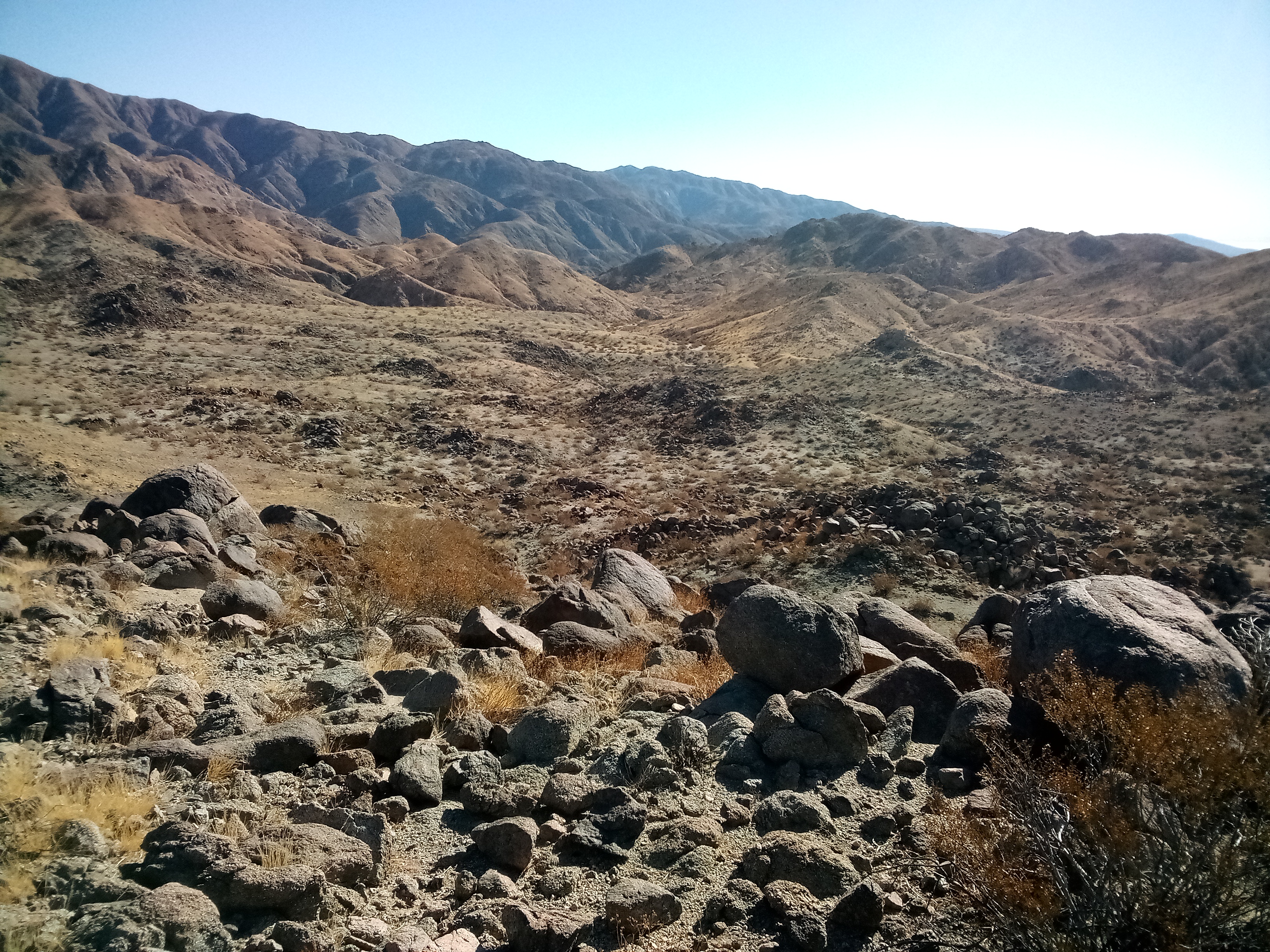
Ruins at Shadscale Mesa


 1. COTTONWOOD WASH ROAD - this forms the east boundary of the wilderness. The best way in is the Smith Camp Rd that leaves highway 191 south of Seleratus BM. It's a graded road to point 4418 where another graded road goes north to the Cottonwood road and a car might make it the whole way. The Cottonwood road is easy 4wd because of sand and chalk dust. Going south is a dead end and going north leads to the graded Green River Cut Off Rd. Posted 2025
2. COTTONWOOD WASH NORTH RIM - I was able to get to Horse Heaven walking the rim and some forks thru point 6184 then came back on the next rim to the north.   There is a parking area at the mouth for the rock art hikers. I just went up the rim to the first fork cutting thru. I went down there but hit a drop at the bottom. I came back up and looked at a route at N39 05179, W110 27514 that would work if I had a gator hook and 20 feet of line. There is one more just past that that might go but I stayed on the rim past point 5318 to 05839, 28221 then dropped down at some potholes with water. I walked that fork along the north side of point 5715 to a narrows blocked by falls just before the 5600 line. I came back to a gap east of point 5715 and went thru to the next fork then up that a short way to a minor class 3 fall, the hardest thing on this hike. I went up OK but easier for two and likely bypassable anyway. I kept going up the easy canyon to 05731, 29043 where a sheep route goes up the rim. I went on up to a neck at 05737, 29287 and on up the rim past peak 6015 then just past point 6184 there is a saddle where I thought I was toast. But straight across the saddle is a class 2 crack where sheep go up. Then all I had to do was skirt around the head of the forks then down the rim to past point 6015 and down to a rim at 06186, 29163 el 5850. I walked the rim down to a drainage at 05935, 27992 which comes back to the rim at some potholes with water. I needed that so I filled up. I kept going down toward point 4925 and hit a trail there at 05460, 26516 that took me down a canyon and to the road with a short walk back to the start. That took me 9 hours, 15 miles with nearly 2000 gain. Rarely steep. This could be shortened a lot by heading directly up to point 5318 on the rim and also skipping the side trip to the narrows. Posted 2025
3. COTTONWOOD WASH SOUTH RIM - there are ways up the rim and over to the rim of Spring Canyon. One way is to start at the mouth and go up a trail at N39 04758, W110 26018. It goes along the left side of a drainage and finally fades then it's easy on up the ridges. The second way is to go up Cottonwood to a class 3 route at 04694, 27037. It goes up to the left to the next level then it's easy to 04565, 27234 then it's a straight shot up the drainage to the rim. I then walked up the rim to 04151, 27483 to get down a  cliff and on down to Nates Canyon. Going up canyon are cottonwoods and potholes, some had water. I came to a minor fall and past that it's easy to go to the rim of Spring Canyon. Someone glued a dirt bike ornament on the rim at 03525, 28578 just east of point 5950. I then went NE down a fork that leads to the big drop in Nates. At a minor drop I went left to 03879, 27613 to get down then on to the drop. There I went north up a drainage that shows green on the topo reading 03949, 27284. I walked that a third mile to a large cairn and exited there and leveled off then made a hard right to 04339, 26910 to get on the descent ridge. I had a deep canyon on my left and just followed it down to the start. 5 hours, 8 miles with 1600 gain.
4. POINT 5948 is on the rim east of the Lower Black Box. The road down Tidwell Draw is easy 4wd. I parked and walked to a saddle south of point 4290 at N38 58112, W110 23703 then on up a ridge at 58146, 23962. I dropped off the rim at 58221, 24609 el 4800 and down into a canyon on the right. It has another little rim and the last spot to drop down it is at 58251, 24835 then it's a short walk to the main rim of the river. The rim is lined with domes so I went right around them into a drainage at 58248, 24820 then up that to 58525, 25072 and then to 58678, 25366 where I dropped into another drainage. I went on to 58804, 25583 then to smooth rock at 58949, 25759. There I just followed the forks that lead to the rim north of peak 6001. Along the way are potholes with 2 feet of water that day at 59177, 26241. At the rim I just walked it to 58938, 27190 and crossed a drainage to get to the summit. No sign of humanity there. 6 hours, 10 miles with 2200 gain. 200 of that is on the return. I put a track on peakbagger under peak 6001. Posted 2025.
5. SMITH CAMP LOOP - a trail goes to the rim from the camp then it's easy to loop north back. The camp is at the 4-way at BM 4548 on the Cottonwood Wash Rd. First I stashed a bike 1.2 miles north at a fork near BM 4606 on the Cottonwood road then came back to the 4-way and turned west to the camp. A trail goes up canyon on the left bank and will bend south. I got off there to smooth rock at N39 01634, W110 24787 then up to a trail at 01618, 25002. It goes on to 01608, 25659 then in another fifth mile it bends left to the rim. I could see  that I could walk the rim south to a point at the 5600 line. But I walked north on the rim until domes got in the way. But there are obvious passages to the right of the domes. I went on to 02214, 26300 and turned right down a canyon. At a drop, I cut over the left bank to 02484, 25928 and dropped down. At the next drop I bypassed on the left then up a ramp at 02734, 25702 to get on the rim. I went on to 02801, 25573 then walked down the rim staying with the canyon on my right. Nearly 4 hours with 1000 easy gain. Cars might make it to the camp from the south or at least get close enough to ebike it. SOUTH LOOP - I returned later and took the same route to the rim but then went south to the point at the 5600 line, north of point 5370. Then I went to a rim at 01114, 25788 and then to 01083, 25452. At 01036, 25212 I went south across a wash then down to the starting trail at 01108, 24660. It took me north back to the start. 3 hours, 1200 gain, all easy. Posted 2025
6. PEAK 5035 is east of Cottonwood Wash. The colorful east canyons are the main attraction. I took the graded road along Cottonwood Wash and turned north on the road going past Trail Spring. I had 3 miles of easy 4wd and ebikeable to a fence. I parked there and walked to a canyon at N34 04022, W110 20637. I went up that to a fork at 04378, 21371 and then up the ridge between the forks to point 4730 and on to the summit. There are ways to drop south off the summit, the easiest being by way of the east saddle and then down canyon and past a fence at the mouth. I left the wash and thru a saddle on the left at 03579, 20734 and headed back. 2 and a half hours with 400 noticeable gain. Posted 2025
7. JOE HOLE WASH is SE of Cedar Mountain running parallel to the main road. A one way hike is too easy to pass up. I parked at a crook in the road east of BM 5473 then rode 3 miles west to the road turning south to Lews Hole. That's a minor drop with a pothole. A trail goes along the right rim for a tenth mile then drops down at a fence. I strolled on down canyon and then for the last third mile turned north up a draw to get to my truck. 100 minutes, 4 and a half miles. Cattle impact is light. Posted 2025
8. UPPER COTTONWOOD WASH - a sheep trail goes out of Big Hole Wash and over into the main fork of Cottonwood. The Big Flat Rd turns to 4wd at peak 6215 and then shortly comes a fork. Go left for 2/3 mile to a big fall. A mtn bike would work on that road. Walk to the trail at N39 05959, W110 31704. It goes up onto a point then go another tenth mile up the point then left up a draw to a rim then to 05944, 31437. Drop down there then thru a gap to 05923, 31248 where it's easy to drop into Cottonwood. At the 6040 line there is a drop, the first of many. I just walked level to the right and dropped to a flat and walked a sheep trail at that level to a 1933 marker at 05744, 30732 el 6000. I went on a bit more to a point then turned back. I spent less than 3 hours. Easy hike. It looks likely that the hike could be extended to Moonshine Waterhole for a loop.  Posted 2025
9. MOONSHINE WATERHOLE - it's a one hour hike to that but I kept going down the rim then back on the rim of Nates Canyon. I parked at the end of the jeep road in Box Flat and walked the easy ground around to Moonshine then walked the north rim down to N39 04667, W110 28938 on the south side of peak 5995 where I could walk down to the creekbed. I went down to the big drop passing cottonwoods and more waterholes, one as big as Moonshine. Then I came back and up a ridge at 04626, 28627 to get on the rim of Nates. I walked on up along the south side of Nates BM. A slope there at 04138, 31510 goes up and around to the north side of the summit block where I chickened out on a crumbly class 3 step about 8 feet high. It's best to have 2 people and a hand line. I walked on around the peak back to the start on a hiker trail. 6 hours, 20 minutes, and 10.7 miles with 1800 gain. Rarely steep. I put a track on peakbagger. There appears to be a stock trail to Moonshine that starts near the end of the road and goes thru Jackass Flat but no cattle for decades. Posted 2025 
10. UPPER SPRING CANYON - for this I started at the end of the road in Box Flat and walked past Nates BM to a gully  SE of peak 6702 at N39 03717, W110 31541. I went down that to bottom and walked downstream to the big drop with many deep potholes along the way and cottonwoods. At the drop, I went left on the rim a  few feet then up to smooth rock at 03333, 29959 el 6000. I walked upstream along the 6000 line for a tenth mile then up a drainage to the rim then walked it back. 5 hours and 1500 gain. The only steep gain is the 400 at the exit gully. Nothing harder than class 2. Posted 2025
11. HORSE HEAVEN JEEP ROAD - this starts on the Cottonwood Wash Rd just north of BM 5073. It goes up to el 6200 on the rim of the north fork of Cottonwood Wash and soon ends. No tricky spots on the road. Posted 2025
12. THE SKYWALK is what I call the skinniest of ridges on the south rim of Pine Canyon north of peak 6630. The 4wd road in from the Box Flat Rd starts at Dry Pond and goes west for nearly 5 miles to a rock art site at peak 6632. There's only one main road to follow and it circles west of peak 6522. Just before the end there is a gully at N39 06022, W110 37992 where I went up and on to 05607, 38017 to get up to the last level then on to the ridge. I walked it out and back then on to the ridge running NW from peak 6645. I could see the canyon on the north side of it was passable so I dropped in at 05925, 38170 and on down to a drop. There I stayed on the right bank around a corner then walked a rim to 06702, 38555 where I could walk up along the west side of peak 6495 to get on the high rim then out to point 6485. I went back around the north side of peak 6495 to get back to Prickly Pear Flat then headed down a canyon at 06295, 37812 to get back to the start. 6 hours and 10.3 miles. Rarely steep. This is one of the great rim hikes of all time. No sign of humanity on those rims but for one cairn. I could see that point 6540 is hopeless. There are ponderosa pines in the bottoms west of peak 6765. Posted 2025
13. GRADE BENCHMARK el 5510 has an easy east slope. Turn off highway 191 at about mp 289.9 and go in on easy 4wd and stay left at main forks to get to the road going up Lost Spring Wash. That leads to the east slope then just pick a route up. I went up at N39 06874, W110 23863 then from the summit I went north across a drainage then down the rim of it to 07143, 24703 where I could get thru a cliff then weaved on down to the road. 2 hours, 800 gain, all easy and very pleasant terrain in a juniper forest. I wouldn't reverse this loop as the downhill leg is softer and steeper. I put a track on peakbagger. Posted 2025
16. POINT 6478 is on the rim where Buckhorn Draw meets Calf Canyon. At point 6228 on the graded main road is a good road going south for 3.3 miles to campsites on the rim. I could have drove a car there. I backed up a tenth mile to a DIY road that goes to the neck then I had a 15 minute stroll out to the point. Posted 2025
17. BUCKHORN DRAW has a graded road running thru it with  rock art and a dinosaur track with signs. Campsites all along the road have a $15 fee. A smooth OHV trails goes up Calf Canyon for 2.6 miles to the end at Cow Canyon but no fee to camp in there. A quarter mile upstream from that on the Buckhorn road is a faint road that goes a mile up the canyon north of point 5895. Nice walk. No cattle. Posted 2025
18. MEXICAN MOUNTAIN ROAD - it runs from the campground at Buckhorn Draw along the river for 14 miles to a barrier just before point 4723. It's easy 4wd and I saw ebike tracks all the way. Red Canyon is closed to vehicles but that only applies to saps. Everybody else drives around the sign. Posted 2025

19. SHADSCALE MESA is along the river just south of I-70. It's a short hike to the high point but a traverse is a lot more interesting. There is a low budget interchange on I-70 at mp 147. There is an underpass and gates on both sides of the highway. A half mile south on a crude dirt road there is a sign to lock a bike to. Then drive to mp 156.4 on highway 24 and turn and park at N38 52287, W110 23158 where a steep road goes up the mesa. Walk the road up then walk the rim to a canyon at 52928, 25123 and go up and over the high point. Then keep going on the rim to 54736, 4977 where a sheep trail goes down to a saddle and follows an ancient road down to the flats where the sign is. It took me an hour to pedal my bike around to the south side where the hike starts and there is a paved shoulder the whole way. The hike takes 3 or 4 hours, easy. I put a track on peakbagger. LITTLE SHADSCALE is what I call the small mesa to the south. I parked at a sand slide at the south end next to the pavement. Then I walked north on the road for a quarter mile then west up a valley to a canyon at 51541, 23745. I went up that to the top then north to the block that looks to be the high point. I went left around it and saw a possible route up but would have some tricky walking above a cliff. So I put it off until I can bring a friend and let them go first. I walked the mesa to the south end at 51261, 22910 and down the slide to the start. 2 and a half hours, easy. No cattle. Posted 2025
20. BENTONITE HILLS - the best hike in bentonite I ever took is in the area south of I-70 and east of highway 24. Turn off 24 at mp 155.9 and go straight thru a 4-way then stay left at main forks to a wash at N38 50989, W110 19764. Go 3/4 mile up that then walk the main wash to 51027, 18831 where it bends right then on to a washed out road at 50956, 18464. That goes up to the rim then go east over mesa 4606 then down to a lower rim and drop off it at 51201, 17058 and down to the flats. Go on to 50812, 17248 then thru a gap at 50364, 18442 then walk most directly back to the start. 3 or 4 hours, easy. All roads easy 4wd. Ebikes make all but the last 3/4 mile of the 4 miles of dirt roads. Posted 2025

Saturday, March 1, 2025

Table of Contents

Arizona 

  1. Eagletail Mtns
  2. Gibraltar Mtn Wilderness 2012
  3.  Harcuvar Mtns 2012
  4. KOFA 2011
  5. Kofa Indian Trails 2020
  6. Lake Havasu City 2023
  7. Little Horn Mtns 2012
  8. Little Picacho Wilderness 2022
  9. Mount Nutt Wilderness 2011
  10. Muggins Mtns, Gila Mtns 2017
  11. Oatman Wildflowers 2017
  12. Oatman Poppies 2023
  13. New Water Mtns 2012
  14. Plomosa Mtns 2013
  15. Quartzsite 2017
  16. Saddle Mtn 2012
  17. Trigo Mtns 2019
  18. Warm Springs Wilderness 2018

 California 

  1.  Anza Borrego Indian Trails 2025
  2. Anza Borrego State Park 2016
  3. Avawatz Mtns 2020
  4. Big Maria Mtns 2018
  5. Blythe
  6. Cargo Muchacho Mtns 2017
  7. Carson Iceberg Wilderness 2019
  8.  Central Sierra Peaks 2012
  9. Chuckwalla Mtns 2012
  10. Clipper Mtns 2016
  11. Coyote Mtns Indian Trails 2024
  12. Dead Mtns 2018
  13. Death Valley, east side 2018
  14. 2005 Death Valley, Utah Flowers 2019
  15. Desolation Wilderness 2011
  16. Granite Chief Wilderness 2011
  17. Indian Pass Wilderness 2017
  18. Indian Trails of Indio Hills 2025
  19. Joshua Tree South 2025
  20. Kelso Dunes Wilderness 2022
  21. Kingtson Range 2019
  22. Little Picacho Wilderness
  23. Mammoth Lakes 2019
  24. McCoy Mtns 2019
  25. Mecca Hills, Joshua Tree  2024
  26. Mopah Spring Indian Trails 2019
  27.  Mopah Range, Turtle 2015
  28. Mopah Range Flowers 2019
  29. Needles Flower Show 2020
  30. Nopah Range 2017
  31. North Turtle Mountains Indian trails 2019
  32. Old Woman Mtns 2017
  33. Palen McCoy Wilderness 2021
  34. Palo Verde Mtns 2017
  35. Pinto Mtns 2024
  36. Piute Mtns 2017
  37. Resting Spring Range 2017
  38. Riverside Mtns 2016
  39. Sacramento Mtns 2017
  40. Saline Valley  2011
  41. Sierra Buttes 2011
  42. Silurian Hills  2016
  43. Soda Mtns 2024
  44. Stepladder Mtns, Chemehuevi 2020
  45. Sweetwater Mtns 2019
  46. Tecopa & Amargosa Canyon Indian Trails 2017
  47. Tecopa Wildflowers 2024
  48. Trilobite Wilderness, Bristol Mtns 2017
  49. Turtle Mtns Indian Trail Backpack 2019
  50. Warner Mtns 2011
  51. Whipple Mtns 2015
  52. White Mtns 2013
  53. Wonderstone Wash Indian Trail 2026
Colorado 
  1.  Arco 2016
  2. Lemhi Range, Beaverhead Mtns 2017
  3. Lemhi Range, Lost River Range 2017
  4. Lewis and Clark Adventure Road 2018
  5.  Mackay 2016
  6. Pahsimeroi Mtns 2018
  7. Southern Idaho 2016
Montana  
  1.  

New Mexico          

Nevada                                                                                                                                                                    

  1. Anchorite Hills, Excelsior Mtns 2020
  2. Arc Dome Wilderness 2020
  3. Arrow Canyon Range 2017
  4. Austin, Nevada 2020
  5. Charleston Peak Wilderness 2017
  6.  Currant Mtn Wilderness 2011
  7. Desatoya Mtns 2020
  8. Desert NWR 2015
  9. Devils Hole Hills 2018
  10. East Range 2019
  11. Ely and Eureka 2011
  12. Fortification Range 2016
  13. Hawthorne 2013
  14. Golden Gate Range 2019
  15. Granite Range 2014
  16. Hot Creek Range 2018
  17. Humboldt Range 2019
  18. Independence Mtns 2015
  19. Jackson Mtns 2014
  20. Jarbidge Wilderness 2017
  21. Lunar Crater Peaks 2018
  22. McKinney Mtns, Monitor Range 2018
  23. Meadow Valley Mtns 2024
  24. Mormon Mtns 2017
  25. Mount Moriah Area 2011
  26. Northeast Nevada Peaks 2015
  27.  Northwest Nevada
  28. Pahranagat Valley 2015
  29.  Pahrump and Beatty 
  30. Pinon, Whistler, Sulphur Spring Ranges 2018
  31. Quinn Canyon Range, Grant Range
  32. Reveille Range 2019
  33. Santa Rosa Range 2014
  34. Schell Creek Range 2015
  35. Seaman Range 2015
  36. Shoshone Mtns 2011 
  37. Sheldon NWR 2014
  38. Silver Peak Range 2013
  39. Snake Mtns, Jarbidge Wilderness SE 2018
  40. Southeast Nevada Peaks 2015
  41. Stillwater Range 2019
  42. Stillwater Range, east side 2020
  43. Sylvania Mtns 2020
  44. Toiyabe Range 
  45. Trinity, Seven Troughs Ranges 2019
  46. West Humboldt Range 2019
  47. West Nevada Peaks 2012
  48. White Mtns 2013
  49. White Mtns South 2019
  50. Worthington Mtns, Tempahute Range 2017

 Oregon  

  1.    Gearhart Mtn Area 2014
  2.  South Sister Area 2014

Utah

  1.  
  2.  

Wyoming

  1.  
  2.  Encampment 2024


Saturday, February 1, 2025

Indian Trails of Anza-Borrego

The route down the east ridge of Pyramid Peak


Travertine Palms

Trail high up at Travertine Palms Wash

Rocks BM trail with peculiar rock piles

Palm near Rocks BM


 The NE corner of the park has a lot of trails and nobody goes in there but for a few hiking to the benchmarks. Nearly every bench has a trail making for endless loop possibilities. 
  1.   WONDERSTONE WASH INDIAN TRAIL - this one goes from S22 and up over a ridge then down Wonderstone. It's the most dramatic I've ever done and doubt it can be surpassed. Take highway 86 to Brawley Rd and drive to a gravel plant. Go south along it on an easy 4wd power road for nearly a mile and leave a vehicle at N33 21629, W116 02188. Ebikes and cycles can turn right up a wash there for another half mile. Then drive to mp 32.55 on S22 and walk a tenth mile to a smooth channel at 17973, 11202. Follow that to the west side of a hill and walk the channel along the base. Upon reaching the north side of the hill, drift right a little to get in the main channel of Palo Verde Wash where you'll see a million footprints. Go on up the wash thru point 18536, 11111 then on to the start of the trail at 18873, 10748 el 1350. The trail goes up along the rim of a side canyon and be sure not to miss where it crosses to the left side of the creekbed at the 1550 level. It goes on up steeply to the top of the ridge el 2000 then down to the bed of Smoke Tree Canyon el 1900. Go up the main canyon 400 feet as the crow flies and the trail exits right at cairns. It gets fuzzy, but be sure to be on it where it levels off  at 19430, 09720 el 2250. It's easy to follow to a creekbed where it vanishes.A pothole there had several gallons. Go up the bed for 300 feet and it exits left. The reading there is 19838, 09605 el 2500. It goes on to a saddle on the main ridge el 3150 then runs toward Rosa BM. It gets fuzzy and I dropped off it and down a ridge at 20493, 09839 then picked it up again at 20758, 09607. A rock ring is along the way at 20699, 09685. The trail goes on to 20895, 09359 then runs left of center at 20933, 09041 el 2480. I took the option to drop down and check for water in the canyon. There were some puddles and wet sand then a big drop. I went back on the rim there then down to where it gets skinny at el 2050. Some rock rings are there and I could see water below. I went down the skinny rim and soon the trail drops right down an obvious slope and bends left and hits bottom where the wash goes over a drop. A flat top boulder there has a grinding hole. The trail runs on the right bank to get past the fall and there is a sand slide. I didn't think that to be risky with a good stick, but a likely option is to get in the main arm of the canyon at about 20911, 08495.  I came up canyon that far on a previous hike if my GPS was reading correct. It's a smooth wash on out to the mouth and I stayed in smooth channels near center to 20950, 05151 then cut over to another channel at 20905, 05037 that took me to the west saddle of peak 649. A trail runs down a wash there and goes up on the left bank at 20811, 04653 then on to higher ground. I then moved left to 20978, 04202 where I could walk the rim of a wash on down to 21404, 03068 and then obvious the rest of the way. That took 8 hours, 15 minutes and nearly 14 miles. Noticeable gain is 2000. The water I saw was from rain 2 weeks before. I put a track on peakbagger under Marble Peak 3320. Posted 2026 
  2. WONDERSTONE WASH LOOP - a one way hike can be done up Travertine Palms Wash then over into Wonderstone. Take highway 86 to Brawley Rd and drive to a gravel plant. Go south along it on an easy 4wd power road for nearly a mile and leave a vehicle. Then take the highway to 86th Ave and go west on good dirt to a gate. There is a large pullout just before the gate. Walk south a few feet to a main wash. That works for a fifth mile then I had to get on the left bank and head for N33 24977, W116 05112. I walked along a wash then in it and on to a trail at 24275, 05701 that goes thru the palms then up the right bank into a saddle on the rim of another wash. I got on the left bank of a wash at 23973, 06032 and went up it a tenth mile and stepped up to a higher level and kept walking the edge of the wash to the end at the 940 line. I went straight down a slope to the wash then up thru a narrows and picked up the trail on the left at 22759, 06994 el 1080. It goes up on top of a bench then on up canyon and fades where the bench ends and a ridge starts. But the route most likely continues up the ridge which I went up almost to el 1800 then leveled off to the right to get on the divide. I had a trail again that skirts bumps and along the north side of peak 2052 and then at 21528, 08011 el 2000 it goes into a saddle. I leveled off there but should have gone higher because I didn't find the trail again until 21477, 08225 el 2100 and lost it again but found it at 21376, 08402 el 2200. Now I had to cross a wash to get on a ridge to the rim of Wonderstone. I got to the rim at 21051, 08217 el 1900 and saw no way down so I walked the rim on a trail for a third mile and saw a way down then walked the wash past peak 649 and got up on the rim at the 460 line. I walked pavement to 21351, 04225 and stayed on the high ground but vehicle damage would make me scout another route next time. I followed the high ground to the flats then on to my cycle. 8 and a half hours, nearly 15 miles with about 1000 gain that requires any effort.  It would take 9 hours with just cars for the shuttle. I put a track on peakbagger under Abe BM. Just going to the palms and back would be a 3 hour hike. I saw no hiker tracks there. Posted 2025
  3. HOT BENCHMARK LOOP -  Take highway 86 to mp 60 and turn east on Treadwell road to get under the highway to a power road as shown on the topo. That goes less than a mile to Big Wash then drive up that to the trail at N33 19336, W116 01558. That soon comes to a fork where I stayed left to a gully where the trail tops out at 19649, 01759.  Then on to 19455, 05324 and then 19996, 01867. In another 200 feet the trail forks. I went left past a cleared circle then to 20111, 01993 and in another half mile left the trail and went left at 20359, 02418. I followed the high ground to 19932, 03202 where I crossed a deep wash then on toward Hot BM. I hit the rim just past the BM and came back to it then followed a trail down the rim and into Big Wash and back to the start. 3 and a half hours, 7 miles with hardly any strenuous gain. I put a track on peakbagger under the BM. All roads are easy 4wd. Posted 2025
  4. BIG WASH TRAIL - this one runs along the rim thru Cool BM and Hot BM.  I went up Arroyo Salada over into Big Wash then down to highway 86. Take highway 86 to an exit at mp 61.1.  Parking there should work but who knows if vandals come along, so I went south on the frontage road for a fifth mile to Gravel Wash at BM -87 . Cycles can go a fifth mile up that. I left my cycle there then drove 15 miles  to mp 35.5 on S22 and strolled up Arroyon Salada to the saddle el 2000 at the end. Then it's best to walk the left rim down the other side to Big Wash then down to the 1180 line then exit left up to the bank. Walk the bank to the trail at N33 19116, W116 06173  then on past Cool BM then comes a dangerous gap. The sissy route is to go left on a trail at 19468, 05413 and down a point to the wash. Walk that to the first right bend then back up to the rim and on past Hot BM then take a left on a faint trail at 19566, 03662 and walk a bench to 19652, 02923 then left down a  gully to the wash. Walk that then exit at 19930, 01593 to get to the highway.  This hike takes nearly 6 hours, nearly 12 miles. Noticeable gain is about 400. If using an ebike for the shuttle there is a paved shoulder except on S22 from 86 to the park entrance. Sunrise Drive is a shortcut in town. I put a track on peakbagger under Cool BM. I found out later that I could have left the lower vehicle at the parking spot for the Slip BM loop. Posted 2025.
  5. BIG WASH SOUTH RIM - for this one I walked up canyon then back on a trail on the south rim. Take highway 86 to mp 60 and turn east on Treadwell road to get under the highway to a power road as shown on the topo. That goes less than a mile to Big Wash then drive 2 miles up that to a main fork. Vehicles go left but park there and walk the right fork. It had zero tracks. Soon there is no main wash so I just guessed at the channels and they took me to the north bank where the blue line is on the topo. For variety I went up an island at N33 19239, W116 04410. That ends in a third mile then I should have gone left to a main wash but instead I went to the north bank where rocks forced me back to the wash. The trail is on up on the south bank at 18929, 05125. It goes 300 feet down a gully then right to 18894, 04967 where it's more obvious. It goes to 18895, 04645 then down a point to the flats. Then either stay low back or use a trail on the left rim. I did that by going up a gully at 19030, 03951 to get on top then walking down to the point then down to the right to get to the wash and back. 3 hours or less, easy. All roads are easy 4wd. Posted 2025.
  6. SLIP BENCHMARK LOOP - this one combines two trails and might be the best. Take highway 86 to an exit at mp 61.1 then go north on the frontage road for a third mile to a main wash then up that to the power road on the topo and that's the park boundary. Walk up the wash a half mile then to a trail at N33 19985, W116 01722. It goes on to a fork and to 20112, 01994 then 20550, 03036 and on to 20532, 03284. I lost it near tire tracks but it goes right of the tracks at 20559, 03191 and  I was on it again at 20572, 03407 then it drops to a wash at 20592, 03550. It goes up the wash over a mile and past Low BM then exits at 20731, 04711 and goes over to the rim of Wonderstone Wash. Stay on the high ground over Slip then on to 20427, 06457 where you cross a gully and a trail is on the other side up on the rim. It goes to 20288, 06194 then on to a point. A gully on the left at 19729, 05275 is the way down to a main wash. Go down that and a trail is on the right rim at 19883, 04074. Stay in the wash until a third mile away then go up a point to the trail. It goes on to a rim at 19939, 03489 and left of a hill then to a rock ring at 19860, 02014. It then drops to the wash that leads back to the start. 6 hours, 12 miles and 300 noticeable gain. I put a track on peakbagger under Slip and Low benchmarks. Next time I'll stay in the canyon south of Slip to connect the trails for a shorter hike and something different. Posted 2025
  7. PYRAMID PEAK el 3480 has an Indian trail to the west saddle el 3150. I went over the summit then down the east ridge. Take highway 86 to an exit at mp 61.1 then go north on the frontage road for a third mile to a main wash then up that to the power road on the topo and leave a 4wd there. Then drive to mp 32.55 on S22 where you should be reading N33 17886, W116 11213 el 900. Any farther west means more rocks. Walk a tenth mile to a smooth channel at 17973, 11202. Follow that to the west side of a hill and walk the channel along the base. Upon reaching the north side of the hill, drift right a little to get in the main channel of Palo Verde Wash where you'll see a million footprints. Go on up the wash thru point 18536, 11111 then on to the start of the trail at 18873, 10748 el 1350. The trail goes up along the rim of a side canyon and be sure not to miss where it crosses to the left side of the creekbed at the 1550 level. It goes on up steeply to the top of the ridge el 2000 then down to the bed of Smoke Tree Canyon el 1900. Go up the main canyon 400 feet as the crow flies and the trail exits right at cairns. It gets fuzzy, but be sure to be on it where it levels off  at 19430, 09720 el 2250. It's easy to follow to a creekbed where it vanishes. Go up the bed for 300 feet and it exits left. The reading there is 19838, 09605 el 2500. It goes on to a saddle on the main ridge el 3150 then it's easy up to the summit then down the east ridge. Be careful not to disturb a rock ring at el 3250. Another possible one is at el 2950. I went on down and over a bump to a saddle at 20211, 08383 el 2700 and it has a ring. I could see a saddle el 2350 down to my left and it has a good ring. I walked east from there down the left bank then cut to the right bank at 20302, 07971 el 2000 then soon I could see a slope to get me up to a saddle on the left rim. I went thru it then down the left bank to a deep wash and got on the left bank of that. When it ended I cut over to the right bank and then was on a huge bench. I drifted over to the right edge and on down past the southern leg of the Slip trail. That would be the best way back but I wanted to check out the bench ahead. I went to to the south of peak 711 reading 20359, 04622 then soon crossed a wash and walked the base of a slope. When that ended I moved far right to stay on the bench then to the northern leg of the Slip trail at 20563, 03321. I took that across a wash to 20474, 02797 then for the last mile headed straight for my cycle. That took 8 hours, 10 minutes and nearly 14 miles with 2500 noticeable gain. I put a track on peakbagger. Posted 2025
  8. TRUCKHAVEN TRAIL connects Arroyo Salada Campground to the Calcite Mine road. Leave a bike at the campground at mp 34.9  then drive to mp 38.3 and turn right on a decent dirt road. Drive 3/4 mile to a deep wash and park. The trail drops down to the left but it's better to walk the road down then up the trail at N33 16533, W116 06523. It goes over a bench then back down and up into a side canyon where it goes up left at the mouth. It tops out on a bench then circles to the right to 16429, 06991 then on thru a saddle at 16348, 07351 and then enters Arroyo Salada Wash. Some people went up the wash but the hardy went up on the far bank and walked trailless terrain to 16338, 07993 and dropped into a wash and up to the trail at 16305, 08064. It goes over peak 960 to the campground then there is a paved shoulder to ride a bike back to the start. 100 minutes, 3 miles with 300 noticeable gain for the hike part. I put a track on peakagger under peak 960. Posted 2025
  9. PALM WASH has trails on the east rim. The Calcite MIne road turns off highway 22 about a half mile inside the park boundary. It's is easy 4wd down across the wash of South Fork then up the other side for half a mile to a fork that goes down into main Palm Wash. That fork has a tricky spot. Once at bottom a trail starts at N33 17381, N116 06156 but soon there is a 6 foot cliff. I chickened out and went on downstream to an easy ridge at 17311, 05926 and it goes up to the rim and merges with the trail. Soon there is a fork and I stayed left along the rim to the base of the mountain. The trail bends right and fades so I came back on got on the other fork at 17831, 06130. It goes on to 18035, 06077 then 18140, 06035 and then at 18204, 05969 it comes to the rim of the North Fork. Just below is a hunting blind overlooking Sheep Tanks in a slot. There is no way thru the slot so I walked the rim to 18205, 05846 then down an easy drainage. I strolled on down canyon and took a shortcut trail at 17370, 05246 to get back in the main fork and back to the start. 3 hours, 5 miles with 400 noticeable gain.  JOSHUA CANYON is the name on the peakbagger sat image for the one on the west side of the Palm Wash North Fork. I parked at 17408, 05210 and strolled up past the 500 line to a main fork. I went right to 3 forks. I took the middle one that has catclaw needing a trim. Soon there is a palm then a good narrows and then a fall. I went back to the catclaw and took the left fork and it opens up then I circled left up to the rim at 17907, 05793 el 860. I went up to the 960 line to get over to the east rim then down it to a trail at 18040, 05660. I went on down the rim to 17637, 05372 then dropped to the right down a wash that leads back to the start. 2 and a half hours with 400 noticeable gain. Hikers walking in from the Calcite road can use the trail at 17309, 05284 to shortcut into the canyon out of the main fork of Palm Wash.    Posted 2026
  10. GRAVE WASH has trails on the rims. I went into South Fork from the Calcite road as above and down to a gully on the left at N33 17396, W116 04608. A tenth mile up that and it's easy to go up on the left rim and walk a spotty trail to the rim of North Fork. The trail goes along that and past peak 711 meets a second trail (which is the return trail ) then in another fifth mile at 18235, 05620 is where the Indians went down to Sheep Tanks. I stayed on the rim to 18495, 05981 to get over a low ridge then on to the rim of Grave. Going down Grave would be easiest and a way down is at about 18575, 05725 but that's an OHV route. So instead I went down at 18654, 05905  then up the main fork and it was obvious how to go up to the rim on the north side of peak 1021. Then south of the peak the trail shows up on the left edge at a drainage shown on the topo. Just before peak 833 there is a saddle with cairns in a circle. Do not disturb as that is likely Indian. A tedious gully goes down there but I went on over that peak then down the ridge to 18410, 05047 el 740. The ridge splits there and the drainage in between is the one but it's best to take the right rim of it down to 18419, 04978 then drop left to the wash and on to the main wash of Grave. Then cross over and up a fork and up a faint trail at 18227, 04968 that goes thru a saddle and down a wash. But don't go down the wash and instead go west onto a bench that has the return trail that goes to the rim of North Fork and retrace back. I lost track of time and distance because I pieced it together over 2 days but likely would take 5 hours.  The 4wd road down South Fork has no tricky spots. An alternate way in is to take a primitive road in from highway 22 at the tower then get on a little ridge at 16992, 04700 and in 300 feet it's easy to drop left to the wash. That would be nearly a mile of extra walking each way but easy.  A third way to start out is to drive up North Fork and go up to the rim where the Indians did. That would shorten the loop by a couple miles but those are pleasant miles. Posted 2026       
  11. 17 PALMS LOOP - a spotty trail connects peak 960 to the palms. I parked at Arroyo Salada Campground and went over the peak on the trail to a wash where it faded. I crossed the wash then on to a gully at N33 16368, W116 07911 then to 16281, 07476 where the trail starts showing up but spotty. I went on to 16104, 07241 then at 15851, 06994 I had a good trail that bends right into a wash and on to the palms. I returned in the main wash with the blue line on the topo. Just upstream from the 500 line is a main fork. I went left there then over the rim at 16009, 08408 and followed washes back using the sat image as I had cell coverage. Nearly 3 hours and 200 noticeable gain. I put a track on peakbagger under peak 960. Posted 2025.
  12. ROCKS BENCHMARK TRAIL - this one is in the NE corner of the park accessed from 86th Ave. It runs on a bench south of Rocks BM. 86th Ave is gated where Lincoln St goes north. I rode my bike west past the gate for a half mile to the end of the road. Then I walked to a wash at N33 25548, W116 05413. I went .17 mile up that then took a left turn on to a wash at 25349. 05734 and then another at 25067, 06088. I went on until I was half a mile from the trail which is at 24483, 06482 and then I left the wash and went direct to the trail. I followed it past a rock pile made by the Indians. It goes up on the bench at 24467, 06580. Rock piles line the trail and then end in a third mile but not because they ran out of rocks. I went on to a fork at 23954, 07710 at the 1040 line where I began a loop. I stayed left up the bench to 23600, 08251 then to a faint trail at 23378, 08829. It took me lower then I walked thru a low spot in the next rim to 23342, 09054 where I could drop to the smooth wash. I went down and came to palm saplings and then a bigger palm and then at 23951, 08088 I climbed up the bank. Then I crossed a gully to the trail at 23932, 07976 and it took me to the fork. Retracing back out is best. I tried following the trail back out more to the east and it dumped me into the rockiest wash on earth. 6 hours and a whole bunch of miles. I gained nearly 2000 but all easy grades. A shorter hike would be to go right at the trail fork and into the wash and up to the larger palm. I didn't get a waypoint but looks on the sat image to be at 23653, 08561. How many people ever see that? Posted 2025

Tuesday, January 21, 2025

Joshua Tree NP South

Huge marker near Ridge BM

Survey marker on Ridge Canyon rim with peculiar pipe

Ridge Canyon rim

Slab at Ridge Canyon

Guzzler in Little Fargo

Peak 4134

Bert Basin

Tims Ladder Trail

East Deception Canyon


East Deception Canyon


  DILLON ROAD runs along the south side of the park and various side roads access the canyons. The historic aqueduct has made access tricky at some canyons. Posted 2025
FARGO CANYON ROAD - it goes paved to a quarry then 4wd for 2 miles to the mouth of the canyon then it goes to the far bank where some pavement has survived. That first 2 miles is lined with shooter trash and household trash. It's fairly clean on up canyon and easy 4wd until the SE side of Low Fargo BM. Jeeps have no trouble though and then the road splits where Rockhouse Canyon comes in. A half mile up Rockhouse are some bad spots then comes a main fork where the main road goes right and on to the Thermal Canyon road but I didn't ride it. The main arm of Rockhouse on up from that main fork is a rocky mess. One jeep got to the 2600 line and dirt bikes likely go all the way thru to the road at the upper end. Ebikes would make it nearly a mile inside the mouth of Fargo. I put info on peakbagger on the map for High Fargo BM. Posted 2024
RIDGE CANYON  is what I call the one between Rockhouse and Little Fargo. It's an easy loop up canyon then back on the west rim by way of Ridge BM. 4wds make it to the 1600 line in the canyon. Just past there are slabs on the left bank that must be associated with aqueduct construction. It's mostly smooth sand up to a 15 foot fall at the 2760 line. A gully on the left is an easy bypass then shortly a second little fall is passed on the left. Then a third fall is class 4 but I chickened out and went left around it then up a minor chokestone and on to the east side of peak 3659. A left fork there leads to the rim south of that peak then no issues down to Ridge BM and then a huge marker above the aqueduct. The rim is easy on down to peak 2594 and then a SE ridge leads down to the slabs. More markers are on the ridge at the 2080 line. 5 hours, 20 minutes, 8 miles with 2140 gain according to the app but hardly any is steep. Posted 2024
HIGH FARGO BENCHMARK el 3051 is an easy loop out of Fargo Canyon. I parked at the NW ridge reading N33 46139 , W116 04095 el 1700. I went up then down the north ridge to one of those huge markers over the aqueduct at 45519, 03379 el 2900. Then on down to 45693, 03304 el 2750 where I could either stay on the ridge down or move to the next one to my right. I chose the latter because I could see it. I hit bottom and strolled back. 3 hours, 15 minutes with 1500 gain. Posted 2024.
ROCKHOUSE CANYON - I walked up canyon then back over peak 4134. I parked a  half mile up the canyon north of peak 2562 then walked up the main fork and took the fork that goes to the 22 on the topo. The fork turns south there toward the peak then at the 3800 line I got on the right rim and on up to the summit. The reg there was placed by M&L in 1980. The next party came in 1983 then the last in 1993. I kept going down the south ridge to N33 47299, W116 01664 el 3550 where I could see the rest. 4 hours, 21 minutes and 8.4 miles. The gain was 2150 but all easy but for the last 200 up the peak. Sissy drivers can park near Low Fargo BM and it will only add a mile each way. Posted 2024.
LITTLE FARGO CANYON makes a good loop up canyon then back on west ridges. I followed the main road into Fargo Canyon as shown on the topo then followed obvious tracks leading into Little Fargo. I parked at the main fork near point 1539. It's easy 4wd that far. I walked up the right fork to a narrows at the 1960 line where a 15 foot fall stops vehicles. A class 3 rock ladder on the left is easier than it looks. I went up canyon to a guzzler that explained why I was seeing a million sheep tracks. 4 young sheep carcasses where there. I went on up canyon and took the fork along the east side of peak 3135 then up a ridge at N33 48718, W116 05719 el 2900. At the 3400 line I dropped down to the main ridge then stayed right of the first two bumps then left of a third large one and on to the west saddle of peak 3182 reading 48732, 06868 el 3100. I stayed on top of the ridge weaving boulders and it soon got easier and then on to the descent ridge at 48689, 07351 el 3000.  A handy sheep trail at 48360, 07249 el 2600 to the right of center makes it easy to go on another fifth mile where I dropped right down a ridge into a basin. I call it Bern Basin. I followed smooth sand down that and had one class 3 fall 15 feet high. I scooted down that on my butt then strolled on to the start. 5 hours, 8 miles with 2100 gain and hardly ever steep. ALTERNATE - another idea here would be to use Ridge Canyon for a loop in the two canyons. Posted 2024.
BERN BENCHMARK is on the west rim of Little Fargo. I made a good loop by parking at the 1160 line and walking up Little Fargo and then up the fork that goes into Bern Basin north of the peak. I went up a little peak on the rim of the basin for a view at N33 47906, W116 07444. I came back down the wash and thru a minor saddle at 47544, 06925 then up to a saddle on the right to get on the main rim and walked it over the BM then on down the rim to the start. Nearly 4 hours and maybe 200 noticeable gain. Easy. The basin is the prettiest area around. Posted 2024.
INDIO HILLS HIGH POINT has a jeep road all the way, but I made a hike out of it by walking up the road then down the long south ridge. At the junction of Dillon and Fargo roads, there is a dirt road heading west to the huge power lines. The southern road along the lines is the better one. At tower #27 there is a sandy roading cutting right that goes thru the hills. The reading there is N33 45062, W116 11259. Stay left at a main fork to get to the east side of the ridge. I parked north of peak 552 then walked the road up to the summit then back down the south ridge on a spotty trail. At 46069, 11611 I dropped down a gully back to the start. 3 hours, 1200 noticeable gain. The jeep road is steep but not eroded. I saw ebike tracks all the way to where I parked. NORTH RIDGE ROUTE - the Macomber Palms hike starts out up the north ridge of the peak and that's a shorter way up. Posted 2024.
BERDOO CANYON ROAD - this starts out as old pavement then at 1.3 miles in from Dillon Rd it drops into a wash. I call that spot the shooting gallery. Shooters have targets in the wash and they shoot in every direction. That lasts a quarter mile. Segments of driveable pavement have survived beyond there until the last segment on the left at point 1558 which is only wide enough for two wheelers. 4 wheelers stay right around it. The first tricky spot is at the 1900 line then at the 3400 line the road splits. The one on the right bank is the lesser of evils. Soon after that is the last tricky spot at a gooseneck then no issues to where the road tops out next to peak 4791. I stopped there, 10.5 miles in. I could have rode an ebike that far. Stock 4wds have no problem with this road. The aqueduct construction camp was just above the 1600 line. It had a hospital. Count on shooters 24/7  as far as the park boundary. I heard a machine gun one night. Cycle riders should wear a bulletproof vest and armored helmet. I put info on peakbagger on the map for Little Berdoo BM. Posted 2024.
WEST BERDOO CANYON is a smooth one that makes a good one way hike. I parked on the Berdoo road at a gully reading N33 49334, W116  10191 el 1250. I went up that then over to the main wash at 49523, 10645 el 1400. I went up staying left at main forks to the SE saddle of Push BM. I left my pack there and went up to the summit and back then down the ridge toward Center BM then on down to Dillon Rd to a pole near the 1000 line where I had my bike stashed. 2 hours, 40 minutes with 1300 gain. Only the last 500 to the peak is steep and that can be skipped. Posted 2024.
INDIO CANYON is smooth sand most of the way. I did a loop up canyon then back on the rim but the hike has to be started at dawn before shooters show up. I parked on the Berdoo Canyon road where it dips into the main wash a bit over a mile in from Dillon Rd. I walked downstream a third mile to an abandoned road going over the rim into Indio. I strolled up canyon and had some minor class 2 falls but at the 2600 line there is one 7 feet high bordering on class 4. I got up it OK then on to the saddle south of peak 3255. I walked up the rim on a sheep trail that levels off along the left side of the peak then went on to a deep saddle el 2150 near Berdoo Adit 1. I dropped down the drainage there on the left bank reading N33 49413, W116 08924 and then about halfway down moved right on smoother ground and hit the Berdoo road at the 1640 line. A bike there saves a 2 mile walk back. That took 5 hours, 8 miles with 2600 gain but 2000 is up the easy canyon. Those stats are just the hiking part and don't include the bike shuttle. Going one way from the 2640 line in Berdoo Canyon then over into Indio and down the canyon to Dillon Rd would avoid shooter risk but not entirely. A bullet fired at an optimal angle could hit Indio and the gravel plant and Dillon Rd. That would be a 7 mile hike and I would take a hook and line for that tricky fall. That's a pristine canyon. Posted 2024
PEAK 4717 is on the north rim of Berdoo Canyon. I made a loop up the east canyon then down the SE ridge. I parked on the Berdoo road at the 1900 line where there is a bad spot. I walked up the road and took a left fork at N33 50198, W116 07802 el 2100. I followed the forks that go to the 34 on the topo. At el 2700 there is a narrows with 2 tricky falls about 8 feet high. I barely made it up but there is a chicken route around the right on a mine road. I kept going up past the 34 then up to the saddle el 3950 on the main ridge. I followed a sheep trail up to the 4400 line then angled right to a trail at 51973, 08543 el 4500 and that got me around a peak to the last saddle. The reg was placed by M&L in 1981. I went down the SE ridge that leads to point 3056 then at el 3400 I could see an easy ridge going down to the right. I dropped down it to the main wash then down to a drop at the 2200 line. I backed up a little then up a minor class 3 gully to get on the south rim then went back down at the base of the fall and strolled on out. 5 hours, 8 miles and 2800 gain but the first 2000 is up easy washes. Posted 2024.
LITTLE BERDOO BENCHARK el 5400+ has easy routes but the scenic route is up the SW canyons and ridges. I parked on the Berdoo road at the return canyon el 2100. Lacking a shuttle, I walked on up the road over a mile to canyon at N33 49979, W116 06664 el  2500 and went up that to 50796, 05399 el 3850 where a steep ridge took me up to the rim. I followed a spotty sheep trail on up to the summit then on to peak 5238. I dropped down a ridge there reading 52149, 06048 el 5150 and walked down thru point 4620 then at el 3250 a crag is in the way. Sheep go along the right side and then the easiest looking route bends left to 50827, 07217 el 2650 where a trail drops left to the wash then on back to the road. 7 hours, 11 miles with 3700 gain but the first 1700 is up easy washes. An ebike shuttle would save over a mile. I put a track on peakbagger. Posted 2024.
  • DECEPTION BENCHMARK el 3241 - I went one way up the south canyon to the NW saddle then over the summit. I parked on the Thousand Palms Rd near the locked gate near BM 1494 then coasted back down for a mile and a half and walked to N33 52826, W116 17987. That got me around the north side of private land and around a point then I strolled up the mostly smooth canyon that runs east of peak 2460 and into the saddle. Then I had easy ridges over the summit and down to the gate. That took 4 hours, 18 minutes and 7 miles with 2300 gain. The first 1600 is up the easy canyon. Reversing this would mean starting 500 higher but the strain gain would be more than double. But you could walk washes to the north saddle of peak 3098 then up the ridge. No shuttle required for that version. Posted 2025
  • STUBBE SPRING LOOP - this is a long but easy one up canyon from the Thousand Palms Rd then down the south ridge of peak 4477. People are driving around the locked gate near BM 1494 but an ebike is the best option. The road to the Hidden Gold Mine is closed but easy to walk. I just walked up canyon then wanted to take the fork with a prospect but it's a disaster. I stayed in the easy main wash to N33 57848, W116 15304 just before the 3800 line then up a gully on the right to follow the rim up 300 feet to a flat. Then I leveled off above the prospect and dropped in just up stream of it. Then I followed the topo into the fork with the springs. I had to drop down a steep gully. The southern spring has a thicket and water some of the time. A camera was set up there. I went on to the defunct guzzler then to a trail at 57596, 13826. It goes a mile then turns left but I stayed straight in washes to the rim at 56196, 12646 then down and over the right side of peak 5102 then down to peak 4477. There is an option there to take the wash down past the mine. It would add 2 miles but likely just as fast. Instead I went over to the south ridge of the peak at 55559, 13235 el 4300 and walked it down. A crag at the 3640 line is passed on the right. 9 and a half hours, 16.5 miles with nearly 4000 gain. 3000 of that is easy, firm washes. I put a track on peakbagger under peak 4354 which is a mile and a half SW of the spring. Posted 2025
  • PEAK 3543 is south of the Hidden Gold Mine. I came in the same way as the Stubbe Spring hike but there is an option to come in from the end of Hotwell Rd but it's 2 miles of bumpy little rocks. I walked the mine road around to the north side of the peak and took a road up to point 3219. Then I went over the summit and ran the ridge almost to peak 3042. It turns rocky there so I dropped down a ridge on the right and walked a wash toward a road going to a radio tower. Just before the road I took a right fork then the next left but it's blocked. So I just followed the main wash on along the north side of the park boundary and picked the easiest ridge down to the start. 5 hours, 10 miles and less than 1000 noticeable gain. A really pleasant hike.  Posted 2025
  • HIDDEN GOLD MINE LOOP - it's an easy loop to walk the road to the mine then come back on the west rim of the canyon. The road fades about where the topo shows then it's an easy wash walk to the mine. I walked under the mine and couldn't see anything so whatever is there can't be very interesting. I resumed up the main wash to the 4120 line then stepped up to the rim and walked toward peak 4038 and dropped down at N33 55040, W116 12378. I went down to a mine shaft at 54823, 12442 el 3640 and looked back and saw another mine 200 feet back that I passed by and didn't notice. I went on to the final ridge at 54684, 12544 el 3400 and down to the start. 5 hours, 10.5 miles with 2600 gain and all but 100 or so is up easy washes. Rocks weren't an issue until the lower part of the final ridge. The best way to get at the mine road is an ebike as in the Stubbe Spring hike. Hotwell Rd is less appealing due to rocks. Posted 2025

TIMS LADDER TRAIL is a steep one going up from Sky Valley Resort. It goes to Wide BM then on to a minor peak el 3100. I went up and came down East Deception Canyon but it's easier to reverse it. Drive to the resort on Dillon Rd then go west another tenth mile and park at a gate. Then ride an ebike east on Dillon to Gemini and go north on that to a T. Go right a short way to a gate. Walk on past the gate a tenth mile then to avoid rocks head for N33 54219, W116 19864 then on to the road and up canyon to peak 2669. It's way easier to take the wash on the north side of the peak and get into the NW saddle then go up ridge to the east  of peak 3584 and then it goes north of the peak. Get into a canyon there at 57115, 20124 and go down it a quarter mile or so where it's easy to get on the west rim. Then just stay on the high ridge all the way to Wide BM. The trail starts at 56024, 21097 el 3100 and hits bottom at 54577, 21610 el 1100 and easy to follow. Rocks aren't an issue until below Wide BM where the trail turns rocky.  5 hours, 45 minutes, 10 miles with 1000 gain up the ridge and then minor ups and downs on the high ridge to Wide BM. SHORT VERSION - try going up West Deception along the east side of peak 3327 then into the north saddle and then come back on the high ridge. Or even easier, go up East Wide Canyon then take the fork running to point 2755. Posted 2024. 
EAST WIDE CANYON is an easy one to make loop hikes. I went up then back in East Deception. The road into East Deception is gated but Gemini is the next road west and it can be taken to the end then a right turn soon leads to another gate el 1320. I parked there then rode my bike to Dillon Rd then west to Wide Canyon Rd. That road ends then I went right for a block to Aqueduct Rd then took that to a fence. Hikers go around the fence at the far left end. I strolled on up canyon and saw hiker tracks as far as the 2240 line. I took the fork running past point 2909 then on to peak 3605. I took a fork there running SE to the saddle  which is south of peak 4128. It reads N33 58380, W116 19824 el 3850. I went down and soon hit a minor drop but a gully on the right gets past it. Then I had smooth sand down to the main canyon. At a main fork el 2800 there was an odd mud flow coming down the east arm and it coated the wash the rest of the way. I got on the right bank at 55639, 19179 for smoother walking and eventulally merged with the road. At the 1440 line I veered off the road thru 54219, 19864 then stayed left of rocks to get out. 6 hours, 45 minutes and 15 miles. I hardly even noticed the 2500 gain. But I did get a workout on the 6 mile bike shuttle. Posted 2024
⦁  LONG CANYON has dirt bike trails. A graded road  goes up canyon to a gate at the 1600 line. Bikes go around that and I saw tracks on the sat image all the way to peak 4100. Another trail goes over Blind BM into Blind Canyon. No dirt bike? Then forget it. Posted 2025
  • SHORT BENCHMARK el 3361 is east of Long Canyon. Cars can park in the canyon where a right fork goes up along the east side of Slid BM. Ebikes can make it up the fork to the park boundary then it's an easy wash up to the north side of Short BM. Then just go over the summit and down the west ridge and along the right side of a hill at N33 58122, W116 25130 then on down the main ridge to the start. 3 hours and 300 noticeable gain. Smooth washes and ridges. Who could ask for more? A few feet up the wash from the park boundary is a peculiar memorial nailed to the cliff on the left. Posted 2025