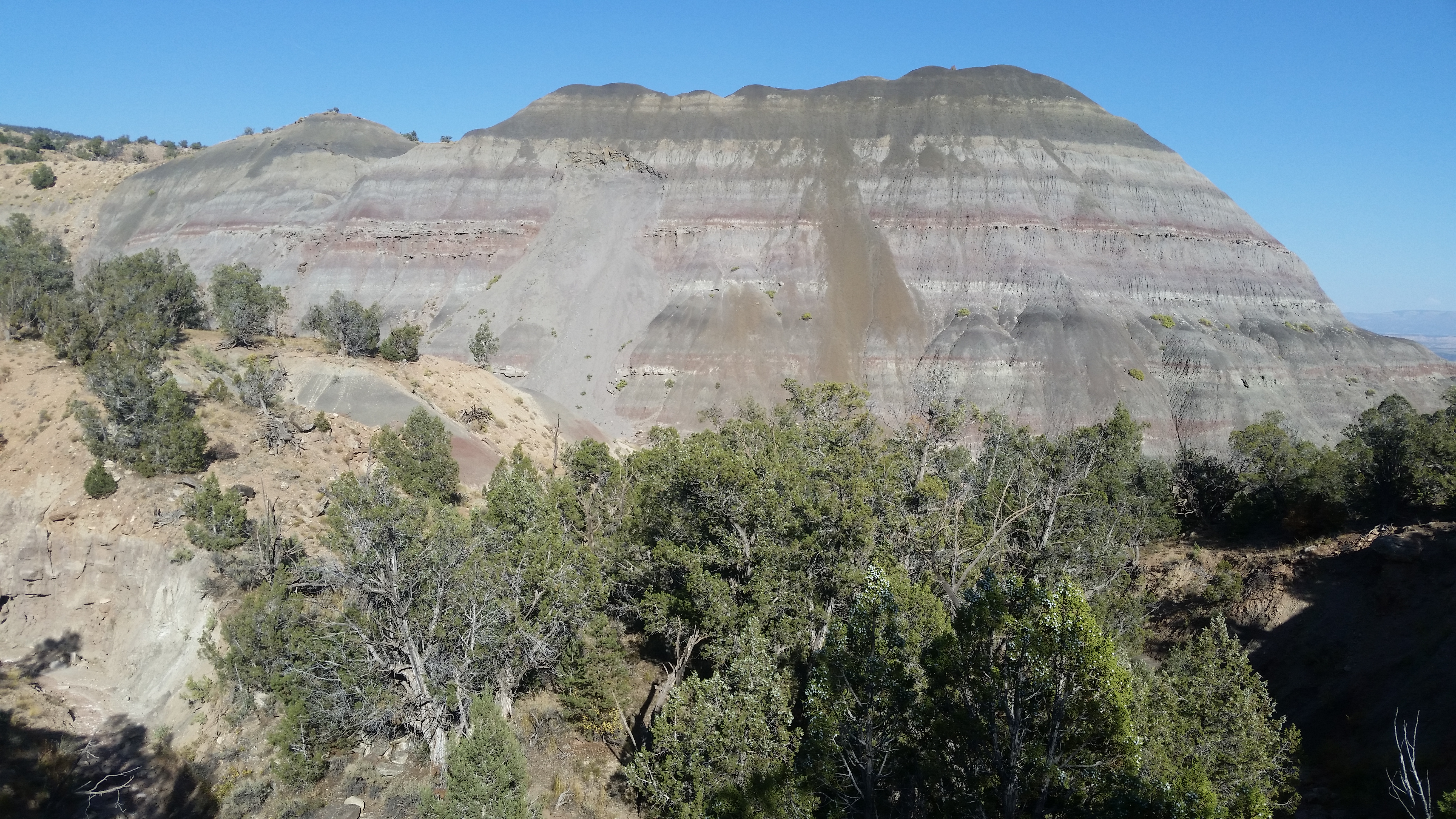
- An Indian trail runs up the west rim of Painted Canyon to towers and meets trails running east and west. Loops can be done. I put GPS tracks on peakbagger under Blink Benchmark.
- PAINTED CANYON TRAIL WEST LOOP - this one goes up the canyon then on the left rim up to the towers. Then I took one running west and looped back. This is the best hike on this page. From the Painted Canyon TH, I walked up canyon for 1.2 air miles to a main fork. I stayed left for half an air mile then took the obvious tourist trail up the rim. It goes down the rim to Ladder Canyon, but the Indian trail goes up the rim to the towers. At el 1500 it goes over a steep little hill but there is a wuss route around the left side. I got to the towers and the trail fades but I circled left to one at N33 39790, W115 59042. It follows a road along the wilderness boundary. At 39713, 59698 it shortcuts a bend in the road and angles up to the right to hit the road again. All remaining coordinates are W116. The trail leaves the road and down a ridge at W33 39634, W116 00553 and on to 39584, 00759 then 39420, 01227. At the end of the ridge an obvious low saddle is to the left. I went thru and up a wash and up to the rim at 38976, 01789 with gorgeous pavement. I walked south a little toward Mecca Hill and into a wash that took me to a main wash then I went up that to a fork at 38530, 01569. I stayed left then left at the next one and it winds around seemingly the wrong way but nope it leads to the divide at 38436, 01375. I dropped down there in mud hills and walked downstream back to the start. 5 and a half hours, 11.4 miles, and maybe 500 noticeable gain. Next time I'll reverse it to be going downhill on the steeper parts and the sandy Painted Canyon. Posted 2024.
- PAINTED CANYON TRAIL EAST LOOP - this time I took the trail to the towers and came back in an east fork of Painted Canyon. From the Painted Canyon TH, I walked up 10 minutes to the sign for Ladder Canyon and went up that to get on the rim. I walked it all the way to the towers and stopped by Blink Benchmark. I then walked the road and headed for an Indian trail at N33 39873, W115 57898. It must have taken them to Box Canyon but so much vehicle impact makes it no fun now. It's better to just plot the best route along the flats to a fork at 38936, 57362 on the north side of peak 1707. It's soft sand down that back to the start and that's why I wouldn't reverse this. 5 and a half hours, 12 miles, 500 noticeable gain. Posted 2024.
- NORTH TRAILS - peak 1513 has trails on the west ridges. The Cactus City exit on I-10 has a high clearance road running south to towers. Westbound drivers have to use the next exit to the east and drive 3 miles on an easy 4wd gas road. Before the towers are two roads forking right. The one on the left at N33 40348, W115 58263 is best. It goes to the mouth of a canyon then a spotty trail goes up canyon at 39889, 59212. It goes over the rim to 39935, 59570 then to 40044, 59809. It soon crosses a road then goes level on the left of a drainage then up a little to the road again. It crosses and soon crosses back then on down a ridge and hits a main wash. There I went right across the wash and up the rim and walked a spotty trail back to peak 1513 and followed the high ground back to the first trail. When I got to where I first crossed the road I left that trail and walked the road. It has a trail but mostly bulldozed. I saw later on the sat image that I could have veered right off the road to a trail at 40034, 59556 then to 40025, 59138 where it runs down a drainage and back to the start. 3 hours, the app has the gain at 800, all easy. All roads are high clearance except the gas road that westbound drivers use. Posted 2024.
- LOST PALMS OASIS is in the southern part of Joshua Tree NP. An easy one way hike is possible. I put a track on peakbagger under Mastodon Peak. At the southern entrance to the park there is an aqueduct. Go east along it on a graded road for 4 miles then left along power lines for a fifth mile to a gate. Leave a car there then ride an ebike 12 miles to the upper TH in the park. The topo shows the trail to the palms. There is a signed side trail to Mastodon Peak. At the palms the trail forks. Left goes down to the palms then it's just down canyon with a couple of minor boulder obstacles then there is a pipeline trail on the right bank at N33 42360, W115 45349. Not used in years, it needs pruning. I could see it on the sat image. It follows the pipeline and hits the creekbed below Victory Palms. Soon there is a canyon on the left that goes to good palms at Summit Spring. A cairned route on the right bank goes up then merges back to the creekbed at 42475, 44859. It's less than 10 minutes to the palms and spring but dry that day. Back in the main wash there is an option to go up a gully at 42206, 44717 to get on a huge bench and avoid ATV tracks in the main wash. Near the end of the bench is a low saddle that offers an alternate route but rocky and takes longer. It is more scenic though and has no tire tracks. For that, go thru the saddle reading 41877, 442222 then a faint trail goes along the right side of the canyon then down. Get on the left bank at 41249, 43829 and then the last steep bouldery drop has a route on the far left. It took me 4 hours and 9 miles and that includes the side trip to the peak and walking the easy way in the main wash at the end. The gain is all super easy but for about 400 and half of that is the peak. A side trip to Summit Spring would add an hour. The only water was a tiny stream about 10 feet long at Lost Palms. The alternate rocky canyon at the end of the hike had a huge pothole full of water. Posted March, 2024.
- COTTONWOOD BASIN is in south Joshua Tree NP and SW of the visitor center. A one way hike can be done by entering by way of Pinkham Wash then out the easy east wash. I parked on the highway at BM 2826 which is mp 31.5 then rode my Zizzo bike nearly 2 miles to the visitor center then went left on the high clearance Pinkham road for a bit over 6 miles to point 3316. I walked to N33 46591, W115 54500 to get around a point and into the wash. I strolled up to the basin then took a side trip up peak 4262. It's too easy to pass up. I stayed in the main wash to avoid gullies then left it for 700 feet to high ground at 44511, 55538 that leads to a ridge at 44622, 55984 then followed the topo up. I came back down then crossed the basin to a century old marker at 44654, 53889. I went on over the divide to a wash at 44586, 53509 then down it to the highway. 5 hours, 12.5 miles and no noticeable gain except for the side trip up the peak and that isn't steep. A mtn bike and high clearance vehicle is all that's needed. It wouldn't be a bad plan to haul 2 or 3 gallons of water into the basin and set up a base camp. Solitude is a big plus. The Pinkham road goes on over a low divide then down the wash to a graded road along the interstate. 4wds have packed the sand somewhat and my cycle didn't have many traction issues. It's 99% easy 4wd with a few harder obstacles in the central part. Jeeps get thru easy. At the 1960 line there is tricky fork. The real road follows posts to get on the right bank then on to the boundary of the park and then a left fork goes to the graded road. Then it's 3 miles to a freeway interchange. It's 20 miles from the visitor center to the graded road making a total of about 23 to get to the interchange. It's hard to judge if fat tire ebikes can make it down the wash. Posted 2024.
- PEAK 4262 is on the west side of Cottonwood Basin. An easy one way hike can be done out of the basin then down the south ridge. I took I-10 to exit 162 then drove nearly 3 miles west on the graded frontage road to Pinkham Wash. I left my truck there then rode my cycle back to the freeway and on to the visitor center then went left on the high clearance Pinkham road for a bit over 6 miles to point 3316. I walked to N33 46591, W115 54500 to get around a point and into the wash. I strolled up to the basin and stayed in the main wash to avoid gullies then left it for 700 feet to high ground at 44511, 55538 that leads to a ridge at 44622, 55984 then followed the topo up. The west summit had a reg placed in 1986 by M&L with only 2 entries since. I then dropped to the south saddle and walked the easy ridge on around the west side of peak 3905 then to peak 3023 where I turned west. I hit a saddle at 43179, 57768 el 2600 and could have dropped down either side. I went down the drainage on the left as it's shorter and more scenic. Soon I could move to the left rim then down and out in a nice wash. At the main Pinkham Wash I stayed near the left bank and walked pristine washes to my truck. 5 hours, 10.3 miles and the only noticeable gain is the easy 500 up to the peak out of the basin. The next day I did the hike over peak 4493 to retrieve my cycle. A party with 2 cars and mtn bikes can do the same over 2 days. I put a track on peakbagger. Posted 2024.
- PEAK 4493 is an easy walk from the visitor center. I went over the peak to retrieve my cycle from the peak 4262 hike the day before. I parked a fifth mile in on the Pinkham road at a wash. I walked up that then to high ground at N33 45199, W115 49937. I walked with the flow for a bit over half a mile to a main wash then up that then got on the right bank at 45284, 51225. Then I had some good pavement to the wussiest ridge on the map at 45080, 51741 el 3500. I followed the topo up to the summit then down a ridge at 45618, 52968 and used the topo to stay on the easiest ridges down to my cycle at point 3316. 3 hours, 10 minutes, and 1000 noticeable gain. I put a track on peakbagger. Posted 2024.
- COTTONWOOD BENCHMARK el 4372 is south of Cottonwood Basin. I did a one way from the visitor center over the peak then down the south ridge. I dropped my cycle off at exit 162 on I-10 then drove 15 miles to the visitor center. I went left there on the Pinkham road for a fifth mile to a wash. I walked up that then to high ground at N33 45199, W115 49937. I walked with the flow for a bit over half a mile to a main wash then up that then got on the right bank at 45284, 51225. I then followed the low ground around the right side of a hill then on to a main wash at 44720, 51914. I crossed it to the far bank and strolled past a century old marker at 44650, 52161. I kept going a third mile or so and dropped left to a main wash then up to a fork at 44619, 52970. I went left and stayed in the main wash then thru the north saddle of peak 4356 then on to peak 4425. A reg placed by M&L in 1980 was still there. I went on to the BM then to 42997, 54870 where a path took me around a bump to the descent ridge. I went down past peak 3994 then peak 3110 then Cottonwood G which has a rectangular marker. I went south from there then it got rockier so I dropped right at 41068, 55096 then soon went to the right down a drainage and hit bottom. I walked the far bank till it ended then on to a road at 40622, 54973 that goes to exit 162. 6 and a half hours, 11.6 miles, 1500 gain but more than 1000 of that is easy washes. The descent ridge is rocky soil but no boulders or cliffs to figure out. Sheep trails skirt some of the bumps. Thick soles needed. An alternate route for ascent or descent is the main wash at mp 31.5 on the road to the visitor center. Not nearly as dramatic as the ridge. I put a track on peakbagger. Posted 2024.
- MONUMENT MOUNTAIN el 4834 is a huge one along the Pinkham road. I made a good loop up smooth washes from the east then down the south ridge. I rode about 3 miles in on the Pinkham road from the visitor center then headed for the main east wash at N33 47962, W115 50852. I went up that to the first main fork and went right then stayed on smooth gravel along the west side of peak 3846 then SW of peak 4157 and on to the final NW ridge of the peak at 49249, 53834 el 4150. I went up and over the summit then down the south ridge on a spotty hiker trail. The ridge levels off around the 4600 line and I stayed right past all the bumps along there. At a saddle reading 47752, 53238 el 3950, I dropped left to a level ridge el 3800 and walked it to a canyon at 47850, 52830 el 3700. I went down that and it got rough so I stepped up to the left thru a saddle at 47570, 52712 el 3500 then down to the flats. A bike there would have saved me a mile and a half back to the start but I was asleep at the wheel. That took 5 hours, 13 minutes, 11 miles and no noticeable gain until the last 700. I couldn't believe how easy the washes are all the way up to el 4100. I put a track on peakbagger. A mtn bike is all that's needed for this without the shuttle but to avoid the mile and a half at the end would need a high clearance vehicle and bike. Posted 2024.
- LEE BENCHMARK el 3383 is on the west rim of Cottonwood Canyon near the south entrance of Joshua Tree. A one way hike is easy using the ancient road to Coyote Mine. I parked on the highway at mp 34.3 then rode my Zizzo 3 miles up to a mega wash at BM 2826. I walked up the wash to the faint road at N33 44079, W115 50787. It soon fades so I went over the rim to it again at 43908, 50778. It goes down a wash then up left at 43878, 50612 and on to the mine. Then it's an easy ridge to the BM and then I went on to a saddle at 43053, 49813. I followed the topo on thru the west saddle of peak 3155 and immediately veered onto the south ridge of that peak and down to a saddle at 42255, 49589. The ridge turns nasty there so I dropped left out of the saddle down the drainage for 350 feet then I could move left to an easy ridge down then walked the base to my vehicle. 3 hours, 40 minutes for the hiking part and the app had the gain at 860 and all easy. ALTERNATE ENDING - it would easier to walk straight south at the end of the hike to a car spotted at 1778 on the canal road. But it makes for a harder shuttle if all you have for a second vehicle is pedal bike and so I think not worth it. Posted 2024.
- GOLDEN BEE MINE TRAIL - this trail goes from the mine to the crest then it's easy to run the crest to the tipples trail. I parked on the Pinto Basin Rd at the tipples TH at mp 8. I then coasted down a mile and a half on my bike and locked to a yellow sign. I walked the flats to the mine road at N33 54908, W115 56199. It is soon gone so I went straight to ruins at 54675, 56249 then was on the road again and walked it to the end at a spool. A trail starts there and goes to the mine then resumes on the right at 54282, 56124. At a saddle it splits and I went right up the ridge and the trail goes around the north side of peak 3298 and fades. But it's easy to go on to peak 3641 then along the east side of the plateau to the easiest ridge down at 54486, 58216 el 3550. I hit the wash then thru a low saddle to 55089, 57813 and on down canyon to the fork with the Golden Bell Mine. I walked a road up the fork to the mine then a trail at 55486, 57506. It goes to mines then up to the right and on up the right slope of the canyon and to the tipples where a tourist trail goes to the highway. 4 hours, 2000 gain, 7.5 miles. Easy terrain. SHORT VERSION - take the trail to the tipples then go east on the ridge and soon the trail to the Golden Bell shows up.Then just follow the topo on to the Eldorado and on to the highway. Posted 2024.
- WASHINGTON WASH - the upper part is the best. I did a loop down into it from Hexie Mtns high point. I parked on the west side at point 4067. I could have drove a car all but the last 5 miles then ebiked it. I walked to the south side of peak 3903 at N33 51720, W116 01852 then to high ground at 51684, 01048. I just kept going up to peak 4725 then peak 4491 and on down the ridge to peak 4161. I dropped south down a ridge there at 51925, 56693. I went down that to the final ridge at 51180, 56673 el 3650 then at 50520, 56614 el 3100 I dropped down to the right to hit the wash. Then I just went up canyon on smooth sand to a fork at 51267, 01089 and went left back to the start. 8 hours, 15 minutes, 18 miles with 3000 gain. The last 1200 gain is up the easy wash. Rocks were not an issue except for the last 300 down to the wash. The reg on Hexie high point was the only sign of humanity but for balloon trash. Sheep tracks were in the wash. Where's the water? Show me the water! I put a track on peakbagger under Hexie high point. Posted 2024.
- TWENTYNINE PALMS MOUNTAIN el 4560 has two roads up that can be connected for a loop. The 4wd Gold Park Road goes in from town as shown on the topo. The road that branches off toward the summit has a locked gate at the base of the mountain. So I just went on past that road for half a mile and parked. Then I walked to the closed road and on up to the summit where I could see the other road to the south near peak 1308. I walked down that back to the start. 3 hours, 1500 gain. I put a track on peakbagger. Posted 2024.
- PAYMASTER MINE LOOP - the 4wd road in by way of Gold Park is closed at point 1118 south of a guzzler. So it's better to come in from the Pinto Basin Rd at the sand pit. There is a faint road cutting north of peak 3607 and it connects to the road to the mine. Some relics are there and a risky tunnel.There is an option to go on up canyon to get on the easy ridge to peak 3734 or just go down the easy wash running west of it then pick a route back to the start. It measures out on the map at 8 miles or so. I came in the Gold Park route and went to the mine then along the ridge to peak 3734 then down to the wash and back. It took 3 hours, 40 minutes. Easy hike either way. Posted 2024.

That's all there was in the book on peak 4262 west summit.
HIKES ON THIS BLOG ARE FOR EXPERIENCED HIKING FANATICS ONLY. INFO HAS NOT BEEN CHECKED. I posted a table of contents on the March 2025 page. All times listed are round trip. Any issues not mentioned such as brush, wading, tricky climbs etc usually means that they weren't an issue. Peakbagger is the main map app I use but Natural Atlas has a free version that shows more trails with mileages. "Civilization is a nice place to visit but I wouldn't want to live there".
Search This Blog
Wednesday, January 24, 2024
Mecca Hills Indian Trails, Joshua Tree NP
Wednesday, January 3, 2024
Soda Mountains Wilderness, California
- ⦁ CRONISE BENCHMARK el 3617 has easy routes from the north. But instead of taking the tedious road around to the north, I made a loop from the south. At exit 230 on the interstate a sandy road goes staight north to East Cronise Lake. Everybody drives across it to BLM road #8806 on the north side. I followed that road to point 1086 like the topo shows then walked north to the main wash at N35 11710, W116 20673 that leads to the west canyon which is south of peak 1927. I strolled up that then up an easy ridge at 12519, 19517 to get around to the flats north of the peak. I cut thru hills at 12911, 19146 then on to where I could see up the north ridge then the rest to the summit was obvious. I also could have stayed in the washes to the east saddle. I found my name in the reg from 2 decades earlier but couldn't remember a thing. I must have come in from the north power road when it was in better shape. CHP helicopter pilots signed in but they don't get credit. I walked from the summit to 11523, 17959 where I could see ridges all the way down. Near bottom I moved left to a gully at 11186, 17790 el 2450 and had easy gravel down to the flats.6 hours, 17 minutes, nearly 12 miles with 2700 gain and that's all easy washes except for the last 800. Next time I'll do the loop minus the peak and there will be hardly any noticeable gain. There is good pavement on the north flats. All roads easy 4wd. Road #8806 goes on past a corral near point 1086 and apparently on to the power road. It is not ruined by OHVs, yet. CRONISE MOUNTAINS HIGH POINT el 2360 can be done from road #8806. I just walked to the north canyon at 07433, 19157 then up the obvious ridge. 1000 noticeable gain. I put a track on peakbagger. Posted 2024.
- ⦁ CRONISE CAT is a sand dune shown on the topo SW of East Cronise Lake. At exit 230 on the interstate a sandy road goes staight north to power lines. Go left along those for a third mile then right and the road will bend toward the dune. I went up a ridge south of BM 1076 reading N35 07333, W116 17643. At 07259, 18137 el 1900 I could see the ears but had to go a little higher to get there then down the back of the cat to the flats. It purred all the way. 90 minutes, 900 gain. All roads easy 4wd. I could have rode an ebike most of the way. Posted 2024.
- ⦁ SANDTASTIC PEAK el 2395 is what hikers call the high point of the Mollhausen Mountains. Take the Rasor exit and get on an airstrip behind a gas station. Go west to the end then a sandy road goes on across a deep wash then splits. Stay left to where the road tops out then walk to N35 06354, W116 12704 and follow easy ground up and to 06141, 12456 then stay on the high ground to the summit. 90 minutes, 700 gain. Easy terrain. If parked at the gas station I would loop back in the east part of the mountain. I put a track on peakbagger. Posted 2024.
- ⦁ PAVEMENT IN THE SKY is what I call the mile long plateau that peak 823 meters sits on just south of peak 2719 . I took the Rasor exit and followed the road as the topo shows to get at the mega wash that runs east of the peak. A nose cone is along the way at N35 09960, W116 14101 and that's the only sign of humanity I saw. I soon came to boulders but there is a passage in the middle then I took a left fork around the north side of the plateau then at 10415, 15448 el 2450 I climbed left to the top. Then I went to the south rim and walked it past some good pavement and a tortoise shell at 09806, 14648 and then on to the south point. I went down a stairway there at 09674, 14647 and angled down to the right to a smooth rim and walked it down then out. I could see that the north ridges of peak 808 would be easy. That takes 4 or 5 hours, 8 miles and 150 noticeable gain. This is so easy it makes pie look hard. It's pie in the sky. The road in is very bumpy 4wd. Posted 2024.
- ⦁ SODA MOUNTAINS HIGH POINT - I made a loop up the south canyon to the west ridge. The best road in is from the Zzyzx exit. It's easy 4wd. I went north to the power lines then west 3 miles to a BLM road that goes to the east canyon. I went .6 mile up that and parked then coasted down a mile and a half on my Zizzo bike to high ground at N35 10101, W116 12040. I walked that to the south canyon then walked the forks that lead to the east side of peak 3461. At 11292, 15242 el 2560 I came to a fall. I climbed up to the right up a smooth ridge and on to 11457, 14814 where I could skirt a bump. I went over the summit then down the north ridge to a saddle near peak 894 then took a hard right to the final ridge at 12088, 13980. I went north down that then moved left near bottom then down canyon to a road on the far left a half mile before the mouth. It cuts right at 11222, 12110 and on to where I parked. The hike took 5 hours, 40 minutes and 11 miles. Gain is 2000 but the first half is up easy washes. I measured on the topo the distance to walk in from the Rasor exit and up the south canyon route and it came out a bit over 6 miles. The south canyon route is the most enjoyable. I put a track on peakbagger. Posted 2024.
- ⦁ SODA OESTE is the name in the reg on peak 1044 meters. Placed by M&L in 1978, only 4 parties signed in since. I took the Zyzzyx exit and then north on the road to the Blue Bell Mine. I went .8 mile past the power lines and parked. I went up the ridge to peak 935 but that's a rocky mess. It's way better to go up the north ridge. Head for a drainage at N35 13566, W116 12796 then move left onto the ridge and up to the summit. 4 hours, 1700 gain. All roads easy 4wd. I could have ebiked it. Posted 2024.
- ⦁ PEAK 874 is a minor one SE of Cooper Mtn. A good loop goes up the east canyon then down the south ridge. I took the easy 4wd power road on the north side of Baker for over 3 miles and parked at N35 14756, W116 07098 then walked to 14973, 07651 and then to the bank of a wash at 15337, 08812. I dropped in and stayed right at a main fork then up to a gully on the left at 15433, 09508. I went up and bent left to a ridge at 15355, 09532 then up that to the main south ridge then down on a spotty sheep trail. I went over peak 835 then left down a ridge at 14337, 08741 and stayed on the right side of it all the way down to the wash then down canyon to the power road with less than a mile back. 3 hours, 45 minutes and all easy gain but for the 300 to get up on the south ridge. Smooth canyons and ridges. Posted 2023.
- ⦁ COOPER MTN el 3438 has a road from the south but I made a loop from the Otto Mine at Baker up the east canyon then down the north canyon. The road to the mine is easy 4wd and goes on a little more then I walked to N35 16313, W116 06879 then 16234, 07446 then 16189, 07972 and at 16184, 08206 a word is spelled with rocks. I kept going with the flow into the main east canyon and stayed right at main forks and then stepped up on the right bank at 16336, 10737. I could see a little saddle a few feet north that is the descent canyon but first I went up the bank to the peak then back to the little saddle and down canyon. I hit 2 drops that I got around OK but it would be better to just walk from the little saddle down the east rim. It's gravel on down to 17325, 10900 where I went over the right bank then down the next wash. At 17725, 10496 I got on the right bank and walked pavement for half an air mile where I could cut right across the flats but hit the Mariana Trench. I dropped in it at 18179, 10197 and went downstream a few feet then over into the next fork and up that a little to exit. The next trench I crossed at 18139,09984 and the last one I entered at 18071, 09860 and went upstream nearly a fifth mile to exit then had it easy to a main wash at 17932, 09592. That soon forks then it's easy to walk between the forks and on to a low pass at peak 553 reading 17534, 09203 then it's downhill back to the start. 6 and a half hours, 13 miles and the only strain is the 400 gain on the side trip up to the peak. Good pavement and smooth washes. Various loops are possible as viewed from the summit. The BM says " Copper". I put a track on peakbagger. Posted 2023.
- ⦁ OTTO MOUNTAIN el 1715 is next to Baker. It has a mine trail up the south canyon. A sandy power road runs along the south side then a road branches off to the Otto Mine. Just past that the trail starts at N35 16334, W116 05975 and goes up canyon to a mine. It's easiest to go up along the left of the mine to the trail above it at 16608, 06015 and it cuts back left to a mine on the ridge then it's easy up the ridge. 90 minutes, 600 gain. I saw no reg. This trail needs to be adopted. With no 4wd I would just make a loop over it. Posted 2023.
- ⦁ PEAK 572 is at the south end of Silver Lake. An easy 4wd road comes up from Baker to the south side of the lake as the topo shows. I walked washes along the north base to the main north canyon at peak 423 then up canyon almost to peak 553. I turned south up a smooth drainage at N35 17563, W116 08801 and over the rim into the main wash that goes south of the peak. I went over the peak and saw a 1929 mine claim then went down the ridge almost to point 411 then left down and along the base back. I could see that I could have gone to peak 547. 4 hours, 500 noticeable gain. Posted 2023.
- ⦁ PEAK 1961 (598) is on the west shore of Silver Lake. A traverse is easy. A graded road cuts across the lake then drivers go south along the shore. Not legal but nobody's going to observe that. Just stay on the playa and drive lightly. I went up the canyon on the north side of peak 488. It soon enters a narrows and I got on the left bank. That ends then there is a fork. I stayed right and soon had it easy on the right bank up the NW saddle of peak 488. The next peak has a smooth saddle high on the right then there is a spotty sheep trail to the summit. I then went down the main south ridge to a wash. It goes back to the shore but it's easier to get on the right bank at about the 350 line and follow the flow. 3 hours, 1000 gain. This is one of the more enjoyable peaks. Posted 2023.
- ⦁ PEAK 1696 (517) is NW of Silver Lake. I made a clockwise loop around it but a one way is better. I was camped on the east side along the graded power road. I walked to the mouth of the canyon that runs north along the west side of the peak. At the mouth there is a mine road on the far right bank. I goes into the wash then resumes to the divide, but I stayed in the wash almost to the divide then went up to the road. It ends just before the NW ridge then it's steep but not loose up the ridge to the summit. I retraced back to the road and then north in the main canyon. Soon the right bank is easy. I took the canyon on the north side of peak 413 to get around to the flats and then I should have gone straight to the highway with a bike stashed there because walking the east side has too many gullies. That took 3 and a half hours and all easy but for the 300 gain up to the summit and I'll skip that next time. The pristine north canyons are the main attractions. Posted 2023.
- ⦁ RED PASS BENCHMARK el 3268 is on the north side just inside the Fort Irwin base. The south ridge is easy. The road in is the only issue. A graded powerline road goes in from highway 127 at mp 9.5 but turns 4wd. Another road goes in at mp 8.1 and merges. The power road would be easy if not for severe washboard caused by OHVs. After nearly 9 miles of 4wd there is a wash at N35 16942, W116 16530. I walked that to the end then up a ridge at 17110, 17583 and had it easy to the summit. 3 hours, 1000 noticeable gain. The last mile and a half of that nasty road could be avoided by hiking the north ridge. A loop over the summit would be good. Another possibility for driving is the corridors on the north side of the power lines. I was on one for a couple miles and it wasn't bad. PEAK 3494, 3 and a half miles to the east, can be done on the drive back. Mine trails on the south side make for a good loop. The road in departs the power road at 20832, 12072 like the topo shows. It's easy 4wd and lightly used. At the last mile it goes into a rocky wash. I started walking there but I goofed because it appears again in a tenth mile. I could have drove a jeep to the TH at 17706, 13309. The trail is in good shape and goes past a tunnel. I went in it but chickened out when I saw timbers supporting the ceiling. The trail ends at a steel tram tower. I went up past it a few feet into a gully at 17842, 13515. That leads to a notch where I leveled off left of center to a saddle then up the ridge. A trail resumes to the right at 17972, 13468 and goes up along the north side of the ridge to a mine on the ridge. It's easy to walk level on past a peak there on the left side then next is the reg at 17849, 13895. Placed by M&L and party in 1978 and only had half a dozen entries. I kept going on the main ridge then left of crags and back to center at 17741, 14001. Then I had it easy down to a major saddle and a spotty trail goes down the canyon. At bottom it runs on the right bank back to the road. 3 and a half hours, 1000 gain. ALTERNATE - it looks good to walk from near the Red Pass BM parking spot to the canyon with peak 853 then run the ridge north to peak 3494. Posted 2023.
- ⦁ HOLLOW HILLS WILDERNESS is tiny but loops in easy washes can be done in the central part. I took the smooth road in from Silver Lake ruins on highway 127. It goes along the wilderness boundary and meets a power road. I parked there and walked to a wash at N35 23549, W116 04719. I went nearly a half air mile up that then 400 feet to a trail on the left bank of a small wash at 23395, 04197 then left around a small hill and on to the main valley. Then to the bank of a wash at 23101, 03414 and on to high ground at 23127, 02019. I stashed a water bottle in the wash there. I stayed on the high ground for half a mile to a wash that leads toward peak 924. I walked the bank to a fork then dropped in and had it mostly smooth to 23045, 00374. There I went left up to the NE saddle of peak 942. Then I went left to the next ridge down and hit the canyon floor and had it smooth to 22069, 00297 at the mouth. I then walked the base to a wash at 22141, 00574. I crossed and on to high ground at 22166, 00707. I walked it down to a wash then down it and up on the right bank at 21983, 01001. I crossed the next wash and up thru a gap at 21927, 01148 and down to the main wash then up. It turns rocky but at 22322, 01560 the left bank works to the east saddle of peak 768. Then I could see the last saddle straight ahead but gullies were in the way. I dropped down into the deep one then skirted above the rest and thru the saddle and down to my water then retraced back. 7 hours, 13 miles and all easy gain except for 2 or 300. Backpackers could set up camp where I stashed my water and take a hike up the NW ridge of Silver Lake BM. I posted a track on peakbagger under the BM. Posted 2023.
- ⦁ SILVER LAKE BENCHMARK el 3773 - I made a loop from the north in easy washes and ridges. I took the smooth road in from Silver Lake ruins on highway 127. It goes along the wilderness boundary and meets a power road and goes across then parallel. I took the next connecting road to get back to the power road then a mile on that to a road that goes to peak 1927. I only had a mile of washboard. I walked up a wash on the east of the peak and thru a saddle at N35 23894, W115 59266 then got on the right bank at N35 23609, W115 58858. I followed the easiest ground around peak 994 then up the canyon north of peak 956. I went up a ridge at N35 23173, W115 59067 then easily stayed left of bumps to the summit. I then walked to the south saddle of peak 1154 then dropped west and moved right to an easy ridge down to the wash. I went down to a fork at N35 23069, W116 00139 and went right then stayed left over a saddle then down the easy wash. At N35 22952, W116 01489 I got on the right bank and it took me to the mega wash leading back. I took a left fork at N35 23796, W116 00922 for the last part. 6 hours, 11 miles and less than 1000 strenuous gain. I put a track on peakbagger April 2024.

Pavement in the sky 
Easy canyon to Cronise BM
Monday, October 9, 2023
De Beque, Colorado
![]() |
| 1940s Pepsi bottle at Coon Hollow |
- PYRAMID ROCK el 5540 is fenced off with closed signs but I assume that's for vehicles. I made a loop from the south. I rode the west road then around to the south road to a left fork that is fenced near point 5009. I walked to a wash at N39 18063, W108 16010 and stayed straight to an obvious drainage ahead. It goes up left then bends right to the east ridge. I went up to the summit then came back and down to 18521, 15947 where a grassy slope leads down to the main east saddle. I only had one way to go to get on the east peak and had an easy ridge to 18602, 15250 where a spotty trail goes down the left side of a drainage. I then walked the main wash down to a fence and followed trails along that back. 2 hours, 18 minutes with 800 noticeable gain. Good badlands and I didn't disturb any of it on this loop. Posted 2023.
- COON HOLLOW is an interesting area west of De Beque. A good loop goes up the jeep road then back on the south rim. County V.2 goes in paved then gravel then easy 4wd to the parking spot south of peak 5464. A cow trail runs along the south base of that peak and meets a road that leads to the jeep road running up canyon. I walked it to el 6300 where it turns west. A faint road branches left to a defunct stock tank then it's easy on to the rim at a saddle el 6400 . I went over peak 6640+ then down the SE ridge but hit steep drops at a rim. So I should have gone down a gully at N39 18536, W108 20597 to the rim then right to a gully with a tunnel at 18442, 20694. The tunnel doesn't go thru so I went over it then down the drainage to a bridge and crossed on it then had easy shelves and then a dirt bike trail. I just stayed on the rim to peak 5945 then dropped off a rim at 18339, 17974 then down the final ridge at 18393, 18129. It's a 5 or 6 hour hike, 1500 noticeable gain, 11 miles. Easy terrain, good pj forests. I put a track on peakbagger under peak 5945. The jeep road up canyon is good for all two wheelers until where it climbs up and that gets tough even for jeeps. Posted 2023.
- UPPER COON HOLLOW has a lot of forks with good looking badlands. Short loops can be done. The road up canyon is easy 4wd to a washout at the 5560 line. A bypass goes left into the main wash but has sharp dips. Two wheelers make it thru. I strolled up the canyon west of peak 5830 and came to a big fall el 5950. I went up the left slope there at N39 19698, W108 21263 then walked the ridge to 19864, 21677 and could see a gully down to my left leading into the next canyon west. I walked it down to the floor then downstream to a slide of dark dirt that nearly blocks the way. I should have got on the right bank there because I came to a big drop below the slide and had to climb out anyway. I went down a drainage at 19552, 21495 to get back in. Near bottom I could have stayed on an easy rim and hit bottom at 19557, 21366. I walked down to the road and back. 2 hours, 20 minutes with 400 noticeable gain. WASHOUT CANYON - the canyon at the washout el 5560 runs north into some good badlands. It's an easy stroll for nearly a mile to a fall blocking the main left fork . The right fork gets bouldery but might go thru. A longer hike is to walk the west rim then down a skinny rim to the west. The rim goes up easy to a good pj forest el 6700. I walked west thru that then should have tried the long ridge going south to 29 on the topo. It looked OK from below, but I went down the gully on the west side of it and had a tricky little drop. Once down it's easy to move right to the skinny ridge and walk it down nearly to the saddle west of peak 5830. It gets too skinny along the way and I had to drop left then come back to center at el 5880. 2 and a half hours, 1200 easy gain. The skinny ridge is the best in the Coon Hollow drainage. Posted 2023.
- PEAK 6855 - I did a loop over that in upper Coon Hollow to the jeep road then down the south ridge. I rode up canyon to where the road climbs up and parked el 5700. 4wds would have to park a mile sooner. Then I walked the main canyon west past peak 6030 and the canyon narrowed down with mudslides trying to block the way but it's not hard to get thru yet. At a fork reading N39 19069, W108 22699 el 6250 I went right for 200 feet then up the right bank. I had clean slopes up to 19354, 22818 el 6900 where I leveled off toward the jeep road. I dropped too low along there and should have gone up to 19551, 22785 near the road. The road is nearly gone. It crosses a tiny stream where a bear lives. I walked it then veered south over peak 6855 and to the south ridge at 19491, 22098 el 6750. I dropped to a class 3 break at 19470, 22133 then at 19401, 22104 I dropped off the left side of the ridge then came back to center then down to el 6400. I then dropped left to a drainage at 19269, 21950 and crossed to the far side and walked the rim down. 4 hours, 15 minutes, 1000 noticeable gain, some easy class 3. I found a 1940s Pepsi bottle near the start half buried. An ebike is the best vehicle for the road up Coon. Posted Sept, 2023.
- MOUNT LOW el 5801 is a lonely one but good loops are possible. I started up a scenic wash along the Coon Hollow road at N39 18875, W108 17302 and strolled up nearly a mile to a main fork el 5150. Taking the right fork would make a good short hike, but I went left to get on the ridge between the forks. I followed the ridge up over point 6058 and on up to the main ridge east of peak 6520. I then rim walked down and left of peak 6268 then down a ridge at 20547, 17263 and on to a wash at 20543, 16818. I walked that to a drop and went down the left side to a rim and walked it to a huge shelf el 5650 and followed that to the peak. Routes go up the south side of the summit block. Just survey junk was there. I retraced back to a faint ATV track and walked it down a clearing and it might go where I needed to go but I took a direct line to 19917, 15551 where I could go down a slope to a wash which I followed south to the main road. 5 hours, 20 minutes, 1400 noticeable gain. An ebike works for the 2 mile shuttle. An easier version would be to start on the new road to Twin Peaks and walk one way down. Posted 2023.
- SULPHUR GULCH has one way options using the north rim road. I was camped at point 5370 and rode my Zizzo down the rim for 3 and a half miles to a road at point 4971 cutting over to the rim. A game trail there at N39 16445, W108 15714 leads down. I soon hit a tiny stream which I saw on the sat image but thought it was an early season stream. I barely stayed dry strolling up to a main fork el 5040 and took the right fork. It had a stream but soon ended and I walked under camp then to a fork and stayed left then came to boulders. I might have passed those on the west rim but I weaved thru then stayed right in a fork and easy ground to the WF road then back. 2 hours, 18 minutes, easy hike. Next time I'll wear wading shoes. No sign of cattle ever. I went to retrieve my bike and returned on the much better road running up to the south side of Pyramid Rock. Posted Sept, 2023.
- HORSESHOE CANYON is an easy one but not as good as Sulphur Gulch. I parked on the north rim NE of point 5725 then rode my Zizzo down to point 5413 and dropped in at N39 16012, W108 17502. I went down to the last cliff above a flat then left to a slide to get down. Then I walked the flat to the mouth of White Sage and down. I strolled up to the exit at 16508, 20761. 2 and a half hours for the hike, 100 noticeable gain. I wouldn't do this again but I might come down from the WF road and exit at point 5725. That looks to be unburned. Posted 2023.
- 6 CANYON is what I call the one draining into Sulphur Gulch near peak 5865. It would be easy walk to the mouth and admire the formations but the canyon is blocked high up. I made a good loop up a ridge to the east then down the west rim. I parked at mp 9 where there is a sharp curve near peak 5540. I walked the wash there and stayed right at the first fork and on into a fork at N39 17585, W108 20904. I went on up it another 400 feet then up a ridge on the right and all the way to a plateau at el 6350. I turned west to a gully at 17932, 21642 el 6200. I went up that then leveled of along the south side of peak 6440+ and had it easy to a canyon. I went up the far side at 17910, 22047 el 6150 then on to the rim of 6 Canyon at 17930, 22292 el 9300. I dropped down there and followed a streambed into the canyon but it goes into a sinkhole. So I went left down a gully at 17937, 22417 and up to the west rim then down. Near the bottom is a wide gully on the right that leads down to washes and those lead to Sulphur Gulch which leads to the road. Nearly 4 hours and about 1000 gain, rarely steep. Really good color and bizarre erosion. Over a mile could be saved by spotting a bike at point 5799 but Sulphur is a nice wash walk. Posted 2023.
- PEAK 6642 - I made a loop up the south ridge then down an east ridge. Leave a bike on the WF road at mp 12.1 where a faint road goes to a stock tank. Then drive on west 1.3 miles to point 6025 then hike up the south ridge and over the peak to a bright gully on the north side that leads into the canyon running east of the peak. At N39 18364, W108 23896 el 6500 start climbing out at an easy angle to the east rim at 18378, 23795 el 6600. Drop down the other side then stay along the 5960 line on open ground to the ridge with the number 1 on the topo. Go SE down that main ridge to 17687, 23105 el 6200 then drop down the right rim of a gully. When it turns to badlands soil, move to center on easy rocks and when those end move back to the right at a tree then down. At bottom a good side trip is the next canyon downstream with good color. Then head for the stock tank road on the topo and out. 4 hours, 1200 gain, all easy. 3 hours if skipping the canyon. Good pj forest, mostly j. Posted 2023.
- 6025 CANYON is a good short one at mp 13.4 on the WF road. At point 6025 a road goes north and then bends left in a quarter mile. I got off there and went right into the canyon and up to N39 18444, W108 24472. I went up the left slope there to 18422, 24499 and leveled off and soon merged onto the rim and strolled down thru a good juniper forest. I aimed for a ridge at 18015, 24626 that goes down easiest to the mouth. Under 2 hours, 200 noticeable gain. Posted 2023.
- ALKALI CANYON is the longest badlands canyon along the Winter Flats road. I made a loop in the major forks. I parked near mp 17 and walked up canyon to the fork just south of the 6 on the topo. The 6 fork is best but blocked just south of the 6. So I took the east fork to N39 18222, W108 28655 where I could cut back over a saddle into the 6 fork. But first I checked out the east fork to the end and it's good but might skip it next time. I then went up the 6 fork and came back to a point at 18121, 28718 and climbed out and on SW to 18078, 28947 where I could drop into the next fork. I hit a shelf at el 6400 and walked it upstream and merged into the main creekbed then left that at 18084, 29225 and west over the rim toward a basin in the west fork with two tiny 6600 circles. I dropped into the west fork at 17868, 29509 and any further downstream would not work but upstream would. I strolled up the fork to the basin where a fence was the only eyesore I had all day. I got behind it for some good badlands pics. I then walked the south bank to 17692, 29494 and dropped south into a drainage with ponderosa pines. In a few feet I moved right past a boulder to get to the main creekbed then down it to the mouth where brush was in the way but I used a trail on the left bank to hit the creekbed of Pine Gulch. Shortly down that is an unmapped road at 17401, 29659 el 6400 on the right bank. With a bike there I would have had a smooth ride back but I didn't study the sat image. The road pulls away from the creekbed and then I left it and shortcutted down the creekbed and hit the road again and back to the start. By skipping the east fork and using a bike for the last 3 miles this would be a 5 hour hike with 500 noticeable gain. I made it OK in shorts but could have easily guessed wrong and needed long pants. Cattle don't go into the upper forks but bears do. If just doing the 6 fork or east fork I would try coming in from stock tanks to the east and aim for the east fork at 18125, 28573. That would be easy. Posted 2023.
- KNIGHT BENCHMARK el 6701 is on the east rim of Main Canyon. It's a short hike but I made a day of it by riding rim roads. At 11.1 on the WF road is an easy 4wd road going south to 3 forks at N39 14023, W108 21274. Left goes out to rims and far right goes to the rim of Pine Ridge where a cliff is in the way. There is stairway on the right at 14138, 22257 that goes to the top then to the left is a road. It looked like a road was constructed to the top but no one noticed the cliff. I just walked the road to the rim then on to the summit. It's a nearly 3 hour easy hike. I rode back to the 3 forks and headed for the rims. The north rim of Asbury Creek is easy 4wd to point 5855 above I-70. The rim of Main Canyon is for OHVs and I went as far as an overlook above Cameo near point 6288. Everything but the Main Canyon rim is firm and ebikeable. Some fat tire ebikes might work on the Main Canyon rim. No rocks. I put a track for all this on peakbagger. Posted 2023.
- ASBURY CREEK is by far the best canyon along the river. A trail goes in from the south rim along the canyon on the east side of peak 6044 but it takes an OHV to get at it. The sat image shows the OHV trail dropping in and it ends on a slickrock shelf. Then the foot trail goes along the right side of the canyon at that level and soon gets fuzzy. I went too low but found out on the return that the trail resumes at N39 11196, W108 19192 and bends right to a white cabin in view on the sat image. I went down along the east side of peak 6044 and hit bottom then had an easy stroll up canyon past point 5485 to an arch at 11909, 20347. I made a U-turn down canyon to a trail on the right bank at 11292, 18503 el 5200 that goes up then down to a trail on the right side of a gully at 11136, 18271 that leads down to a spring. It pours over a fall there el 5000 that ends travel. I then retraced back and was able to find the trail out. Next time I would stay on the trail to the cabin and try to go direct to the spring then go up canyon to the arch. I saw no way up to the north rim. I spent 5 hours but got lost. A Verizon signal on the rim makes it easy to navigate the OHV trail. It's easy 4wd to a fork east of peak 6004 then a fat tire ebike might work for the last 5 miles on the OHV trail. The GPS track I put on peakbagger for Knight BM shows the roads. Posted Oct, 2023.
- UPPER MAIN CANYON - a one way hike can be done from the road crossing el 5950 downstream to the Round Mountain Trail that shows on newer maps. I rode the WF road to mp 19 and turned left down to the crossing. I left my pack there then rode on 8 miles and parked where the road drops to a gas well. I then rode my Zizzo bike back to my pack and dropped in on the north bank where the road pulls away to avoid brush. A tiny intermittent stream was there and I had an easy stroll down to the RMT. The last mile is best because horses can't get in. I got on the right bank at N39 12924, W108 23262 then walked a trail downstream for a tenth mile and hit the RMT. That goes up and bends left at 13146, 23454 and then at el 6200 it goes right somewhere but I just kept going up to the road at 13627, 23794 el 6350 and walked it back to the start. This is a bit over 4 hours and 1000 gain for someone with a 4wd and ebike. I took 5 hours as I walked the road some. This is the best part of the canyon but I would take wading shoes in May. All roads easy 4wd. There is free campground on Round Mtn just west of peak 6820. Posted Sept, 2023.
- HUNTER CANYON SOUTH FORK is best done as a one way with minor rappells up to 50 feet. The trail up out of Adobe Creek would be one way to get in. I made a hiking loop from the top down. I parked along the road (a good camp is near there) west of Corcoran Peak and dropped down a ridge at N39 18593, W108 31842. I followed paths thru light brush then near bottom moved right and hit bottom at the 6360 line but I should have stayed left on a path that hits bottom at 18756, 31922. Either way works then it's a dry,open creekbed and at el 6200 there was a seep and plenty of water. At el 6000 I came to a 50 foot drop and I walked the north rim then down a little ridge at 18767, 33362 to get back down below the drop. But soon I had a 6 foot drop at el 5880 and decided to bail. I went straight up the south slope on a faint trail at 18743, 33422 and about halfway to cliffs I leveled on a safe trail for a tenth mile to 18722, 33524 then directly up on game trails. At 18660, 33491 el 6200 there is a trail bending left up to another trail at 18591, 33471 and leads up to a burn area. I stayed on the right edge of the burn until I saw a trail going up thru it then stayed on center in thin grass to a road at 17867, 33792. That road is on the topo and tops out at el 7450. If I had my folding bike stashed there I could have coasted the last 2 miles back. 4 hours, 17 minutes with 1500 gain. Next time I would reverse this now that I know it goes. An ebike for a shuttle would make it easier. Rappelling thru would start at the 50 footer with trees for anchors. The remaining drops would be less and I know there is a 20 footer near the mouth and it had a pool. Fresh bear tracks were in there, even below that 6 footer that turned me back. Take bear spray. He'll be pissed now that I've exposed his hideout. The best road in is graded county X.5 running north of Corcoran Peak then turn south on the road thru the west pass. That road is high clearance with ruts but no rocks. Posted Sept, 2023.
- TWIN PEAKS el 7442 has a new road on the north side to el 6800. The Roan Creek Road goes NW out out of De Beque to county X.5. Go 2.7 miles on that to a sign for Rustic Ranch then go left on a good road then stay on the main road. Some cars can make it to el 6250 then it's easy 4wd to N39 20666, W108 19854 el 6700. I could see a steep route up to the main ridge but didn't know I would be doing a traverse, so it's better to come down that route. So stay on the road then start up a ridge at 21020, 20641 el 6850 and up to a game trail at 20914, 20808 el 7200 that leads to the main ridge then up. Going down the main SE ridge has a couple of class 3 drops of 4 feet or so. That's narrow and to be avoided in howling wind. Short hike. The 6 miles of dirt road is ebikeable. Posted 2023.
- ALKALI CREEK is a top notch wild area 6 miles east of De Beque with super easy walking, north of Castle Peak. A good road goes up Horsethief Creek then bends north to Smith Gulch. I parked on BLM land at N39 19479, W108 07357 and could have drove a car all but the last quarter mile. It's all public road. I then followed the topo up a fork of Smith to get into Alkaline and went up to the first major fork just below el 6200. I took the east fork along the south side of Housetop Mtn and it had a stream and little falls then at el 6600 there is a 20 foot fall with a flow. I saw the resident bear has a trail up around the right side so I went on to a fork at el 6900 and then turned back to the main fork below 6200. I took the other one and it had a stream for a third mile. I stayed left at main forks to water running over bedrock at 17914, 04264 el 6650. Not far past there is a tricky fall then one past that and so I turned back to the fork at el 6400 and went south in that but it gets bouldery and not worth it. I put a track on peakbagger under Horse Mountain. That took 8 and a half hours and only maybe 200 feet gain that wasn't super easy. Just going to the falls in the east fork would be less than 12 miles round trip and that's the best fork. All forks have plush forests of large conifers. I stayed dry but might not in May. Hikers who like to thrash around in brush will need to pack their own because there isn't any. And bear spray might be good in case that's a dopey bear who doesn't know he's supposed to be afraid of humans. Or invite a friend that you can outrun. I saw a million bear tracks in dry mud but nothing recent. No sign of cattle ever. I put a track on peakgagger under Horse Mountain. Posted Sept, 2023.
- SMITH GULCH is a well preserved little jewel on the north side of I-70 east of De Beque. I rode in on the road shown on the sat image but on the ride out I saw the No Trespassing sign. So next time I would go on Memorial Day and park 2 miles west on BLM land at an underpass. Then I would ride my folding bike on old highway 6 to it and walk under the freeway and on up canyon. I saw no signs along there but it is private. If that fails, then the north side of the freeway could be walked to where BLM land nearly touches it then circle over to the canyon. It would be worth all that only if the stream is flowing and that can be checked at the highway. A little over 2 miles up canyon are little falls. The left bank passes those then merges back to the creek. I had to get on the left bank again but the right bank might be better to get at the source of the water. I spent 2 hours but it would be twice that if I had to walk from the underpass. No sign of cattle ever. Posted Sept, 2023.
Tuesday, September 19, 2023
Flat Tops Wilderness Area, Colorado
![]() |
| Wall Lake |
![]() |
| The hard way to Sand Peak |
![]() |
| Ute trails |
![]() |
| Elk herd |
![]() |
| Elk herd |
![]() |
![]() |
| Colorado River Road |
![]() |
| Hunns Peak |
![]() |
| Orb on Sand Peak |
- FLAT TOP MOUNTAIN el 12354 is an easy one. The standard route is trail #1122 from the end of the road el 10250 at Stillwater Reservoir. It goes to the west saddle el 11200 then it's a tundra walk. 5 hours, 2200 gain, 9 miles, not steep. DOME MOUNTAIN el 12227- a one way hike can be done by going over Flat Top and along the rim then down to the Sunnyside Trail #1861. It's an easy tundra walk (and one of the greatest )to Dome Mtn. A 1911 marker is along the way at N40 00181, W107 04053. Then comes a class 2 descent to the SE saddle. It's an easy side trip up to Dome Peak el 12172. From the saddle, I went down the drainage toward the trail but that's a bad route. I was lucky to find a descent route but it's bound to be way better to go east out of the saddle and down a tundra ridge running down the east side of Dome Peak. I could see it from the summit but the drainage looked OK too but it wasn't. I hit the trail at N39 59625, W107 02297 el 10800. The trail runs like the FS topo shows but I missed a fork at around el 10200 and had to cross a clearing to get back to the trail that leads to the Sunnyside TH. I had my folding bike stashed there and coasted down past Gardner Park to FR900. It took 7 hours to go the 11 miles from TH to TH then an hour to go 5 miles on the bike. The 200 feet up Dome Peak is the only noticeable gain once past Flat Top and it's optional. I could skip the bike shuttle and hike the whole 16 miles in under 9 hours now that I know where I goofed. The best road in to the Sunnyside TH is county 3 at mp 38.5 just south of Yampa. It turns to 4wd but easy late in the season when mudholes are dry. The same goes for FR910 that connects to FR900 by way of Gardner Park. That road is a little rougher. The FS topo shows all this. Posted August, 2023.
- DERBY PEAK el 12186 - a counterclockwise loop can be done from Stillwater TH, not to be reversed. I walked the trail past Mosquito Lake to the plateau then south on trail #1803. I left it at N39 58927, W107 09965 and followed tundra to the long west ridge. I went to a game trail at 58292, 08208 that goes up to the right to tundra. I could soon switch back left on tundra then top out on the summit plateau. I went over the summit then to 58525, 07370 left of center where it was easy to walk down the ridge then north along the rim to a gap at 59522, 07656. I went thru then down a drainage to a lake. The best route (but I didn't try the center) is along the right side of the lake to the rim then some tall brush gets in the way. But there is only 50 feet or so of it to get to a clearing at 59760, 07589 where there is a game trail running down thru the cliff band. It turns south and levels off then splits. I stayed on the lower one and it soon goes straight down on soft dirt. At bottom I walked to a game trail at 59821, 07381 on the west side of Hooper Lake then crossed some bushes at 59867, 07304. Then I just took an easy angle up to hit trail #1860 to get back. 8 hours, about 2000 gain, not steep, 14 miles. The descent route is class 2 but snow will linger. Posted August, 2023.
- DEVILS CAUSEWAY el 11800 is the most popular hike I took. It's a narrow ridge that shrinks down to 4 feet wide. A good loop starts at the end of the road el 10250 at Stillwater Reservoir and follows trail #1120 past Mosquito Lake then up to the plateau and joins trail #1803. And that trail is accurately shown on the regular topo but not the FS topo. It goes on over the Causeway then back down the start. 5 hours, 1600 gain, 10 and a half miles. Reversing this would mean steeper uphill hiking. Posted 2023.
- THE SLIDE el 10200 is a feature nearly 7 miles north of Tonopas. Cars can go north from town on gravel FR285 for nearly 6 miles to a camp spot then ebike the rest. A display is set up at the rim. ATVs and ebikes can go SE from there on 2F to hike Green Ridge el 10555 but it has a lousy view. I would just ebike from Tonopas. These roads are on the topo. Posted 2023.
- COLORADO RIVER ROAD connects highway 131 for 35 miles to Dotsero. The lower half is paved and the upper half is graded and treated to supress dust. There are pullouts to spend the night. One at mp 19 has a restroom. A tiny free campground is at mp 4. No Verizon signal. There is a bike path along I-70 connecting Dotsero to Gypsum. A BLM campground is just west of Gypsum. Sunny but cheap. Posted 2023.
- DERBY MESA LOOP is a 16 mile graded road that starts near the Burns post office and comes back down a mile from the post office. It tops out in about 7 miles where there is sign for a 4wd road going to trails 1858 and 1860. In another couple miles the 4wd road for Crescent Lake branches off and has a lot of camping space there. That road goes nearly 12 miles to the lake. The last mile and a half is for rock crawling jeeps. Stock jeeps and SUVs were making it to Emerald Lake. With an ebike I would start on the southern leg of the mesa loop and see if I could make it to the apex and coast down. Posted 2023.
- RED DIRT CREEK - at mp 15.3 on the river road is a high clearance road up along the creek. In a fifth mile it forks. Left goes to Poison Creek. Right goes up along Red Dirt Creek past off grid houses, one was ransacked including modern vehicles. A bogus sign says it's a private road but I had a public road for 3 miles to the forest boundary. Then it's a trail on a closed road. This is good for cycles and ebikes. Posted 2023.
- BLOWOUT HILL el 8687 has a 4wd road to the summit. At mp 11.6 on the river road is a good road going up Trail Gulch. In 4 miles turn right on easy 4wd and follow the topo. A few ruts are a challenge. Two wheelers work well because rocks are few. Total mileage one way from pavement is 9.5. The road goes on to Dotsero Crater but I used an easy 4wd road from I-70 frontage road to get to that. Next time I'll try going straight thru. Posted 2023.
- W MOUNTAIN el 11890 can be done as a long but easy loop from Sweetwater Lake. The road in leaves the river road at mp 6.9. I parked near the end el 7800 below the Hilltop Ranch then rode my bike back to the lake and walked up trail #2032. Soon there is a shortcut trail going left. It soon rejoins the main trail. At el 9600 there is a roaring stream coming down from the springs just below Hack Lake. I didn't filter that and had no more running water until a fork of Turret Creek. I followed the trails on the topo to the tundra then walked to a post at N39 50696, W107 08409 el 11200. I weaved bushes there then on to more bushes where an elk trail goes thru at 51006, 08472. That got me to the summit plateau and I strolled on to a cairn at 52472, 08256 with a broken jar and no book. I kept going on the tundra then dropped on the edge of talus at 53031, 09489. In a tenth mile it leveled off and I cut right to get down to a huge flat. A pond there had something that looked like large tadpoles. I walked on to the south side of peak 11531 where an elk trail goes down but I didn't see it until 52913, 10492. It's better to find it sooner to avoid ultra steep dirt slopes. I stayed straight on it then it leveled off to the right to 53041, 10586 then it drops into the forest. There are many ways thru the forest. Here's what I did. I went to a clearing at 53127, 10659 then to a stream at 53246, 10749 where I stood on a boulder and could see that I could push thru bushes for 50 feet to get across the stream. I went on across a clearing at 53235, 10838 then to 53258, 10998 and along a meadow at 53266, 11113. Then I had only 450 feet more to hit the Turret Creek Trail just above the falls. I had one wade on that near the end of the hike. 10 hours, 22 minutes. The app has the mileage at 20 and gain at 4500 but all easy grades. The trails need long pants due to weeds hanging over. The off trail part I could have done in shorts. Mosquitoes were long gone and deadfall was not an issue. Posted August 29, 2023.
- HUNNS PEAK el 11235 is an easy tundra walk but a long drive. At about mp 1.7 on the river road is where the Coffee Pot Road (FR600) starts and goes 29 miles to Deep Lake. Cars make it that far but bumpy in places. Before the lake there is turnoff for Bison Lake. I followed the topo for 4 miles and parked where FR644 branches off then walked over peak 11128 to get to Hunns. It has a BM on a one foot pedestal and two dates stamped on it. That last 4 miles of road turns to 4wd but is ebikeable. Lots of dispersed camping along the 29 miles in and I had a Verizon signal until about halfway where the Deep Creek overlook road forks to the right. Posted 2023.
- FLAGPOLE MOUNTAIN el 10607 - FR801 can be used to make a loop over the mountain. From Silt I followed county 311 to FR801 going up Divide Creek. A car could make it 10 miles up that to camp spots then the remaining 10 miles is easy 4wd when dry. Ebikes are a possibility since rocks are few and it's hard packed, just a bunch of ruts. The road tops out at el 10400 and it's a short walk to the summit and there is a flag with a solar light. I rode on down the western leg of FR801 which is decent gravel with a couple of spots that might need 4wd if ascending. A lot of camps along that road have a Verizon signal. This is all on the FS topo and sat image. Posted 2023.
- EAST ELK CREEK has a maintained trail running down it, #1841. It can be walked from the lower TH for 4 miles to a waterfall in the Spring Creek fork at el 8200. The upper TH is where the topo shows it but it hits the creek at the 9400 line, not 9600. The road to that, FR603, is the craziest. It's good one lane and OHVs not allowed. FR652 is the one to the TH and easy 4wd, when dry, for nearly 3 miles. I walked down from there to Spring Creek then up that trail but it fades at el 9200. No brush beyond there but a lot of tall grass and it better be dry (it wasn't). I went up the left fork staying high on the left bank to el 10400 where I could go straight up to a faint road on the rim. I then circled west of peak 10940 on elk trails back to the road but that's over 16 miles. It would be a lot shorter to walk the old road past peak 10942 then down to the trail. I would try that plan if backpacking in from the lower TH and setting up base camp at the main fork el 8000. I saw spots there. Another option would be a one way hike from the top down. It would be a dozen miles if starting at the beginning of FR652 but a lot of time shuttling. A third option would be to go up the Hadley Gulch trail then down the East Elk trail, IF it's still there. I measured that trail on my laptop as 7 miles up to the #1841 upper TH by way of FR651 for a total hike of 16 miles. All the roads are ebikeable but how many batteries? Posted Sept, 2023.
- BUFORD ROAD - that's the main graded road, FR245, connecting New Castle to Buford, not open to OHVs. The spur road to Meadow Lake is also good but everything else is crap. Lots of dispersed camping. Posted 2023.
- BLAIR MOUNTAIN el 11440 has a jeep road over it. I made a 70 mile loop on my DRZ 125. Cars can make it to Meadow Lake from New Castle or Buford. 2 miles before the lake is sign for Blair. FR601 goes 9 miles to it. It's easy 4wd until el 11000 where there is a short section of minor steps. Stock jeeps have no trouble going on to the summit. Ebikes should be able to get close. I saw bike tracks along there. South of Limestone BM is where the trouble starts and strictly for seasoned drivers. It's steep rubble the size of footballs going down below 11000 then FR651 is the one I took to get back up to 11000 ( I had to walk the bike up the last 50 feet ) then down to FR603 which is a good road. It has a million switchbacks down to pavement. That took 6 and a half hours. Next time I'll just go to the summit and make a U-turn. That's pretty easy. Posted 2023.
- RIFLE MOUNTAIN PARK - highway 325 goes north from town then pavement ends at the park in a gorge. It's a good bike ride 5 miles up thru the gorge onto national forest land where there is a main fork. Left goes shortly to a guest ranch then it's endless mudholes and ruts to the plateau. The right fork is tedious embedded little rocks for 5 miles to the Buford road on the plateau. Be smart and make a U-turn. Camping was $10 per vehicle in the gorge. Nice creek in there. Not much to do unless you're a climber. They need to put a cell tower on the rim. Posted 2023.
- GRAND HOGBACK ROAD- that's a paved road then good dirt road running on the north side of the Hogback connecting New Castle to Meeker. I rode it to Meeker then back on the Buford road for a 100 mile loop. Posted 2023.
- NORTH MAMM PEAK el 11123 has a good trail most of the way out of Beaver Creek. A paved then graded road goes to the TH el 8650 out of Rifle. Signs point the way. It's a smooth trail with soft plants hanging over and they bettter be dry. At el 10500 I left the trail and walked tundra along the north side. I hit a cow trail that topped out at el 10750 then stayed low along some ponds until I ran out of tundra. I angled up thru talus to a steep dirt chute on the north side of the summit then up. 6 hours, 2600 gain, 12 miles. No camping at the TH or along the road from Rifle but you could walk the first tenth mile on the trail and camp at the creek. I put a track on peakbagger. Posted 2023.
- ROAN CLIFFS HIGH POINT el 9286 has an easy 4wd road the whole way and it's maintained to stay that way. County 244 leaves Rifle at Fravert Reservoir and meets county 242 at a T and that goes on up switchbacks to the rim. The public road goes on past Gardner BM to a locked gate at point 8636. Going north on the rim likely has a public route out but I only went 3 miles. Good camping along the rim. Posted 2023.
- SLEEPY CAT PEAK el 10848 is out by itself. The least bad road from the south is FR250 from Lake Avery. It's not worth driving that unless with an OHV. I didn't check the road in from Yellowjacket Pass. I easily rode my 125 to the OHV trail going up the south ridge. I parked at el 10050 where it turns bad. I walked to the end then an old trail goes up the ridge. I walked that a short way until I was 250 feet from a game trail on the right at N40 07279, W107 32277. I walked that then went up steep at 07395, 32056 and topped out to the right of a minor bump. I strolled on up the ridge to the summit. Junk up there is likely remnants of a fire lookout. The summit was cleared to improve the view. 2 hours, 800 gain. I kept riding east thru Lost Park and Long Park then up FR230 and down the east leg of it to county 8. Countless mudholes were dry or skirtable. There are a lot of gorgeous meadows and no cattle. These roads are good for two wheelers but a 125 is as heavy a cycle I care to ride. Heavy cycles are tricky to balance between deep ruts and hard to drag out of quagmires. FR250 may get bladed some day. Sheepherders use it. Posted July, 2023.
- MARVINE CREEK TH - I didn't hike there but I saw a million horses at the TH. That would be some stinky hiking. Outfitters take tourists up there. Posted 2023.
- SAND PEAK, PAGODA PEAK - these two have an ATV trail running along the south side from Ripple Creek Pass. I tried to ride in that way but too swampy for a two wheeler. So I went down to mp 35.6 and took the Deadhorse Loop Road which is FR230. It's easy for two wheelers and jeeps. At el 10400 the ATV trail branches off and was able to ride to Sand Peak and stroll up that. Snow blocked me from riding on to Pagoda. I kept going on FR230 to Long Park then down to county 8 but that last bit is ultra steep. The ATV trail is closed to motorized vehicles every Sept 1. That would be the time to try a mtn bike from the pass then down FR230 to mp 35.6. Posted July, 2023.
- TRAPPERS PEAK el 12002 has an easy route up from Wall Lake. I followed the Wall Lake trail from Trappers Lake then when I got to Wall Lake I left the trail when I was 190 feet from a clearing which is at N39 56938, W107 14659. I went on to the edge of a meadow at 56873, 14677 then a game trail climbs out of the meadow at 56763, 14733 and heads toward the east saddle. It's obvious from there to the saddle then up the ridge. I retraced back and took a trip to Flander Benchmark. A craggy ridge is just before that peak. An elk trail goes around the far right edge of it then it's clear to come back to center then there is a tenth mile of light brush to get at the summit. I returned to the trail and went west to the Big Fish trail. I crossed a bog to get at it but should walked the bank of the stream and avoided crossing. It goes down like the topo shows then just before Florence Lake there is junction with the newer Himes trail at 58752, 17083 el 9850. That trail is what I took back to the start but it gains 500 feet so an easier option would be to stay on the Big Fish trail down to the Himes Campground with a second vehicle waiting. 10 hours, 13 minutes and about 3000 noticeable gain. The app has it at nearly 19 miles. Just doing the peaks and returning down the Wall Lake trail would be a lot shorter but not as good as a loop. Or skip Flander and do the loop. Posted July 11, 2023.
- BIG MARVINE PEAK el 11879 is the easternmost major peak in the wilderness. A spotty trail goes up it. I started at Trappers Lake on the Wall Lake Trail el 9750 and followed the topo to the junction with the East Marvine Trail just past Twin Lakes. That trail is just a string of cairns on tundra. At N39 57269, W107 18994 is where the trail to the peak branches off, also marked by cairns. It has light brush but a more open route is at 57442, 18986 though slightly longer. Both lead to a cairn at 57322, 19334 and the trail is obvious from there. 8 and a half hours, 18 miles, with 1300 gain to get on the pleateau then 800 on the final trail to the summit. Including Plateau Benchmark would add 4 miles. I saw no loop possibilities but a one way down to the Marvine TH would be feasible. Posted July, 2023.
- LOST BENCHMARK el 11928 is north of Trappers Lake. A long loop can be done. I parked at the Trappers Lake TH then coasted down on my bike to the Skinny Fish TH. I walked up the good trail 1812 to el 10900 where there is a sign for a shortcut trail. That's steep so I stayed north a little more then cut up to trail 1803 then on up to the peak. The trail gets faint on the tundra but not needed anyway. I went on and shortcutted along the west side of peak 11723 then near peak 11582 I was on a heavy use trail. I walked it down to the Trappers TH. 8 hours, 20 minutes, 17 miles, and about 3000 gain. This could be reversed with a motorized shuttle but trail 1812 is so easy and smooth that it's not a big deal. Having the cold wind at your back on the tundra is a bigger concern. Posted 2023.
- HIMES PEAK TRAIL - a one way hike idea is to take that trail just past Florence Lake then go down the trail along Big Fish Creek to a second vehicle at the Himes Campround. I can't speak to the whole route but the Himes trail was clear. Make sure the river bridge hasn't washed out. An ebike would work well for a shuttle but with a pedal bike I would reverse it. Posted 2023.
- LILY POND TRAIL - this is an easy one way by starting near Ripple Creek Pass and walking the divide trail then down the Lily Pond Trail. It just so happens I was camped at the lower TH on county 8 at mp 39.1. I rode my cycle to the upper TH at mp 44.2 then followed the topo. There are two gushing springs reading N40 04615, W107 15161 at a large meadow near the junction of the two trails. I barely stayed dry crossing that meadow to get on the descent trail. The pond is aptly named. 3 and a half hours, hardly any strenuous gain, 8 miles. Nice meadows. This is a good wuss hike. Sandals would be handy for the soggy meadow and a wade near the lower TH. Ebikes work for the shuttle. Posted 2023.
- DUNCKLEY FLAT TOPS el 10270 is a good traverse. I left my cycle at a cattleguard on county 8 at mp 58.7. Then drove on to Dunckley Pass el 9763 and parked. A road starts up from the pass then a steep hiker trail goes on from the end of it to the plateau. To do the high point aim for a clearing on the right edge at N40 12343, W107 09713 then follow the topo. From there I weaved east into a clearing and walked to an old road at 12745, 10385 and walked it along the rim. I dropped off at 13825, 12512 then down to a long clearing at 13710, 12634 and down that to another clearing at 13225, 12583. But nope, that clearing was too soggy. I should have stayed right of it directly to 13192, 12659 where I weaved to anyway then down to the road a few feet up from the cattleguard. The last quarter mile has deep, soft plants. Easy to walk thru but slow because I couldn't see where I was stepping. 3 hours, 400 strenuous gain, 5.6 miles. Next time I'll skip the high point and just walk the south rim. The high point has no view. Ebikes work for the shuttle. A longer hike would be to find a way down to the Gill Reservoir trail. That trail goes to county 8 at mp 58.1. Posted July, 2023.
- PYRAMID PEAK el 11532 has a trail up from Sheriff Reservoir. Trail #1117 goes up to the divide then leave it and walk south around a bump then up the ridge. I tried the north side of the bump but too rocky. 4 hours, 2000 gain. Posted 2023.
- TROUT CREEK has a forgotten trail from Sheriff Reservoir to el 10200. I made a loop up Sand Creek then down Trout. The Sand Creek trail starts out across the dam. There is a tricky signed fork near Crater Lake but the correct trail is left toward Sand Lake. I got off the trail at N40 07833, W107 06429 el 10600 and easily crossed to the far bank of Sand Creek. I went upstream a tenth mile then right on easy tundra and entered a forest at 07698, 06711 el 10700. I weaved thru that to a clearing on the divide at 07568, 07148 el 10800, just north of peak 11005. I followed an elk trail down to the end of the clearing then it switched back sharp left and I went down to 07490, 07310. Then I went straight down on deadfall for a few feet then cut right to a boggy clearing. I stayed on the right edge of it to 07492, 07386 then straight down in a drainage to Trout Creek. I went down the bank a few feet to a clearing at 07461, 07626 and soon the trail appeared. It does veer away from the creek to 07954, 07988 then on to the inlet of the reservoir where a log saved me a wade. That took 3 hours, 36 minutes for 7 miles but I never rested because it's so easy. There is 1100 easy gain. I barely stayed dry so late season is best when bogs are few. There is a lot of deadfall on the route between the creeks but most of it I could weave or step over. Posted July 27, 2023.
- ORNO PEAK el 12133 has a forgotten trail up the north side from Sheriff Reservoir el 9700. I made a loop up it then down trail #1117 near Pyramid Peak. The Sand Creek trail starts out across the dam. There is a tricky signed fork near Crater Lake but the correct trail is left toward Sand Lake. It tops out in a clearing and fades. It goes to the right across a drainage and I used game trails at N40 07120, W107 06213 to weave thru light brush to get to the trail again at 06989, 06136. It goes along the left bank on tundra and crosses to the right at 06799, 05967. The trail tops out at 11050 then I turned east on the trail shown on the topo. I could see it better at 06130, 05392 and walked it to a saddle el 11250 then turned left on a trail on the edge of tundra. I walked it along the east side of peak 11378 then on to 05192, 05551 el 11400 on the south side of peak 11515. It goes west into a saddle el 11450 then up the ridge and then angles up to the right to the summit ridge west of the peak. 100 elk were standing on the trail just before topping out. They know a good hike when they see one. I went to the peak then came back and walked the rim to peak 12027 and then a little more to a good view at the end of travel on the rim. I then dropped to the left on steep tundra to an elk trail at 05522, 08256 el 11200. I walked it to 05745, 08521 el 11000 then 05878, 08600 el 11100 then to 05938, 08667 el 11050. I had an easy forest on to a clearing at 06061, 08736 el 11050 then down that to an elk trail at 06163,08838 el 10950. I could then easily walk NW just below the 11000 line to trail #1117 at 06916, 09249 el 11000. A quarter mile before the trail is a good stream that has to be rising out of the ground not far uphill. The trail is easy to follow back to the start. 8 and a half hours, 16 miles. The gain to the summit is 2500 and hardly any is steep. There is some minor gain cutting over to the descent trail. Be sure to have the track I put on peakbagger. This is the best hike I did around this area. Posted July 23, 2023.
- SAND POINT el 11182 has a good gravel road up from Chapman Reservoir to el 10000. A bumpy 4wd goes on another mile to el 10300. Ebikes should work and maybe beyond because there was no sign at the closure about it. It's not in the wilderness. The closed road goes on the where Middle Hunt Creek is coming down and that would be shortcut but I stayed on the road to the top. Right away a trail forks right to Killarney Reservoir. After a short way on that it's easy to veer right to the rim and walk it to the summit. On the return I retraced back on the rim to Middle Hunt Creek and walked the left rim of it down to the trail. 4 hours, 900 easy gain. Posted 2023.
- CROSHO LAKE has a narrow high clearance road to it. It would make a good ebike ride but other than that it's for fishermen. Posted 2023.
Subscribe to:
Posts (Atom)