Search This Blog

Friday, August 26, 2016

Arco, Idaho

Arch at Arco

Sheep Mountain

Homemade bulldozer. A frame was added to support a cable for lifting the blade. Note the two holes on the arm next to the left track. The blade angle was changed by moving it back to those holes. The 4 cyl gas engine is complete.
Arco has a good grocery, Family Dollar, laundromat and a Honda shop. Idaho Trails  is a website that details all the trails and dirt roads on a topo map for the whole state.
  • APPENDICITIS HILL el 8523 has an OHV trail to the top. Turn on 3000N south of Moore and drive to a 4-way at a cattleguard reading N43 43110, W113 24064 el 5700. The OHV trail runs south then up the south rim of Rocky Canyon. Just stay on the main trail. I rode a 125 to el 8000 then it got too steep and rocky. With a 4wd or mtn bike, I would hike from Rocky Canyon because that road is easy. Keep straight at the 4-way and the road ends at el 6100. Ignore side roads along the way as they end soon. An ATV trail goes on up canyon and likely goes up a side canyon to the south rim trail. The trail makes a big dip into the saddle el 7900 south of the peak, but you can shortcut into that. The Crawford BM is at 43406, 28400. Another route is to drive north from the 4-way and take the unmapped road going up the ridge and it joins the road out of Berry Canyon. I only went a short way on that and saw it was an eroded mess. The Berry Canyon road is blocked by a ranch at the bottom. Posted 2016.
  • ARCO HILLS HIGH POINT el 7300+ is a nice peak with a surprise forest. Take SR 33 to mp 2.4 and turn on the road going up Deadman Canyon. It's rutted but mtn bikes would work. The road ends in about 4 miles at the 6400 level. I went up a steep ridge right there reading N43 40201, W113 09370. When crags got in the way I moved right along the tree line and up into a saddle el 7100 then walked along the west base of the crags until there was an easy way up to what looked like the high point at 39886, 09577.  2 hours, 1000 gain. Posted 2016.
  • BIG SOUTHERN BUTTE el 7500+ has a decent 4wd road to the top. Drive to the BLM fire station in Atomic City. Go south a bit over a mile and turn at the sign for Big Butte Rd. Follow that for some 20 miles or so as it circles the butte to a ranch on the NW side. The road turns up into a canyon then becomes 4wd about a mile and a half from the ranch. The last parking for 2wds is on the left at N43 24680, W113 02573 el 5700. The road continues up the canyon for 3/4 mile. This part is the steepest. Cycles have 2 extremes. Either it's too soft or very hard with a layer of BBs on it. The road gets easier as it exits the canyon. The best rig to use is a 4wd with a locker as the road is always plenty wide and not eroded. A reg is just east of the summit where the map shows a BM. I hiked from the 5700 level. The whole trip took 2 hours, 45 minutes with nearly 2000 gain. Some obvious shortcuts can be used on the return. Posted 2016.
  • HOWE PEAK el 8701 has a decent 4wd road to the top. JUMPOFF PEAK el 9045 is a side trip with an eroded road. Take SR 33 to mp 9.9 and turn into Eightmile Canyon. The road  reaches the crest in the major saddle el 7650 between the peaks. Two roads go south. The one on the right is for Howe. The left one goes to a shady camp area with tables at a climbing area called the Fins. The road to Jumpoff Peak goes north from the major saddle. Jeeps would have no trouble. The road forks right before towers. The real peak is behind  the towers, so stay left at the fork to get behind the towers then it's a third mile walk to the summit. It's an OHV trail beyond there. If you're climbing at the Fins and can't make the road, a trail departs the road at N43 43621, W113 04661 el 6800. I rode up Wood Canyon on an OHV trail then ran the crest from Howe and on past Jumpoff Peak then down Jumpoff Canyon. That canyon gets rubbly. At the bottom it was easy to circle back thru Arco Pass. Signs were up. Wood Canyon is accessed by the same roads used for the natural arch. Posted 2016.
  • HUDDLES HOLE is an area of lava SW of Arco. I read about this at sagehiker.net. Lava here is easy to walk on. Go west from town on US 93 for a couple of miles to 3100W. This is about half a mile west of the river. Go south on that good road for 4 and a half miles to a sign for Huddles Hole at a right fork, just inside Craters of the Moon NM. Take the right fork for 6 miles to a locked gate where the road crosses the lava. That 6 miles has mild ruts but is perfect for a mtn bike. There was no sign on the gate banning bikes. I walked past the gate for a few minutes then turned left on flat lava and walked out a third mile to a huge area of flat lava. My GPS was reading N43 27850, W113 20102. It was easy to walk back along the northern edge. I spent an hour wandering around looking at cracks and sink holes. That lava all starts to look alike. This is best done as an excuse for a cycle or mtn bike ride, when weather is perfect. Posted 2016.
  • KING MOUNTAIN el 10612 has a 4wd road up the SW ridge to a glider launch site el 8000. At Moore, take 3350W to 3300N then follow signs to the launch site. A sunny camp spot el 5800 is at the canyon mouth. The road is steep but not eroded. The only tricky spot is at N43 46108, W113 17386 el 8000. The road ends 100 feet beyond that at a level spot with a table. A hiker trail goes up the ridge for a mile to the summit. Near the top the trail goes left into a gully. It runs high on the right side of the gully on bedrock, avoiding most of the scree. I had a reading there 46690, 16565. The summit is at 46698, 16438. The walk along the crest to North King looked too easy to pass up. But apparently only to me, because there was nothing on it. A  guzzler is half way along. That peak reads 47579, 15766 el 10750+. It took me 3 hours to go up and down King with 2600 gain, and the side trip to North King took 100 minutes. Peak 8150 is the high peak south of Beaverland Pass. A road goes gently to a launch site at el 7300 then goes parabolic. 4wds can go as high as a turnaround at N43 44185, W113 17970 el 7850. ATVs go a little more then crags stop everything with wheels. Not for amateurs.  The main road goes over the pass to the natural arch hike then it's an easy drive out to the south. Posted 2016.
  • LITTLE RAMSHORN PEAK el 10550 is what I call one of the peaks at the head of Ramshorn Canyon. Elk trails go up the east rim. The graded King Mtn Rd runs along the west base of the range. Take that to N43 47449, W113 20949 and turn on a crude road. Another road goes in further north at 3700N. That one would be better for mtn bikes. The road ends at a TH el 6700 where a mega slide dammed up the canyon. That shows on the topo. A trail weaves thru the slide then forks at 50321, 16879 el 7400. Go right and the trail climbs into a lovely forest and fades at el 8000. Walk a short way to another trail at 50725, 16728 el 8000 that angles up to the left along the base of a scree slope. Keep going to a saddle at 50922, 16679 el 8350 next to peak 8436. Go north a quarter mile, crossing a minor drainage, to get to the saddle el 8500 on the rim. Now follow an obvious elk trail running left of center to 51250, 17382 el 8900 where it takes a minor dip. It resumes going up for a tenth mile then takes a bigger dip to a tiny spring, losing over 100 feet. The elk tricked me here because I went down but there's a hidden trail nearby that stays high at 51324, 17503. Either way, the peak soon comes into view and it's a cakewalk to the top at 52204, 18252. The spring is at 51370, 17687 el 8800 and would need a funnel and filter. That's the only liquid water I saw. A big pile of snow was near the summit on the north side. 7 and a half hours, 4000 gain and hardly any of it is steep. For a shorter hike, just go to the saddle on the rim at el 8500. You'll see the best part of the forest. The west slope of the canyon is a mind boggling mess of crags. Peak 10601 is the next peak north and hikers call it Ramshorn Peak. Posted late July 2016.
  • NATURAL ARCH - this is 8 air miles north of Arco and someone went to a lot of trouble to build a nice trail. Start at the center of town where SR 20 departs from US 93. Go south on SR 20 for a third mile then turn left on a frontage road. Go south on that for a third mile to a sign for the arch at a dirt road. Follow signs then at the last mile it gets tricky for cars and it's too steep for mtn bikes. If signs are down, just stay left at every major dirt road. The TH is at N43 44381, W113 15715 el 6900. The trail goes less than half a mile to a view of the arch at el 7400. Steps were made out of RR ties. The TH is bad for camping but a good shady spot is 10 minutes up the trail at el 7200 if you can lug your cooler that far. There is an easy 4wd road that goes west over Beaverland Pass for 5 miles to the valley floor. Posted 2016.
Antelope Creek is north of Arco. It has a graded road running two dozen miles up to Iron Bog campground. The road has been treated for dust about half way up. It leaves US 93 at mp 93.7. Countless dispersed campsites are along the way. 
  • SHEEP PEAK el 9649 - an easy ridge goes up from Marsh Creek. Go 6.7 miles from US 93 on the Antelope Creek Rd and turn on FR 210. The road is rutted, mtn bikes would work. At el 6800, stay right at a fork and go on to a parking spot el 7300 near the end of the road. Start up the ridge at N43 47190, W113 33276 el 7400 and stay near center to el 8300 where a minor crag is in the way. I easily went left around it but elk go right. From here on up it's a nice forested ridge with no cattle. About a third mile before the peak some more crags try to spoil the party. A convenient elk trail goes left around the crags and dips down a little. Stay on it to a ridge at 46804, 34920 el 9250. Now go up the ridge, slightly right of center to the summit area then it's a short walk to the cairn at 46841, 35131. 4 hours, 2400 gain. The last 400 feet is the only steep part. There is some light brush up to el 8300. Posted 2016.
  • WADDOUPS CANYON is about 9.3 miles in along the Antelope road from US 93. A 4wd road goes up it then makes a horseshoe back to peak 7241. It makes for a good cycle ride but I wouldn't bother with a 4wd. A big WSA sign had been put up. Posted 2016.
  • BIG FLAT TOP el 9350+ has an easy SW ridge. Drive 11 miles up the Antelope Creek Rd and go right at a major fork. That good road swings up into Cherry Creek then on to FR 748 at Richardson Canyon reading N43 44954, W113 41116 el 6600. Some cars could get that far. Turn right on the rutted road and go a mile and a half to the end of the legal road el 7200. Hike the road to el 7500 then cut over to the SW ridge at 46339, 39755 el 7550. Just stay on the ridge or make a loop like I did. At el 8100 I cut right to a saddle  then got on a major trail there reading 46460, 38756 el 8600. I followed that to another saddle el 8800 south of the peak where over 100 elk were grazing. Elk trails go up from there to Knob BM at 46778, 38499. I went back down the ridge. That took 3 hours, 18 minutes with 2200 gain. Some light brush. Chances are there won't be any signs up and you can drive to el 7500. Mtn bikes would work here. The main road goes on north and shrinks to an OHV trail then over a divide el 7700 and on down Trail Creek to the main road in Adler Creek. I followed that road down to Darlington then went south on 3650W back to Antelope. That loop took 3 hours on a 125. Mtn bikes would work as it's mostly packed dirt with minimal roller coastering but I would shuttle up Antelope.  Posted 2016.
  • TIMBERED DOME el 8356 has a jeep road up the north slope to el 7200. Turn off the Antelope road at N43 41089, W113 34866 and go a fifth mile to a fork. Go right up Latham Hollow to a divide at 37916, 33742 el 7100 where the rest is in view. The jeep road ends at a small camp spot then it's easy hiking up the north slope but I did have to weave a bunch of rocks in the trees. Here's how to minimize that. Walk up to a table at 36991, 32413 el 8100 then when that fizzles step up to 36917, 32484 and walk easy ground aroud the right side of the rocks and finally up to the survey junk at 36810, 32524. I couldn't find a BM. 90 minutes, 1200 gain. I could do this in shorts. Mtn bikes would work as far as the divide but I would hike from there, making it a 3 or 4 hour hike. Posted 2016.
  • APPENDICITIS HILL CREST - jeeps could still make it to peak 7365 as shown on the topo as of 2016. Turn off the Antelope road at N43 41089, W113 34866 and go a fifth mile to a fork. Go left over into Trail Creek then follow the main road up to the crest. Turn left there and stay on the high road. It took me over an hour to ride a 125 from Antelope road out to the end. One steep hill on the way back looked tricky but traction was not an issue. That's one wild ride. I could see a foot trail going on up the mountain. Consult the sat image if you're hiking the peak that way. Posted 2016.
  • MILLER PEAK el 8610 is easy to get at. Turn off the Antelope road at the sign for Bear Creek RD. Follow that good road to signed Bear Creek Summit el 7500. Walk east on a closed road for a tenth mile and everything is in view. Some light brush is below el 7800. I minimized that by walking to the end of  the road then down a little across a drainage and up a bald ridge at N43 43371, W113 42292. Trying to stay high means more brush. 2 and a half hours, 1500 gain. I could do that route in shorts. Posted 2016.
  • SMILEY MOUNTAIN el 11500 is typically climbed via the steep south ridge, but a one way hike from Antelope Pass and down the east ridge to Bear Creek is a lot easier with the same gain, and you get two peaks for the price of one. Turn off the Antelope road at the sign for Bear Creek Rd. There is a camp area there. Go 3.1 miles to FR 522 and leave a 4wd there, or at the end of FR 522 a mile and a half up that road. Keep going on the main road another 9 miles to the pass. It's mostly smooth with a few easy 4wd spots. Start up the ridge on a rutted track that ends in a tenth mile. It's obvious how to pass minor bumps on the right. At el 9600 there is a major trail that runs over peak 10300+ then down into a broad saddle and fades. Stay left of center to the next trail at N43 44226, W113 47353 el 10400 that goes into a saddle then go up to el 11000 where a narrow trail skirts around the left side of peak 11151, which I call Anderson Peak. If that trail is not dry, stay on center to the peak at 43717, 47907 where the rest is in view. Drop down to the huge saddle between the peaks. At peak 10806 is where I hit a talus field. I took a direct line along the side of that little peak, but it was tedious. I'd say to stay on top of the ridge, though it gains a little. It's an easy stroll from there to Smiley at 41966, 48601. Now go back down north a short way to where it levels off then down on fine scree to the 11000 level and use faint trails to get to 41964, 48075 el 10550. That's where the east ridge narrows down. Keep going down to a faint road at 41918, 47182 el 9350. That road will fade but it's a short walk to another one at 41969, 45900 el 8550. That road goes to the end of FR 522. The reading there is 41833, 44198 el 7200. It took me 2 hours, 30 minutes to get to Anderson, 4 hours 30 minutes to Smiley, 7 hours 15 minutes to hit the end of FR 522 at Bear Creek at about 10 miles from the start. I gained about 3600, and what little of that was steep could be zigzagged. ALTERNATE DESCENT -  Looking down from the summit area, I could see a major game trail going right into the main saddle at the head of Anderson Canyon. If that works, it would be a shorter shuttle that cars might handle. Posted 2016. 
  • DRY CANYON has a road for a couple of miles to shady camps with a stream. Turn off the Antelope road at N43 39207, W113 41712. It's good for an easy mtn bike or cycle ride. Posted 2016.
  • COLD MOUNTAIN el 9178 has a jeep road up it. Turn off the Antelope road at N43 37935, W113 43000 and follow FR 218 along Leadbelt Creek. After 3 miles turn left at a sign for Dry Fork. Go to a fork el 7150 at the base of the peak. Both forks go, but right is best. The road tops out on the crest then goes a mile south to the site of the BM. Jeeps would still fit on the road as of 2016, but that can't last. It's the best cycle/OHV ride in the area. Posted 2016.
  • ANTELOPE CREEK TRAIL - a one way hike, mostly trail,  can be done starting at the divide then down Antelope. Leave a 4wd at the lower TH on the Antelope road at N43 37771, W113 43769 el 6800. Then drive east nearly a mile to FR 218 and and follow that easy 4wd road along Leadbelt Creek. Stay right at main forks then the road tops out on the divide el 7400 after 4 and a half miles. Walk west on the divide on a closed road. Just over an air mile from the start the road will enter a forest. Soon a foot trail branches to the right. If you miss it, stay on the road as it will join the trail again. Eventually the road fades and there is only the trail. At el 8300 a side trip can be taken to peak 8700+ less than half a mile away reading 35286, 45398. It's the highest thing around. Return to the trail and make sure to be on it where it goes down a ridge at 35627, 45231 el 8200. It goes down into a saddle el 8000 then up the other side where I lost it. I used elk trails to drop down to the left and hit the creek at 35865, 45818 el 7600, but it might be better to head straight down from the saddle. I had a man made trail at the creek that went all the way to the lower TH. There were 5 creek crossings less than knee deep. The trail hadn't been cleared in a while but that only cost me 10 or 15 minutes. And it keeps cattle out. It took me 5 and a half hours. The gain including the peak was less than 2000, mileage was about 8. Long pants are needed due to some light brush. Posted 2016.
  • HURST PEAK el 10774 is what  I call the highest peak at the head of Hurst Creek. Start at the TH on the Antelope road at N43 37771, W113 43769 el 6800. Walk the trail for 1.4 air miles to Hurst, the first creek on the right. The trail goes along the right side of the creek to meadows el 8600, never crossing the creek. It gets grassy at meadows along the way. One meadow at el 7900 with some ore car wheels is tricky. The trail goes right of the meadow thru brush. I left the trail at el 8200 and climbed up the south rim, breaking thru the trees at 38133, 48134 el 8500. That was steep but I soon found a trail coming up, possibly from the meadows el 8600. That would be easier if you can find it. It shows on the sat image at el 8950. The rim was easy. It was obvious how to pass minor bumps, usually on the left. The summit is at 37128, 50379. I could look back down and see a route down to the lakes in the cirque. I retraced my steps to 37319, 50086 el 10100 then went straight down and soon angled left. It was soft like a sand dune with some rocks thrown in for good measure. Going down the canyon was easy, with some light brush, to the trail at the meadows el 8600 reading 38152, 48894. Another trail I saw on the south side of the meadows might be the one going up the south rim. 9 hours, 4000 gain, about 14 miles. Basecamps are along the trail. The first one I might use is at 37995, 46914 el 7700. That's a top notch hike that no one ever heard of. Posted  July, 2016.
  • IRON BOG LAKE and FISHPOLE LAKE make for a good loop. Drive up the left fork from the Iron Bog camground. The trickiest part for cars is right near the campground. It's about 3 miles to the TH el 7900 at the end of the road. Hike a mile and a half to a fork el 9100 at Iron Bog Lake. Go right to a pass el 9600. Peak 10147 is to your left. Leave the trail and walk up along the base of the peak to an overlook el 9800 of the lakes. You could drop to the lakes here but there is an elk trail just up the ridge at N43 38949, W113 51487 el 9850. A side trip up peak 10147 from the overlook is easy. It's craggy at the top but an obvious class 2 chute goes up it. The summit is at 38981, 51167. The elk trail drops down to the lakes area and then it's easy to wander around. The return trail is on the shore of Fishpole Lake at 38510, 51129 el 9250. 4 and a half hours, 2300 gain. Posted 2016.
  • BROCKIE LAKE el 9922 has a good trail. Take the right fork at Iron Bog campground and drive on 4wd for about 4 miles to the end at el 8600. Mtn bikes would work. The lake is 1.3 air miles away at timberline. It has some tiny camp spots in the trees. 4wd access screens out most of the yuppies and horses. They go to Iron Bog Lake. Posted 2016

Mega slide damming up Ramshorn Canyon


Monday, July 4, 2016

Southern Idaho

Graham Peak towering over the City of Rocks

Bally Mtns in the foreground, then Cache Peak then Mt Harrison

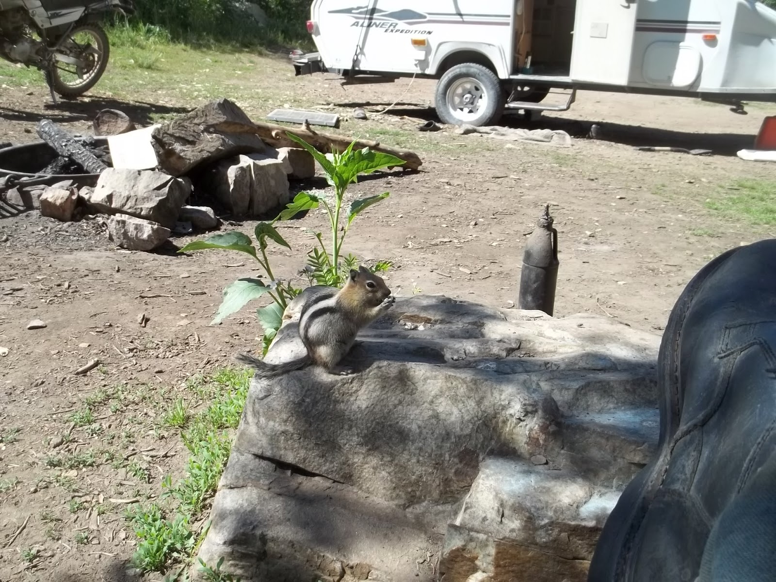
One of the locals looking for handouts

I told him to get a job

  • CACHE PEAK el 10339 is by far the highest in the state south of I-84. The decent Logger Springs 4wd road goes up the SW ridge to el 8500. That may be the only snow free route before August. It starts at the west entrance to City of Rocks Reserve. It goes up just inside the Reserve boundary into the national forest, signed as #562. Follow it to the end then hike the trail behind the barricade signed for Independence Lakes. At el 9400 the trail veers left and into snow on that late June day. I left the trail there and went straight up the ridge. Light brush sets in at the 9500 level, but there's a game trail thru it at N42 11177, W113 40373. I drifted to the right side of the ridge on game trails to avoid rocks then went left up a trail at 11199, 40101 el 9900.  Some boulders had to be negotiated but that was easy then on to the reg at 11134, 39665. 3 and a half hours, 1800 gain. Later in summer when snow is gone, it would make sense to stay on the trail until it tops out.  GRAHAM PEAK el 8857 has a road to the top, FR 707, branching off FR 562 at 08262, 43789 el 8400. It goes a mile and a half to the summit,  which is the highest in City of Rocks. The first third mile was rutted. A million shady camps are along FR 562. Snow was still blocking 4wds in late June. The Independence Lakes TH has a better road. I saw cars there. I was blocked by snow at the second lake in late June. The Ranger Trail forks off to the left before the lakes. I didn't walk it, but one map shows it goes thru the saddle el 8600 on the NE ridge of the peak. Posted 2016.
  • COTTEREL MOUNTAINS HIGH POINT el 7100+ has a decent road to the top. It leaves SR 77 at mp 11. 2wds might slip on steep spots. The Coe Creek recreation site is down at the west side of the peak. It has a fenced camp area, very grassy. The crest road is the main attraction here. Cycles and mtn bikes can go north 3 or 4 miles to a cattleguard then come back. No cattle were along  that stretch and flowers were nice. Private land blocks exit routes to the north. Going south on the crest road is mostly coasting. The main road  goes down Nibbs Creek. At el 5250 a road branches right. You can stay straight on the main road to a 4-way at a cattleguard then go right to SR 77, or take the road branching right for an air mile to a fork. Both go, but I like the right fork better. Either way, you hit SR 77 at a sandpit at mp 3.8 el 4750. This is all on the topo map. Jeeps can do these roads but there are a few tricky spots. Posted 2016.
  • ELBA BENCHMARK el 8046 is the high point of the Jim Sage Mountains. The shortest way up is Kane Canyon from the east. Take highway 81 to a graded road at N42 13221, W113 21525. Follow that for 4 miles to where it veers right into a ranch. Go left there at a fork then soon there is another fork. Go right for 2 miles on easy 4wd to the last turnaround at 11397, 27849 el 6000. I went a mile more on a cycle but had to drag it to turn it around. I walked the road to the 6800 level and stopped there, but could see it would be easy to climb the south rim and go on up. I hiked a west side route that is a crest run from Keg Hollow Spring. Turn off the west side highway at mp 6.2 onto an easy 4wd road. Follow that road and stay right at a fork then the road forks 3 ways about a mile in from the highway. Take the middle fork, reading N42 08824, W113 34108. The road circles up into the canyon then gets narrow at the 6100 level. Turnarounds get scarce. I wouldn't take a 4wd beyond a turnaround at 08559, 31375 el 6500. OHVs can get to the end at the spring el 6600. The road bed was good but small rocks needed to be kicked off for the last mile. Let your girlfriend walk ahead to tend to that. Mtn bikes would work here. Hike from the spring on cow trails into a saddle at 08385, 31019 el 7050 which puts you above brushline. Go up the ridge to a man made trail at el 7400 then walk that a short way. It will start down and fade so get off it and walk the bald crest. It's obvious how to walk left of minor bumps. Game trails make it easier. The game trails fizzle out where the crest drops to a major saddle el 7800, about 200 feet deep. A useful trail is down at 10255, 30254 and it goes into the saddle. Stay left around a rocky hill in the saddle then keep going to the BM and reg at 11056, 29676. The hike took me 5 hours  with about 1700 gain on the ascent, not steep. The only noticeable gain on the return was the 200 feet out of the major saddle. I took a shortcut back down the head of Keg Hollow at 08668, 30504, but that takes long pants. If you want to get a good look at this range, this is one way to do it. The crest is nearly pristine with minimal cattle impact and no fences. The best hike would be to run the whole thing one way. BLACK SAND HOLLOW ROUTE - some hikers went that route. The only thing I could find is a bad road at mp 8.2 on the west side highway. It goes along the edge of private land, but hikers with cars could just walk in from the highway.  I didn't scout very far in that way, but I could see an ATV track coming up that canyon into the major saddle el 7800 on the crest.  SOUTH ACCESS - the graded Narrows Rd goes along the southern tip of the range. A good road leaves it at 04586, 32475. Stay on the main road going north for 4 miles to Jim Sage Spring el 6300. The last half mile might need 4wd. Mtn bikes would be feasible to get in here. A wooden fence surrounds the spring. A rubbly ATV track starts along the right side of the fence and goes up to a fence at a saddle el 6850.  A rocky trail goes up the bald ridge along the fence for a mile to peak 7282. That's a 2 hour hike with 1000 gain. The main crest could be accessed here. Posted 2016.
  • MIDDLE MOUNTAIN el 8400+ was on my agenda but I could find no public access on the east side. The SW side is the only hope for that one. Posted 2016.
  • MONUMENT PEAK BENCHMARK el 8060, south of Twin Falls, is the high point of the Goose Creek Mountains that seem to be nameless on maps. It has a road up it. From Hansen, go south on Rock Creek Rd, aka 3800E. It goes along the creek then turns to dirt at the 7000 level. The first thing to do is stop at the sign for ROSS FALLS. A trail goes for 5 minutes to a 20 foot fall. The next thing is PIKE MOUNTAIN el 7710. Just before the end of pavement is a huge parking area on the left. At the north end is FR 507. It's a decent road to the summit where there are observation decks and a map of the area. For MONUMENT PEAK BM, go another 5 miles after pavement ends then turn right on FR 671. Go about 1.1 miles then the BM is up on the left at N42 07190, W114 13078. Some 2wds can make it. One interesting mtn bike ride could be done coming back on dirt roads then down the cycle trail in the Third Fork. A much longer ride could be done by riding north from the peak on main dirt roads to get to FR 531. Along that road is the Harrington Fork cycle trail #006 at N42 13767, W114 11901 el 7700. That goes downhill all the way to the picnic area on Rock Creek Rd where you spotted a second car, of course. There is also a trail that starts on the west rim of Rock Creek, called the Rim View Trail. I saw some bikes coasting nearly 10 miles down that to Third Fork, but as of 2018 that trail was closed to bikes. What else is it good for? Several campgrounds and some freebie spots are along the Rock Creek Rd. The campground at Third Fork was free in 2016. This whole area is useless for hiking but aside from mtn bike rides, there are dirt bike and dual sport cycle rides. I rode both rims of Rock Creek on a heavy cycle using the Cherry Springs Rd and the Dry Creek Rd. Those are easy but the North Cottonwood Rd has too much bedrock jutting up. Trapper Creek is another pleasant ride. It has a big cliff at the 5200 level with petroglyphs and pioneer inscriptions from 1875. The Harrington Fork and the main trail up Third Fork are easy dirt bike rides. A store at Rock Creek has gas and free maps of the forest roads and trails. Posted 2016, 2018.
  • MOUNT HARRISON el 9265 has a paved road to the top. It leaves SR 77 at mp 12.8 and goes about a dozen miles. Bennett Springs campground is about half way along and had no fee. Right after that the road makes a hairpin turn. Inside that turn is the spring where the creek arises. I filled every jug I had there.  CONNER BENCHMARK is a worthwhile side trip. Take the 4wd Connor Ridge road that departs from the ski lodge. It goes up on top of the ridge then smooths out and levels off for 2 miles to the BM at N42 18887, W113 33518. Mtn bikes would work. The SKYLINE TRAIL is a cycle trail starting at Twin Lakes campground. It's easy for the first mile and a half then turns rocky and brushy and useless for anything. Posted 2016.
  • RAFT RIVER MOUNTAINS are in Utah but accessed from Idaho. Clear Creek has a free campground and Onemile Creek has plenty of dispersed camps, but grassy so take a lawn mower. The high crest has a 4wd road the whole length. Sawtooth National Forest has their maps online. I followed signs from Almo (which has a store with gas) on graded roads to Yost. Then stayed on the main road to a T. I went left then stayed right at the next two Ts to the end of graded road. There is a pullout there where small RVs could park and take a jeep on up.  I was able to haul a camp trailer up another mile to where FR 011 forks right and FR 005  drops down Onemile Creek. The best camp is a shady one about a tenth mile down where I set up basecamp el 7300. FR 005 had been bladed recently. For the high point el 9930, use 4wd to go up FR 011 to FR 009 at a T on the crest el 9600. The road crosses George Creek along the way where there are a million shady camps. From the T, go east about 2 and a half miles to the high point reading N41 54680, W113 21960. Shortly beyond that the road goes along the rim with a good view of Bull Lake. Right after that is a good log cabin that was open to the public.  I went on east on FR 009 then took a 5 minute walk up to INDIAN BM at 54684, 18434 el 9493. The crest drops off there and the view is good. GEORGE PEAK BM reading 53362, 28990 el 9601 is at the west end of the crest. It's a decent road that far then it shrinks to an OHV trail and drops down Johnson Canyon to Yost. Jeeps can come up Johnson Canyon and turn right on FR 002A. That road tops out at el 8000 then it's a short walk to the Mahogany Peaks at 52748, 35355 el 8300+.  The BALLY MOUNTAINS HIGH POINT el 8040+, is in view from the basecamp on Onemile Creek and makes for a good hike. Walk a tenth mile up the road from camp and get on the closed road that goes up the crest. The reading there is N41 56171, W113 28679 el 7400. The road goes thru a couple of  gates then fizzles when a fence blocks it. It's easy to walk on up to the summit at 57842, 28415. I could see FR 005E down below so I walked back a tenth mile then went down the ridge to the road. There was a mile and a half of road walking back to camp. That took 2 and a half hours, easy. GEORGE CREEK is another easy hike I did near the Onemile Creek basecamp. Drive about a mile up FR 011 to a closed road at el 7600. Hike down that a third mile then get on a trail forking left at N41 55609, W113 28616 el 7250. Follow that around to the mouth of the creek where a road comes in from private land. That road soon fizzles then keep going up the creek on a trail for a short way to the main fork. The trail goes up the south fork. I had to wade across, then turned around  at the 7300 level, but I wish I had gone a little more to find the springs where the creek starts. Nice hike, no cattle in there for years.  CHARLESTON CREEK has a smooth ATV track. The road in leaves Yost at N41 56406, W113 31931. It goes up the creek then up into a saddle el 7800. From there, a track runs west along  the ridge for nearly a mile and a half. Good views.      MTN BIKE RIDE - one ride I saw here is over the crest and down Bull Canyon. I would drive up FR 011 to el 9100 just before Cabin Spring. Then ride/walk up to the crest then east to trail #001 that drops off the crest west of Bull Lake and goes down to Clear Creek camground.  The roads are mostly packed dirt but I didn't go down the trail. Posted 2016.

Thursday, June 2, 2016

Silver Island Mountains

Lamus Peak and Jenkins Peak

This range is a peninsula extending out into the Salt Lake Desert. A 54 mile graded loop goes around it, but I wouldn't take a 2wd or RV very far without checking. Take I-80 to exit 4 near Wendover. There is gas at that exit. Go north a mile and a quarter then take a left fork for 3/4 mile to where the graded loop starts. RVs use large camp spots in the first couple of miles. More large camp spots are about 12 miles out at the foot of Lamus Peak along a 2 mile stretch of playa.  Brush is not an issue for hikers here but cheat grass is abundant on the flats and it sticks in your socks as it dries out in summer. The only water is a few guzzlers therefore horses and cattle are completely absent. Wendover has a Smiths at the west end and a Family Dollar at the east end. Posted 2016

  • VOLCANO PEAK el 6011 has an easy route up the north ridge. Don't take the graded loop, but keep going north a couple miles to Leppy Pass. From Leppy Pass, take the graded road next to the large building. Go .7 mile then veer right on an easy 4wd road. Follow that road and stay right at forks until you reach a fork a mile in from the graded road. Go left at that fork and park at the end in half a mile el 5200. The peak twins can be seen to the right of a keyhole. Hike up a drainage to a point on the north ridge at N40 47869, W113 58764 el 5600. Now level off and follow sheep trails around the left side of a crag to get to a saddle el 5650 behind the crag. The rest is obvious. It's hard to tell which of the twins is highest, but it's easy to walk from one to the other. The east one had the most sheep do do, so it must be the one. The sheep should know. They live there.  The hike takes under 2 hours with 900 gain. Mtn bikes would work here. Posted 2016.
  • RISHEL PEAK el 6212 is a big, tilted slab of limestone covered with scree. Drive the graded loop to N40 47503, W113 56916 and turn on an easy 4wd road. Go 2 miles to a bad spot and park el 5000 on the west side of the peak. Walk north up the valley along the base to the main saddle el 5300. I went straight up the ridge from there but there were several hundred feet where it went parabolic with scree. Forget that. Instead, from the main saddle, get on the next ridge to the left and go up to 49161, 57456 el 5600. Now walk level to the north for 350 feet to get on the next ridge and go up that to the main ridge then easily on up to some surveyor junk on top at 49022, 57265. 2 hours, 1200 gain. SHORELINE CRAG is one to do on the drive  back to the graded road. Walk from the west side up to N40 47729, W113 57326 el 5200 then start up left of center on easy class 3.  Posted 2016.
  • TETZLAFF PEAK el 6267 has an easy ridge up the west side. Turn off the graded loop at N40 48404, W113 55356 and go 1.7 miles on 4wd. Mtn bikes could make the first mile. The unsteepest route is to go up a ridge at 50036, 55071 el 5300. Stay on it all the way to the main ridge el 5850 then turn south to the reg at 50041, 54559. 2 hours, 1300 gain. Posted 2016.
  • TETZLAFF BONNEVILLE SHORELINE - A short hike can be done on the cut that Lake Bonneville made on the east slope of Tetzlaff Peak. Drive the graded loop to a 4wd road at N40 50906, W113 53387. Start there or drive up the road a piece. I went half a mile up this road and parked at a mine el 4400 that tunnels all the way thru the wash wall. Hike on up the road and it fizzles out in a canyon right below the cut. Keep going up canyon to a mine trail at 50926, 54514 el 4800. That trail goes shortly to a mine on the shoreline cut. Now walk back out on the cut. It disappears at first for 300 feet, then resumes for half a mile to a canyon rim where it disappears again. I backed up from there a little and went down a ridge toward the junction of the 4wd road. At the 4500 level I hit another shoreline and used that to get back to the start. It took me 68 minutes with 400 gain, easy. I didn't take a pack, but did use a stick for the steep descent. Lake Bonneville peaked at el 5100, then broke thru at Red Rock Pass, Idaho. It lost 300 feet in short order. That 4800 level is known as the Provo level and is featured on this hike. Posted 2016.
  • JENKINS PEAK el 7268 and LAMUS PEAK el 6280 can be climbed together using class 2 sheep routes up the west side. Drive the southern leg of the graded loop for about 10 miles to another graded road forking left. That road shortcuts over to the northern leg. Follow it north for 2.2 miles to a 4wd road on the right reading N40 53367, W113 53662. Turn and go about 2 and a half miles to a T and park el 5000. Mtn bikes would work. Note the white layer half way up the mountain. Hike a half mile to a ridge at 54009, 50509 el 5300. It's easy as pie to go up that until the 6100 level at the top of the white layer where crags get in the way. Go around the left side of the crags and merge into the creekbed, then it's obvious how to go on up to the main ridge el 6600. Now stay near the center of the ridge until some crags about .4 mile before the peak. Gullies go up thru the crags. Use the center gully. When it tops out, stay low on the easy ground and cirlce to a notch at 54132, 49773 where you can see the rest of the route. The summit is at 54391, 49628. I saw one sheep there. Retrace your steps back to the white layer and step over to a viewpoint at 53809, 50138 el 6000. You can see how the white layer makes a natural pathway. A sheep trail runs along it and goes right into a saddle el 6150 where you can see the rest of the route to Lamus. For the descent from Lamus, go back to the north saddle el 5950 and walk at about that level to a view at 53412, 50355 el 5900. Some crags are just below. Drop down and walk the left side of the crags to a saddle at 53415, 50482 el 5700 where an easy descent ridge is in view. And it has a mine trail on it. Just hiking Jenkins is about a 4 hour hike with about 2500 gain and not all that steep. The side trip to Lamus has 600 gain. So the whole enchilada round trip is 6 hours. That's pretty reasonable when you're at the bottom looking up at those treacherous cliffs. This is the best hike on this page. Ruins shown on the map at the west base of Jenkins is mainly the shell of a 1920s car. Posted 2016.
  • CAVE ROAD - a crude road at N40 51993, W113 51632 goes a half mile to a minor cave where someone did a hell of a lot of digging. Posted 2016.
  • LAMUS PEAK MINES, west side, have trails to make a short loop. Turn off the graded loop at N40 52045, W113 50996 and drive a 4wd road for a mile and a half to the end at a collapsed shack el 5100. A sharp dip at the start of this road is the only tricky spot. Mtn bikes would have a steep ride. Look north from the shack and you see the trail climbing out of the canyon. Walk it into the next canyon and go upstream to some tunnels on the left bank. The trail winds steeply up thru the tunnel area then tops out at 53303, 50353 el 5600. Now it crosses over to the right fork to a bottomless pit.  You can look up the fork and see how easy it would be to go up to the main saddle then climb to the right up to Lamus Peak. A faint trail goes from the bottomless pit back down the rim to some more mines right above the shack. The whole hike including going up to Lamus might take 3 hours. Posted 2016.
  • LAMUS SOUTH RIDGE MINES - an ultra steep mine road goes up the south ridge of Lamus Peak. It's best to hike from the next road west. Turn off the graded loop at N40 52244, W113 50127 and go a third mile on 4wd to a parking area el 4600. Walk east thru a gap into the next canyon and get on a faint mine trail at 52531, 50198. Go up canyon to a minor saddle where the trail cuts left to mines. Get off the trail and go thru the saddle and over to the break at 52624, 50033 el 4800 where the mine road comes up. Go up the road to mega tailings at the 5200 level where the miners buried their own trail. Go up around the left side of the tailings then the trail fizzles. Now keep going across the tailings for 200 feet to the trail again at 52733, 49882. Go up to the 5500 level and take a left fork which soon ends at a tunnel. Now just go up the center of the ridge and soon join the other fork. The trail soon ends near the 5800 level where I stopped. It looked like I could make it to the top of Lamus. 2 hours, 1200 gain for the whole hike. Take a stout stick. The road you parked on ends at the 4700 level then it's a short walk to a tunnel. Posted 2016.
  • SHEEP CRAG el 6162 is what I call that thing east of Jenkins Peak. A sheep route goes all the way. Park along the graded road at N40 52665, W113 48643 and walk to the west saddle at 54018, 48737 el 5650. Don't try to drive closer. Fighting rocks and gullies won't save any time and will make a big mess no one wants to look at. From the saddle, go east up the ridge on class 2 then it's obvious to move far left for the final cliff band. An easy class 3 staircase goes up thru it. The summit is at 53972, 48497. The summit didn't have the usual cairn and I left it that way. That took me 2 and a half hours,2000 gain. Some old mine stuff is along the way, including a stove in pieces. Posted 2016.
  • JENKINS CANYON has a road. Turn off the graded loop at N40 53980, W113 47235. It's easy 4wd for a mile and a half to the end at a guzzler el 5100. Jenkins Peak can be climbed from here. Posted 2016.
  • CAMPBELL PEAK el 7272 has an easy SE ridge. Turn off the graded loop at N40 53980, W113 47235 and go a mile and a quarter on easy 4wd. Look for a faint road forking right. It goes along the base at 54991, 47844. Park at el 5100 after a half mile on that fork and go up the SE ridge at 55315, 47760. The route becomes obvious as you go up. The summit is at 56182, 48514. That took me less than 3 hours with 2200 gain. A very pleasant hike and not steep. It looked easy to walk the crest to Jenkins for a loop. Posted 2016.
  • CAVE CANYON - a bumpy 4wd road goes up that canyon for nearly 2 miles to the 5100 level. No deep ruts. It leaves the graded loop at N40 54556, W113 46118. Campbell Peak and Graham could be climbed from this canyon. Posted 2016.
  • GRAHAM PEAK, SILVER BENCHMARK el 7563 is the high peak in the range and the only BM I saw there. A class 1 route goes up the east canyon. Turn off the graded loop at N40 55140, W113 44949 and drive up Silver Island Canyon for 2 and a half miles to a faint road on the left reading 56934, 45867. Take that to the end in half a mile el 5600. Walk west a quarter mile into the east canyon and go up to a main fork then start up the ridge between the forks. The reading there is 57326, 46784 el 6000. Stay on that ridge up to the cliffs reading 57422, 46992 el 6650. Now you can look up to the left and see a wide, grassy shelf going up along the base of the cliffs. Follow that up to el 7400  wherethe ridge starts to top out, then stay left of center to a saddle at 57256, 47292 el 7400 then its a fifth mile to the reg. For a more adventurous loop, a SE ridge can be used. Park near the obvious canyon that accesses the SE ridges. Go up canyon and then take a right fork. Get on a slope on the left side at W40 56798, W113 46518 el 5700. Use ledges to zigzag up the slope to gain the top of the ridge then go up to a monster crag at el 6600. A path thru the cliffs can be seen up to the left. It starts left of the crag at 56957, 47127 el 6650. Go on up and top out at 56928, 47258 el 7000. Now more crags are in the way. Drop down the left side a little to a huge juniper then follow easy ledges for a tenth mile past the crags before you can come back up at 57020, 47285 el 7150. Now it's an open slope up to the reg at 57099, 47375. Complete the loop by walking north on the summit ridge to the wide, grassy shelf at 57274, 47266 el 7400. Follow that down along the base of the cliffs until the obvious descent ridge comes into view. That is at 57422, 46992 el 6650 in case you get off track. It took me 3 hours, 37 minutes to do the loop with a gain of 2300. Posted 2016. NORTH SIDE HIKE ( from an earlier trip) -  the north ridge is a cake walk IF you can get there. There was nothing to stop jeeps getting there, just slow going. Take I-80 to exit 4 and go north a mile and a quarter then take a left fork that goes 3 miles to Leppy Pass. Go right of a building on a major dirt road for over a dozen miles to a 4wd road reading N40 57760, W113 53175. This 4wd road and the last 6 miles of the main road were hit hard by August 2015 floods.There were a million minor ruts across the main road and some deep ones. The Donner party would have turned back on this mess, but I saw a grader headed that way the next day. Drive up the 4wd road to a fork at 57764, 49771 el 5100. The right fork goes to a guzzler which had water then the road soon fades. But take the left fork for a fifth mile to another fork el 5200. Look for a faint road dropping down to a wash on the left. Soon that road is overgrown, but it's easy to hike east up the wash into a canyon and on into the obvious low saddle el 6200 on the north ridge. If you get confused, aim for 57989, 47724 el 6100 where some bolts and hangers were installed. Huh? Just keep walking up the ridge from there. There are some minor bumps on the north ridge but its easy to walk the right side of them and cut off 20 or 30 feet. As the ridge starts to top out, stay on the left side to a saddle at 57256, 47292 el 7400 then it's a fifth mile to the reg.  4 hours, 2300 gain. A nice, unspoiled area. This hike is so easy you might want to carry a sack of rocks just to keep from feeling guilty. Posted August 2015.
  • FLOATING ISLAND has a good road that would make a good mtn bike ride. Turn off the graded loop at N40 55775, W113 43138 and go 4 miles to the north base. An eroded track runs west along the base for a third mile and fades. There you can see the route to the high point which reads 54933, 38306 el 5100. I could hear noisy hawk chicks below the summit. A long beach of Lake Bonneville is near the top. The Donner trail runs on the east side. Several wagons were found in the area. 90 minutes, 900 gain. The main road goes around the east side of the island and onto the Bonneville dike then south to I-80, but there's no interchange. There may be a gate thru the fence for westbound traffic. Posted 2016.
  • COBB PEAK el 7021 is not too hard from the graded loop. Drive to the SE side of  the peak and walk the flats for a third mile to the main SE valley at N40 57018, W113 41924 el 4500. Don't try to drive the flats. Nobody wants to look at tire tracks. Hike up the main valley about a mile in from the road and take the main left fork el 4850. Go up a short way and get on the left bank at 57481, 42954 el 5050. Walk up keeping the main wash close on your right and soon a wide gully will come into view that goes up to the SE ridge of the peak. It tops out at a saddle reading 57427, 43534 el 6300. Go on up the easy ridge then about half way to the peak some crags are in the way. Go around the right side and stay right of center all the way to the summit at 57589, 43928. It took me 4 hours, 7 minutes with 2700 gain. The first 700 gain isn't noticeable. A class 2 hike.  Some camp spots are nearby along the road at some rock outcrops. Posted 2016.
  • CRATER ISLAND HIGH POINT el 5700 is easy but the road has a few eroded spots. Turn off the graded loop at Donner-Reed Pass reading N41 00620, W113 46999 onto a formerly graded road. It looked like it hadn't been graded since the Donners passed by. It runs nearly 10 miles to the shoreline at the tip of the island. Drive about 6 miles then hike less than a fifth mile to a saddle at 05184, 45238 el 5050. The rest is obvious to the summit at 05283, 45680.  70 minutes, 900 gain. I went on down the road to the shoreline, but an eroded section stops all but OHVs. A track runs along the shoreline for a mile then fizzles. Posted 2016.
  • MOUNTAIN BIKE RIDE - I wouldn't care for riding the 54 mile loop, but I would consider riding out on the Bonneville raceway then cut over to the graded loop at the foot of Lamus Peak and come back on that. A crude road comes off the playa right at Lamus and it can be seen on the sat image. That ride only works after long dry spells and when there's no race.
  • LEPPY PEAK el 6716 is the high point of the Leppy Hills at Wendover. Take exit 410  off I-80 and get on the north frontage road. Go east a tenth mile then turn on a gravel road and go north a bit over 3 miles to a pass el 5650. Keep going another half mile then go left on an easy 4wd road. Go half a mile and park at el 5800 right where the road drops to a guzzler. Hike up the canyon south of the road all the way to the crest then go left to the reg at N40 46934, W114 04311. The south summit has a fallen tower that now serves as a reg. 80 minutes, 1000 gain. This is a good looking peak and too easy to pass up. Posted 2015.
    Tetzlaff Peak and the lake shoreline

    The lake almost took the top off of Floating Island
    The Lamus south ridge mine road. It doesn't switch up, it comes straight up to this notch

Monday, May 23, 2016

Fortification Range Wilderness

Cottonwood Canyon amphitheater

Upper basin stream

Upper basin. Fortification BM is far right

Patterson Peak
The Fortification Range is the nicest area I've seen in the Ely BLM district, but horses are ruining it. But that's normal for Nevada. The graded Atlanta Road runs along the east side.  Drive US 93 to a sign for Atlanta at mp WP 7.5. Turn and go a dozen miles to a 5-way with 2 cattleguards reading N38 39018, W114 25722 el 6000. A camp trailer or small RV can be parked there as a base camp. The good road heading west goes to the Indian Springs area. The high clearance road going thru the south cattleguard runs along the base of the range. The main Atlanta Road goes on south to the ghost town in about 13 miles. There are 3 high clearance fence line roads along the way that connect over to the base road. One is at  N38 36963, W114 24480 along the south side of a cattleguard. The next one is at 35386, 23611. The last one at the south end is at 31321, 20738. Mtn bikes would work on all these roads. Posted 2016.            

  • FORTIFICATION RANGE HIGH POINT el 8431 is commonly climbed from Basin Spring. Northbound hikers should drive to a cattleguard on the Atlanta Rd at N38 31321, W114 20738 and go west along the fence on a crude road. After nearly 3 and a half miles there is a T at the base road at the foot of the range. Southbound hikers should turn at a cattleguard on the Atlanta Rd reading 35386, 23611 and follow that a mile and a half to the base road. Then follow the base road to a faint road reading 33034, 24694. Turn there for a mile to a horse trail forking left. The reading there is 32782, 25607 el 6500. Follow the trail at first then veer off and start up a ridge on the right at 32625, 26354 el 6800. Just keep going up and the ridge circles to the reg at 32810, 27272. I came directly back down and hit a stream at 32600, 26878 el 7300. It flows on bedrock for a 100 feet then vanishes. I followed the creekbed on down and hit the horse trail again at 32512, 26185 el 6700. The loop is all in a pj forest and took 3 hours, 5 mins with 2000 gain, some light brush. Mtn bikes would work on these roads as they are packed dirt. Posted 2016.
  • FORTIFICATION BENCHMARK el 8268 is the only BM on a major peak in the range. A loop can be made using the Cottonwood Canyon trail on the return. Drive west on a crude road from a cattleguard on the Atlanta Rd at N38 36963, W114 24480. Follow along the south side of the fence for nearly a mile to a gate at a 4-way. Go thru and keep straight for a few feet and take a left fork and go to the end in a third mile, right after Deer Spr. You should be reading 36614, 25871 el 6250. To get there from the 5-way, drive the base road for 2.6 miles to the 4-way and the gate. It's a fifth mile after a signed turn for Cottonwood Canyon TH. From the parking area, hike south on trails to get to the east canyon at 36150, 26184 el 6400. It had a stream that day. Go up canyon using trails on the left bank. After half a mile there is a scenic basin el 6700. Climb up the south side thru a break at 35933, 26824 el 6950 to get on the rim. Another option is to keep going up canyon and try to find the trail horses use to get on the rim. Either way, follow the rim up along the canyon into a burn area then aim for the minor saddle 300 feet east of the summit. The reading at that saddle is 35734, 27434 el 8050. Go on up to the summit where someone built a small rock wall. That must be the fortification. Come back down and walk north along the crest to a trail on the rim of Cottonwood Cyn reading 36311, 27566 el 7800. Go down the trail to a spring in a stand of ponderosa pines at 36538, 27535 el 7100. The spring looked safe but was so tiny a funnel would be needed. No horse poop around it. It's the only water I saw in the whole canyon. The trail continues on down canyon to a road then you just walk around the point back to the start. 4 and a half hours, a little over 2000 gain.  If you just want to hike the trail up Cottonwood Canyon, go north from the 4-way for a fifth mile and turn at the sign. It's a mile up to the TH. The trail is maintained to the spring in the pines at el 7100. There are good views along the way of all the eroded volcanic rock forming the huge amphitheater at the head of the canyon. Posted May 2016.
  • PATTERSON PEAK el 8028 is what the BLM calls the peak at the north end of the wilderness, next to Indian Springs. A loop can be done starting at the east base and hiking south into the high basin el 7500 then going north on the skinny crest to the summit. From the 5-way, drive west on the good road a bit over a mile to where it shrinks to a crude road at some boulders. Go another tenth mile then go left at a fork for another third mile to a closed left fork.Make sure you're reading N38 38610, W114 27358 el 6300. Hike that fork and it soon fizzles. Keep going to a low ridge at 38204, 29699 el 6500 where you have a view of ascent options. I intended to go up a left fork at 37839, 27867, but decided to stay in the main fork. Hindsight revealed that the left fork might be better. I went  from the low ridge into the bottoms at 38020, 28020 el 6700 then crossed to the left side of the creekbed at 37918, 28080 el 6800. Boulders forced me high up the left slope but I found my way thru to where the canyon levels off and the stream was flowing at 37675, 28128 el 7400. It was  easy to walk along the stream for a fifth mile to where horse trails start showing up in the open basin. It's easy to walk along the east side of the basin to the head of the creekbed then circle west to a viewpoint at 36957, 28482 el 7900. Then head north on the high ground for nearly 2 miles to the summit at 38493, 28532. This skinny ridge turned out to be as easy as it looks on the map. Boulders are in the way about a third mile before the summit. Stay low around the right side of those. From the summit, stay on the high ground until it finally starts dropping to a viewpoint at 38498, 28198 el 7750. Go down the rocky main ridge right there and soon the rocks disappear and it starts heading straight back to the start . The loop took 5 hours, 13 mins with nearly 2000 gain. Some light brush. Horses had been pulled from this area. Posted May 2016.
  • INDIAN SPRINGS is a short hike. From the 5-way, go west .9 mile then turn left on a high clearance road. The road soon ends. There is a horse trail near the end at N38 38553, W114 26953. It goes across the stream then up along the east side for half a mile to an upper basin el 6500. I was able to come back on the west side but no trail. Horses had been removed. Posted 2016.
  • LIMESTONE HILLS HIGH POINT el 7860 is a pleasant hike thru a thin pj forest with hardly any brush or horse impact. Drive north from Atlanta and keep right on graded roads for 5 miles then park a quarter mile from the south canyon which is at N38 27502, W114 14713 el 6800. Walk up the canyon and take a right fork at 28039, 14713 el 7100. Follow that up into the main saddle el 7500 south of the summit then turn left to the reg and surveyor junk at 28351, 14473. No one had signed since it was placed 14 years earlier. It's obvious how to make a loop back down. 2 hours, 1300 gain. Posted 2016.

Monday, March 14, 2016

Riverside Mountains Wilderness

Riverside Mountain

Mountaineer Peak

Bridge near the Mountaineer Mine


  •   RIVERSIDE BENCHMARK NO. 2 el 2254 is the highest peak in the Riverside Mtns. One route uses the washed out Calzona Mine road. Take US 95 to mp RIV 33.7 and go west on a gravel road for nearly half a mile then take a left fork. Go half a mile on easy 4wd to a foundation and park. The road turns nasty here and is blocked by a slide in less than a fifth mile with no turnaround. The quarry on the other side caused that slide. Walk the road  to where it crosses to the right bank about a quarter air mile from the start. Get off it there and use a more pleasant left side trail. It goes along the left bank under a cave dated 1907. Then the trail drops to the bed and goes up that for less than a tenth mile then resumes on the left bank again. Just keep going to the main saddle ahead el 1300. Now just turn right and go up the ridge. It looks rough but is class 2. A fifth mile before the peak is one craggy bump in the way. Game trails skirt along the west side and make it easy. The BM and reg are at N34 02153, W114 31092. The best way back is to use the mine trails. Walk the summit ridge to a viewpoint at 02002, 31145 where you can see an easy route down to the main trail. Just walk down the ridge a little more to a saddle then switch back left and then go down a rocky but stable ridge. Once on the trail, it goes thru a saddle el 1600 and splits. Stay on the trail going down along the right side of the creekbed. Go left at a hidden fork reading  02154, 30716 el 1200 and it gets you back the way you came, or for a more interesting route, keep going downhill a few more feet to the old road and walk down that to the end at a mine camp. This camp is where the Mountaineer Mine is shown on the topo. The wash enters a gorge just past the camp, but an obvious trail goes up the left bank and bypasses the gorge, but it only takes 20 minutes to walk down the gorge and hit the trail at the bottom. Follow that trail down to a steel cage and walk a road from there for about 400 feet to where the road starts uphill. Leave the road and cross the wash to a trail that goes uphill back to the start. That loop took me 3 hours, 1600 gain, but I didn't stop to rest much. Mountaineer Peak could be done as a side trip taking maybe 2 hours. MINE TOUR VERSION - an easier loop can be done by touring the mines and skipping the peak. Start out hiking the same as above. Walk the road  to where it crosses to the right bank about a quarter air mile from the start. Get off it there and use a more pleasant left side trail. It goes along the left bank under a cave dated 1907. Then the trail drops to the bed and goes up that for less than a tenth mile then resumes on the left bank again. Right there is where the Calzona Mine is in view. Go up to a trail at N34 02392, W114 30316 el 950 and circle up to the mine. Along the way the trail goes over  an overhang where a mine camp was set up. A tunnel at the mine goes into darkness. From there, walk down the west edge of the tailings for 100 feet and hit a trail which goes to a mine on the ridgetop. It seems to end at el 1300, but it switches up to the right on bedrock and goes about 200 feet to the mine el 1400. Just above the mine is a good view of the mine camp area including the Mountaineer Mine. Return down the trail and the next trail can be seen across the canyon, and it's a thru trail. About half an air mile from the start is where that trail crosses to the right bank then the trail forks. Take the right fork and cross the old road. The reading there is N34 02371, W114 30483, just west of the Calzona Mine. The trail goes north up the slope and ends at a tunnel. Come back from the tunnel a short way and angle up to a major saddle el 1250 on the ridgetop. Now another trail can be seen coming over from the road. It's tricky to get on. You have to go uphill from the saddle to get on it.  I walked it north to the end in a tenth mile at a shallow tunnel. Next you want to walk that trail back to the road then follow the road down to the mine camp at the Mountaineer Mine then return to the start as described above.   Posted 2016.
  • RIVERSIDE BENCHMARK NO. 2 el 2254  via NE ridge - a trail goes up from a quarry to el 1550 on the NE ridge, just NE of peak 1814. Take US 95 to mp RIV 33.7 and go west on a gravel road for nearly a mile then park at the quarry gate ( hikers going up and down the same way could drive closer). Walk up the main wash then get on the trail on the right bank at N34 02763, W114 30044 el 700. It goes until the bank runs out then up the bed a short way then back on the right bank. It splits, the correct trail starts up at 02706, 30472 el 950. It goes past a tunnel then across a drainage. At el 1500 it dips a little then crosses the drainage and ends on the ridge at 02602, 30705 el 1550. Now it's easy to go up the ridge on game trails to the summit. A fifth mile before the peak is one craggy bump in the way. Game trails skirt along the west side and make it easy. The BM and reg are at 02153, 31092. The best way to loop back is to use the mine trails. Walk the summit ridge to a viewpoint at 02002, 31145 where you can see an easy route down to the main trail. Just walk down the ridge a little more to a saddle then switch back left and then go down a rocky but stable ridge. Once on the trail, it goes thru a saddle el 1600 and splits. Stay on the trail going down along the right side of the creekbed. Go left at a hidden fork reading  02154, 30716 el 1200 and it gets you to a washed out road that goes thru a saddle then down a canyon with the Calzona Mine. Look for cairns marking a trail on the right bank that parallels the road to the flats. Then it's  an easy walk back to the start. 3 and a half hours with 1300 of noticeable gain. This is the best route.  Posted 2017, 2020.
  • RATTLER MINE LOOP - a good loop can be done starting near the Calzona Mine then on to the Rattler then over to near the Gold Rice then back by way of the Mountaineer. Take US 95 to mp RIV 33.7 and go west on a gravel road for nearly half a mile then take a left fork. Go half a mile on easy 4wd to a foundation and park. The road turns nasty here and is blocked by a slide in less than a fifth mile with no turnaround. The quarry on the other side caused that slide. Walk the road  to where it crosses to the right bank about a quarter air mile from the start. Get off it there and use a more pleasant left side trail. It goes along the left bank under a cave dated 1907. Then the trail drops to the bed and goes up that for less than a tenth mile then resumes on the left bank again. Just keep going to the main saddle ahead el 1300 where a trail can be seen in the distance going  SW up into another saddle el 1600. To get on that trail, keep going down the road for 350 air feet and turn right on a trail that cuts over to the trail that goes to the saddle el 1600. Go thru the saddle on the trail for .45 mile where the trail forks. Go left down across a gully then over to the Rattler Mine. Get on a trail there reading N34 01610, W114 31470 el 1350 and walk it to a boring dig at the end el 1600. Then walk south for 200 feet into a saddle el 1650 where a trail can be seen 300 feet below. For the easiest route down, walk the ridge to 01457, 31283 el 1650 and look down at the route. Go left a few feet then go down to the right. About half way down, it's best to cut left over white rock then on down to the trail el 1350. Walk the trail NE to a saddle el 1700 on the divide. The trail goes thru then down to the Mountaineer Mine, but a more intact trail is on the west side of the canyon. For that, walk north on the divide for a tenth mile to another saddle where the trail is obvious. Follow it down to the creekbed then go thru a short narrows then the trail goes up the right bank. Walk the right bank and soon an obvious trail goes up the left bank and bypasses a gorge, but it only takes 20 minutes to walk down the gorge and meet the trail at the bottom. Follow that trail down to a steel cage and walk a road from there for about 400 feet to where the road starts uphill. Leave the road and cross the wash to a trail that goes uphill back to the start.That loop took me 4 hours. Posted 2017.
  • MOUNTAINEER PEAK el 1963 is what I call the peak north of Riverside Mtn. A class 2 route goes up the west side. Take US 95 to mp RIV 33.7 and go west on a gravel road for nearly half a mile then take a left fork. Go half a mile on easy 4wd to a foundation and park. Walk up the road a short way past a boulder barrier and get on a trail going left reading N34 02480, W114 29917 el 700. Follow it down to the main canyon floor and walk a road upstream to a mine sealed by a steel cage. Shortly past the cage is where the canyon bends left. The correct trail goes down to the bed at the bend and goes upstream a few feet and resumes on the right bank at a minor fall. Stay on the right bank and soon the trail climbs to a pass and drops a little to a mining camp. Get on a trail at 02135, 30359 el 1000 but only follow it a few feet then walk the easy left bank up the wash. When the bank fizzles, drop to the bed and stay in to 01917, 30652 el 1100 where you exit left up a trail. Now go straight up into a side canyon to 01852, 30584  el 1300 where you cross the bed and go up a shallow gully on the other side. The gully soon tops out and then walk nearly level on a sheep trail to a shelf at 01978, 30462 el 1500. Or, about 450 before the shelf, angle up to a saddle at 01942, 30436 el 1650. Either way, you'll be going up along side a big drainage all the way to the top of the summit ridge. Then walk left of center on a sheep trail around to the left side of the summit block then go up easy bedrock to it at 01949, 30278. On the return, I stayed in the wash thru the mining camp and went down the canyon back to the cage. The canyon has some easy class 3 spots and a countless small potholes in bedrock. The hike took me 3 and a half hours, about 1500 gain. Posted 2016.
  • RIVERSIDE MOUNTAIN el 2100 is a twin peak with an easy route up the west side but a 10 mile jeep road around the north end of the range is the only legal way in. Take US 95 a half mile north of the county line then go west on easy 4wd. Stay right at one tricky main fork and go on to a block with petroglyphs and a maze of forks. Get on the correct one at N34 04458, W114 32968. Go south on a worsening road and stay right at forks until a fork about 1.26 air miles from the peak. I parked there el 950 but jeeps could go as far as 01092, 31699 el 1100. A washout is a tenth mile beyond that then it's not far to the Gold Rice Mine at the end of the road. From there, drop over to the east into a major wash. Use the flat right bank and when it ends just keep going over a low rise and the bank gets easy and flat again. Soon an obvious easy route to the high peak comes into view. Go up to the BLM BM at 00808, 30893. The other summit is shown to have the USGS BM, but I couldn't find one. It took me 3 hours with 1300 gain. Posted 2016. EASTERN APPROACH - I prefer to come in from the east and circle to the west side. Take US 95 to mp RV 27.8 and turn on a crude road. 2wd trucks might make the road, mtn bikes certainly would. Drive nearly 2 miles to a parking spot at the legal end of the road where it enters a wash. I call that wash Gold Rice Wash. There are 3 options. Either keep driving like everbody else, walk the road in the wash, or shortcut it like I did. Walk north from the parking spot for a tenth mile to the next wash and walk up that a few feet to a deer trail on the right bank. The reading there is N33 59149, W114 32351 el 600. Follow that and soon it crosses to the left side of the wash and thru a low saddle el 666 then down into Gold Rice Wash. Go up to a side wash and get on the right bank at N33 59804, W114 32630 el 750. Go up that for .13 mile and then cross over to the left bank. OHVs try to come up this fork but it's too rocky and they give up. Stay on the high ground to a flat of dark rocks at N34 00289, W114 32466 el 850. Walk north on that and soon the road is in view as it climbs out on the far side of Gold Rice Wash. Drop into the wash, which is now roadless, and go up it to a main fork. Go right a couple hundred feet to a mine trail at N34 00875, W114 31801 el 1050. The trail goes up on the high ground between the forks then comes back down to some ruins in the right fork where it drops into the creekbed. Go up the creekbed a short way then go up a little point to get on the right bank. Soon a sharp gully is in the way but it's easy to go up around it.  Stay on the right bank and then over a low rise and the bank gets easy and flat again. Soon an obvious easy route to the high peak comes into view. Go up to the BLM BM at 00808, 30893. For the return, I used the west canyon. Walk down the north rim of it to a saddle el 1600 then switch back left to get in the canyon. Go down and get on the left bank at N34 00812, W114 31269 el 1400. At a minor fall el 1050 , leave the canyon and cut left over easy flats to a faint trail at N34 00776, W114 31983 el 1000 that drops back to Gold Rice Wash then retrace back to the start. That loop took me 4 and a half hours with about a 1000 feet of noticeable gain. It's a top notch hike. Posted 2017. 
  • STEECE MINE is on the east side of Mountaineer Peak. A good  loop can be done using mine trails connecting to the next canyon south. Take US 95 to an easy 4wd road about 50 feet north of mp RIV 32.41. Drive half a mile up the road then park and walk the road west on up the canyon for about half a mile and stay right in a right fork then the road switches up to the left to a flat area. Get on a road there going west reading N34 01534, W114 30090 el 700. A trail can be seen straight ahead. Walk the road to the trail and go up to a fork at 01462, 30214 el 800. The right fork goes to mines, but take the left fork into a creekbed. Go up the creekbed to an easy 6 foot fall which is the trickiest thing on this hike. Go left at a fork there for a few feet to a trail on the right reading 01399, 30290 el 850. Walk the trail up to the divide el 1100 then follow it down the other side into the creekbed. Walk down to a big fall at the mouth and go left around it to a gully that gets you down the fall. Now go down the creekbed  and walk thru a slot then make an easy exit on the left on a faint trail.Wallking directly back across the flats won't work because of deep trenches. Instead, walk up the rim along the slot to a gully at 01285, 29847 el 600 where a trail is in view on the other side. Walk it for nearly a tenth mile then it forks. Stay on the low trail and it will soon bend left to cross a side drainage then go back to the start. That is as colorful a canyon as I have ever been in. 2 hours with 300 feet of strenuous gain.  LOOP 2 - more trails are north of the Steece Mine. Start on a trail in the flats at N34 01589, W114 29554 el 500. It  goes up along a ridge to a dangerous vertical shaft in a wash el 950. I was going to come back in the wash, but I could see a drop below. So I went down at 01831, 29968 to get around the drop and on down the canyon then it was a short walk back. That loop took an hour and a half. A faster way back from the shaft is to retrace back on the trail for 2 or 300 feet to a fork and go right to another fork at  01636, 29976. Go right and it leads down to the road in the main canyon. Posted 2017, 2020.
  •  MINE TRAIL TOUR - mine and Indian trails can be used to run north / south thru the best part of the range. Leave a car or bike on US 95 at mp RIV 28.8 then drive to mp RIV 33.7 and go west on a gravel road for nearly half a mile then take a left fork. Go half a mile on easy 4wd to a foundation and park. Walk up the road a short way past a boulder barrier and get on a trail going left reading N34 02480, W114 29917 el 700. Follow it down to the main canyon floor and walk a road upstream to a mine sealed by a steel cage. Shortly past the cage is where the canyon bends left. The correct trail goes down to the bed at the bend and goes upstream a few feet and resumes on the right bank at a minor fall. Stay on the right bank and soon the trail climbs to a pass and drops a little to a mining camp at the Mountaineer Mine. Get on a trail at N34 02135, W114 30359 el 1000 but only follow it a few feet then walk the easy flat left bank up the wash. When the bank fizzles, drop to the bed and stay in to a trail on the right at  N34 02003, W114 30616 el 1100 then go up shortly to a fork. Left goes to a foundation, but stay right to the divide el 1700 at the head of the canyon. Then walk south on the divide for a tenth mile to a saddle el 1700 to another trail. It goes thru the saddle on the divide then down into a mini gorge. Exit at the Gold Rice Mine on the left at N34 01228, W114 31477 el 1200. Use the road there to continue down along the wash to the Indian trail at N34 00722, W114 32166 el 950. The trail goes directly across the deep wash then into another wash. It fades but stay on the easy ground and pick it up again where it's cutting left at N34 00244, W114 31980 el 900. It goes shortly to another wash reading N34 00197, W114 31863. Go down that wash about a quarter mile and look for a tall cairn on the right bank. Right along there is where the trail goes on  the right bank for 300 feet then drops back in to pass a fall. Then  stay in the main wash going downstream to N33 59577, W114 31608 el 700. Exit on the left bank and the trail goes along the left edge of a flat thru a saddle at N33 59519, W114 31466 el 700. In a quarter mile the trail splits. Stay left across a wash then across a flat then thru a minor saddle and on to a fork. Get on the correct trail there at N33 59336, W114 30784 el 600 and stay on the main trail to US 95. It took me just under 4 hours with about 1000 gain and then a half hour to ride a bike back. It would be a 2 hour side trip to climb Mounaineer Peak of Riverside Mtn. Posted 2016.
  • INDIAN TRAIL LOOP - this is an easy hike in the southern part of the range.  Take US 95 to mp RV 27.8 and turn on a crude road. 2wd trucks might make the road, mtn bikes certainly would. Drive nearly 2 miles to a parking spot at the legal end of the road where it enters a wash. I call that wash Gold Rice Wash. Walk north from the parking spot for a tenth mile to the next wash and walk up that a few feet to a deer trail on the right bank. The reading there is N33 59149, W114 32351 el 600. Follow that and soon it crosses to the left side of the wash and thru a low saddle el 666 then down into Gold Rice Wash. Go up to a side wash and get on the right bank at N33 59804, W114 32630 el 750. Go up that for .13 mile and then cross over to the left bank. OHVs try to come up this fork but it's too rocky and they give up. Stay on the high ground to a flat of dark rocks at N34 00289, W114 32466 el 850. Walk north on that and soon the road is in view as it climbs out on the far side of Gold Rice Wash. Drop into the wash, which is now roadless, and go up it to where an Indian Trail crosses at N34 00706, W114 32131. Climb up the right bank and follow the trail into another wash. It fades but stay on the easy ground and pick it up again where it's cutting left at N34 00244, W114 31980 el 900. It goes shortly to another wash reading N34 00197, W114 31863. Go down that wash about a quarter mile and look for a tall cairn on the right bank. Right along there is where the trail goes on  the right bank for 300 feet then drops back in to pass a fall. Then  stay in the main wash going downstream to another trail at N33 59580, W114 31647. Go west on that thru a saddle el 750 and on to N33 59715, W114 32046 and then shortly into another saddle with some diggings. The trail splits there, take the left one on thru another saddle then Gold Rice Wash is in view. The trail goes on to join the wash next to the low saddle el 666 near the start. That  walk took 2 and a half hours, add some time for rest stops. The area was covered with desert mule deer tracks. Posted 2016.
  • ALICE MINE is in the north part of the range. One big structure survives. Take US 95 for half a mile north of the county line and go west on easy 4wd. Stay left at main forks in the actual road to the mine. Don't get tricked by tire tracks going up a side wash about 2 and a half miles in. ALICE MINE LOOP TRAIL -  a loop can be done using a trail that goes in from US 95. Cars can get at it. Take US 95 to mp 33.7 and turn on a good quarry road. Go about a third mile and turn on a road branching north then go another tenth mile and park at a gravel pit. It's suitable for RVs. Walk north from the pit on the road and aim for the trail at N34 03763, W114 29431 el 500. I stayed on the road until a half  mile from the trail.  The trail soon drops into the creekbed then goes up the bed thru some boulders and resumes on the left bank. Next, the trail tops out at a saddle el 950 and splits. Stay left then the trail drops into a mini gorge and goes up the bed for 100 feet then goes up the right bank. It then goes over into another wash then up the bed of that for about 300 feet and exits on the right bank el 900 and goes up thru a saddle.  It's easy to follow from there to a saddle at the mine area where the trail splits again. The high trail is easiest but the lower one passes the thru the mine area then comes back up to meet the high trail at 03262, 30636 el 1100. Shortly there is a tunnel then just keep going up the trail. It loses 60 feet crossing a  drainage then tops out at a saddle el 1350. It drops down the other side and gets steep. I broke out the walking stick there. The trail goes on down to the main wash and goes along the left bank. It climbs to a higher left bank at 02767, 30313 el 850 then eventually drops back to the main wash. Shortly after that is an overgrown road on the left bank that leads back to the quarry.  That took me 3 hours and not very steep. A lot of work was put into that trail. It will be up to hikers to keep it from fading away. I tried to get directly to the trail from US 95, but private land blocked me.  Posted 2017.
  • GOLD DOLLAR MINE - Take US 95 for half a mile north of the county line and go west on easy 4wd. Stay left at a main fork in about a mile then go 1.7 miles and stay right then follow along the main wash for another mile and park where it turns into a rocky mess el 1000. Hike up the main wash on the washed out road for half an hour to a mine camp el 1250. The canyon has a main fork here. A trail goes up the left fork to el 1500 and 2 trails go up the right fork all the way to the crest el 2100. I decided to make a loop. I went up the right fork on the right bank but the trail on the left bank looked better. At el 1550 I came to a tunnel and a rock inscribed " G. Liljestrom 1903" at about the point on the topo where the Gold Dollar Mine is shown. I kept going up canyon to another tunnel el 1850 then on to the crest el 2100 where the trail faded on the north side of the range high point. That would be a short side trip.  I went north on the crest using sheep trails left of center at 02295, 31036 el 2100 to get around a bump. I came back to center in less than a tenth mile then went down to an obvious saddle el 1750 and dropped into the left fork. I went down the creekbed to a mine el 1500 and used a trail there to get back to the road. That loop took me 2 and a half hours with 1100 gain. Posted 2016.
  • VABM 1284 is in the west part of the wilderness. Deer trails allow for various loops. Take US 95 to mp SBD 2.3 and follow a sandy road along power lines for 8 miles to a trail at N34 01824, W114 36956. It goes south to 01653, 36867 then to a guzzler in a wash at 00970, 36797. I walked down the wash then got on the right bank at 00889, 36730 and on to 00604, 36963 where I dropped into a wash and went SW up a fork to the main saddle el 1250. I then went left on a trail to get down to the main wash and went south down that to a trail at 00113, 37282. It heads south toward VABM 1284 which is a quarter mile away. I went to the summit then dropped down to a major canyon running NW and up to a fork at 00185, 37464. I went left to get thru to the west side flats and on to high ground at 00538, 37766. That leads into a canyon with an easy trail on the right bank. It goes thru a saddle el 1450 SE of peak 1709 then down to a main wash. I went down that to 01240, 37300 and took a left fork back to the power lines then it's 3/4 mile back to the start. That took 3 and a half hours with maybe 400 gain that isn't easy as pie. This is a good looking area. I rode SW along the power lines for 4 and a half miles to a metal signpost at BM 982. I turned north for 9 sandy miles and hit highway 62 at mp 113.6.This is all easy 4wd. Posted 2022.
  • WEST RIVERSIDE MOUNTAINS HIGH POINT el 2667- a quick route goes up the west side. Take highway 62 to mp SBD 116.1. Go south on a sandy road for 4 miles and look for faint tracks going left to a main wash which reads N34 03016, W114 40405. Drive up the wash then start hiking the right bank at 03188, 39836. Go up to a rocky drainage and hike up along the right side reading 03240, 39215 el 1500. It leads to a gully of bright colored rock at 03306, 39023 el 1850. Go up that then move left 170 feet to a wide gully at 03358, 38957 el 2100. Go up that for a distance of 350 feet then move left  to the next parallel gully and go on up to the ridgetop el 2500. Go north shortly to the reg at 03456, 38878 with only a dozen entries in the last 3 decades but I couldn't find it in 2022. 3 hours, 1400 gain. GROMMET BM el 2121 is another peak of interest and easy to get at. Drive back to a 4-way a half mile before the highway and go east less than a fifth mile to another 4-way. Turn right on road #855 and go 2 and a half miles to the end on smooth sand. It's half a mile to the reg and a lot of survey junk at N34 04632, W114 39381 with 700 gain. Posted 2016, 2022.