Search This Blog

Sunday, February 19, 2017

Muggins Mountains, Gila Mountains

Muggins Peak summit block

Muggins Peak

The west side route up Klotho

B-17 piston on Bomber Peak
Fortuna Rd at exit 12 on I-8 has a supermarket, gas and dollar stores. Walmart is at exit 9.
  • KLOTHOS TEMPLE el 1666 is the high point in the Muggins Mtns Wilderness. The standard route goes up the south ridge, staying west of center near the top to avoid crags. A sheep route goes up the west canyon, over into the south canyon then east out of that to meet the standard route near the letter "g"  at el 1470 shown on the topo. Both routes are class 2 and a loop can be done. , making for the best hike around Yuma. Take 4th Street out of Dome Valley. When it turns to dirt, stay on the main road and keep going east a bit over 5 miles on easy 4wd along power lines to Twin Tanks Wash at the base of the peak. Walk down the wash a fifth mile and go left in a fork at N32 45630, W114 16282 el 500. Follow that fork up to a minor fall blocking the main channel. Use an easy ledge to the right of it to get past it. Then there are three channels to choose from. Two main ones and a lesser one in the middle. Take the one in the middle and it will join the left one at the notch el 1000 where you top out. Go thru then down about 40 feet to the creekbed of the south canyon, right at the top of a big fall. Go up the creekbed to a tricky little fall. A class 3 route climbs up to the right just before the fall, but  a class 2  stairway is right beside the fall. Go up that and angle back to the right a little to a bedrock gully at 45483, 15929 el 1150. Go straight up the gully until you bang your nose into a cliff. Then walk left to a stairway thru the cliff. It's obvious but the reading is 45504, 15854 el 1375. Then angle up to the right and hit the standard trail at el 1470. Cairns there were the first ones we saw. Go left on the trail, marked by a million cairns, to the summit at 45672, 15854. Then go back on the trail and keep going south to peak 1238 where the standard route drops off the south side of the ridge. But don't go that way. Instead, drop west down an easy ridge at 45129, 15954 el 950. It goes down into a drainage then follow that down to West Wash. Just before bottoming out, it's easier to cross over the right rim where someone built a large cairn. Then go down West Wash and turn up a right fork at 45117, 16665 el 400. Follow a sheep trail up and over a low saddle then down into Twin Tanks Wash where you go upstream back to the start. This loop clocks in at under 4 hours and under 4 miles with about 1400 gain. The power line road goes on and on, but an OHV trail forks south from it and likely goes down Morgans Wash and out. They ride all the way around the  wilderness. Posted 2107.
  • MUGGINS PEAK el 1424 is a twin crag with a tricky class 3 route. Use 7TH Street in Dome Valley. Drive to the end of pavement. There's  room for RV parking there, but not many. The road goes on another mile and a quarter to a parking area. 2wd trucks and mtn bikes can make it. And some cars. From the parking area, walk the road into Muggins Wash for 7 minutes to a trail on the right bank just before a kiosk. Follow the trail along the wash then it dips into the wash about 1.1 air miles from the parking area. Climb out there on the left bank and go up a drainage at N32 44517, W114 15002. Go on up into the main saddle then walk level over to a bedrock gully at 44632, 15168 el 900. Go up that then move right a little to get into the main gully. Go up until the gully gets vertical then cut over to the right and get on the rim of the next gully reading 44683, 15102 el 1200. Someone put a chicken register there. Go up that gully a short way then go up an obvious bedrock drainage on the right and that gets you into the saddle between the crags. The west crag is considered the summit. Wide ledges zigzag up to the summit block then comes the trickiest part. Go up the center to the top then walk a short knife edge over to the true summit. I was able to scoot back down the summit block on my butt except for one spot where a rock horn was poking up but it was easy to swing around. It took us 3 and a half hours with 1000 gain from the wash. We had a hand line with us but never used it. Any hardcore hiker not afraid of heights can do this, but it would help to have someone sitting on the summit dangling a 60 foot or longer hand line for extra security. Jeeps are allowed to drive up Muggins Wash for nearly a mile beyond the parking area, but walking is faster. Posted 2017.
  • FORTUNA BENCHMARK el 2154 aka BOMBER PEAK is the high point in the public part of the Gila Mtns. A hiker trail goes up the north gully by way of a B-17 crash site.  JESTERS PEAK el 1954 is the next peak west. It has a better trail. Take  I-8 to Foothills Rd at exit 14 then get on the south side frontage road and go east a couple of miles to Ave 15E. Turn south on that for half a mile to a road that is on private land reading N32 39131, W114 22525. That is a direct route to the Bomber Peak TH. We only came out that way because it's not posted at the far side. For Jesters TH, we drove on down Ave 15E to 48th St then turned east on private land and went up a ridge at 38598, 21911 . To avoid private land, go a little more south on Ave 15E to state land and turn east and go up the northermost ridge you can for easier driving. Signs there say permission is required, but the locals don't bother with that to drive across to BLM land. Everybody is using the private land as of 2018. Whichever way you go, it's a couple of miles to the Jesters TH at 38231, 20808 el 720. We hiked both peaks from Jesters TH  because it's a long and winding road over to the other TH. Jesters Peak is a 2 hour hike with 1300 gain. At el 1700 the trail goes parabolic and class 2. For Bomber, we walked from the Jester TH over to a wash at 38383, 20648 el 680 then went up that a short way then over the low left rim to a faint trail at 38582, 20363 el 680. We followed that up a wash then climbed up to the left rim to the Bomber TH at 38570, 20211 el 800. That trail goes directly up into the north gully. Most wreckage is in a right fork at 38160, 19816 el 1650. A hiker trail goes on up the fork to the summit which is at 38063, 19771. We could see down the NW gully so that's how we descended. Two hikers posted this loop route on the internet, but they started at the freeway. They were carrying 40 pound packs, so we figured we could do it with 5 pound packs. The Bomber Peak loop took us 3 hours, 10 minutes with 1700 gain. Access to this area might get harder. The frontage road along I-8 east of Ave 15 is already fenced off. The roads we used are easy 4wd. Mtn bikes would work but it's bumpy. Posted 2017.
  • TELEPHONE PASS TRAIL - this is the "in" place to go hiking around Yuma. It goes to the towers on the north side of I-8.  Take  I-8 to Foothills Rd at exit 14 then get on the north side frontage road and go east to the end where a dirt road angles off to the left to a wash. The trail goes up that wash then on to connect to the steep, paved road that goes up to the towers. On the return, a steep trail that starts near some benches can be used to come down the south rim. This is the dullest hike we did in the area, but would make a suitable moonlight hike. The trail is at N32 39810, W114 21652 and not to be confused with one near there that goes steep up to a cross. A jeep road right next to the freeway might get closer. This is mainly a place to go cruisin' for hot chicks. And if you like your chicks really hot, do it in July or August. Posted 2017.
  • GILA BENCHMARK el 1616 is a prominent peak in the north Gila Mountains. A decent route goes up the NE canyon by way of the mine shown on the topo, which turned out to be fictitious. Take US 95 to mp 38 and turn on a canal road. Go nearly 2 miles then stay right at a main fork. Go another couple of miles along  the RR tracks to a trailer house next to a trestle. Go under the trestle and get on the correct road in a wash at N32 45300, W114 22060. Follow that for a mile and a quarter to the NE canyon at 44516, 22674 el 450. The target saddle can be seen from here. Walk up the canyon for 250 feet then use the left bank. Go up to the correct fork at 44456, 22873 el 600. Follow that up to the saddle at 44404, 23119 el 1100. A tent pad and mine are in the saddle. Now it's easy to walk the ridge up to the reg in an ammo box at 44243, 23284. 2 hours, 1200 gain.  A geoglyph is nearby at 45027, 21851. A road goes to it from  the trestle. An Indian trail goes from the geoglyph to the big canyon to the south then a mine trail goes on for 20 minutes to some deep shafts. Posted 2107. 
  • GILA CITY BENCHMARK el 1080 is the high point of  the Laguna Mountains. An easy sheep route goes up the NE ridge. This is barely inside the YPG, but we saw no signs or fences. Turn off US 95 at N32 47921, W114 22880 and drive or mtn bike half a mile on a crude road. Walk over to a bench at 47834, 23454 el 300 then go up the ridge directly ahead then just keep going up. 90 minutes, 800 gain. Posted 2017.

Sunday, February 5, 2017

Indian Pass Wilderness


I didn't spend much time in this area. Burros have overrun most of it.

  • QUARTZ PEAK el 2178 is the high point on Peter Kane Mountain and the highest in the Indian Pass Wilderness. Take highway 74 to mp IMP     and turn at the sign for Black Mountain Rd. Go 2.7 miles on graded road and park at a huge camp area where pavement starts. I prefer a route with the fewest tire tracks. Walk over to the bank of a wash reading N33 06043, W114 51360 el 1150. Walk along the wash and just keep going SE on easy ground to a deep wash. Drop down into it then pop right back out again on a flat at 05650, 50398 el 1300. Use the flat to shortcut a bend in the wash to get to a game trail at 05524, 50115 el 1350. Walk 200 feet on that then it's easy to cross to the left bank. Follow the left bank and a game trail stays up on the left bank all the way under the peak. The easiest way to go up is to follow the canyon up into a saddle at 05375, 49535 el 1850 then go thru into an easy drainage and up that to another saddle el 1950. Then go up the ridge to the reg at 05343, 49378. 3 hours, 1000 gain but you notice half of it. The Black Mtn Rd goes on for 5 more miles to towers but with a lot of big potholes. Not one of the towers is Verizon. That paved part would be a good bike ride for the hardy. Posted 2017.
  • MICA BENCHMARK el 1400 is the second highest peak in the Picacho Peak Wilderness as far as I can tell. An easy 4wd road comes in from the south as shown on the topo and it's good for mtn bikes. Take the Ogilby Rd to N32 55840, W114 50868 and turn at the sign for Hyduke Mine Rd #659. Stay on 659 for 4.8 miles to road #913 reading N32 57144, W114 46710. Go 3 and a half miles then go left at N32 59721, W114 45227 and then another fifth mile to the end of the legal road el 900. Of course everyone keeps on driving but it's less than a half mile to the end of the road at a wash. Go up the wash on a trail to another trail at N33 00325, W114  44864 el 950. Follow that  trail up the right fork for a quarter of an air mile then the creekbed turns toward the peak. To avoid crags, go up along the creekbed to the main saddle then go left up to the reg at N33 00428, W114 44396. 90 minutes with about 300 gain that matters. This short hike is mainly an excuse to take an easy mtn bike ride into the middle of nowhere. Posted 2017.
  • INDIAN PASS RD can be used to drive between the Indian Pass Wilderness and the Picacho Peak Wilderness and proceed on to Yuma on the west side of the Little Picacho Wilderness. It's about 42 miles of dirt and was all maintained but for 7 miles in the middle, but in 2021 there had been no grading for a while and there is some sand before the pass.  Leave the Ogilby Rd at mp 12.4 at the sign for Indian Pass Rd. Go 9 miles on good road to the pass. An Indian trail crosses on the north side of the pass. The road drops down for half a mile into Gavilan Wash. That's the hardest part. It's trying to wash out but still easy for 4wd. The road goes down the gravel wash for half a dozen miles then enters the state park where it's maintained again but still 4wd. It cost $10 per vehicle in 2017 just to drive thru. It's about 8 miles thru the park then miles of washboard to Yuma. Little Picacho Peak is one hike along here. I read that one party went up a north gully to a cliff band then went west to a class 3 route to get up. I wouldn't take a car anywhere in here. Posted 2017, 2021.
  • PICACHO PEAK el 1920+ is class 3 all the way to the main summit ridge, as long as the 2 ladders are in place. Then a false summit has to be passed using ropes for the last little bit. Use the graded Pichacho Road on the east side and turn off into Little Picacho Wash at N32 58702, W114 38196. It's nearly a mile on easy 4wd to the end of the road. Keep going up the wash on foot thru a boulder jam. After that, it opens up and a jeep  road appears on the right. But stay in or along the wash around a right bend then the main hiker trail climbs out at a side wash. The trail goes right up into the SW gully and tops out in a V notch. Climb up to the right and back a little thru a keyhole then it's obvious how to zigzag up to the first ladder, a short wooden one. Right after that is a crack, like a short slot canyon. Some jump across but we climbed down in to get across. Next comes a tall aluminum ladder then it's smooth sailing to the false summit on top. Some go over it, but we're not climbers so we rapped down the left side of it (east) from a boulder. It's 15 feet or so straight down to a shelf then an easy walk on to the real summit. We came back and used Tiblocs to ascend the ropes to get back up. It took us 5 hours total. We were over prepared. Next time we would take two 50 foot ropes ( or a 100 foot rope to double over), a 15 foot sling, ascenders, helmet, knee pads, and the usual harness gear. An ibis hook would help if the ladders start getting iffy. We might go back and just do the class 3 part to the false summit. It's practically on top. The Picacho Rd is the real obstacle here. It's miles and miles of washboard hell. Posted 2017.


Cargo Muchacho Mountains

Boiler dated 1891 at Pasadena Peak.

Helicopter Hill with Picacho Peak behind.

Dead hiker on Pasadena Peak. C'mon man. The peak's not that hard.

Junk that was flown onto Helicopter Hill
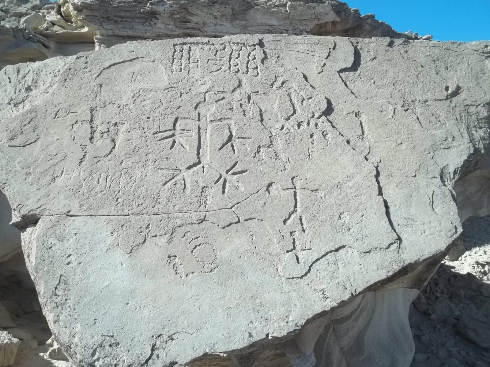
Graffiti fields
    The paved Ogilby Rd runs along the west side of the range, shown on maps as S34. At exit 164 on I-8 there is a gas station but it was nearly two dollars higher than Yuma. Posted 2017
    • CARGO MUCHACHO PEAK el 2217 is what hikers call the high peak. An easy route goes up the NE canyon and an Indian trail helps. Take Ogilby Rd to mp 8.9 at N32 53924, W114 50376 and turn on a crude road. It goes a mile to a wash. I rode a cycle a half mile up the wash, 4wds might make half that and some jeeps make it a mile up. Walk up the wash. If it gets rocky, the left side of the canyon floor usually works. Stay off the higher banks. Get on the trail at 53896, 48255 el 1000. It goes high up the right bank and on to the NE canyon at 53759, 47743 el 1400. It's obvious from there. Go up canyon to the main saddle el 1800. Then up the ridge to el 1950 where a wide shelf angles up to the north side of the summit where it's easy to go up to the reg at 53558, 47900. It needs a jar. That took me 3 hours, 11 minutes with 1200 feet of gain that matters. Posted 2017.
    • PEAK 2217 LOOP - a loop can be made around the peak using Indian trails in the canyons and return thru the Tumco Mine area. This is my favorite hike in the range. Take Ogilby Rd to the Tumco sign at mp 7.8. Go half a mile to the TH and leave a bike. Then drive to mp 8.9 and turn on a crude road. Go half a mile then walk to an Indian trail at 54176, 49806 el 750. Walk it to a road that leads into the main canyon.  If the canyon gets rocky, the left side of the canyon floor usually works. Stay off the higher banks. Get on a trail at 53896, 48255 el 1000 on the right bank. It stays mostly on the right bank all the way to the main saddle el 1600. I lost it and found it again at 53737, 47674 el 1500. It goes thru the saddle then down the canyon on the other side. When the canyon levels off, it goes over to the left bank then that fizzles and it comes back to the right bank and gets faint. Stay on the right bank then step up a little to 53044, 47016 el 1000 to get past a gully then go on another 400 feet and thru a notch. Then drop to the wash and go down a tenth mile then turn right up a minor fork and follow a jeep trail over the main saddle el 1100 and into the main south fork. Go up that roadless fork on a spotty trail. I saw a waterhole in there at 52681, 47240 el 1050. It had hundreds of gallons a month after rain. The easiest way into the next canyon south is to use an Indian trail before the waterhole at 52626, 46993 el 1050 that goes up along the left side of a side canyon into a saddle el 1200. It goes down the other side on the left but fades then reappears at 52442, 47053 el 950 on the right bank then hits the floor of the north fork of American Girl Wash. Then just stay on the right bank for a quarter mile then cross to the left and keep going to 52508, 47795 el 1000 where the trail goes up on the left bank again and on to the main saddle el 1150. Go thru the saddle then the trail goes left and down to the easy banks of a wash. Cross soon over to the right bank and follow a spotty trail to tailings. A trail goes up the left side of the tailings then on top is a main road that goes on thru the Tumco Mine area and on to theTH. That took 4 and a half hours with 1000 noticeable gain then I had an easy mile and a half bike ride back to the start. Without a shuttle there is a spotty Indian trail at 53169, 49891 el 600 that can be walked on the flats back to the start. These are good looking canyons and not too hard to walk in but rocky. TUMCO MINE - one point of interest is a concrete reservoir. It's outlined in blue on the topo just SE of the four tanks. Walk in from the main gate to 52738, 49315 and look right to see the dam and a narrow road leading up to it. A trail goes on past it up to the saddle then down along the cliff base and into the next saddle to the west then down past the tanks. Then a road at 52896, 49397 can be walked back out past the peculiar cemetery.  Posted 2020, 2021.
    • NORTH INDIAN TRAILS LOOP - hikers can use a trail cutting thru the range in the canyons north of peak 2217 then return on trails on the flats to the north. Take Ogilby Rd to N32 53924, W114 50376 and turn on a crude road. It goes a mile to 54246, 49731 el 700 where a trail crosses. Park there then walk the road into a canyon then go up it. If it gets rocky, the left side of the canyon floor usually works. Stay off the higher banks. Get on a trail at 53896, 48255 el 1000 on the right bank. It stays mostly on the right bank all the way to the main saddle el 1600. I lost it and found it again at 53737, 47674 el 1500. It goes thru the saddle then down the canyon on the other side. When the canyon levels off, it goes over to the left bank then that fizzles and it comes back to the right bank and gets faint. It's obvious how the Indians had to go. Aim for a game trail at 53102, 46903 el 1000 and follow that along a side draw for 350 feet until a hidden gap comes into view then walk thru that to a major canyon running north. A bad jeep road goes up it used by suckers who don't know a dropoff awaits. The road tops out at a saddle then a trail runs on the right bank. Go on down that to another road then go left on that and cross a gully at 53991, 46586 and then on to a trail at 54304, 46565. Walk that to 54557, 46934 then 54744, 47197. Next comes waterholes then the trail is visible again at 55066, 47673. It follows along a road then merges with it. After a fifth mile on the road the trail forks right, but leave it and head for a gully at 55233, 48549. Cross over and follow tire tracks and soon another trail merges in. Follow it to 54851, 48830 then on thru a minor canyon back to the start. That took 4 and a half hours with 800 noticeable gain, not steep. The canyons are pristine but not the flats. Posted 2020.
    • PEAK 1687 has Indian trails wrapped around it and some mine stuff.  Turn off the Ogilby Rd a fifth mile north of the RR tracks at the sign for the American Girl Mine Rd #710. Go 2 miles on that then keep left at a main fork for 2.3 more miles on #710 to a fork. Go left a fifth mile and park at American Girl Wash. Walk up it to N32 51706, W114 47017 el 700 where an Indian trail runs along the left bank of a side canyon. Walk it nearly half a mile then over a saddle el 850 and into the north fork of AGW. Stay on the left bank for nearly a fifth mile then the trail crosses to the right bank and goes past a rocky hill then starts up a side canyon. Leave it there and walk the right bank of the main canyon for a quarter mile then cross to the left and keep going to 52490, 47769 el 1000 where the trail goes up on the left bank again and on to the main saddle el 1150. From there I could see likely routes up to the peak, but a cold wind caused me to save it for another day. The trail goes down the other side of the saddle and fades when it hits bottom. Get on the right bank and walk it until a crag forces you to the left bank where an unused road leads to a huge mine area. A train size tunnel is on the right facing south. Keep going south on a jeep road to the flats and avoid an Indian trail shortcutting left past rock ruins. It goes into tedious plowed up ground. Stay on the road and follow the base to the trail again at 51663, 48089 and it goes past a foundation then into AGW and then go upstream back to the start. It works well to walk the right bank of AGW for the last half mile. 3 hours and there isn't any strenuous gain. Posted 2020. In 2026 I took a side trip up to the summit by going up a north canyon at 52499, 47820 and up into the east saddle then a drainage left of center was obvious. That version took 3 and a half hours and the 600 feet gain up the canyon is moderate and easy terrain. I put a track on peakbagger.
    • PASADENA PEAK el 1574 is infested with mines and trails. Loop hikes can be done. Turn off the Ogilby Rd a fifth mile north of the RR tracks at the sign for the American Girl Mine Rd #710. Go 2 miles on that then keep left at a main fork for 3 more miles to the huge AGM pit. Cars can make it to within a mile then mtn bike the rest. Start hiking south along the rim of the pit on some faint tire tracks at N32 51411, W114 47000 el 650. When the rim peters out, drop down a game trail to the wash below that feeds into the pit. Go up the wash on a road to a 4-way. Go straight thru to the end of the road at some mine ruins. Get on the trail there at 50809, 46685 el 1000. The trail forks at el 1150. Both go. The left fork goes to a mine at el 1350 then a ridge can be ascended to the summit. The right fork goes up a drainage then veers right to a hidden fork. Both go, but left is shorter up to a saddle el 1450 SE of the summit which is at 50954, 46571. The descent trail drops off the NE ridge at 51030, 46508 el 1400. It drops down to the north for a distance of 200 feet then veers left to the NW saddle el 1200 where another trail is cutting thru. Take that trail down to the north to more mine ruins at the base around the Pasadena Mine then walk the high road back to the start. That loop took me 3 hours with about 600 feet of noticeable gain. And I took a side trip. LOOP 2 - another loop covers the east side. Keep driving past the AGM pit for a mile to a fork at N32 51646, W114 46259. Go left up a wash then the road will climb onto the bank then park at the next fork in the road. Walk the right fork to the end at the start of a trail reading 51136, 46035 el 850, just past the Guadalupe Mine. Vic Hanson and I went up this trail to the summit. We came back to a fork at 50931, 46404 el 1400 and stayed right and walked down to a canyon bottom on the south side at 50831, 46097 el 850. We went up the other side of the canyon on a trail and over the rim el 1100 to a road at 50744, 45758 el 850 then up that to a divide el 1100. A short trail goes up from there to a mine with a long pipe that was likely for jackhammers. Continuing over the divide we walked a trail down along the left side of the road to get back to the start. That took us nearly 4 hours with 1300 gain but it was closer to 3 hours next time I did it. Posted 2017, 2021.
    • AMERICAN GIRL PEAK el 1200+ is what I call the peak on the SW side of the AGM pit. A loop can be done around the pit. Turn off the Ogilby Rd a fifth mile north of the RR tracks at the sign for the American Girl Mine Rd #710. Go 2 miles on that then keep left at a main fork and go another 2 miles then park near the ascent canyon which is at N32 51336, W114 47612 el 650. A major saddle is in view at the head of the canyon. Go up to it then turn left to the reg on the summit at 51117, 47407. There are obvious ways to descend the east canyon. I went down then cut over to 51076, 47358 el 1150 then 51033, 47302 el 1050 and then down to a wash and walked a trail on the left bank. That led me to a road in a wash that drains into the pit, but it would have to be rappelled. Instead, I used a game trail at 51120, 47110 el 750 that goes onto the rim of the pit then cirlced back. It's a 2 or 3 hour hike with 700 gain, not too steep. For another hike nearby, a twin peak el 900+ is 2/3 mile to the west of the pit with a road spiraling up it. The road starts on the north side at a metal tank. Either park on the east side and walk to it or drive back out to road #812 at 51074, 48458 and drive around. ATVs can make it part way up the peak. When the road ends, it's either go straight up on rubble to the reg on the east summit, or take a less steep route by staying on the trajectory of the road and angle up on bedrock to the west summit which is what I did. I descended the rubbly route and it wasn't bad. Posted 2020.
    • PEAK 2084 has a decent route up the NE canyon to the east saddle. Take Ogilby Rd to Hayduke Rd at mp 11.2 reading N32 55837, W114 50871. Turn and go 1.8 miles to a long, bumpy crossing. On the far side, turn right on road #662 then go 2.2 miles to road #828 then go right on that for a third mile to waterholes near a huge cairn. Indian trails cut thru  the area. Now turn south toward the peak for half a mile to the mouth of the canyon at 54663, 47492 el 900. Get on the left bank and stay on it using a spotty mine trail to 54247, 47675 el 1300 where the rest is in view. Just go on up the main canyon to the east saddle el 1950 where 2 shelves go up left of center. Both go to the final ridge then it's easy bedrock to the summit at 54040, 47767. I was expecting a reg but there wasn't even a cairn. 2 and a half hours, 1200 gain but only half could be called steep. These roads are on the topo but might need 4wd and are mtn bikeable. Posted 2020.
    • PASADENA MOUNTAIN el 1500+ has a trail up the south side. The graded Sidewinder Rd connects I-40 at exit 164 to the Ogilby Rd where the RR tracks cross. About midway along that 8 mile stretch is where power lines with huge steel towers cross the road. Turn there and go .4 mile then go left for nearly a mile to the trail reading N32 48564, W114 45747 el 450. Cars can no longer make it due to sand but an ebike can. There's nothing to lock a bike to but there's no crime in California anyway. The trail tops out at el 1350 then a faint trail marked by cairns goes on to the peak at 49323, 45688. 2 hours, 1200 gain. OGILBY HILLS HIGH POINT el 788 is on the south side of Sidewinder Rd. We parked at N32 48647, W114 48221 el 400 and went up an easy creekbed to the reg at 48655, 48524. Posted 2017.
    • PASADENA MOUNTAIN CANYONS LOOP - a loop can be done up the east canyon then down the north with an optional side trip to the summit. Take the Sidewinder Rd exit 164 off I-8 and go north for 2 miles then stay right at a main fork. Stay on the main road #622 along the east side of the range to fork under power lines at N32 48906, W114 43743. Take the left fork into Araz Wash then go up a half mile or so. I parked on the right bank then walked up a fork at 49475, 44948 el 600. I went up that and stayed left at a main fork then on to 49146, 45575 el 1050 where I took an easy angle up the left slope for 350 feet then went straight up to the rim. I walked on to 49166, 45690 el 1300 where I could look NW for a tenth mile and see the low saddle el 1350 which is SW of the summit. I dropped down about 30 feet to easy ground and on to the saddle where the standard route to the peak passes across. I skipped the peak but that's where I would detour to it. I down the other side of the saddle and stayed on the left bank all the way to the main canyon then walked down it to a road at the mouth. I turned right and soon came to a fork. I stayed right and had an Indian trail to my left. I followed the road thru two low saddles then the trail forks to the right and took me back to the start. That took 2 and a half hours with less than 500 noticeable gain. This is a little patch of wilderness. Posted 2020.
    • STUD MOUNTAIN el 2130 has a mine trail up Araz Wash to el 1200. Take the Sidewinder Rd exit 164 off I-8 and go north for 2 miles then stay right at a main fork. Stay on the main road #622 along the east side of the range for a bit over 5 miles then turn left on road #715 reading N32 50354, W114 42964  then go 3.3 miles to road #829. Turn north on that for a third mile to the end at the TH reading 50818, 45474 el 850. I could have rode an ebike that far in 2021.    Follow the trail along the creekbed to the end then keep going up and left into a major saddle el 1500. Then go up the ridge for 250 feet to a viewpoint at 51299, 45278 el 1650 where the rest is in view. Just stay left of center to a gully at 51308, 45209 and either go up it or any point thereafter to get on the main ridge.The reg is at 51456, 45160. 3 hours, 1300 gain. Road #715 goes on another half mile to the Surprise Lakes which had water on one of my visits. Road #622 goes on north for 4 miles to a flat top volcanic formation el 1112 that I call HELICOPTER HILL. Military choppers were making repeated landings on it. They must have hauled the vehicle up there. We hiked up the NE side with no problem. Beyond that is what I call the EAST HILLS. The high point of that is a short but steep hike. We followed the main road over to it then used game trails along a wash at N32 53991, W114 45167 el 850. That wash goes right under the south side of the peak then it's obvious how to go up into the west saddle then up to survey junk on top at 54337, 44993 el 1416. After that we went to Yuma by going back to the south side of Helicopter Hill then taking road #830 at 52720, 44861. Then we followed GPS to the GRAFFITI FIELDS at 53231, 41540. The main road runs SE thru the fields for a mile and a half then on another 7 miles to pavement at Yuma. Mtn bikes would work on these roads but OHVs kick up dust on weekends . Posted 2017.
    • PEAK 1314 INDIAN TRAIL - this little peak is on the east side. An Indian trail cuts thru north of it and a loop can be made around the peak on sheep trails. BLM road #662 runs along the west side. Park along it and then walk to a jeep road at N32 53690, W114 45063. It goes into a canyon with a trail on the left bank. Walk the trail over the main saddle and down the other side then into a wash. Exit on the right bank at 54081, 44631 and walk the base on faint trails around to an easy canyon and get in the correct fork at 53775, 43969. Soon there is sheep trail on the right bank and it goes to the main saddle and splits. Left is the short way down to the floor then get on the right bank at 53207, 43884 where a trail goes to the right thru a low saddle to get back to the west side. 3 hours, hardly any strenuous gain. I came in off the Ogilby Rd on the American Girl Rd and parked on the bank west of peak 965. An Indian trail cuts thru along that wash. I walked it to the trail at peak 1314 and had a 4 hour hike. Posted 2021.
    • LOOP AROUND THE RANGE - jeeps and cycles can do a 30 mile loop around the range using the Ogilbly Rd one the west and BLM road #662 on the east. Ebikes can do a shorter loop by cutting thru the range on the American Girl Mine Rd. The topo doesn't show the section along the west side of peak 1416. Take Ogilby Rd to Hayduke Rd #659 at mp 11.2. Turn and go 1.8 miles to a long, bumpy crossing. On the far side, turn right on road #662 then stay left at main forks and the road will go off the map but there's only one main road to follow and it will resume on the map. Ebikes will soon want to cut thru the range at a fork. It will go into a rocky wash for nearly half a mile then up the left bank. But it comes back down in a tenth mile then it's easy on out past the American Girl Mine . Back on 662, the road will follow steel towers then pull away and there's a choice. Staying left leads to the interstate. Staying right (that's what I did) with the towers leads to Sidewinder Rd and back to Ogilby Rd at the RR tracks. It took me nearly 2 hours on a Yamaha  XT350. I would rather do the ebike loop because that's the best scenery. It's hard to get a heavy cycle thru the range. Posted 2021
    • PEAK 1112 INDIAN TRAILS - an easy loop can be made around this east side peak on trails. Take the AGM road from Ogilby and on past Obregon as the topo shows and then at N32 51708, W114 46219 the road goes up on the right bank of a wash. It soon drops back down but stay on the bank to the end in a few feet then walk down to the wash. A trail is on the low left bank. It ends at a left bend then stay in the wash on the bad road. The road will go up on the right bank then a trail goes left up a hill and on out to the flats where it forks. Pick up the right fork at 52251, 45590. It goes along the base of peak 1073 for .36 air mile where it splits. Keep right on the higher trail then on and veer left for a quarter mile to a wash at 52422, 44261. Drop in and go left 400 feet to get on the far bank then walk 100 feet or so away from the bank to hit a trail. Walk it to 52990, 44529 and it goes along a wash then cuts over to the left bank of the wash and then at 53609, 45304 a skinny trail goes up to a road. The return trail is at 53516, 45445 and goes to 53307, 45398 then 53103, 45318. Next, it crosses a huge wash and resumes at 52729, 45444. But a minor cliff is in the way. So leave the trail a fifth mile before the resume point and go left around a low hill to get down the cliff and on to the trail and back. 3 hours and 7 easy miles. All roads easy 4wd and ebikeable. Posted 2026.
    • 1891 BOILER LOOP HIKE - a bad road can be walked to the boiler from the Padre Madre Mine then back by way of the Cargo Mine. I put a track on peakbagger under Pasadena Peak in 2026 showing the boiler. Drive in on the graded American Girl Rd to an active mine just before the PM Mine. A high clearance road goes on along the right side of the mine then in a quarter mile park along side an open pit. Then walk the roads to the boiler as the topo shows. Then go back SW to a trail at N32 50675, W114 46885. It goes thru a saddle then left to another saddle then go down a road to a left bend where a trail goes along the left side of a canyon to a fork at 50147, 46764. The left trail goes up to the swimming pool at the Cargo Mine. Then go down a road there and work over to a trail at 50017, 46879 and it goes over to a wash then on the left bank at 49984, 47067. It goes SW a third mile or so to adobe cabin ruins which is the tiny black square on the topo. Then a road goes north over into a valley then walk that north to the open pit. 3 hours, 5 miles, easy grades. Any wuss can do this hike. Posted 2026
    PILOT KNOB el 880 is on the south side of I-8. Exit at Sidewinder Rd then go south a fifth mile then veer left to a quarry. Some hikers use a road on the west end of the quarry. But a real trail is east of the quarry at N32 44200, W114 44604. It goes up to the airway beacon foundation which is the high point then down to the bad mine road that leads to the quarry . We could see another trail coming up the NW canyon. 1 hour with 500 gain. Posted 2017.
    Indian trail cutting across north of peak 2217

    Friday, January 20, 2017

    Palo Verde Mountains Wilderness

    Geoglyph at Tadpole Tank

    Thumb Peak

    Opal Hill Mine. That bus had 1979 plates.

    The Indian trail crossing the range at the south Flat Top, shown upper right.
    Palo Verde has gas and a couple of mini marts. Free camping is at the county park 2 miles south of town. Less than a mile south of that is a sign for Cibola Refuge. That road goes half a mile to fee campgrounds. At mp IMP 69 on highway 78  near Walters Camp Rd  is where big RV camp areas start. Posted 2017.
    • PALO VERDE PEAK el 1800 is the high point of the wilderness. Go south from Palo Verde town on 78 for over 5 miles to graded Stallard Rd at mp IMP 75.4. Take that road for 2 and a half miles to the dump. Go along the left side of the dump on easy 4wd. In a third mile is a fork where small rigs can camp. Take the left fork for over 4 miles and start hiking up a little rib at N33 20235, W114 46887 el 700. Head for the main north gully at 19933, 46648 el 1000. Go up that as it bends right and ends at the headwall el 1250. At the wall, go left along the base to the east side of the summit and circle up to the flag at 19766, 46627. No reg. 2 hrs, 1200 gain. Updated 2019.
    • SHARKS TOOTH el 1463 is a crag a half mile south of Palo Verde Peak. A class 2 route goes up the SE gully. Take highway 78 to mp 70.2 and walk to high ground at N33 17599, W114 45435 el 350. Go up to a burro trail at 17907, 46157 el 450. It goes along a wash for .15 air mile then cuts thru a gap to the next wash. Go on up to a shortcut trail on the left bank at 18565, 46513 el 550 then go on to the SE gully at 19074, 46659 el 750. Follow it up to a high saddle then go left to the summit at 19279, 46808. 4 hours with 700 feet of strenuous gain. Burros have trashed all but the last half mile but it's still a pretty good hike. Posted 2019.
    • MILPITAS WASH LOOP DRIVE - a 30+ mile loop can be done around the range with a 4wd and all the major peaks can be climbed on a long weekend. Take highway 78 to mp 68.6 and turn at the sign for Milpitas Wash. Go west for about 4 and a half miles to road #658. That's an easy 4wd road that goes for 3 and a half miles to access the southern Flat Top. Keep going west on the main road another 4 or 5 miles to road #706. That road goes nearly 3 miles and gets closest to the Flat Tops. The Milpitas road goes on to MILL BM on the left reading N33 23934, W114 55328 el 1150. Road #513 goes to the base of it. That's a half hour hike. TADPOLE PEAK el 1520 is what I call the high peak on the east side of the main road. Park at a bend and walk half a mile to a wash at the base reading 23664, 54081 el 850. Go up the wash then climb the ridge at 23467, 53923 el 950 and follow it all the way up to the reg at 23668, 53625. Rocks thin out at el 1100. That's a 2 hour hike. Back on the main road, a geoglyph is on the right at 23844, 54523. An Indian trail runs right by it and on to Tadpole Tank which is another half mile up the road. You could go scuba diving in that. RITT BM is next. Stay on the main road around to the north side of it then hike up a bad road #516 onto the ridgetop then walk on to the BM and reg at 25012, 55031 el 1150. That's a 1 hour hike. The Indian trail comes around the east tip of this little mountain. The main road will morph into the Wiley Well Rd and enter the Mule Mtns LTVA. An unsigned fork is there at 26957, 53560. Turn right and go nearly 2 miles to fork at 27195, 51997. Both go, but left is better. The Opal Hill Mine is a fifth mile on the right fork. Both forks soon merge and the road gets easy on out to Palo Verde town. The turnoff for the Thumb Peak hike is along the way. The road goes thru the front yard of a farm house just before town. Another option is to go south from the farm house for 3 miles to the dump. Then go right on road #569 and that goes to Milpitas Wash. The Lost Mine and Palo Verde Peak hikes are along that road. This loop is on the AAA map, but not the spur roads. Posted 2017.
    • SAGUARO PEAK el 1534 is what I call a jagged peak about 2 miles west of Palo Verde Peak. A class 2 route goes up the west side. Take highway 78 to mp 68.6 and turn at the sign for Milpitas Wash. Go west for about a mile and a half to power lines then keep going another fifth mile and turn on a crude road. Go nearly 2 and a half miles to a wash and park. Walk up the wash using the left bank then go thru a gap at N33 19520, W114 48729 el 800  and go up to a main fork about half a mile before the peak. Go up the left fork to a game trail on the right bank at 20063, 49046 el 900. A lone saguaro can be seen up to the right. Follow the trail to the main west saddle el 1000. From the saddle, go up a  drainage to el 1100 and then head for a narrow gully at 20329, 48971 el 1300. It's easier to pass below the gully at el 1150 then circle back up to it on stable ground. Go up the gully to a notch then go thru the notch and stroll up on easy ground to the SE side of the summit then go up to it. It reads 20316, 48921. For a loop back, go back down the gully and keep going down to the main wash and walk it down to 19626, 49381 el 800 where you exit left. Go across flats to a trail at 19434, 49149 el 800 then the rest is obvious. 3 hours, 800 gain. This is one of the better hikes. It's rocky, but usually not hard to weave thru on foot. The saguaro is the only one I saw in the range. Posted 2017.
    • SOUTH FLAT TOP el 1600 has an easy route up the south ridge.  Take highway 78 to mp IMP 68.6 and turn at the sign for Milpitas Wash. Go 4.4 miles to easy 4wd road #658 reading N33 17779, W114 50827. Take that for 3 and a half miles where rocks spoil the party in a wash el 850. Everything is stopped in another half mile. Walk up the wash to an Indian trail at 21138, 51034 el 1000. I was expecting to find a trail because I saw it at the Lost Mine TH. I knew they had to be cutting across the range to Tadpole Tank. From there it's easy to see how to go up the ridge to the summit. 3 hours with about 500 gain up the ridge. I walked the trail east for a third mile and it vanishes in a wash. Posted 2017.
    • NORTH FLAT TOP el 1500+ sits in the middle of the wilderness. A 4wd road comes in from the south as the topo shows. Take highway 78 to mp IMP 68.6 and turn at the sign for Milpitas Wash. Go 9 miles then turn on road #706 reading N33 20083, W114 53958. A rocky crossing about a mile in is the worst spot on 706, but mtn bikes would work for the remaining road. I never saw a closure on 706 so I kept going nearly 2 more miles to a washout el 850 that stops everything.  It's another half mile on the road to a foundation then the road dips into a wash with a dry well pipe. Keep going a few more feet to a game trail at 21882, 51887  el 950 that goes up a right fork in the wash and into the main saddle el 1000 between the two Flat Tops. Turn left and go up the ridge to the northern Flat Top. The ridge is easier than it looks. An ocotillo garden and carpet of rocks is on top. It's just one layer embedded in light colored soil, not hard to walk on but slow. It takes 20 minutes to walk the half mile across to the northern tip. Someone cleared a circle at 22544, 52088 then it's just another 500 feet to the tip where there's a good rock to sit on. That took me 3 hours with about 500 gain up the peak. I did the south Flat Top as a separate hike up the south ridge because the NW slopes are the most miserable rocky mess I have ever seen, but I found out in 2019 that going up directly from the main saddle isn't loose rock. But the north ridge is another option. From the main saddle el 1000 between the Flat Tops, go down a deer trail then up another one at 22199, 51444 el 1000 that goes up along a drainage then tops out on the north ridge el 1150. That ridge looked OK,  but I kept going along the east base of the peak. I went down from the north ridge to the main wash and walked a trail on the left bank. I came upon a 3 foot deep waterhole at 21795, 50898 el 950. It's best to cross to the trail on the right bank just before reaching the waterhole. I saw a deer there. It was easy to walk along the trail at the base of the peak all the way to the Indian trail on the south side at 21137, 51036 el 950. That trail goes SW along a wash, switching bank to bank. At 20781, 52227 el 800 it dips into the wash then goes about 400 feet then exits on the right bank and soon makes the turn toward Tadpole Tank. It fades out along here but it's easy to walk the flats back to the start. It took me 2 and a half hours to walk that leg of the hike from the main saddle back to the start.  If I hiked up the north Flat Top and came back the Indian trail route, it would take me under 5 hours. Good scenery. Anyone walking back on the Indian trail should not drive more than 2 miles in from the Milpitas Wash road on road #706. The Milpitas Wash road is graded but too soft to risk a 2wd. Posted 2017.
    • FLAT TOPS INDIAN TRAILS LOOP - trails can be used to circle around both Flat Tops. Take highway 78 to mp IMP 68.6 and turn at the sign for Milpitas Wash. Go 9 miles then turn on road #706 reading N33 20083, W114 53958. Drive a mile and a half then walk to a wash at N33 21055, W114 53415 el 750. Go up that then exit left at 21563, 53314 el 800. Then weave thru rocks to a ridge at 22064, 53335 el 850. Go up that for 3/4 mile and a trail starts appearing in a rock field. Walk it to 22525, 52593 el 900 and down a canyon to sleeping circles where it veers right and gets spotty along a major wash. It goes steep up the right bank but it's just as good to stay in the wash then exit on a faint trail at 23458, 51728 el 700 and go on to another trail at 23306, 51293 el 750. Go up a canyon on that and it fades in the creekbed then use the left bank at 23016, 51356 el 750 and walk a smooth channel. When that plays out cross to the right bank where there is a rock arrow. We dropped to a lower bank there then soon came back up to the high bank and kept going up canyon on faint trails bank to bank. At the head of the canyon, the main trail circles to the right to the saddle el 1000 between the Flat Tops for anyone wanting to climb the peaks. To skip them, go left up a game trail at 22199, 51444 el 1000 that goes up along a drainage then tops out at a saddle el 1150 on the north ridge of the southern Flat Top. Go down from the north ridge to the main wash and walk a trail on the left bank. A 3 foot deep waterhole is at 21795, 50898 el 950. It's best to cross to the trail on the right bank just before reaching the waterhole.  It's easy to walk along the trail at the base of the peak all the way to the Indian trail on the south side at 21137, 51036 el 950. That trail goes SW along a rocky wash, switching bank to bank. At 20754, 52307 el 800, it exits on the right bank and soon makes the turn toward Tadpole Tank. It fades out along here but it's easy to walk the flats back to the start. The loop should take 5 hours with hardly any strenous gain. Vic Hanson and I opted to climb the peaks from the main saddle in between. We went up to the north one then came back to the saddle and went directly up from there to the south one and didn't have any backsliding but it goes parabolic. Peakbagger.com shows the south Flat Top at 21720, 51439. We stayed on the main easiest ridge going generally south to get down to the trail. The hike took us 7 hours with 1200 rocky gain added for the peaks. This is the best hike on this page, largely because burros can't make it that far and stink it up. Posted 2019.
    • LITTLE FLAT TOP el 1397 is what I call the smallest of the three. A loop can be done on the east side.  Take highway 78 to mp IMP 75.4 and turn on graded Stallard Rd. Go 2 and a half miles to a dump  then go left on road #569. Go a quarter mile then take a right fork up a wash for over a mile to power lines. Go right along the lines for .4 mile to a major wash at N33 23399, W114 46361. Drive a mile up that then walk because boulders soon block everything. A guzzler is 1.6 air miles up the wash from the lines. Leave the wash there and aim for another wash at 22700, 48261 el 500. Walk the left bank on deer trails and stay on the low ground to 22496, 48703 el 600 where the trail drops into a wash. Go up that and into a fork at 22313, 48971 el 650. That fork leads to an old road in a tenth mile. Walk that into a major wash. The road goes back and forth across it but it pays to stay in the wash. Exit the wash at 21698, 50086 el 850 and follow game trails on the low ground to a minor wash at 21580, 50588 el 1000. Go down that a tenth mile then exit left thru a minor saddle then you're in the wash running along the southern Flat Top. A water hole in the wash at 21795, 50898 el 950 was 2 feet deep that day. A trail runs on down along the wash on the east side of the Little Flat Top for anyone wanting to skip the peak. Vic and I decided to go over the peak. We went up the south ridge at 22091, 51243 el 1100 then soon hit a short, crumbly looking knife edge. I let him go first to test it. I can replace him, but I can't replace me. It turned out to be stable and class 3 or less. We went over the summit then down at 22457, 51225 el 1350 where rocks were thinner. We hit the wash and got on the left bank trail at 22625, 50770 el 800. That is likely an Indian trail because plants growing on it indicate it's too old to be a burro trail, though a few burros have used it. We walked the trail over a mile then we took another trail at 22963, 49543 el 650. That one disappeared in a wash and we got on the right bank at 23010, 48594 el 550 then that fizzled and we got on the right bank again and stayed on the high ground back to the start. That took us about 5 hours with the 450 feet up the peak being the only strenuous gain but the peak can be skipped. By "skipped" I mean bypassed, not hopping on one foot. This is easily the second best hike on this page. Posted 2019.
    • THUMB PEAK el 1375 has an interesting route up the east side. From the town of Palo Verde, go west on Palo Verde Rd for about half a mile to a tricky fork at a farm house. The correct road continues west along the south side of the house and on to the west edge of the fields. Then go right a tenth mile then left up a wash to the top of the bench. Stay on the main road for nearly 6 miles in from the farm fields then go left. The reading there is N33 26599, W114 50164. Go another 2 miles to the end of the legal road el 550 and park. An Indian trail can be seen along the last third mile of the road. That trail can be used to walk along side the road for 20 minutes to Clapp Spring. Then stay on the road (or a trail down to the right of it ) past the spring to a wide valley then go up along the east side of the peak and up the main drainage. Stay on the left side of the drainage until about el 900 then it's  easy to angle up to the right side into a wide gully reading 24324, 51925 el 1100. The rest is obvious. Go up to the end of the gully then up a chute to a wide shelf. Then angle up to the right to top out on the summit ridge reading 24347, 51970 el 1300. Now there is a short stretch of knife edge but it's wide enough to be safe and then it's just a few more feet to the reg on the summit. 3 hours with about 700 gain that matters. Not for the squeamish.  The spring was dry in 2017 even after big rains, but some big potholes were at the base of the peak reading 24401, 51718 el 700. The spring had a puddle in 2009. Mtn bikes would work on the road in except for the wash that climbs onto the bench. Posted 2107.       
    • LOST  MINE LOOP - a mine tucked away on the north side of the range makes a good hike using washed out roads. Take highway 78 to mp IMP 75.4 and turn on graded Stallard Rd. Go 2 and a half miles to a dump  then go left on road #569. Go a quarter mile then take a right fork up a wash for over a mile to power lines. Go left to the next tower where road #568 forks right reading N33 22985, W114 46415. Take that road for a mile to the legal end at a barrier el 500. Mtn bikes would have a mile of wash to deal with to get to the barrier. Everybody drives around the barrier, but that won't help anyone who is hiking the loop. Walk past the barrier a tenth mile where a faint Indian trail forks right. The trail goes to the same place as the road, just better for walking. Follow it into the main wash at 22094, 48106 then use the right bank (which strangely has no trail)  and go on up that along the wash until you meet the road again. The bank starts to get hilly so it's better to walk the wash. Drop in at 22174, 48748. The road goes back and forth across it but it's best to stay in the wash. The wash circles to the south to the mine. Some tunnels, minor structures and a 1940s car are there. These mines are more like caverns with their skylights 100 feet up.  To return, get on a road at the far side of the mine reading 20874, 49517 el 1000. About 200 feet down the road is another major mine on the left bank.The road has a deep trench down the middle then it bottoms out in a wash. It pays to use the left bank at 21438, 48896 el 750. When that fades, get on the right bank where a road goes back to the start. This easy loop of about 8 miles takes 3 or 4 hours. Nice colors. The Indian trail goes on across the range to Tadpole Tank. Posted 2017.
    • SLOT CANYON - a good slot about a third mile long sits right next to highway 78. Drive to N33 18707, W114 44264 then turn up a wash for half a mile to the slot. A left fork has a trail that can be used to walk the south rim and drop in at 18774, 44972 el 300. I went a short way down to a class 3 drop about 8 feet high and pool which is normally dry. One way to make a loop hike is to stay on the south rim trail to a fork at 18604, 45592 el 450. Follow that west across a wash then it turns north and eventually into a deep wash that goes back to the slot. In 2019, we went all the way thru the slot with no rope needed.  Another canyon is at mp 74.5. There is a deep waterhole .7 air mile up that, the deepest I saw in the wilderness. A trail is on the left bank about half way along. Vic Hanson found that water on one of his walks. Updated 2019.
    • RVer's LOOP HIKE - an RV  camp area is on the west side of highway 78 at mp IMP 68.8, right at the junction with Walters Camp Rd. A good loop can be done. Start on the west end on a rough track reading N33 17085, W114 46827 el 450. Walk that west until it fades out in gullies then keep going to the power lines which are on the Old Palo Verde Rd. Walk north on that road and go up a side canyon at 18786, 47345 el 650. Some potholes in this canyon had a lot of water. A trail goes on up east thru the main gap el 800 with some colorful rock then down a wash toward the highway. Exit the wash on the right bank at 18001, 46257 el 500 and into the next wash. Walk along that wash on a left bank trail for a quarter mile then go right on a trail then stay on the low ground for the home stretch. I drifted left to get to some odd bedrock at 17607, 46152 el 400. A trail goes from the upper end of that bedrock back to the start. For the last third mile I got off the trail and walked flatter ground to the left. That took 3 hours, easy. I dreamed this up to kill time waiting for football to start, but it turned out pretty good.  At camp, I could pick up all 4 TV networks. An AT&T tower is in sight, but I couldn't get a decent VZ signal, not even in Palo Verde town. Posted 2017.
    • PEAK 1320 is another hike that can be done from the RV parking areas near mp 69. It's a dominant peak a mile and a half south of Palo Verde Peak. Walk to N33 17307, W114 46647 then on to a wash at 17657, 46246. Use a trail on the left bank and stay on the low ground to a flat at 17900, 46351 el 500. Keep going toward the peak and enter the main east canyon where there is usually a left bank with a trail to walk on until it turns west and steepens. Go up to a shelf on the left at 18459, 46899 el 1150 then circle up the east side to the summit at 18423, 46925. 3 hours with 700 noticeable gain. Posted 2019.
    • MOUNTAIN BIKE RIDE - a jeep road NE of Palo Verde Peak makes a good ride. Take highway 78 to graded Stallard Rd at mp IMP 75.4. Go .4 mile on that to road #207. Ride that a half mile to a fork. The right fork ends in half a mile on a steep hill. The left fork is the better one as it goes easy for nearly 2 miles along an Indian trail. This road is on  the topo. Posted 2017.

      Flat Tops Indian trail


      Sharks Tooth

      Lost  Mine

      That car has a removable roof.

    Sunday, January 1, 2017

    Piute Mountains Wilderness

    Route 66 got hit by a flood in 2016.


    Washes that normally would make for pleasant hiking have been churned into an obnoxious mix of loose sand and burro poop.
    This range is overrun by burros and useless for anything but a 4wd loop right up the middle.The nearest gas would be Amboy, if they're still in business. It won't be cheap. 

    • From Essex, go east on Route 66 for 6 and a half miles to BLM road #050. There is a crude gate there made of barbed wire and a sign for Piute Crossing. I took that road and stayed right at forks and circled back to Essex in about 20 miles. The first 3 or 4 miles sustained the most flood damage, but 4wds will have no trouble re-establishing it. The road cuts thru the range and stays in wash bottoms. After 7 miles there is a T where I went right on road #212 to the Lazy Daisy Ranch. The road goes right thru their front yard and so they might block it someday. The high point of the range is a short hike from  road #050. Park near a low saddle at N34 43915, W115 06637 el 3300, which is about 6 miles in from the highway. Walk thru and up a long valley then climb up on the left at 44309, 05218 el 3650. Walk burro trails on the ridgetop to the reg at 44747, 04763 el 4150+. That took me under 3 hours with only about 600 or 700 feet of noticeble gain. Some hikers drive closer up the valley. Not legal, but burros have trashed it anyway. Posted 2017.
    • FENNER SPRING is a short hike. Drive in from Route 66 for over 2 miles then take a left fork in a soft wash reading N34 46089, W115 07593. Go a mile up that to another fork and take the right fork reading 45629, 06693. A jeep made it this far. Walk up the wash then next there is an option to use a trail on the left bank at 45488, 06488. Follow that or the wash bed to the spring at 45243, 06240. A pool had a tiny trickle flowing out, but of course burros ruined it. 1 hour with hardly any gain. Posted March, 2017.


    Fenner  Spring. Burros can't read.

    The trail to Fenner Spring