|
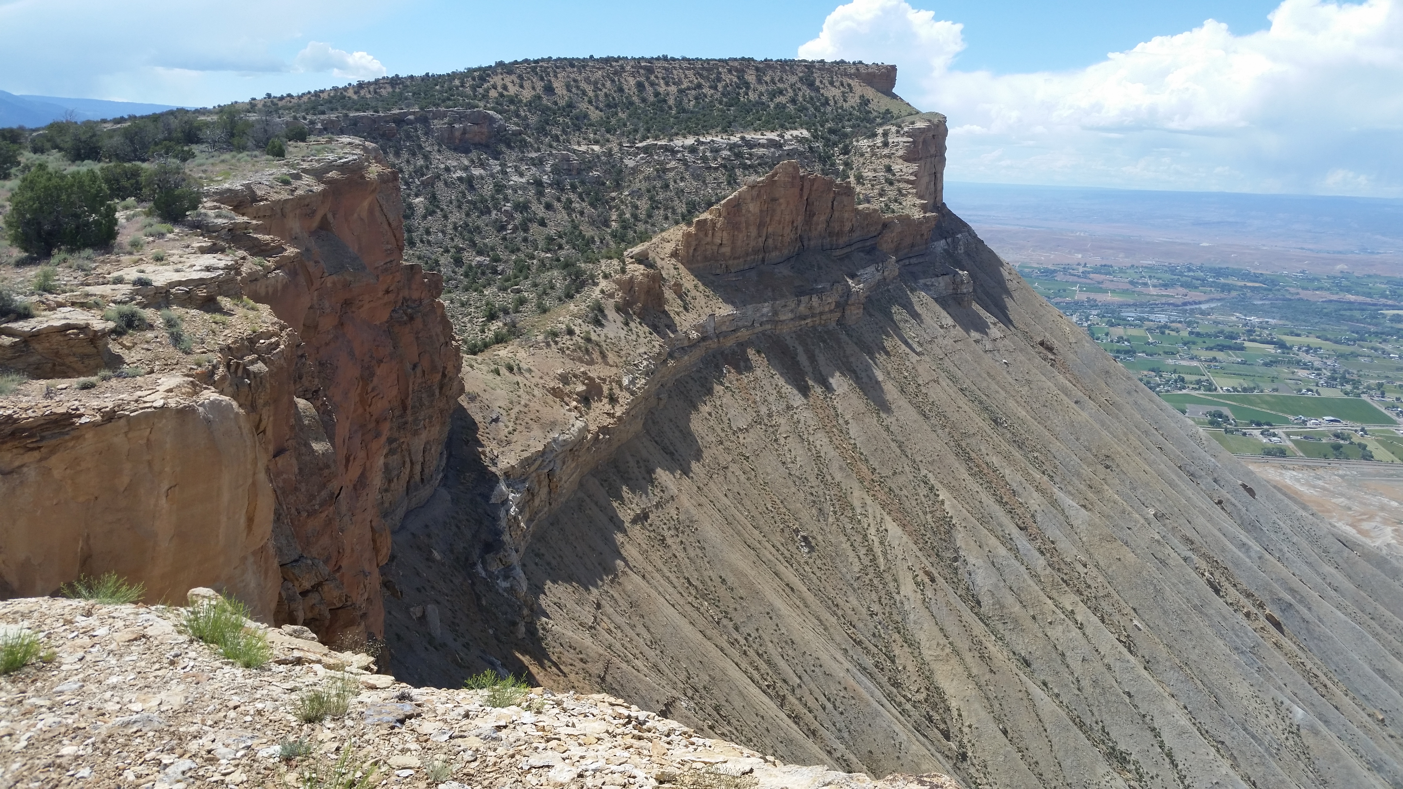
| The class 3 route on the rim of Can BM is under the stick I'm holding. I tried descending another route slightly to the right but was turned back by ultra steep dirt. |
 |
| The view from the Green River rim trail. |
 |
| Upper Sulphur Creek |
⦁ The Book Cliffs run for up to 240 miles depending on which website you read. The higher elevations are brushy and I avoided that. I was hiking in shorts unless otherwise noted. C
- RANGE CREEK - the lower part has public access using the Little Park Road. The Horse Canyon Rd is paved to the mouth at a bridge then it's about a mile to a main fork el 6482 with a tiny stream. Left goes to the part of Range Creek where all the rock art is but needs a permit. Right goes 25 miles on easy 4wd to the lower part of the creek and there's just one main road to follow. Then it's 3 miles downstream on a road with sharp dips to the end of vehicle travel at a camp spot under cottonwoods at point 4443. It's a one hour stroll on down to the Green River. I could barely jump the creek. I saw a couple of minor petroglyphs. WATER - the spring 8 miles in at 6689 had a trickle and puddles. The next one in less than 2 miles at 6625 had a flow out of a pipe. It's best to drive up the wash for that one. Then in Turtle Canyon at N39 18705 W110 10476 there was a short trickle just below the 5200 line. Range Creek is a good clear stream and bound to be perennial. I wouldn't count on the others. I rode my 125 and it's one the best rides of all time. The road is hard packed with few rocks and then the last 3 miles along the creek had some minor sand and easy fords. I put a track on peakbagger under Cone Shape BM. If I had a time machine I would go back and ride the road to Big Horn Mtn. No cattle in decades. Much of the topo map is 80 foot contour lines. UPPER TURTLE CANYON is one of the best in the Book Cliffs. I parked along the road where the Big Horn Benches road branches off then dropped in and strolled up canyon. A peculiar boulder at 19860, 12745 has a pinyon growing out of it. Something's gotta give. The first water was at a minor fall at the fork SW of point 6602. More little falls had flows beyond there then at the end of easy travel is a 20 fall with a shower spring underneath at the 6400 line surrounded by towering cliffs and big conifers . I checked above but it's tedious so I turned back. 3 hours, 7 miles. The west fork looks good on the sat image. PEAK 6491 is at the south end of a pristine bench. I started up a drainage along the road at 19723, 13985 then along the west side of point 6521 and on to the east saddle of peak 6680 where I could see the bench. I went on past point 6482 then a class 3 break in cliffs at 17998, 14518 then thru the last cliff at 17825, 14822 also class 3. That took 4 hours, 6.4 miles. Perfect pj forest. Posted May, 2024.
- BOOK CLIFFS TRAIL - this goes up thru the cliffs north of Woodside as shown on newer maps. It accesses Smith Benchmark or even Saddlehorn. At mp 276.9 on highway 6 is a high clearance and ebikeable road that goes 3 miles to a guzzler el 5100. The trail starts just beyond at N39 18591, W110 18660 with a million cairns placed by locals. It goes up a steep ridge to el 5600 then left to a gap in the cliffs. It goes along the left side of the gap and on up to saddle 5958 then down a drainage and then the left bank. It hits Little Park Wash and that's all of it. I walked down the wash on OHV tracks and got on the left bank at 18218, 17475 to cut a gooseneck. I climbed out at 17617, 16885 then went south to 17339, 16898 and kept going up thru point 5813 then at the rim a peak is in the way. It's easiest to go up almost to the high cliff then level off and on up to Smith. I retraced back and stayed on the rim then down the ridge thru point 6162. The rim would be shorter back to saddle 5958 but rough. 6 hours, 10 miles, and nearly 2000 noticeable gain. The best version would be to descend the SE ridge to Trail Canyon as in the next hike below with a 12 mile shuttle. Posted 2024.
- SMITH BENCHMARK el 6432 is on the rim east of Woodside and one of the best hikes on this page. A good route is up Little Park Wash then back down the long SE ridge. A graded road goes along the Price River from Woodside to Trail Canyon. A sandy ATV trail goes a mile up that canyon then left up Little Park Wash for a quarter mile to boulders. It's easy to walk on up canyon to the 4800 line where I cut a gooseneck then another at point 5022. At N39 15971, W110 15879 I cut another gooseneck. At 16195, 16187 el 5100 I went up the center of a ridge and topped out south of point 6077. I left my pack there and went to the summit. I circled around the right side of peak 6397 and over to the west rim then up it to the summit. No reg. I went back to my pack then on to the end of the ridge staying along the right rim near the end. Then I dropped left to a drainage at 15412, 15870 and down that to get below the high cliff. I went right on a shelf to get down and on to the saddle el 5450 connecting to the next mesa. Sheep were grazing in the saddle. I had the option there to drop down to Little Park Wash but that would likely take longer, so I walked up the ridge center to get on the next mesa near point 5630. I walked across it and east of point 5492 then north down a ridge at 15126, 14736. I went down another 100 feet then turned east down a ridge to hit bottom then back to the start. 6 hours, 38 minutes, 12 miles with nearly 1500 noticeable gain. But I cheated and rode the ATV trail in a mile. Near the summit I saw a cairn at 16108, 17225 el 6100. It marks an easy route down to point 5930 over the river. Then that rim could be walked and the high rim regained at point 5879. I might try that version next time. The area is pristine with no sign of cattle ever. Posted 2024.
- TRAIL CANYON -a loop can be done up canyon to Joe Spring then west on a faded trail to Little Park Wash and back down that. A graded road goes along the Price River from Woodside to Trail Canyon. A sandy ATV trail goes a mile up canyon to the mouth of Little Park Wash. I walked on up Trail Canyon following ebike tracks. Along the way there is trail on the left bank at N39 15051, W110 13965 that goes for 6 minutes to the best preserved stone cabin I have ever seen. The ebike tracks ended up canyon at a 20 foot fall with a seep at the 4880 line. A bypass trail on the right bank is at 15676, 13797. I went on up and took the trail on the topo to the spring but it had only a dry trough. I then went west on the trail and took a shortcut to 16296, 14132 where I could walk NW along a canyon bench below the trail. I came to a fork and dropped to the creekbed then on upstream and got on the left bank just before the trail crosses. I followed it, meaning the line on the topo, up to the divide and to just before 2-66 where I cut left of the trail down a ridge to 17241, 15846. I went on to 17339, 16317 where the trail finally shows up and goes down the right side of a drainage to a cabin as shown on the topo. I dropped into Little Park Wash then down it. A gooseneck at 5322 can be cut but I daydreamed past it. The next one near peak 5492 can be cut but drop back at 15972, 15880. The next one to cut is at 5022 then the last is at the 4800 line. That took 7 hours, 13 miles and the 200 gain up to the divide is about the only strain the whole way. This measurement is from the confluence of the two canyons. I can cut to nearly 6 hours by skipping the spring and paying closer attention to the gooseneck shortcuts. No sign of cattle ever. Posted 2024.
- MOUNT ELLIOTT el 7142 has a jeep road most of the way but the Price River has to be forded. The road goes from Woodside along the river. Subaru types can make it to the ford. Any jeep that can cross can go all the way to the 6600 line east of peak 7059 then hike to the north saddle. Then go far left to get past the first cliffs then go right at the last cliff to get around to the west side. All class 2. I crossed the river on my 125 a few feet up from the ford. The flow was allegedly 44 CFS. An ebike would be in walk mode a lot but might be better than walking the 15 miles. Posted 2025
- LITTLE ELLIOTT MESA el 6775 has a trail out of Blue Castle Canyon to el 5300. It tops out on the rim a half mile west of Blue Castle Butte where the rim turns north. The west side river road is paved to N39 05107, W110 08834 where a 4wd goes left and drops into the wash on the north side of Blue Castle. I was able to ride my 125 a short way up the wash ( I could have got an ebike to the trail with some carrying ) then walked it until I was reading 450 feet from the trail which starts at 05525, 12827 el 4700. A gully there with cairns leads 450 feet to the trail. It goes up and bends left then back right up to 05355, 12898 el 5050 then to 05331, 12990 el 5200 where it goes up to the base of the rim cliffs then right along that to the top at 05332, 13106 el 5300. A million cairns are there now so GPS shouldn't be needed once on the trail. I strolled up the rim a third mile then left into a cove where I could see a class 2 route going up on the left and another route on the right. I chose the latter and topped out at peak 6168 but it's nearly class 4 with exposure, so the other route is better. It's obvious until a minor cliff near the top. One good route is at 05201, 13784 el 5900 then the route tops out at 05189, 13812 el 6000. For just the high point, stay low on the flats to get past peak 6419 then go up on the SE ridge of the peak. At el 6400 go along the top of a minor cliff band on the south side of the peak. Wait until almost directly under 05746, 15064 then go up to it and on up to the last cliff where a chute goes up, but I went left along the cliff base to a class 2 route up. No sign of humanity on the summit. Don't climb up the eastern half of the summit because that saddle in the middle is tough. It took 3 hours with 1300 noticeable gain to get to the mesa rim. I didn't go straight for peak 6775, but I crossed a canyon at 05319, 14340 to get to the west rim. That's the best rim walking along there. I went to a view of Cliff BM and could see that it's hopeless. If there is a BM out there it must have been flown in. On the walk back along the rim I nearly had a head on collision with a herd of sheep. There is no water on the mesa, so they have a long hike for a drink. I then walked over and climbed peak 6775 and then on the descent passed by a 1961 BLM marker at 05377, 14485 el 6150 then near the rim there is camping gear at 05312, 14102 el 6100. It's been there over a year and needs to be brought down. I couldn't see his tracks anywhere. The tent and sleeping bag are in stuff sacks. On the trail down I saw more trash including a broken walking stick at the TH. I spent 10 hours total. Posted 2023.
- BLUE CASTLE CANYON - I started out the same as the Little Elliott Mesa hike as far as where the trail tops out on the south rim el 5300. Then I just walked the rim into the upper part of the canyon. One goal would be to take the left fork that goes to the rim south of peak 6410. A longer hike would be to go up Middle Mountain. For that the canyon must be crossed to the far rim. Drop down to the creekbed at N39 06138, W110 14986 el 5650 then go upstream a tenth mile to an easy route that goes up to opposite rim but the final climb is a 15 foot class 3 crack which tops out at 06228, 15107 el 5650 . Then stroll down nearly a mile to a canyon and go up the creekbed until 200 feet from 06560, 13877 then go up to it and level off to get into the right fork. Then go up a slope to a stairway at 06480, 13798 el 5900 that leads to the top of the ridge then it's obvious up that to the rim at 06782, 13691 el 6400. Some old cans are there. I walked a fifth mile to the other side for a view then retraced back down to the class 3 crack and dropped in and decided to take a shortcut down the creekbed, the Hastings Cutoff so to speak. I came to huge boulders with an obvious grassy bank on the right to bypass them but couldn't drop back down until I got to 06278, 14358. I soon came to more huge boulders and passed on the right again, but it might work better to go up to the left and down around those. I kept weaving boulders and at 06256, 14047 I stayed on the left bank to a large cottonwood tree then dropped at that and crossed to the right side and then it was smooth sailing. It took an hour to get thru the boulders but nothing harder than class 3. Intermittent water was in there starting where I dropped in. And cottonwoods. I spent 10 hours with 1700 noticeable gain but that included the trip to Middle Mountain. I did a backpack in 2024 and posted it. Posted May 12, 2023.
- LONG CANYON is blocked by private land at Gunnison Butte, but a route in goes thru the saddle west of peak 4666. The west side river road is paved to N39 05180, W110 08718 where a 4wd road goes up the bench. In about 2/3 mile it bends left then walk to a wash at 06136, 08721. Follow the main channel to a steep slope at 06434, 08972. A game trail is to the left but dangerous. Go up the slope then left to a trail up into the saddle then stay right a few feet to a trail going down a gully. Go on to 06751, 09082 to get down. A tiny stream was there. The source was the spring at the 4400 line coming out of the wall. I went on up for half an hour but this is backpacking country. It's hard to tell cattle were ever in here. Posted May, 2023. UPDATE - I returned May 20, 2024 and the spring was a slow drip. I went up canyon to the next spring and it was dry. Then the third spring had a useless seep. I went on to a main fork at the 4920 line. I went 5 minutes up each fork and it was slower going but still not hard. That took 6 hours and 13 miles. It's an easy stroll except going in and out over the rim.
- ELLIOT MESA STOCK TRAIL - I was told about this by a local man but didn't hike it. The trail goes up from the Price River just before the Green River. On the topo a bowl can be seen west of point 5522. A trail can be seen there on the sat image and that is likely it. The only way at it without crossing water or private land is to go into Long Canyon then walk the bank of the Green River. Locals use to drive the bank but the rancher blocked it near Long Canyon. Posted 2024.
- CAN BENCHMARK el 6826 is 13 miles NE of Green River. A stock trail goes up a north fork of Tusher Canyon and tops ouet between peak 6376 and peak 6355. It's easy 4wd up Tusher to a sunny camp spot SE of peak 5266. Cow trails go up canyon but the important one goes up a left fork at N39 06796, W110 01369 el 4800. It soon switches right then goes on up the left bank of the main canyon and tops out at a fence el 5850. Just past that is a right fork with a route up the right bank. I walked on around the east side of peak 6355 then down a minor ridge at 08617, 00380 el 5950 to get across a wash. No cattle impact beyond there. Remaining coordinates are W109. Then I walked up a ridge to peak 6304 and stayed on that level around to the north side of the peak at N39 09409, W109 59180 el 6200. I c ould see the summit rim and the class 3 spot is about center. I went up to a flat spot at 09246, 59088 then angled up left to the last cliff then right along the base and it led me to the class 3 crack. I topped out at 09201, 59079. The reg jar had no lid. That took nearly 9 hours with nearly 2000 noticeable gain. It goes parabolic for 300 or so to get on the summit rim. No cattle for years and not likely to come back. Where's the water? Backpackers would have to count on rain filled potholes. I saw a silty one el 5800 near the fence from rain a week earlier. It's going to be hard to find a better peak hike than this in the Books. Posted 2022.
- SULUAR MESA TRAVERSE - an old road up Naylon Canyon is an easy route up then I cut thru the saddle north of peak 6834 to get down to a bench that I could walk around the north side of Can BM then down the stock trail SE of peak 6376. I put a track on peakbagger under Can BM. It would be easy to use ATVs for a shuttle up LH Tusher Canyon but I didn't have that option. So I left camping gear at the stock TH and rode my 125 up Tusher to Naylon. I could have drove a jeep as far as Cottonwood Spring. It had a fenced pool. I walked up Naylon with no sign of the road until a left fork where it's on the left bank. It goes bank to bank then up on top. I left it to cut thru the saddle north of peak 6834. I went thru the saddle then stayed left to get down then at the last cliff band I walked right to get to the easy bench. I just walked it around just above the 6200 line in a perfect pj forest. I went on past Can then down the sharp point SE of peak 6304. Then I walked that level around to the stock trail then down to camp. The next morning I walked 4 hours back to Naylon to get my cycle. 8 hours 19 minutes for the traverse. The app has it at 16.4 miles with 2200 gain but hardly any is strenuous, but a lot would be in reverse. WATER - Naylon had streams in every fork. Tiny streams crossed the road near the adits, but a bigger one was NW of peak 6466. Once I left the road I only found water once. It was small pools and seeps at the top of a dry fall where I crossed the east fork of Winter Camp Canyon. I forgot my GPS but it's near N39 09564, W109 57885. In April and May I wouldn't count on any water past Naylon, just as a precaution. And nearly all of that is bound to be seasonal. Cottonwood Spring may be perennial. Cattle were moved out of Tusher on April 29. They can't get into Naylon. Posted April 29, 2023.
- NAYLON CANYON is pristine and as easy as it looks on the sat image. A loop can be made up the right fork and down the left. Jeeps can make it up LH Tusher Canyon to just past Cottonwood Spring (it has a fenced pool) where boulders block anything bigger than an ATV. It's not far to Naylon. I went up to a slot with a bypass trail on the right and then stayed right at forks. At el 6300 a big stream rises out of the creekbed. I went past that to a canyon on the left at N39 09899, W109 52938 el 6400. I went up that 100 feet or so then climbed out on the left and walked west on the lowest ground to the spring in the left fork. I passed thru a saddle at 09867, 53246 el 6550 then crossed a canyon, which had a stream. Then over the rim at 09901. 53618 el 6750 and down to a drainage at 09943, 53678. I walked that down and when it got steep I drifted to the right to get down upstream from the spring. I came to a tricky little drop which might be doable but a puddle at the bottom would soak my boots. A risky ledge is on the left and I saw later it might work to go higher and come back down to the ledge. But I went around to the west rim and down a gully and it had a stream. I got down to the spring on the left bank and it had a tiny flow. I walked on down that fork with a good stream and back to the start. 4 hours, 15 minutes with 200 noticeable gain. The pj forest here is as good as it gets and some big evergreens are thrown in for good measure. Boulders near the mouth keep cattle out. I was amazed at all the water but it must be seasonal because I can't see any on the sat image. Posted April, 2023.
- TUSHER BENCH is what I call the pristine plateau between the main forks of Tusher Canyon. A quick route goes up out of the left fork and tops out near point 6005 and then a descent route is near peak 6230. I took the 4wd road up LH Tusher for a bit over a mile to the fork that drains down from peak 6230. Then I slogged up the main canyon for 105 minutes to the ascent ridge at N39 06477, W109 56510 el 5250. I went up then near the top bent to the right to get on the rim at the second saddle east of point 6005. Then I followed the topo to the soutt rim and walked it down to peak 6230. I walked level around the right side of that then down to a drainage at 05309, 58782 el 6100 then an easy ridge at 05442, 58692 to get down to the canyon floor. Cow trails lead down it to the start. 5 and a half hours, 800 noticeable gain. I saw hiker tracks on top. He likely came up out of the right fork. Posted 2023.
- TUSHER TO COAL CANYON - that's a decent cycle or ebike ride going up Tusher then along the bench to Coal and down that to town. When Coal opens up there is a roading going right a short way to boulders with good petroglyphs. The dirt part of this is about 25 miles and 7 or 8 for the paved part, all public roads. Posted 2023.
- TOM FARRER TRAIL - this is an old road that can used to access the south rim of RH Tusher Canyon then the rim is easy. I went as far as peak 6541 then dropped down but likely could have gone to Sid BM and descended the Whiley Hall route, but that would be a monster shuttle. I posted a track on peakbagger under peak 6520. I parked about 3 miles up RH Tusher where the descent canyon comes in on the right then pedaled a bike up canyon nearly 8 miles to the trail. First I walked up Ute Canyon for 10 minutes to a falls in a narrows and filled up bottles. I then followed the trail to the end near peak 7036 then stayed in the creekbed to a slot. There I walked the right rim nearly level until merging with the top of the main rim el 6400. I went on to a break in cliffs at N39 04588, W109 55197 to get in the saddle south of peak 6673. Then I easily walked along the east side of peak 6755 then just south of peak 6541 I dropped off the rim at 03291, 56864 el 6500. I walked the next level to 03417, 56994 el 6350 then down a slope at 03670, 57256 el 6200 then to 03811, 57384 el 6050 where I went straight down a broad ridge. I dropped thru rougher terrain at 04029, 57436 el 5600 but could have walked easier ground a tenth mile to the right of it. Once at the bottom I walked the right rim of the canyon then dropped in but there must be a way to stay on the rim almost to the road because cattle can't use the creekbed due to minor drops. I arrived at the start after 6 and a half hours of easy hiking with 1500 gain according to the app but nothing very steep. 11.4 miles is the mileage. I was lugging long pants for nothing. The roads are easy 4wd but an ebike would be a better shuttle vehicle. A stream was running down the road for miles from Cow Spring. Grazing in RH Tusher is light. Posted May, 2023.
- UPPER HORSE CANYON - the Farrer trail out of RH Tusher can be used to make a loop. I walked it to Tom Spring where an upper trough at N39 06056, W109 52014 had a tiny stream out of a pipe. I kept going down the valley to a slot el 6400. There I walked the right rim nearly level until merging with the top of the main rim el 6400. I stayed near the 6400 line to a point at 04426, 55033 el 6300 then dropped down and went right to a minor ridge at 04326, 55047 el 6200 where I went down and across a drainage. I went higher and on to the last rim at 04112, 54995 el 6050. I dropped down to the right then back left to hit the main creekbed of Horse, just above a minor fall. I walked up canyon and had a series of easy boulder jams. It smoothed out in 20 minutes and I went on to Cub Spring where there is a shiny new trough but not operational yet. It might be a wildlife project. I only found potholes with rain water where the topo shows the spring. I went on up canyon to the fork before Cub Valley at 05260, 50940. Fresh bear tracks were everywhere. I strolled up that fork and then up to the rim at 06054, 51097 and on to an old road that shows on the topo as a pack trail that leads back to the Farrer trail. 7 and a half hours and the 800 gain at the start was darn nearly the only noticeable gain. Good pj forest and easy creekbeds. I got light scratches weaving sagebrush in Farrer Valley. This is a 15 mile cake walk. Posted Oct, 2023.
- RATUS BENCHMARK el 7919 sits on the east rim of Showerbath Canyon. It's nearly 20 miles of easy 4wd up Tusher Canyon to Showerbath. I went up the second fork on the right reading N39 08172, W109 50545 el 6400. In half an air mile I came to a fork el 6600 which is east of peak 7090. I took the left fork but should have gone up the ridge between forks as that's what I wound up on. At el 6750 I went left around cliffs then back to center and at el 7000 I walked level to the left to look for routes, but no I should have stayed on that same ridge. It goes parabolic up thru 07694, 49576 el 7300 then tops out a third mile south of peak 7601. Then it's a stroll to the summit block. A 5 foot climb on the left side is the safest but tricky for a solo hiker. A gator hook and etrier makes it easy. I then retraced back past peak 7601 and dropped into Ute Canyon and had an easy walk along an intermittent stream with bear tracks. At 06818, 50626 el 6850 there is a trail that bypasses some rough stuff. At el 6650 there is a wide trail on the left bank that looks like a road. It soon leads to a big drop where I started following the topo up to the Farrer road. I went up to a trail at 06733, 51463 el 6600 that leads to a flat. At the end of the flat I went up a trail at 06733, 51463 el 6700. It fades but it's easy on to a slope at 06741, 51122 el 6650 that leads up to the road el 6750. I walked that down and if I had an ebike waiting it would have saved over a mile of road walking, but nope. That took 6 hours with 1700 noticeable gain. No GPS track for this because peakbagger has never heard of it. Grazing in Showerbath is light and none in Ute for years. Showerbath Spring had a safe looking flow just above where the topo shows it. It needs a funnel. Posted May, 2023.
- SAL BENCHMARK el 7216 sits between forks of Horse Canyon. The road into lower Horse is for OHVs and a jeep might be too wide. A jeep can come in from Coal Canyon which is rough or Tusher which is easy 4wd. For all that driving I would take a weekend and do Sid Benchmark too. There is a track on peakbagger for that one. I walked up the west fork of Horse to a narrows el 5400 with falls. It can all be passed on the left but I prefer to climb the first little fall then make a hard left up to the bypass. I strolled on up canyon then up a clean slope at N39 03536, W109 55358 el 5650. I went up to a game trail at 03276, 54898 el 6500 thats lead to the main rim. Then I stayed right around a minor peak and came back to center and was able to stay on center all the way to the summit at 03992, 53200. 8 hours, 1600 noticeable gain. Easy terrain. No cattle past the narrows. No GPS track for this because peakbagger has never heard of it. Posted 2023.
- SID BENCHMARK el 6520 is on the west rim of Horse Canyon. I made a loop up the canyon then back on the rim to the BM then down the canyon south of peak 6364. I put a track on peakbagger under peak 6520. I walked up the west fork of Horse to a narrows el 5400 with falls. It can all be passed on the left but I prefer to climb the first little fall then make a hard left up to the bypass. It's easy on to the main fork el 5840. Just before that I could see a likely route up to the next level, but passed on it and went on to a minor narrows where I started up and easy ridge to a break at N39 04095, W109 55025 el 6050. I went on to another break at 04127, 55262 el 6350 then straight up to the last break at a little drainage el 6500. I then walked the easy rim using the topo to navigate. At 03271, 56698 el 6500 I dropped to a lower level then down a little more to 03241, 56683 el 6450 where I could walk on toward peak 6364. I dropped again at 02666, 57244 el 6350 then walked the center up and over the west part of peak 6364 and encountered the only class 3 of the hike, maybe 12 feet high. At 01959, 57447 el 6250 I dropped down then went far right on a ledge to get down. Then made a hard right to a crevice for the last bit. All that should be bypassable by skirting the west side of the peak. Once down into the saddle, I saw old cans. Then I took a side trip to the BM and came back and started down the canyon south of peak 6364. Where it makes the big drop over the rim, I walked left a few feet to a break then down to the next cliff at 01751, 57348 el 5850. I walked level on top of that for a tenth mile to a slope in plain view. Upon arriving there I found cairns that led me to a ridge at 01663, 57191 el 5700 where I could see the rest of the descent. That took 8 hours with about 1000 noticeable gain. 80 minutes of the total was the side trip to Sid. I got a head start by riding my 125 as short way up the canyon to the confluence with the descent canyon. Posted 2023.
- BUTLER CANYON - a loop can be done on a stock trail that starts along the river road south of Butler and goes to el 5300 then an easy ridge goes on to the top of Suluar Mesa, then drop into upper Butler and down it to the big drop and then north a little to a stock trail to get back to the river road. The trail starts near the river road at N39 08206, W110 05771 el 4150. But first I went 3 miles on up the road and left a bike. I came back and went up the trail to the first plateau. It resumes there at 07998, 05585 el 4800 and goes to the south side of peak 5459 and ends. The reading there is 07863, 05244 el 5300 in the event of reversing this route. It's easy to stroll around the south side of peak 5647 then up the ridge at 07588, 04407 el 5400. Go on up to the next little cliff then stay left of center to get up then it's obvious up to the last cliff band. Just go left and merge into a drainage that has an ancient shovel. Soon it's the top and I stayed to the right then headed for 07440, 03285 el 6100 where I could get at the south rim for a view. Then I headed north across the mesa and saw a lot of ancient cow shit. They must have used the trail that I took for Can BM. I dropped off the rim into Butler at 08163, 02877 el 5950. I angled down to the left then down to an easy ridge 08284, 02753 that leads down to the creekbed. Soon a dry fall is in the way but an easy gully goes left around it. I started seeing signs of recent cattle and then a lot of cattle remains. I kept going down canyon to the next drop. I took a trail on the north rim and dropped down a class 3 break at 09214, 03976 el 5100, but I could see a class 2 route off the south rim a few feet upstream. I went on down canyon on cow trails to the big drop and there a trail goes over the rim to get at the stock trail reading 09547, 05504 el 4750 that goes down to the road. It's easy for people but too tricky for cattle. 6 hours, 2000 noticeable gain for the hiking part. Nothing harder than class 2. A pedal bike works for the shuttle. I saw inscriptions on the ascent trail that looked to be dated 1949. I found out about that trail from a geocache site. It wouldn't be a bad hike to go up to the mesa top then check out one of the south points. It took me 2 hours to get to the top. Posted 2023.
- GREEN RIVER RIM TRAIL - a one way hike can be done with a bike shuttle. The river road runs north from Green River town along the east bank for 18 miles. Pavement ends halfway at a pay campground then it's decent dirt the rest of the way with some dispersed freebie camps. I left a bike at the end of the road then came back 3 miles to the trail at N39 09783, W110 05829 el 4200, just north of Butler Canyon. It goes up the left side of a canyon then tops out on the rim at 09547, 05504 el 4750. The trail goes along the rim nearly level. The most interesting part is in the middle where the plateau narrows to a few feet wide, not for the squeamish. But you can step up a little higher for safety. At 11750, 04469 el 4550 is where it drops to the end of the road. That part is on the topo. 3 and a half hours for the hiking part with 550 gain at the start being the only strain. The rim can be walked on to Rattlesnake Canyon then back on the river trail. But that's best done as a separate hike by starting along the river in case there is an issue with brush or an encroaching river. I did that years ago. Posted 2022.
- HATCH MESA el 5586, at the mouth of Floy Canyon, is in pristine condition dotted with juniper. No cattle ever. There is an easy 4wd road on the east side running north toward point 5470. A car can make it to that road and ebike the rest. At the end of the road it's obvious how to go up a steep game trail. I strolled over to point 5419 and could see a likely descent route there. A cairn marks where to start down. But that's for some other time. I rim walked to point 5586 then down the skinny SE point. When a cliff blocked me, I dropped left thru some boulders to get down and had an easy route to a ridge at N38 56781, W109 56236. I walked it down then crossed the flats back to the start. 3 hours, 15 minutes and 400 noticeable gain. Nothing scary. This is an easy way to see Utah the way Mother Nature made it. Posted 2023.
- HORSE MESA el 6091? has a stock trail out of The Basin. It starts at N38 59337,W109 54967 el 5150. A 4wd road leads to it from the main east side road. Once on top I walked across a neck then up a game trail at 59834, 55511 el 5550. It cirlces around to the NW side then it's obvious on up. I retraced back to the main mesa and walked to the south rim at 58657, 56238 then left to point 5498 and on a little more to a viewpoint then back. I spent 4 and a half hours with 1000 noticeable gain. No cattle for decades on the mesa and there weren't many. The roads are ebikeable. The main east side road has some sandy spots. Trough Spring is a bunch of useless seeps trashed by cattle. Posted 2023.
- FLOY BENCHMARK el 6377 is north of Horse Mesa. I walked the south canyon to the saddle el 5700 between the BM and peak 5975. I could look up and see a route right of center. I went up thru N39 01173, W109 54093 e 5900 then on to the saddle behind the summit then up. It was only 90 minutes to the BM but I needed a longer hike than that. I kept going up the main ridge staying low left on easy shelves then up a break at 01754, 53666 el 6450. I then walked right to the rim then up that to peak 6752. I went west around it but looking back the east side looked easier and shorter. Just past that peak is a low fin. I walked the right base then at a second one I walked the left base then up to a class 3 crack at 02481, 53006 el 6600. It's 8 feet high and the hardest obstacle I encountered. I kept goint up the rim thru point 6791 then at the el 6800 line I leveled off to the right and on to the west rim of the canyon draining south from peak 7132. I could see a class 2 descent route off the east rim so I circled over and at 02769, 51179 el 6750 I dropped left to get past a cliff. I followed the rim on down then took a right turn to a break at 02605, 51279 el 6600. I dropped down then walked 200 feet to the right to a drainage then down the left side of it to 02658, 51316 el 6450. Then I resumed going right but only slightly dropping to a shelf at 02728, 51271 el 6400. In another 100 feet I dropped down a gully and soon the left side is easy in trees. At a minor drop there is a stairway on the far left side of the creekbed. Then I leveled off to the right along a cliff base then down to 02782, 51442 el 6100 to get to the easy canyon floor. I strolled on down smooth sand to the road following bear tracks then had a mile of road to walk back to the start. It's an 8 hour hike and then another 20 minutes on the road without a shuttle. I would have had a bike shuttle but didn't know I would make it. There is about 1500 noticeable gain but rarely steep. This is a crazy walk on the wild side. Easy 4wd access and ebikeable. Posted 2023.
- CRISTMAS RIDGE el 5855 is a mesa at the mouth of Floy Wash. A one way hike is easy. I took the easy 4wd road up Floy to Thompson Pass and locked a bike to a fence then retraced back down Floy for 3 miles from the pass to an obvious ridge with a class 2 route, just a little north of point 4881. I went up that then wandered down to peak 5565. It has an easy stairway at the east end. Then I rim walked north across two necks then up the high point and on to the pass. 3 hours and the only strain is the 600 gain up from the road. Cattle have been gone for decades. The stock trail goes up the canyon east of peak 5565 but is useless because the road in is bad. Posted 2023.
- CRESCENT CANYON has 3 named forks. I went up the right fork and came down the middle fork. The direct road into the canyon is for jeeps. The bench road coming from Thompson Canyon is easy 4wd. Cow trails start up the right fork and there is an essential one at el 5700 that cuts left across a gooseneck. I went on up the main canyon to a fork el 6400 then up between the forks to a cliff at N39 02173, W109 45081 el 6500. I walked right along the base until I could easily go up to 02152, 44988 el 6650 then walk level to the left for 250 feet then up a ridge. Cow shit there told me I was home free. I walked the ridge to the top then took a side trip south to a point at 01653, 44553 el 7050 for a view. I then walked north along the east side of peak 7118 to a path thru sagebrush at 02839, 45031 el 6950. To get in the middle fork, I stayed high then made a hard left to 03469, 45245 el 6850 and dropped in. I took a chance on getting thru it because I had enough daylight to back out and try the next arm. I had no issues until way down it drops into a deep slot but it's easy to walk the right bank a few feet to get down. Another slot past that has a long trail on the right bank then it's bank to bank on trails back to the start. 8 hours with 1000 noticeable gain. Just enough light brush on top made me resort to long pants. Cattle were on the plateau years ago but I couldn't find their route. They sure didn't go up the canyons. Two Pepsi cans were north of peak 7118. Where's the water? Show me the water! Posted 2022.
- DEER POINT el 7386 is on the east rim of Crescent Canyon. I made a loop up the main fork then down the middle fork. Jeeps can get to the confluence of the two forks and OHVs go another mile to a boulder jam. I walked from the confluence along a small stream that rises at the spring on the topo el 5900. The flow was intermittent beyond there and by 6500 it was dry but I soon left the creekbed on a game trail at N39 04790, W109 45887 el 6600. There's more than one way up but I went on to 04805, 45799 el 6700 then up steep to 04770, 45773 el 6900. In a few more feet I was on a ridge. I went up it to the last cliff then left to a class 3 climb that tops out at 04760, 45705 el 7050. I soon saw that I could have gone another 150 feet along the cliff base to class 2 routes up. I went on to 04764, 45413 el 7250 then on to the summit. I then walked SW to 04316, 45372 el 7300 to get down to a lower level and eventually down to the 7200 line to get around to the main ridge that leads to peak 7118. I dropped to that ridge at 04102, 45323 el 7150 then just before peak 7118 I took a right turn to 03469, 45245 el 6850 and dropped into the middle fork. I had no issues until way down it drops into a deep slot but it's easy to walk the right bank a few feet to get down. Another slot past that has a long trail on the right bank then it's bank to bank on trails back to the start. The middle fork had little water. 8 hours with 800 noticeable gain. This is a better hike than the right fork loop and no long pants needed. The main fork would make a good destination for backpackers to set up a base camp and try for Renegade Point. When I was in Thompson Canyon at el 6150 I could see likely routes up to Deer Point. Posted May 19, 2023.
- BOOK BENCHMARK el 6828 is 4 miles NW of Thompson Springs. The high clearance bench road coming out of Thompson Canyon is the best road. I rode my cycle 6 miles on it then could see an obvious route to the SW saddle. The ridge is easy on up until crags get in the way. It's best to stay low on the left under those until 200 feet from the summit which is at N39 00010, W109 46199. No reg. 2 and a half hours, 1000 gain. Posted 2022.
- THOMPSON SPRINGS is at exit 187 with a truckstop. Old pavement goes a bit over 4 miles into Thompson Canyon to the Sego Canyon rock art site. Water is pouring out of a pipe a tenth mile before it. A half mile past the rock art is a 3 way fork. Right goes up Sego Canyon. I went 9 miles up that graded road for a good view near peak 8083. The middle fork goes graded for 2 miles up Thompson Canyon then it's high clearance for nearly a mile to the end. I took a one hour stroll up the right fork. It's pristine. The left fork at the 3 way goes up on the bench and on to Crescent Canyon then down to the old highway but takes a jeep to get thru unless it gets graded. I made a loop on my cycle and came back to Thompson Springs on the old highway for a total of about 26 miles. These roads are bikeable but the hilly bench road needs a high powered ebike. Posted 2022.
- THOMPSON CANYON is a long one but a one way hike can be done using the Sego Canyon road to get at the head of the canyon. You get to hike a good canyon and ebike another. Leave a 4wd at the end of the road el 5950 in lower Thompson then ride an ebike 3 miles back down to the Sego road then 11 miles up that to a secret jeep road at N39 08871, W109 43190 el 8500. Hide the bike around there then walk the jeep road to the rim of Thompson then down an elk trail at 09133, 43787 el 8250. It goes down a ridge and at a minor cliff it goes to the right around it. As usual with game trails it splinters. At 08963, 43949 I dropped down to the right and hit a major trail and walked it to the creekbed. Soon a stream appeared and some thickets. I got on the left bank at 08722, 44006 and walked 100 feet then cut over to the right bank then back down at 08697, 44041. In another 400 feet I hit a good trail on the left bank that took me to a main fork el 7400 and it had a stream. It was mostly clear sailing on down with an occasional fallen tree or branches to step over and a lot of stream jumping. One trail not to miss is on the left at 07592, 44336 then one on the right at 07156, 44471. A half mile befoe the lower TH is a fence with a gate on the right bank. That keeps cattle out. 4 hours, 17 minutes for the hiking part and nearly all downhill. The app has it at 8.3 miles. Occasional light brush kept me in long pants for the first half. I barely avoided wading and so sturdy wading shoes might be the best footwear. All the roads are hard packed with few rocks. The start of this hike goes a short way into tribal land but I doubt they are going to care. With a bike hidden, no one will know anyone is in there. Avoid in hunting season. Posted May, 2023.
- SAGER CANYON - I made a loop up canyon then over Sager BM and down the next canyon to the west. The road comes in from the old highway like the topo shows. In 4 miles there is a T and the topo shows to go right, but there is a newer road by going left. In 1.7 miles the newer road goes steep up Sager and meets the other road. Either way takes a jeep unless it gets graded. I walked up canyon to the left fork at peak 6892. I didn't trust it so I went past that peak and started up at N39 03831, W109 39865 el 6450 and angled up left to 03788, 39890 then topped out east of peak 6892 then skirted along the north side of it then merged into the left fork. I climbed out of the left fork so I could walk easy ground to the north side of peak 7378 then on to the south side of Sager BM. I went up the south gully but it's way easier to use a gully at 04163, 40862 el 7400 to get on the south ridge then stroll to the south gully and up to the reg. I then walked to the rim at 04073, 40902 el 7300 and dropped into the return canyon and that turned out to be a cakewalk. At el 6900 I hit a short slot with several drops up to 4 feet but easy. That can be passed on the right bank if floods block it. At the mouth I got on the left bank at 01337, 38566 el 5650 and walked a trail for a fifth mile then it goes left thru a minor saddle then along the base back to the start. 7 and a half hours with about 1000 noticeable gain. The app has it at 14 miles. I used long pants in the left fork due to light brush. This is a top notch wilderness adventure. The upper canyons have tall evergreen forests. For a short hike just go up Sager for an hour to a cottonwood grove and the start of the tall evergreens. Posted 2022.
- NASH WASH is a very long canyon and not grazed anymore. The road in departs highway 128 at mp 42.8 and goes 15 miles to the Cunningham Ranch, acquired by the state in 1991. A car would make it that far but morons have plowed up the road in a few places by driving it wet. The road ends 2 and a half miles past the ranch at a corral just past Bull Canyon. It has a stream and plush cottonwoods. A trail goes on and on and best for backpackers. Bull Canyon had a stream and an easy 4wd road. I took that and stayed right at forks to a plateau el 6300. I could see the ridge to peak 7950 might go, so I went up staying left around every obstacle except one. Just past peak 6761 there is a game trail running low left. Then it goes to a higher level at N39 06380, W109 35421 and on to 06554, 35329 el 6800 which is the only time where I went right around cliffs. At el 7350 I went far left to 07378, 35045 el 7400 then straight up and on to the summit. 5 hours, 40 minutes, 1700 gain. Nice forest. Going on to Elba BM might need long pants. On the return I found that peak 6761 can be passed high on the east side but there is a risk of sliding into an abyss. All the oil wells in the area looked kaput. Posted May, 2023.
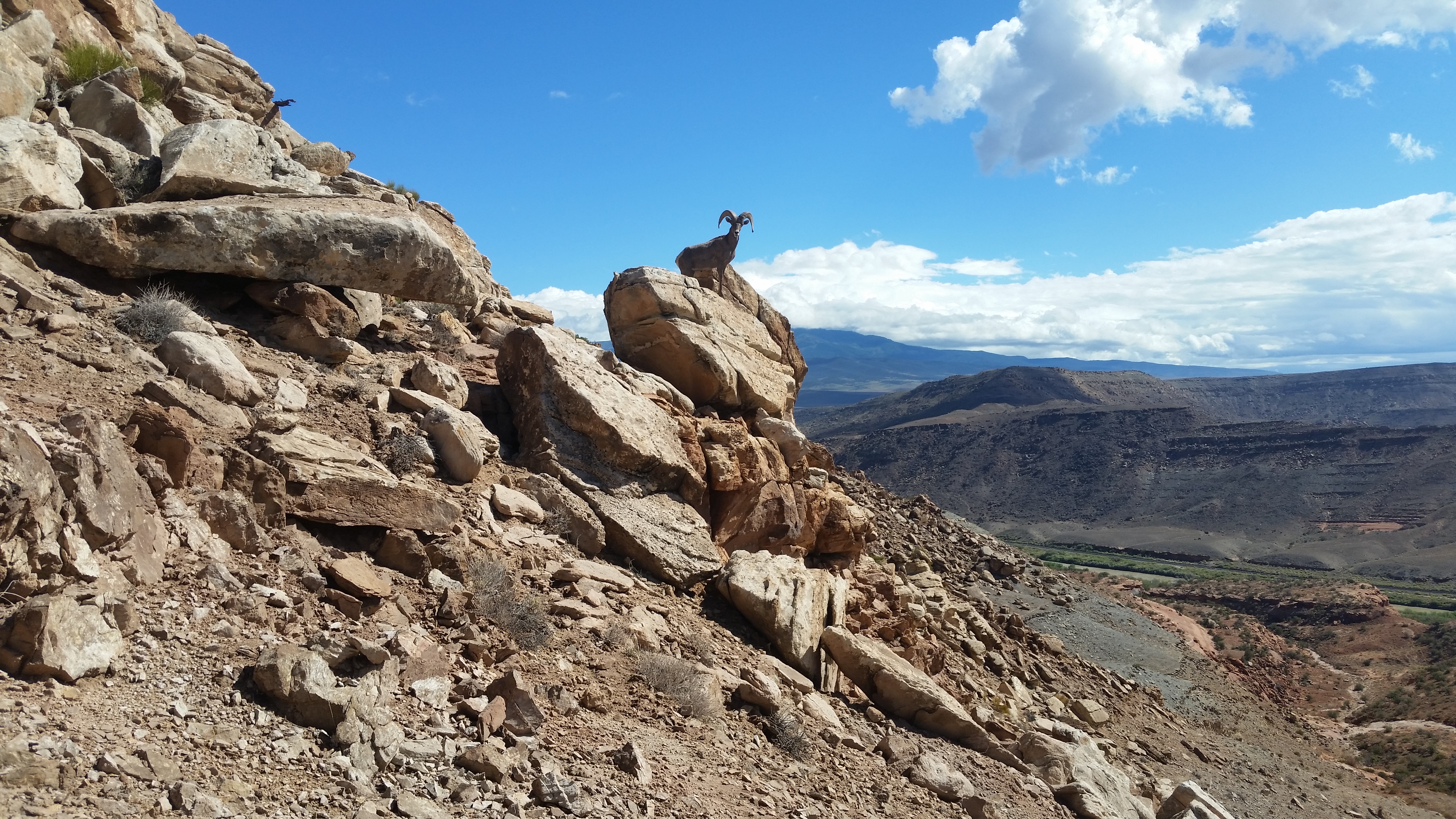
- TEPEE POINT ROAD- the road along that bench had just been graded almost to Big Hole then an ATV trail goes on . It's shorter to take the road into Dry Canyon and a newer road connects out to the bench. I strolled up Big Hole for half an hour. It had a tiny stream and no cattle. A herd of bighorn sheep was hanging around. It's about 7 miles along the bench from Dry Canyon to Big Hole. It's ebikeable. Posted June, 2023.
- DRY CANYON has an easy creekbed. ATVs go a long way up it. I parked my XT350 at peak 5534 and strolled up canyon to peak 6273 where I could see an easy route up that peak. I started up an easy slope at N39 06102, W109 27906 el 5750 and went up to the peak then walked the rim back. A cliff just before peak 5754 forced me down the ridge east of peak 5534 reading 06913, 25627 el 5720. I stayed on center all the way down. 4 hours and the only strain was the 500 gain up to the rim. I could see from the rim that I could walk the ridge out to peak 5993 then down the north ridge into Swedes Hole but that would need a shuttle. This is so easy it makes pie look hard. NORTH RIM - I was back a few days later and walked up canyon then up a side canyon and up the north side of point 6154. Forget that. I saw a better route. I should have gone up the rim from peak 5761 and on to point 6401. Then up the ridge and there's a class 2 route right of center reading 06734, 28346 el 6550. It angles up to the right and there are various ways up the final rim. I walked on to peak 6920 that has survey junk and a reg. I kept going on the rim staying on center then at el 6400 there is an 8 foot class 3 drop. Below that I dropped right at 07711, 27526 el 6250 to get past a cliff. I got back on center then took a ridge SE of point 5945 reading 08035, 26166 el 5800 to get down. I stayed on center then near bottom moved right a little to get down the last cliff then came back to center. 5 and a half hours, 1700 gain. This is the best rim walk in the area. No cattle on the rim. Not even elk tracks above 6400. I'll be back to do it right. Posted 2023.
- COAL CANYON is one of the best canyons in the Book Cliffs and has light grazing impact. ATVs go up to el 5450. I rode my 125 that far and walked up along a small, clear stream. At the next main fork both arms were running. I stayed left and followed the topo to the rim on the north side of peak 6881 reading N39 05920, W109 31671 el 6400. Along the way at 07137, 29472 el 5740 was the last good water that day. I only saw traces after that. At the fork el 5800 it turns pristine. An elk carcass was along there. At the rim, I could see a route up peak 7331 so I went up along the right side of a drainage at 06101, 31511 el 6500 then up to a stairway at 06173, 31463 el 6650. I then worked my way up to the east end of the summit ridge el 6900 then strolled over the summit. On the way up at el 7000 there is an elk trail right of center. It was soon obvious how to walk the rim to Turner Park. At 06866, 32056 el 7200 I went down a drainage to a slightly lower level then walked on to a drainage at 06809, 31575 el 7050 that leads down to Turner. I was soon on the left bank and hit an elk trail at 06835, 41481 el 6900 coming down from the rim. It would be better to find that on the rim and come straight down it. It leads to the park where I got on a minor ridge at 06981, 31222 el 6700 then down to an elk trail at 07372, 30679 el 6250 that leads down to the main canyon where elk drink at the top of a fall. A trail drops around the right side of the fall then there are a few more minor drops then I retraced back. 8 hours, easy walking until the rim then 1000 feet up to the peak. I was lugging long pants but never used them. Just walking to the rim and back is a good one. Peak 6881 looked easy. Backpacking is an option but June and later will have carpets of dry grass making for a major fire hazard. Posted June 4, 2023. NORTH FORK - I went up that a couple days later along the west side of peak 5962. I stayed right at the main fork west of peak 6272 then I came to a thicket but could walk the right bank a short way to a small waterfall. It's class 3 up that then I hit another thicket. I goofed there because I couldn't see that I could walk the left bank for 200 feet to pass it. Instead, I went up a class 3 crack at 09079, 29406 el 5950 then moved left into a drainage. Then up the left side of that then back to the right and weaved up to the rim el 6050. I then circled south around peak 6716 to check out the huge dry fall on the east side of the peak. Then I walked to peak 6272 and down a break at 08364, 28752 el 6200 then made a hard left to a class 2 gully at 08338, 28667 el 6050. Then I dropped off the rim west of peak 5962 at 08183, 28636 el 5850. About halfway down there is one more cliff band and I walked left along that to an easy slope down. That took 4 and a half hours with 200 noticeable gain starting from el 5450. A couple of spots needed long pants. The stream was running the whole way but I noticed a decrease in flow at the starting point from 2 days earlier. I might skip this if cattle ever come back. Posted June 6, 2023.
- SPRING CANYON has loop possibilities. I went up canyon then back on the north rim. I parked near the mouth and hit a small stream in half an hour from the start. I stayed left at a main fork el 5600 and soon came to cottonwoods. Not far beyond there the thickets became too tedious so I went up on elk tracks at N39 09654, W109 28751 el 5700. I walked upstream 200 feet to a break in the cliffs then up to 09700, 28774 el 5800 and then walked right and weaved up to the last cliff at 09691, 28660 el 5950 and topped out near point 6042. I then circled over to the north rim and stayed just below the 6400 line until it was easy to get on center near peak 6483. Then I dropped to a lower level at 09970, 27338 to get past peak 6546. At peak 6303 I turned south to a break at 09405, 26808 el 6200 then drifted left for 250 feet to a cliff with lots of breaks then down a slope to the last ridge at 09102, 26974 el 5800. Near the bottom I went left at 08979, 27008 el 5450 to get down then back to the start. 7 hours and the 300 gain to get up to the rim was the only strain I had. This whole area is lightly grazed but not recently. I would skip it if cattle are in. I saw a million elk tracks around peak 6303. Posted May, 2023.
- FLUME CANYON is an easy one. I made a loop up canyon and back on the east rim. The road comes in from exit 214 and goes 13 miles to a main fork at a steel corral. Go right then left at the next fork and on to the mouth in Diamond Canyon. I walked up canyon for 100 minutes and came to a tiny stream at el 5800. Water seeps out of the base of a cliff and so it was not all from storms 3 days earlier. A narrows is right after that with a dry fall that's easy to pass. At the top of the fall I could see a class 2 exit route. I started up a ridge at N39 13375, W109 24822 el 5900 and went up until I bumped my nose on a cliff band. I went right along that to get past it then directly up toward the rim cliff band and bent to the right to the top at 13345, 24610 el 6350. I then weaved to a drainage at 13452, 23964 el 6450 and on to slickrock at 13457, 23716 el 6500. I turned south there and had a thinner forest with less weaving. I went over peak 6515 to 12941, 23760 el 6450 then 11884, 24222 el 6450 then at peak 6448 I suspected cliffs so I stayed level on the left side on a faint game trail. I was reading 11597, 24351. The trail trends downhill a little to flat ground behind the peak then I came to a minor cliff before peak 6248. I walked left around that and had an easy flat then dropped to 10894, 24686 and walked the base of a cliff to the descent point on the rim at 10837, 24894 el 6150. It's at the first saddle south of peak 6248. I dropped below the rim then walked the cliff base north for nearly a fifth mile to a ridge west of peak 6248. It goes down to a minor cliff with a route on the right side. Then the ridge splits and I expect there is more than one way down. I went down the drainage in the center at 11008, 24978 el 5750 then drifted left to 11017, 25060 el 5550 then hit bottom and back out. 6 and a half hours and the only noticeable gain is the 600 climb out of the canyon. Cattle were in the lower canyon years ago but that is nearly recovered and I saw no other sign of humanity other than invasive plants like tamarisk. Boulder jams kept cattle from going very far. This is the best hike in the area. Antone comes in second and Sulphur is third, both being longer hikes. The other fork at the steel corral goes up Cottonwood Canyon for nearly 7 miles to the end of the road. Cars can get to some camps then muddy fords need 4wd. It had a good stream and so did Diamond with no cattle. These roads are good for bike rides. Or just hang out and read a book. There should be plenty to choose from. After all, it is the Book Cliffs. Posted October, 2022. In June 2023 the road at Flume Canyon had a deep trench cut by a flood. ATVs are getting around then it's a good road with one more trench and a bypass around that and then ends at Halfway Canyon. I didn't see any hiking possibilities but it's a good ebike ride.
- SULPHUR CREEK has a pristine south rim to make a good loop. The road comes in from exit 221 on I-70 like the topo shows. Cars could make all but the last 2 miles then bike it. An abandoned ranch is at the mouth and a faint road goes past it on the far right bank for a tenth mile. I parked and dropped into a trench to get under a fence then up canyon on cow trails. After an easy 3 hour stroll I went up an easy ridge at N39 15112, W109 22164 el 5800. It broadens and I moved left a littel and on up to the top. I stayed on the high ground to 14343, 22419 el 6500 then to peak 6524. I skirted it on the east but that backfired. I should have gone over it. At peak 6485 I had to skirt to the east to 13917, 21602 el 6350 to get down a cliff. Then to 13785, 21542 el 6300 and back to center and on to peak 6318 with a view and old cans. Then I dropped NE to a skinny ridge and to 13168, 20059 el 6100 where I dropped down a minor cliff then moved back to center. I went on down over point 5804 then at el 5600 dropped left down an easy ridge at 13065, 19252 and retraced back. That took 8 hours and the only strain is the 600 gain to climb out of the canyon. Good pj forest.Cattle were in the canyon years ago but didn't wander much past the 5400 line. The land owner could block this. Posted 2022.
- ANTONE CANYON has a huge plateau on the west rim. The road in is the same as to Sulphur Canyon then a road runs along the base to Antone. A faint road goes from a stock tank at the mouth but is washed out in half a mile. I rode my cycle a little more then walked cow trails up the main canyon. At el 5500 a minor fall blocks cattle but it's easy for hikers to go on up canyon. I climbed up at N39 14087, W109 23298 el 6150 and soon I could see a decent route up to my left. I went up and on to peak 6642 for a good view. Then I stayed on the high ground to peak 6262. Here's the route I walked in case of phone failure - to 13483, 22952 el 6550 then 13257, 22896 el 6400 then to a point at 13135, 22692 el 6350 with a view and old cans. Then to 12577, 22452 el 6250 where I turned left and went over peak 6262 then to a ridge at 12599, 21476 el 6200. It runs level then bends down to the right. I stayed on center to a big cliff near the bottom and went left to get to the creekbed then out. Good pj forest here too and some firs or some such in upper Antone. That took 7 hours and the 500 gain out of the canyon was the only strain and it's not bad. Posted 2022.
- DRY CANYON is a tributary of Westwater Creek. The south rim has miles of pristine pj forest that's easy to walk . I made a loop using the road up canyon. The road comes in from exit 227 on I-70 like the topo shows. I parked at the 5400 line. A car could make all but the last two miles and bike the rest. I walked up the road almost to peak 6317 then cut south of that peak to N39 15274, W109 20274 el 6300 where I could see peak 6404. I circled south of that peak by dropping down a class 3 crack at 15126, 20064 el 6200 then down to 14980, 20006 el 6100. There I angled down to the right then back left to get across a drainage and then on to the rim. I followed the topo to peak 6403 then north to a point at 14980,18510 el 6200 then down the ridge to the start. 5 and a half hours with super easy gain but for maybe 300 which is regular easy. It's borderline for shorts. Posted 2022. NORTH RIM - I was back in 2023 and walked the north rim. I parked a mile and a third up the canyon where the road was realigned around a pillar. I strolled up the road for 90 minutes then went up the right side of a drainage at 16399, 21215 el 5950 to get on top of the rim. I walked on to point 6187 at 16670, 20639 then to 16652, 19388 el 6300. At peak 6377 I stayed low left then over peak 6465. It has a reg in a plastic jar that won't last. I then went over to the rim and down a stairway at 15811, 18174 el 6200 then straight down to a cliff then right a little to a stairway at 15751, 18197. I kept going down the ridge then right a little to 15556, 18129 el 5500 to get down a cliff then back on center to bottom. 4 and a half hours and no strenuous gain. Good pj forest, no cattle, no brush issues and thousands of prickly pear blossoms, mostly the yellow variety. Posted June, 2023.
- HAY CANYON, EAST CANYON - a 50 mile loop can be made using maintained roads. I went up East for 16 miles or so to the divide. It was dry but the spring at el 7900 had ice water coming out of a pipe. Just downhill are shady camps in aspen. The divide road runs 16 miles or so to Hay then that road goes 16 miles back to the confluence with East. The only water in that canyon was where the stream rises at the spring where Hay meets Westwater but trashed by cattle. The roads were hard packed except the first 7 miles of East had sandy patches. No sign of cattle in East. With an ebike I might try going up Hay to see if I can make it to the rim. Posted June, 2023.
- DEMAREE CANYON has a newer gas road around the head of it but not maintained lately. Take highway 139 to mp 19.5 near point 5436. Drive up a canyon on easy 4wd with some erosion. At N39 28410, W108 51977 el 7250 is where boulders have blocked all but two wheelers. A turnaround is a few feet before it. I was able to ride my 125 on to peak 7481 then the road drops across a canyon and on to peak 7416 where I stopped at about 12 miles in from 139. The road gets worse there and goes down steep. Ebikes might work as far as peak 7481. There are good views. The gas company might fix this road because a well near the end looked operational. I put a track on peakbagger under peak 7619. The Natural Atlas app shows this road. Posted 2023.
- LOOKOUT MOUNTAIN el 8330 has a newer road along the east side then up the south ridge but it's gone to hell. At mp 33.2 on highway 139 is an easy 4wd road that goes to a main fork. Right goes private into South Canyon. Left goes along the east side of the peak but soon has deep ruts then boulders next to peak 8064 where jeeps stop. Two wheelers and ATVs can get to the south side of the peak where a road at N39 32205, W108 49974 el 7250 branches off to the right and goes up the south ridge. I could have rode an ebike that far. I rode my 125 to the end of the road el 8050 then followed pathways thru the brush to survey junk on the summit. Hikers without the right wheels can try the north ridge. Whiley Hall put up a track for that on peakbagger. I kept riding south on a left fork to the end of the road near peak 7041. I tried the right fork and barely made it to the end just past peak 7579. A road there drops down to South Canyon but it's unused too. Dry troughs are along the road all the way to peak 7579 but they forgot to bring cattle out. The Natural Atlas app shows these roads. Posted 2023, 2024.
- DOUGLAS PASS has dirt roads up to the divide but only the east one is public. It goes nearly 3 miles to a main fork next to peak 8780 on BLM land. Right is less graded and goes for 7 miles on the divide staying above 8000 feet to a main fork. Both forks go a mile and a half to the end of public travel. The left fork near peak 8780 goes nearly 2 miles to an FAA installation then an OHV road goes all the way down to highway 139. It's a good road as far as the east side of Scare Mountain then gets too narrow for jeeps. Deep ruts in places make it tricky for all but two wheelers. I rode my 125 on down to Brushy Point then stayed right on down to Pollock Canyon then down that to county road 27. It's 26 miles from the pass to the county road but a car can make the first 5 miles. It took me 3 hours but on a mtn bike or ebike would be 4 or 5 hours and would need a second car at the county road. Then it's 22 miles back to the pass. The only good water I saw was a tiny stream on the north side of Scare Mtn. I put a track on peakbagger under Dome BM and Brushy Pt. It's the best ride I found in the Book Cliffs for cycles or bikes. There are plenty of camp spots on the divide with a Verizon signal. No sign of grazing on the divide even though there are a million stock tanks. These hard packed roads are good for all two wheelers. UPDATE - a road forking right north of peak 8376 is the best way down. Few rocks. I'll use that to reverse this loop on my 125. Posted 2023, 2024.
- COUNTY ROAD 128 is a good loop ride. It leaves highway 139 at mp 57.8 and goes up Philadelphia Creek then bends south. I just stayed on the main road and it took me to East Douglas Creek then I followed that to the highway at mp 54.8. It's 28 miles of dirt road. A Subaru type vehicle could make it. An ebike would need power for the first 16 miles then there is little uphill after that. I had a Verizon signal to keep me oriented. Good views. Posted 2024.
- CATHEDRAL BLUFFS el 8715 has county roads the whole way. County 122 leaves highway 64 at mp 28.9 and goes 14 miles to county 103. Any car gets that far but 103 had mild ruts. But in less than a mile on it is a good camp spot with Verizon. Then an ebike could make the remaining 10 miles. A Subaru type car could make 103 all the way. I put a track on peakbagger. Posted 2024.
- TEXAS MOUNTAIN, OIL SPRING MOUNTAIN - these two can be done going one way on easy 4wd. At mp 52.8 on highway 139 is where county road 116 goes up Little Horse Draw. At mp 4.7 on 116, at the 6400 line, is the road that goes up to Texas Mtn as the topo shows. At the base of the peak the road splits. I stayed left around the east side and then a road branches off to the summit. I kept going around the east side and met the west side road which is more used. It goes on to Oil Spring Mtn then I hiked up the south ridge. A gorgeous forest is on top and easy to walk as far as the high point then gets brushy. I retraced down and rode south on the high road then at point 8665 I dropped into Missouri Creek. That's an unused road and only good for 2 wheelers. I was lucky no trees fell on it. The creek had a good flow but heavy cattle and horse impact. Same for Red Cedar Spring and from there I went on back to the pass south of Oil Spring Mtn then took the road down to West Creek. There is a public easement thru the private land to get to highway 139. There is a Verizon signal most of the time making navigation easy. These roads are good for 2 wheelers. I put a track on peakbagger. Posted 2023.
- WHITE FACE BUTTE el 7003 is in pristine condition. I followed county 116 from mp 52.8 on highway 139. At mp 12, I went left on county 111 to county 109 then to the peak. I could have made it in a car. There is a tedious road along the east base then the NE ridge comes into view. I went up that and wandered around on the plateau. It has a perfect pj forest with a few big conifers thrown in for good measure. The summit has survey junk. 3 hours, 600 noticeable gain. This is a little jewel. County 109 soon meets the road that goes to Baxter Pass, but a crossing there on Evacuation Creek is tricky for cars. The stream there was the only water I saw. Posted July, 2023.
- PEAK 6760, PARK MOUNTAIN, RABBIT MOUNTAIN - I made a loop to all these peaks on maintained roads but some crossings have sand. I followed county 116 from mp 52.8 on highway 139. At mp 12, I went left on county 111 to county 109 then at mp 11.4 turned right on a lesser maintained road to get to the north side of peak 6760. I made a horshoe loop on the rims. I started up at N39 47788, W109 03296 el 5900 to get on the west rim and strolled on to the summit then down the east rim. At el 6600 I thought I was coming to a drop and so I went left around it but I think I could have stayed on center. I went on down to the final ridge at 47622, 02970 to get down. 3 hours, a little over 1000 gain. This is a top notch rim walk. The forested canyon I circled look like a good hike too. I kept riding west on the road to the main road along Evacuation Creek, which had the only water I saw, and turned right to the Park Canyon road. I went up that 5 miles or so to the state line where a good road goes up to within about a mile of Park Mountain summit. That's an easy stroll. I retraced back to the main road and turned right and on to the Rabbit Mountain road . It's just north of point 6081. I followed that over the mountain, skipping the side road to the summit, and bottomed out at county road 23 where I turned right and shortly hit county 116 to get back. I rode more than 80 miles on my XT350 but it's easy. Some roads are on private land but not posted. I had a Verizon signal making navigation easy. I put a track on peakbagger under all 3 peaks. Posted July, 2023.
- BIG SALT WASH - 16 Road goes out of Fruita up the canyon to a locked gate just past Lapham Canyon. A car can get there. There are creekside camps along the way under cottonwoods. I rode up Lapham on easy 4wd along a clear stream to the west ridge of peak 8320. I walked the ridge over the summit and down the north ridge. I hit some light brush mostly on the lower part of the north ridge. Most of this peak is in a burn area. I then rode south on the main road to an overlook past peak 6852 and came back and then down Post Canyon which is the steepest. That's 25 miles of hard packed roads that an ebike could do. No cattle in the whole area for years. I put a track on peakbagger under peak 8320. Posted June, 2023.
- COAL GULCH is a mountain biking hotspot. Natural Atlas shows the trails, some are motorized. 16 Road is the direct way in from Fruita. I went in on 18 Road and cut over to it. The BLM has campgrounds along 18 for mtn bike enthusiasts. The road up Coal Gulch is good and I could have drove a car nearly to the main fork at el 6000+. Left goes to a gas well and turns bad. Right goes easy 4wd up to Ross Ridge then down to a point where a motorized trail drops into Lipan Wash just past point 6701. The road gets ultra steep down to the point. I didn't see much hiking potential here but with an ebike I could ride up Coal then down the motorized Sarlacc Trail or maybe into Lipan but that's a long one. The bottom 2 miles of Sarlacc is open to ATVs. I rode my 125 up it to the rim. Mountain bikers are cheating by driving to the upper Sarlacc TH then coasting down. LIPAN WASH TRAIL - I went back later and rode up the trail up from the mouth then walked to where the trail exits up to the ridge. I saw a lot of dirt bike tracks there. Here's what riders would encounter if dropping down off Ross Ridge near point 6701. The trail hits the creekbed and there was a minor stream. At the 5560 line the stream goes over a 20 foot drop. Bypass trails are on the right bank, the higher one being the safest. Those trails merge and go down a rough stairway about 50 feet long that stops most dirt bikes. 3 riders could rope bikes down then there is nothing else to worry about. Mountain bikers have dry sand to deal with below the drop but it gets firmer toward the mouth where a trail crosses. Left goes shortly to a dirt road which is how I rode in. Posted June, 2023.
- ADOBE CREEK has a steep stock trail, the North Soda Trail, up to the east rim. Gjhikes.com has info. I used it to make a loop around the rims. 21 road goes paved to a gas plant then graded to the turnoff just south of point 5105 shown on the topo. The rest is high clearance and ebikeable then the last mile past point 5405 might need 4wd. The TH is at N39 15658, W108 33939 el 5650. The trail goes up canyon bank to bank then at half an air mile before it climbs up to the rim it goes high and hilly on the right bank. It's easier to stay in the creekbed for that last half mile then the trail starts up at 16308, 33305 el 5900. It gains 1400 to the rim but it's not all steep except for the last 1399 feet. Then it's a stroll to peak 7412. I could see across the canyon that I could descend from peak 7383 so I circled over to it on trails and roads that hadn't had a vehicle since God was a baby. Once on the peak, I dropped to an elk trail at 16349, 34046 el 6950. I took a complicated route to it but should have gone more direct. Then comes the one and only cliff with a class 3 break at 16316, 34068 el 6850. Once down that I circled NE on a nice juniper plateau to the last ridge at 16331, 33680 el 6550 then down it to 16377, 33491 el 6350 and hit bottom where the trail starts up the east rim. That took 6 hours with nearly 2000 noticeable gain. Dirt bikes turn back before the trail makes the big climb but I saw mtn bike tracks all the way to the rim. It's so steep that even coasting down would be no fun even if there's a decent route to the top from some other trail. The trail is in a V that collects rocks. I can't recall a trail as steep as this one. And the Tellerico Trail isn't a decent route either for a mtn bike loop. Maybe the trail is being use to practice for the Rampage competition. I posted a track on peakbagger under peak 7412. The TH is on private land and might get blocked some day. I saw no water except for a stock tank on the rim. Posted June, 2023.
- HUNTER CANYON has a motorized route thru it but the middle part is for rock crawlers. 21 Road is paved to a gas plant on BLM land then a good dirt road goes on to the mouth. Mtn bikes can make it on up to the first 2 main forks then rock crawlers take over. At the gas well shown on the topo is where a real road appears again and goes up to Ross Ridge. The main forks would have the best hiking potential but are blocked. I walked up the first one for 5 minutes along a tiny stream to a boulder jam then just past that is a 20 foot fall with dripping springs on the wall. The second fork soon has a large undercut then shortly a 10 foot fall. It might be bypassable but not easy. Posted June, 2023.
- TELLERICO TRAIL is a dirt bike trail that goes from the Grasso Mine to Corcoran Point. I walked up it then down a horse trail to Corcoran Mine then back along the base for a loop. 25 Road goes north out of Grand Junction and turns to dirt. A car can make the first 2 miles or so then it's high clearance thanks to morons driving it wet but it's mtn bikeable. There's parking near the mine then I just walked up the road a short way and the trail appears on the left bank. It soon goes up to the left and is easy to follow. Once at the summit, I retraced back down the trail and got on the horse trail at N39 14092, W108 31152 el 6850. It goes down an easy ridge to 14504, 31310 el 6100 then bottoms at a creekbed. I walked a trail on the right bank but stayed high until I saw dirt bike tracks in the creekbed. Well heck, it must go thru. Nope. That yahoo must have come down the way I did because boulders made him turn back. I went on down and the worst I had was a 5 foot drop. I hit the road near the mine and should have stayed on it to a hilly dirt bike trail at 13745, 32734 el 5400. It was going my way so I walked it then got off at 13492, 31691 el 5550 and kept going back to the start. 5 hours and the app showed 2200 gain and 8 miles. I put a track on peakbagger. Posted 2023.
- MOUNT GARFIELD 6765 has a popular trail up the south side but an easier route goes up out of Coal Canyon. I made a grand loop and put a track on peakbagger. Take exit 45 at Cameo and drive north thru a shooting complex and the road turns graded and goes to the Coal Canyon TH with a restroom and some camping spots. 4wds and mtn bikes can go on up Coal Canyon at least 3 miles to point 5402 and on that day I could have drove a jeep to the 5520 line. Then it's easy to walk the creekbed to a horse trail at N39 08263, W108 23739 el 5600. It goes up a drainage then in a tenth mile up on the high right bank. At el 6250 or so I Ieveled off to the left to a class 3 break at 08007, 24316 and dropped into a pristine canyon. I went up to a saddle north of peak 6484 on the main rim where a trail drops down to Moulton Valley by way of point 5554 . It had animal tracks but not hiker tracks. I walked it up to the peak then retraced back to the saddle and saw a class 3 crack above that would get me on the rim to continue west. It's trickier than the other break. I walked on 2.33 air miles to a saddle el 6550 and turned down that canyon. But it's cluttered so the ridge down thru peak 6541 might work better. I hit the main creekbed of Coal Canyon then went upstream to a tiny stream at point 6069 where boulders put an end to OHV travel. I went on to a fork on the right at 09909, 26500 el 6100. After a few feet up that I climbed left onto the rim and went up the ridge and came to a cliff at el 6500. I went right around it and on up to the last cliff below peak 6744. I stayed low left around it then up a class 2 break and up along the west side of peak 6744 then hit the Ute Trail. I walked that and it takes a huge detour at point 6794 but there's a shortcut trail wich I missed. It goes on to the Hoodoo Trail at 09416, 25222 el 6650 and that took me back down. I lost the trail near the bottom and found it again. Then it stays high above the creekbed of Coal Canyon for miles but it's hilly and I saw no point in it so I dropped to the creekbed and back to the start. 9 hours, 2000 noticeable gain, 15 miles. It took 100 minutes to get to the summit of Garfield. Next time I'll return down Coal Canyon because I was not impressed with the Ute Trail. The TH for Hoodoo is at 08200, 22854 el 5650. Posted June, 2023.
- MOUNT LINCOLN el 6661 has routes up the SE side and the west ridge, the latter being the quickest. I used the same road as above up Coal Canyon for about 3 miles beyond the restroom to a maze of forks just north of point 5402. I parked and walked the leftmost fork heading toward peak 5725. At the 5600 line I cut around the north side of that peak to get on the west ridge then up to the summit. The reg is on the BM el 6649. I then made a counterclockwise rim walk loop out to the north end. One cliff along the way has a break at N39 08781, W108 20822 el 6050. One the return I dropped off the west rim at 07958, 21216 el 6500 to a game trail below that took me back to the west ridge. 5 hours, 1300 noticeable gain. The whole plateau is in pristine condition with a good pj forest. This is my favorite hike in the area as I like pristine. I put a track on peakbagger. I saw no sign of humanity on the west ridge. Posted 2023.
- SPRING CREEK is a pristine canyon with a good stream and easy to walk. It's the best canyon I've found around Grand Junction. Natural Atlas app shows the trails I used and so does gjhikes.com but not as detailed. I started at the Coal Canyon TH and walked up Main Canyon then took the Spring Creek Trail. The trail goes up the south fork but I left it and went up the north fork which has the stream. Horses can't go far up it anymore. Soon I came to minor falls and bypassed on a game trail on the right bank. I went up to the fork that has the big fall shown on the topo. That fork had a stream. I went up that and came to a minor fall that would be class 3 but exposure to an 8 foot drop caused me to chicken out. I backed up and got above it on the west bank but that didn't work. I resumed going up the main canyon and came to problem boulders that I passed on the left bank reading N39 10846, W108 23923 el 5800. I went on up to an exit point at 10731, 24313 el 5900 that would put me on the next ridge west of peak 6445. I climbed up on the bank and found game trails galore and looking at the sat image later figured game animals might be using a gully in a side canyon to my right. But I didn't know that then so I went up steep to the left thru 10700, 24270 then topped out at 10686, 24233 el 6200. I then followed horse trails up the easy ridge almost to peak 6792 where I leveled off around the north side and hit the Spring Creek Trail at 09321, 24667 el 6600+. I went down that and at about el 6100 is a tricky fork. Right goes to a spring but left is the way down. 8 hours and the 400 gain out of the canyon was the only strain I had and that could be ameliorated by finding the game route. Reversing this would backfire because the trail is steep. I wore shorts but the upper canyon is borderline for that. I picked up 5 ticks in that section. I barely avoided wading and so sturdy wading shoes might be best. Just going to the fork with the big fall then retracing back would be good enough for most. I saw no sign of hikers in there. Posted June 16, 2023.
- .

Naylon Canyon had a lot of water. 

Floy Canyon has some practical jokers. 
Horse Mesa 
Thompson Canyon 
Mt Garfield seen from the west. A forgotten trail can be seen in the saddle. 
Balanced rocks in Spring Canyon