Search This Blog

Saturday, October 1, 2022

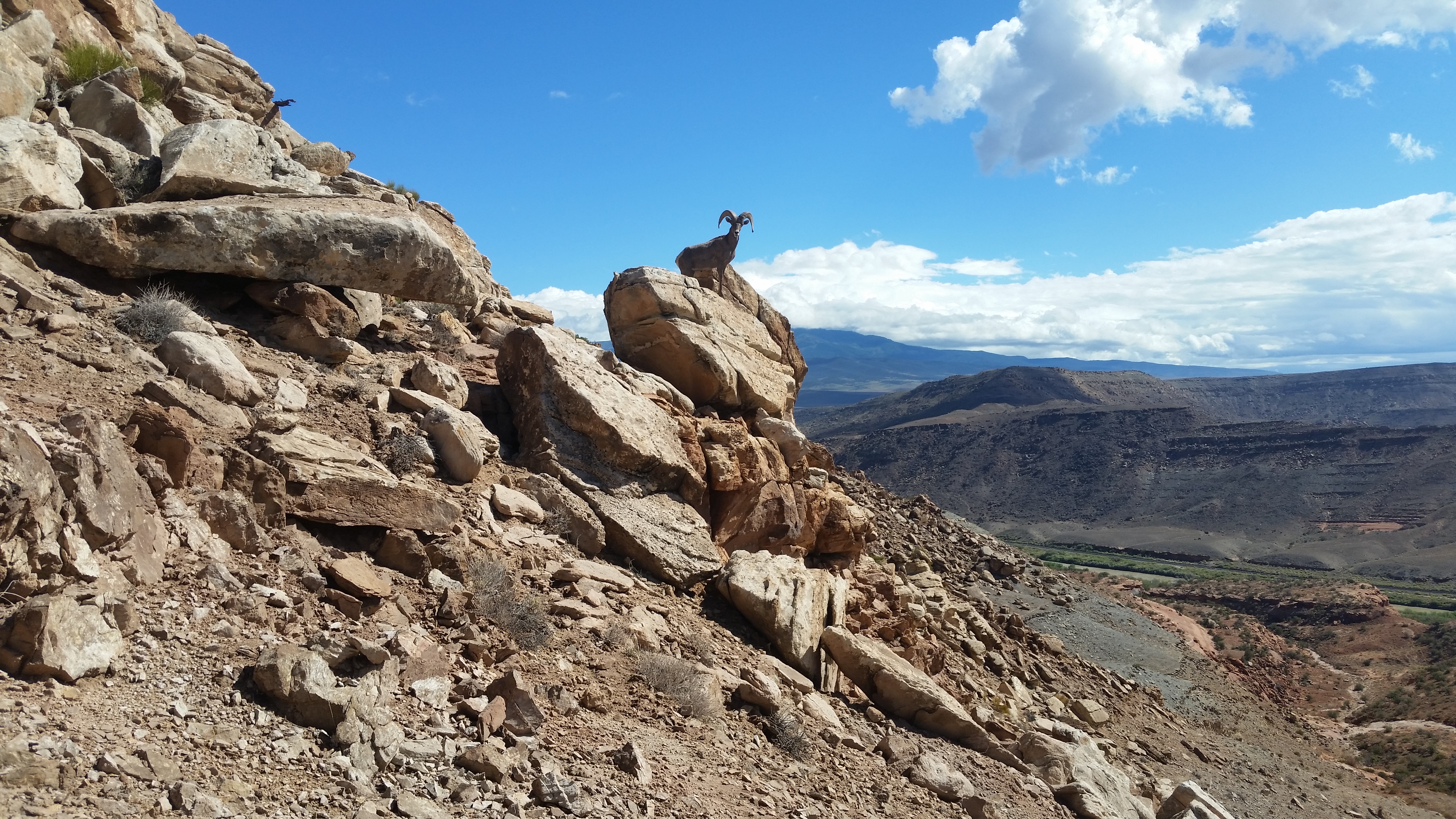
Dominguez Canyon NCA, Colorado

Sheep grazing in Escalante Canyon


Rock art in Palmer Gulch

Escalante Canyon

Dominguez Canyon

Dominguez Canyon

Gunnison Rim


Rock art in Triangle Canyon

Triangle Canyon


Little Dominguez. The slide in the center can be used to ascend up to the left to peak 6012. Star Mesa is right side.

Confluence of Little Dominguez and Big Dominguez

Bangs Canyon

The only submerged benchmark I've ever seen.


 ⦁ The Natural Atlas app has a free version that shows the trails with mileages. The peakbagger app is better for other details and I posted some GPS tracks on it. I had no trouble wearing shorts on every hike. The area is infested with bighorn sheep that are losing their fear of humans. Posted 2022.
DOMINGUEZ CANYON has a popular trail running up it. The best hike is to go up canyon and take a trail up to the rim then come back over Triangle Mesa. The graded Bridgeport Rd leaves highway 50 at mp 52 and ends at the TH, just beyond restrooms. The trail goes over a mile along RR tracks and past an old bridge then across a new bridge then up the canyon. It goes past petroglyphs then in another hour there are more petroglyphs but heavily vandalized starting in 1858. At N38 48122, W108 26164 el 5650 there is a sign for the Cactus Park trail. I went up that to the rim el 6200 and it leads to the closed road on the topo that goes to Triangle Mesa. I stayed along the north side of the mesa until the road topped out then went up the west ridge. The last cliff band has a tricky move but not hard to go up. I walked to the far side then down at 49445, 24078 el 6150 and there I had two choices. One is a class 4 route. For that, head for an easy chute at 49606, 23454 el 5600 then down to the last rim at 49479, 23060 el 5100. A gully is in view below but to get in you have to walk another 250 feet on the rim then drop and come back to a huge boulder with two class 4 routes down along it, maybe each 10 feet high. That's risky without a rope so I backed up and walked a cow trail on the rim to 50359, 22974 el 4900 and then straight ahead another 100 feet there is a stock trail going down to the road along the river. It's a tenth mile on the road to the old bridge. Signs along there say private but the BLM map and caltopo say it's public. A BLM sign is nailed to the old bridge. That took 7 hours but the detour to the class 4 route might have taken an hour. The noticeable gain might be 1000. Posted 2022.
TRIANGLE CANYON is what I call the one on the north side of Triangle Mesa. It turned out to be the best canyon hike. I started at the Bridgeport TH and went over the saddle south of peak 5293. I crossed the old bridge on the river and went a tenth mile downstream where a stock trail goes up to the left. Private land signs along that tenth mile are in conflict with the maps. Nearly a fifth mile down from the bridge is a bigger sign that says Escalante Ranch No Trespassing and that is likely the real entrance to private land. The trail goes to a minor saddle then up to the left to the next level and it's easy to work up to the saddle. I went thru and stayed right then down to the lower canyon rim. I walked it to the mouth then dropped in and came back up the creekbed. When I got into the deeper gorge, I hit a major boulder jam that stops cattle. But hikers can go around the left side and stroll up a pristine canyon. I wanted to walk the south rim back and the first exit I saw is at N38 49867,W108 24405 el 5300. I walked past it to a left bend then took an easy angle up and rim walked to a trail at 50390, 23654 that took me back to the saddle then I retraced out. Nearly 5 hours with 600 noticeable gain. No running water. A loop could be done using the Dominguez Canyon trail. I would start in that canyon and go up to the Cactus Park trail then almost to Triangle Mesa before dropping into Triangle Canyon. Posted 2022.
STAR MESA el 6580 - a good loop can be done ascending a stock trail out of Little Dominguez and descending the west side. I started at the Bridgeport TH and walked up Little Dominguez and got on the right bank at N38 48969, W108 22518 where a trail shortcuts a bend then meets the old road. The road goes past a cabin to a slide at 47975, 22187 el 5000 where the stock trail goes up. At the top of the cliffs it bends lefts and fades at a plateau el 5800. Obvious routes go on up, but I wanted to walk the whole summit plateau so I went to the east end then up to a break at 47179, 22436 el 6200 then stayed right of center and soon was on top. I strolled on to the high point and could see in upper Poison Canyon a natural tunnel, a very rare formation. I went on to the far end of the plateau then dropped down at 48197, 23745 el 6350 and on down to a closed road. I went left on that then down a ridge at 48041, 23820 el 6100 and bottomed out at the last rim at 47952, 24061 el 5550. Rocks are stacked there to get down a minor drop but too tricky for a solo hiker. A 20 foot hand line would have got me down off a tree. But I went upstream on the rim for a fifth mile to a trail going down a slope to the creekbed. The canyon soon opens up and a trail runs on the left bank and meets the Dominguez Canyon trail which goes back to the start. 7 and a half hours, 1500 noticeable gain. Posted 2022.
McCARTY TH to BRIDGEPORT TH - a one way hike can be done using the McCarty Bench then to Leonards Basin and up that to point 6012 then point 5916 and down to the river trail. I went up the McCarty Trail to el 5250 where a road branches right. I walked that a few feet where it tops out then up to a trail at N38 44475, W108 16408 el 5350. It goes along McCarty Bench to 44821, 16479 el 5350 where it crosses above falls and goes around the corner then up along the left side of a drainage to el 5400 where the bench goes on easy for over a mile. I skirted a drainage at 45335, 17620 el 5450 then on to a ridge at 45875,17848 el 5300 that has a game trail dropping to Palmer Gulch. I followed the topo to the invisible Gunnison Trail to get into the saddle el 5200 west of peak 5301. A faint road goes along that level toward Leonards Basin and then there is a trail on the left bank where the basin narrows. It merges into the creekbed and I went up it to 46726, 20645 el 5200 then got on the right bank. It looks like a stock trail at first and is easy to go on up to the saddle el 5800 south of point 6012. I had the option to drop down and left some to get into Little Dominguez, but I was feeling chipper for an old coot so I went up left of center on a sheep trail to point 6012. Then I walked the west  rim and down to a basin and up a drainage left of point 5905 and on to a reg at point 5916, the first sign of humanity I saw along the rim. For the descent, I used a crack at 49522, 22054 el 5850 then drifted left a little down an easy ridge to 49675, 22089 el 5400 and then straight down a broad slope. The last cliff band has a stairway at 50059, 22309 el 4850 then one more straight below it to get to the river trail. I had the luxury of a GPS track on peakbagger by Whiley Hall for the descent route. It took an hour along the river to get to Bridgeport TH. That took nearly 9 hours with about 2000 noticeable gain and mostly easy terrain. And it's the most unspoiled real estate I saw in the NCA. A bike can be used for the 16 mile shuttle because highway 50 has a wide shoulder. A solo hiker with a car and bike can set up camp along the Bridgeport Rd then leave a bike at that TH and drive around to McCarty and do the hike. Then the next day, ride over to retrieve the car. It took me 2 hours to ride a pedal bike. Posted 2022.
PEAK 6012, PEAK 5916 - I did these on the one way hike from McCarty TH but there is another option. Go up Little Dominguez and try the little canyon west of 6012. It has cliffs high up that can be passed by staying right. If that fails, there is a slide further up the main canyon, maybe 2/3 mile, that will work. I could see it from Star Mesa. That's the route I would choose and just make a loop over the peaks and down to the river. Posted 2022.
GUNNISON RIM - a pristine section of the lower rim can be walked one way from the Bridgeport Rd up upstream to the jeep trail near point 5243. I was camped on the Bridgeport Rd at a large camp area and walked from there. I left the road at N38 51148, W108 20962 el 4950 and followed very easy ground and ever so slightly gained elevation and came to the saddle el 5200 west of point 5372. Coming down that point would be another way to start this hike, but I wasn't camped up there. I dropped down to the 5050 level and easily walked along that. The only time I had to make a decision was at a spot el 5000 NW of point 5458. And I picked wrong. I went up to el 5100 but had to come back down in a draw. Staying along the 5000 line then up the draw should work better. I just followed rim the around to a basin below point 5243 then a little more to the jeep trail which is now OHV trail 78A. I walked up that to road #78 at point 5163. I had a bike there and coasted most of the way back to camp. The hiking part took 2 hours, 40 minutes with maybe 500 noticeable gain and not steep. This is one of the most pristine areas I saw in the NCA. I didn't even see cow shit in the basin below point 5243. How'd they miss it? Posted 2022.
DOMINGUEZ RIM - crude roads go all over this. At mp 58.3 on highway 50 there is a sign for Escalante Overlook. Westbound drivers have to go to mp 56.8 and come back. The high clearance road goes 2 miles to the rim. Left goes down to the Escalante Rd. Right goes to Palmer BM and then the road pulls away from the rim. The rim can be walked to peak 5454 and there is a game trail that drops down to a peninsula protruding from the rim. It would be easy to drop on down to the floor but I didn't see any point in that. Ebikes work on these roads and loops can be done using the highway because it has a wide paved shoulder. Posted 2022.
ESCALANTE Rd leaves highway 50 at mp 59.3.  It goes graded nearly 3 miles to the river bridge. 2 miles beyond that is the McCarty TH.  At mile 3.6 the Escalante Rim Rd goes left.  At mile 8.4 the road enters a long stretch of public land. At mile 9.3 is Potholes Campground, no fee. At mile 12.4 is a stream, the best water I saw in the NCA, reading N38 39215, W108 22244. At mile 15 is a ford past Escalante Forks where I turned back. I could have drove a car to the ford. Posted 2022.
PALMER GULCH is blocked at the mouth by a ranch. The easiest way in is to buy the ranch. If that's not feasible, the McCarty Trail can be used to drop in off the rim then walk down canyon and out on the McCarty Bench. I dropped in at N38 43613, W108 18688 el 6240 and into a side canyon below falls. A game trail at 43805, 18936 el 5750 on the far bank leads to a large bench below point 6255. Walking the ridge down between the forks would be fastest, but I wanted to explore upstream. I walked the bench and dropped to the creekbed at 43846, 19769 in a maze of balancing rocks. I strolled on down the easy, dry creekbed to a main fork el 5200 where long trails go bank to bank on down to an easy ridge at 45752, 18411 el 5000. That ridge leads up to McCarty Bench. I walked it to 45589, 17661 el 5400 then on to where the bench fades and then a trail drops a little and goes around the corner and crosses a drainage just above falls. Descending along that drainage would likely work but I didn't have a shuttle. I stayed on the trail until I met the McCarty Trail then back. 7 hours, 18 minutes and 1500 noticeable gain. This is the best hike in the area only as long as cattle don't come back. They were thick years ago as far in as the bench below point 6255. There is an old tree fence running across Camp Ridge at el 6200. It shows on the sat image. It's the longest I've ever seen. Posted 2022.
BOYCE GULCH NORTH RIM LOOP - the McCarty Trail can be used to get to the rim then loop back by way of point 5935. Go up the trail to el 5300 and look up at point 5935. There is a drainage to the left that looks good for the descent at the end of the hike. Stay on the trail until close to the north rim of Boyce then just walk it to the rim of Escalante then on to a wash at 43903, 16629 near point 5935. It soon goes over a drop so move right a little then down and back to the trail at the 5360 line. Nearly 4 hours and 6 miles. Noticeable gain is 1000 feet and on the trail. Easy terrain. Posted 2022, 2025.
SOWBELLY MESA has an ancient trail dropping into Boyce Gulch. A good one way hike can be done by starting up the McCarty Trail. I walked that trail then veered off to a stairway at N38 42818, W108 19057 el 6300 that put me into upper Boyce. I went upstream and stayed left in the next fork and hit the north rim of Tatum Gulch at 42280, 19156 el 6300. I strolled the rim awhile then cut over to the ancient trail at 42855, 17621 el 6050. It angles down a tenth mile toward the road, then fades, so I dropped straight down a little and had no trouble getting below the cliffs and found the trail again. I stayed on the easy bench just below el 5600 using game trails and hit the real trail again at 42907, 17002 el 5450. It goes down a ridge to the creekbed then it's a half a mile to the mouth at the Escalante Rd. I had a bike there and coasted 2 miles back to the McCarty TH. 4 and a half hours and the only strain is the first 1000 feet gain up the McCarty Trail. Good pj forest. Posted 2022.
LITTLE MESA is a rarity because it still has 5 roadless miles. I made a loop up the Dry Mesa road then down Little Mesa. I parked at the petroglyphs el 5050 at the north end and walked the road to a fork el 5300. It's ebikeable to there. Left goes up Dry Fork and is not motorized. I stayed right to el 5950 then left the road and walked level on a faint trail for a quarter mile to a point at N38 40520, W108 17386 el 5950. I dropped there to the creekbed of Tatum Draw and strolled up to 40137, 18135 where I could easily go up to the mesa top south of point 6578. Then I had a super easy walk to point 6020 then descended on a spotty trail at 42382, 16110 el 5750 then to a stairway at 42503, 15589 el 5300 just above the start. 5 and a half hours, 1200 noticeable gain. 2 hours was road walking but that could be cut in half by riding an ebike to the fork in the road el 5300. Cattle were on the mesa years ago but where's the water? Posted 2022.
UNAWEEP CANYON WEST RIM - a one way hike works here. I coasted on my bike from camp near mp 149 on highway 141 down to a pullout at mp 151.7. A trail goes from there upstream along the cliff base and soon there is a class 2 sheep route going up and to the right and tops out on the rim south of point 5130. It's a ledge about 3 or 4 feet wide. I walked the rim to a canyon cutting thru with a descent route at N38 56096, W108 30148 el 5600. There is a route down by hugging the left wall to get past the boulders. I wanted a longer hike than that so I walked the low bank of the canyon until I merged into the creekbed. I went up that passing a multitude of deep holes where sheep get water. One had tadpoles. There is a minor fall at el 5800 that can be passed on the right in a crack. I kept going sometimes stepping up on the bank to pass a cluttered section then at el 6020 I exited up the left slope and hit the rim at el 6400. I strolled down that to a sheep route at 55313, 30574 el 5950. It goes down to the right then back left to a slide that goes the rest of the way down. I walked on to 55372, 30012 el 5450 then to camp. 5 hours and all the gain is super easy but for maybe 400 feet. This is a lot of pristine country to be so close to a major city. Posted 2022.
NINEMILE HILL EAST RIM - I walked one way from Cactus Park on the near pristine rim to point 5336 then on to an easy route down the west rim east of point 5247 on highway 141. The high clearance Cactus Park road leaves the highway at mp 145.2. I went 4 miles on it then left on road #31 for a fifth mile and parked. I walked up the road to where it goes hard right then went straight up to the mesa top and down to the east rim. I followed the topo and had a simple walk until one canyon that has a hard to find crossing. I dropped in at N38 54515, W108 28356 el 5700 then went downstream a few feet to an easy exit. I strolled on down to point 5336. Sheep hang out there and have a route down at the end of the point on the north side. I retraced back a little and crossed the next canyon at 55728, 27605 el 5300 and filled at a pothole there. I went up to the low north rim and found cairns. I followed those along the slickrock rim until I merged into the right fork of the canyon. I went higher there and on to another trail with cairns at 55659, 28594 el 5550. That soon leads to a main road and a road forks from there on the high ground toward the west rim and then I dropped left into a drainage. There is a class 2 route down the rim where the  drainage pours off at 55961, 29091 el 5450 and it is bolted with a rope hanging down. It's overkill. I went down and stayed on the right side of the drainage and hit highway 141 at mp 149.3. That took 6 hours, 15 minutes with hardly any strenuous gain. Bikes can work for the 9 mile shuttle. The highway has no shoulder but traffic is light. Staying on the rim all the way down to point 4674 on the highway would work too. Posted 2022.
BANGS CANYON - I went up canyon staying left at main forks and came back on the Tabeguache Trail. That's a jeep trail that starts at mp 52.8 on highway 141.  I walked it to the first switch where a foot trail goes left and that's better to get on the ridge. I went over the ridge then down the left side of a drainage on a game trail and on to the mouth of the canyon. That's private, but once in I looked up and saw a likely route  on BLM land north of point 5066, at about N38 58612, W108 29144. A cow trail goes up canyon and there is a camp with an old stove at 57971, 30352 el 4900. At el 5000 the left bank has a trail and I stayed high to a trail at 57558, 31068 el 5100. That took me across to the west bank then I walked to a minor crossing at 57527, 31244 el 5200. I kept going south and merged back to the creekbed at a main fork NW of point 5690. I followed the south fork using the west bank and weaved back to the creekbed west of point 5690. I could look up and see a slickrock rim el 5600. I walked up a ridge to the right of it and topped out at a class 3 crack at 56719, 31359 el 5600. Then I rim walked to an easy crossing at 56162, 31319 el 5800. I was low on the rim for the last tenth mile to that. Then I loosely followed the 5800 line until I had a straight shot to the jeep trail north of point 5760 and it leads back. 6 and a half hours and the gain is super easy except for maybe 400. Cattle have been gone for years but the south fork will always be pristine. It's the main attraction with all the slickrock. Posted 2022.
GIBBLER MOUNTAIN el 7628 - a loop can be done over the peak then back in Farmers Canyon. A 4wd road runs between the two. Take the graded Dominguez Rd to el 7941 and turn NE for about 5 miles and park. It's a tedious road but cycles and ebikes can thread a lot of the bumps. Walk to the jeep trail that goes to the south ridge then go up and over the summit and down the north ridge. I went to a break at N38 50279, W108 30856 el 7050 then down to the flats and on to ATV trail #16 at 50428, 31637. That leads to a drainage south of peak 6927 and it goes down to the floor of Farmers. After checking out the big drop, walk the creekbed upstream and when it bends away from the east bank there is a game trail on the east bank to follow then just go back to the start. Nearly 5 hours with 700 noticeable gain. A lot of good pj forest especially on the summit. Cattle have been gone out of Farmers for years but if they come back I would skip it. It's starting to look natural again. The road goes on 5 miles to highway 141 but steeper. Posted 2022.
RIM TRAIL is a 4wd road near the Divide Forks Campground on the Uncompahgre Plateau. A car can make the Uranium Rd to el 8968 then ebike the rim road. It goes 6 miles to a TV transmitter near Plateau Benchmark. Take a TV and watch some football. Posted 2022.
The farmer in Farmers Canyon looks like a chef


Sunday, September 11, 2022

Lizard Head Wilderness Area


Sheep Mountain el 13188


Lizard Head el 13113

View along the Lake Hope trail


Rock Of Ages Mine
Navajo Lake

Female riders turning back on the Calico Trail


Dolores has a Family Dollar and small grocery but it's only a dozen miles to the Walmart at Cortez. Rico has gas. The USFS topo maps on apps such as peakbagger are essential to see hiking trails and road numbers. A map of motorized routes can be downloaded by searching " san juan national forest mvum". That map also shows private land. Posted 2022.
GROUNDHOG RESERVOIR ACCESS - to get there from Dolores, go north on 11th Street and pavement ends in 15 miles. At mile 31 there is an RV park at the reservoir. The road goes on 3 more miles to the national forest boundary where it's FR533. I pulled a camp trailer on up it to el 10660. A car could make it. A spring comes down to FR533 where FR428 branches off at el 10428. Light mosquitoes were everywhere, even the summits. Posted 2022.
GLADE BENCHMARK LOOKOUT el 9264 is 20 air miles north of Dolores. I made a loop ride on my XT350. I rode north out of town on 11th Street to mp 16.9 then left on FR514 for 10 miles to FR510 forking to the left. I took that for nearly 8 miles to the lake. I came back to FR514 and went on another 2 miles to a main fork where FR521 goes left to the river bridge, but I stayed right on FR514 for 8 miles to FR493. That goes 3 and a half miles to the lookout but is high clearance. Visitors are allowed when the lookout is occupied and there is a bald hill next to it as a view option. I returned to FR514 and went right on it and it looped down for 17 miles to the river bridge. I rode up the river for 11 miles to McPhee Dam. A left fork goes to the top of the dam but is gated. A lot of camps are along the river and no cattle for years. I made a U-turn at the dam and came back to the main road where I had 2 choices. Either take FR521 back or cross the river and ride the highway. I took the latter choice and went across the river to a T then left to highway 666 and back to town. I could have drove a car on everything except FR493 to the lookout. Posted 2022. 
GROUNDHOG MOUNTAIN el 12165 has an easy south ridge. I parked at a good camp spot on FR534 where the USFS topo shows FR534.A forking to the right at el 11100. I walked that closed road for a fifth mile then went up an open slope to get on the ridge. I came to a rock field and went around the right edge. Near the summit a crag is in the way. I went along the right side of it then cut along the left side of another one behind it then walked a hiker trail up the center to the reg at N37 50098, W108 13107. 3 hours, 1100 gain. Posted 2022. 
LITTLE CONE el 11981 has an easy south ridge but private land has to be crossed. I took FR618 from FR611 for 7 miles to a road shown on the USFS topo with a locked gate. I walked that road to a logging area el 10700 and took a left fork to a game trail at N37 55110, W108 05707 that led me onto the south ridge. I went up thru an uncluttered forest to a clearing at 55205, 05505 and on to the reg. That took 4 hours, 15 minutes with 2000 gain. The private land is dormant but that might change. Cars could make it to Lone Cone guard station then ebike the remaining 6 miles on FR618 which is easy 4wd.  Posted 2022.
LONE CONE el 12613 has an easy north ridge. A hiker trail comes to it from FR612 and summitpost has info on that. I got to it easily from the end of FR534.I. That 4wd road had been cleared to a camp spot at the end el 11100 but I parked at a fork el 10900 where the road turns rocky. I walked to the end of the road then north from there on easy grades to N37 53531, W108 15610 then 53564, 15502 to get on the north ridge and up. 3 hours, 1700 gain.It's nearly all talus but no sliding. Cars can make all but the last 3 or 4 miles then mtn bike the rest. Posted 2022.
BLACK MESA el 11600+ has an easy 4wd road all the way shown as FR611.A on the USFS topo. It goes from FR611 for 4 miles and there is only one road to follow. Some bumpy little rocks are along the way. Posted 2022. 
DUNN PEAK el 12595 has easy terrain and hardly any talus. I could have drove a car in from Groundhog Reservoir to FR616 near Fish Creek. Then FR616 is high clearance for 3 miles to where it starts descending the other side and a closed logging road el 10800 branches off to the right. I walked that to N37 50068, W108 08333 then turned left on a game trail and on to another trail at 50334, 08042. I zigzagged up the grassy slope and came back left thru 50382, 07936 then more zigzagging to a flat spot on the county line at 50585, 07868. It's easy from there to the reg. When I saw how easy it is to descend down Fish Creek, I strolled down to the north saddle el 12100 then down a drainage on tundra. I hit an elk trail at el 11800 and followed it to a spring at 50727, 07273. Going on down the creek to FR611 would be preferable but I didn't have a shuttle. So I walked to 50349, 07455 and went straight down to a flat el 11200 then right to a trail at 50132, 07498 then down to an ancient road at 49930, 07710. I walked that less than a fifth mile to the road shown on the topo and walked it uphill back to the start. 4 hours, 15 minutes, 2000 gain. If all I had was a car, I would walk up FR616 then over the peak and down Fish Creek. FR616 is ebikeable but turns into a bad jeep road as it descends down the north side. Posted 2022.
LONE CONE LOOP - I rode my cycle for 55 miles on good roads around Lone Cone. I started at camp 10660 and went north up FR611 for 2 miles to a pass el 11029. That part is  high clearance then I could have drove a car for the rest of the loop. I followed FR611 to the forest boundary then stayed left on main county roads to Groundhog Reservoir and back to the start. Posted 2022.
STORM PEAK, ANCHOR MOUNTAIN - these two 12000+ peaks are easy from the south using the Priest Gulch Trail. FR545 departs highway 145 at mp 29.6 then it's 14 miles to FR592 and that soon goes to the trail el 10600 like the topo shows. I could have drove a car the whole way. That hike took 4 hours, 21 minutes with about 2000 gain. These peaks are easy tundra. Posted 2022.
ROARING FORK ROAD departs highway 145 at mp 38.6. A car can make the first 7 miles then it's easy 4wd for 12 miles on to the Scotch Creek road. It goes down to the highway at mp 44.3 but it's a tougher road. The main road goes 5 miles down to FR578 along Hermosa Creek. Going left there leads 14 miles back to highway 145 at mp 53.4. That stretch has the best scenery.This is one of the best dual sport cycle rides. FR578 is to be improved in late 2022. Posted 2022.
BLACKHAWK MOUNTAIN el 12681 is an easy one using the Colorado Trail from the Scotch Creek road. That 4wd road leaves highway 145 at mp 44.3. It starts out rocky but smooths out. At el 9600 I had engine trouble and had to turn back. I did this before in 2004.
ELLIOT MOUNTAIN el 12340 is on the west rim of the Dolores River. One way hikes can be done from the Calico TH el 10250 then down to the river on the Wildcat Trail, Burnett Creek Trail or the one I used, the Horse Creek Trail. Ebikes work for the 10 mile shuttle. FR535 leaves highway 145 at mp 53.9. It's a decent road for 5 miles to the TH. Some cars make it. A restroom and dispersed camping are there. The trail goes up along the side of Elliot making for a short side trip to that peak. It then goes over Sockrider Peak but there is an option to skirt that one. Upon approaching the saddle north of Calico Peak there is an option to walk level to the left and hit a trail that goes down the fork east of peak 11375. I took that route and hit the main trail at N37 42496, W108 04657 el 10500 and walked it down to FR423 then to the highway at mp 48.8. That took 6 hours, 48 minutes with about 2500 gain. A creek flows near the start but no more water until Horse Creek. I filled on the trail at 42700, 03817 el 9900. The Rico ranger station, open on Saturdays, should be consulted to make sure no private land issues crop up. A new house is at the end of FR423. Posted 2022.
TELESCOPE MOUTAIN el 12201 is the best tundra peak around. FR496 is high clearance and open as far as the fork with FR496.A el 10850 and both are closed beyond there. I could have drove a car the first half mile up FR496 then ebiked the rest. I walked up FR496.A to a faint road forking right at el 11200. I went up that to an elk trail at N37 43541, W107 58890 then to another at 43489, 58986. I leveled off there for a stretch then up to a trail at 43527, 59212 el 11600. I followed that down a clearing to 43497, 59329 el 11500 where an old manmade trail exits deadfall. It goes to 43497, 59490 then to the saddle el 11450 that is NE of peak 11727 then over that peak and then it likely drops down to Rico. But it's easy to go on up to the summit. 3 and a half hours, 2000 gain. Posted 2022.
FLATTOP MOUNTAIN el 12098 is super easy. An ancient road goes part way. Turn off highway 145 at mp 53.4 and go 5 and a half miles on FR578 to a meadow el 11300. Walk across it to the road at N37 43658, W107 55587. Go on to 43993, 55882 then over a minor peak and the road will fade in deadfall. Elk trails run right of center through that then there is a trail at 44436, 56416 that leads into the open and then the summit is at 44723, 56890. No reg. 2 and a half hours, nearly 1000 gain. The only headache is wet grass. FR578 is to be improved in late 2022. Posted 2022.
BLACK FACE el 12147 has a trail over it to use as a one way hike. The Lizard Head Trail starts at Lizard Head Pass el 10200. It's shorter to park east of the restrooms and use a trail there that connects to the main trail. Then just follow the signs over the summit and down to a bike stashed at the Cross Mountain TH then it's an easy bike ride for 2 miles back. I did this in reverse because I had a pedal bike. 5 hours for the hike with about 2500 gain. Posted 2022.
LAKE HOPE el 11900 is a popular hike. FR627 is a decent high clearance road and ebikeable that goes to the TH el 10700 like the USFS topo shows. There are small camp spots along that road. It took me 90 minutes to walk to the lake with about 1400 gain. I followed the trail on past the lake to the divide el 12445. I could see that the 13er north of that point is a class 2 rubble slope. Posted 2022.
ROCK OF AGES LOOP - a good loop can be done in the Lizard Head Wilderness starting at the Rock of Ages TH as shown on the USFS topo. The Elk Creek Trail can be walked around to Navajo Lake then up to Rock of Ages Mine and back to the start. Take highway 145 to mp 77.5 then turn off and follow signs for 8 and a half miles to the TH at the end el 10200. 4wd is needed at some spots but any car can go halfway then ebike the rest. Subaru type cars were at the TH. No camping allowed there but there are several small spots along the last half of the road. I went up trail to the sign for Elk Creek Trail and walked it around and on past the lake then at el 12200 there is a new trail branching right but no sign there. I walked it a short way to get water then came back and walked the trail up to the mine then over and back to the start. That took 7 hours, 25 minutes. The app has it as 12.5 miles with 3700 gain. I would trust the water from the numerous streams. There is a gushing spring on the trail at about N37 51906, W108 01711 then another about 100 feet before the junction with trail 406 that goes to Woods Lake. Posted 2022.
WHIPPLE MOUNTAIN el 11922, in the Mount Sneffels Wilderness, has a trail most of the way. Turn off highway 145 at mp 75 and follow the road 8 miles to the sign for the TH el 10600. The last 2 miles need 4wd and the last mile can be tricky for cycles when wet. Which is why I made a U-turn at the TH with a storm brewing. Posted 2022.


Tuesday, August 9, 2022

Mancos, Colorado Area

The road to Rush Basin
Helmet Peak

Steam engine at Rush Basin


  • Mancos has a Family Dollar and small supermarket but it's only 20 miles to the Walmart at Cortez. The USFS topo maps on apps such as peakbagger are essential to see hiking trails and road numbers. A map of motorized routes can be downloaded by searching " san jaun national forest mvum". That map also shows private land. Posted 2022.
  • SPILLER PEAK el 13123 has a class 2 route out of Rush Basin. FR567 is miles and miles of rocky road. It's risky to drive a jeep in the last few miles because turnarounds can get scarce. The road ends at el 11800 then a trail goes up to the left to two lakes. It's easy from there to the south saddle el 12500 then up. ALTERNATE - a jeep road goes to el 11700 on the west side of peak 12201 as the USFS topo shows. I wouldn't take a jeep past the last switchback at N37 25454, W108 06725 el 11700. A mine trail goes on up to the top of the ridge to a T. Right can be used to run the ridge to Helmet Peak. Left runs along the south side of peak 12201 to Rush Basin lakes. It fades but but resumes at 25489, 06517 and goes on down. Or go over peak 12201 and down to the lakes. It's obvious from there to the south saddle of Spiller. Backpackers could use the trail to get to the lakes. The big one had a good outflow and all snow was gone in late July.SECOND ALTERNATE - drive part way on FR567 then walk on up to Spiller then walk back down to the lakes and follow the mine trail under peak 12201 and on to a junction at 25240, 06918 which is a few feet NE of point 11522. Either drop down on a trail there to FR567 or go on to Helmet then try going down the south ridge. Posted 2022.
  • HELMET PEAK el 11969 has a 4wd road to el 11200 on the south ridge. FR322 runs past point 10951 then crosses a talus field. It forks there and the left fork goes to the south ridge and levels off. Turnarounds get scarce beyond there. Posted 2022.
  • MADDEN PEAK el 11972 has an easy SW ridge with a trail to point 11455. FR316 starts out smooth then it's high clearance to el 10200 where it's closed a bit over 8 miles in from the highway. I just walked the closed road and ignored right forks and it took me up the ridge. On the descent, I retraced to el 11500 and dropped down a grassy slope to Starvation Creek. Springs are gushing out of the talus el 11200. I walked on down to FR316 shown on the topo at el 11100 and walked it back. 3 hours, nearly 2000 gain, all easy. The closed road is open to pedal bikes but steep. Posted 2022.
  • CENTENNIAL PEAK el 13062 has trails all the way. Roads are graded to FR346 then it's high clearance and mtn bikeable for a mile and a half to the Sharkstooth TH el 10900. The USFS topo shows the trail going up to the north ridge el 11936 then hiker trails go from there. Just above 11200 on the trail is a big spring gushing out of the talus. 4 hours, 2200 gain. This is a wuss 13er. Posted 2022.
  • HESPERUS MOUNTAIN el 13232 has an easy route up the long NW ridge. Ebikes and cycles can ride up from Transfer Campground on ATV trail #631 to a fork near point 10331. Stay right on #175 then left on #169 to the creek crossing and park at el 10100. Walk across the creek then left on #621 to a clearing at N37 27635, W108 06394. Walk that to another clearing at 27573, 06463 then go up on high ground for 300 feet then bend right for 250 feet to timberline. Zigzag up talus to get on the back side of the NW ridge where it's an easy forest. Stroll on up to the steep part at el 12000 where a class 2 hiker trail goes right of center then back to center and up to the summit. At 26687, 05554 there is an option to take a less steep right fork. 5 and a half hours, 3100 gain. High powered ebikes can come down trail #631 from FR350 but will have to walk down rubble from 10500 to 10400. ATVs can't go beyond trail #175. The USFS topo shows all.Posted 2022.
  • WEST MANCOS TRAIL #621 - I did an 11 mile one way hike down from the Sharkstooth TH to Transfer Campground. I followed graded roads to FR346 then parked and walked a mile and a half on that road to the TH then followed signs all the way. I had one shin deep wade at el 9300. Near the end I filled at a spring at N37 27702, W108 10449. Crystal Creek comes after that and was the last good water. Then comes a good view at 27988, 11338. That took 5 hours, 10 minutes with noticeable gain of less than 500, mostly near the end. The USFS topo shows the trails. SHORT VERSION - walk up the trail from Transfer to trail #173 then up that to the rim and back on ATV trail #631. All trails are open to pedal bikes but way too bumpy for me. Posted 2022.
  • BURRO MOUNTAIN el 11560 has an easy ridge from Windy Gap. Deadfall is a minor nuisance and that thins out as it goes. I descended by way of FR350.G but it has trees across it too. I could have drove a car in on FR350 except for the last mile. A 20 mile loop can be done around this mountain on an ebike. Starting where FR350 meets FR561, I would begin on the latter and go clockwise. Posted 2022.
  • MENEFEE MOUNTAIN el 8867 has an easy 4wd road all the way. Turn off highway 160 at mp 61.4 and go nearly 3 miles to a fork. Right goes nearly a mile to the high point. Left goes 2 and a half miles to Menefee Peak el 8824. These roads are good for bikes when dry. Posted 2022. 
  • WEBER MOUNTAIN el 8202 has access from the east. Take county road 41 out of Mancos to the end of pavement and go on nearly 5 more miles to a BLM display with sunny camping el 6550. A car could have made it. I walked the fence and crossed the creek to a road high on the far bank. It soon enters private land but not fenced or posted. I stayed far left on an overgrowing road then up a ridge at N37 15391, W108 18749 el 6600. At 15544, 19046 el 6900 I leveled off to the right and on to 15630, 19118 el 6900. I stayed on the high ground up to 15703, 19252 el 7050 then up a steep ridge to 15679, 19570 el 7400. From there I moved right then up to the crest at 15741, 19802 el 7900. I had an easy stroll to the summit cairn at 16647, 20014. No reg. 4 hours, 1700 gain, some light scrub oak. Not the cleanest pj forest but not bad. If the private land becomes an issue, then going staight up to peak 8135 would get around it but more gain. Posted 2022.
  • CUMBERLAND MOUNTAIN el 12388 has a hiker trail up the NW ridge. CR 124 is paved to Mayday then cars can make the next 4 miles then it degrades and is 4wd by the time it gets to the saddle el 12000 next to Snowstorm Peak. There is a small turnaround at the saddle but the road is private beyond there. The trail leaves the road at the upper edge of brush el 11700. All but cycles have to park sooner at a main parking area el 11600. Short hike. Snowstorm is tough to go up unless walking the private land. Posted 2022

Thursday, July 7, 2022

Abajo Mountains Area, Utah

Dark Canyon

Scorup Cabin


Tuerto Canyon
Ancient stove

Indian Benchmark


 ⦁ Blanding and Monticello each have a Family Dollar and supermarket. Blanding has a bigger supermarket but both are closed on Sunday. I didn't have any trouble with brush on the 10000+ peak hikes. Posted 2022.
ABAJO PEAK el 11360 has a good road all the way from Monticello. It turns to graded dirt at Loyds Lake and goes 11 miles to the summit as FR87. At 2 and a half miles along the way is where camps under the pines start at el 7900 with a Verizon signal. At mile 5.3 el 8750 there is a good spring on the left. Any ebike that can make it up can use OHV trail #52 to cut over to North Creek Pass then coast back to town. That trail starts where the topo shows and goes over peak 10660 where it gets rough. But an easier dirt bike trail skirts around the east side of that peak and and comes back to the OHV trail. SOUTH PEAK el 11122 can be climbed from Dickson Pass el 10452. I went up over peak 10988 on good but steep terrain. The final 300 feet has a game trail switching up it and topping out a few feet west of the reg. I retraced back to the north saddle el 10752 then walked level to the left on a trail then down to N37 48867, W109 27555 and on to the road at 49088, 27803 el 10350. That descent route is rocky soil and OK for downhill travel but I wouldn't care to go up it. That took 103 minutes with nearly 1000 gain. This peak has better views than Abajo. Posted 2022.
MOUNT LINNAEUS el 10969 can be done as part of a loop including peak 11010 and peak 11014. Take the maintained FR79 to FR354 which is easy 4wd and mtn bikeable. It ends at the Shay Ridge ATV trail el 10300 shown as #27 on the topo. The topo also shows trail #454 starting there but it's a fiction. It's easiest to follow the ATV trail to the south side of peak 11010 and climb that then go south on an ATV trail following a fence. It soon becomes a foot trail and skirts peak 110014 but it's an easy detour to that summit. Then the trail goes over peak 10998 and fades but it's easy to walk the bald ridge down across trail #15 and on up to Linnaeus. Trail #15 can be used for the return. It had a tiny stream crossing it in the next gully west of where the topo shows a spring. It's a 3 hour hike with about 1000 gain, no brush. Only peak 11014 had a reg. Posted 2022.
HORSEHEAD PEAK 11209 is a twin peak with both summits the same elevation down to the foot. I can't recall another such example. There are three ways up. Going up from North Creek Pass starts the highest but is steepest with talus. A second way is up from FR79 on a grassy slope into the main saddle between the summits. I went a third way up an east ridge. I walked FR5002 to the end then up the ridge thru a pleasant forest. At el 10900 I veered right to N37 51379, W109 28270 and leveled off over a talus field and on to the north summit. Then I went to the south summit and retraced back down. 2 and a half hours, 1500 gain, no brush. This is the best of the summer peaks in the range. Nearly pristine. The pipeline on the topo seems to be a fiction. Posted 2022.
TWIN PEAK EAST SUMMIT el 11012 has a dirt bike trail up from the north saddle. It's not legal to ride but that doesn't stop anybody. Dirt bike trail #20 starts where the topo shows and goes to the north saddle then it's easy to follow the outlaw trail on up. I walked from the summit directly east down near the treeline but that's too steep. Use the SE ridge. That took 70 minutes with 1000 gain. Posted 2022.
JACKSON RIDGE el 11164 is an easy climb from the OHV trail that connects North Creek Pass to FR87. The ridge from Cooley Pass has no issues. I started at North Creek Pass and it took me 90 minutes with 1000 gain. Posted 2022.
SHAY MOUNTAIN el 9989 has a bad ATV trail all the way. A paved road goes to Foy Lake (shown as Spring Lake on the topo) then FR104 is a major dirt road that goes on to FR5082 then to FR5081 and that ends at the Shay Mountain ATV Trail el 8350. I walked it to N37 55525, W109 33369 el 9500 where a closed trail goes on up. 3 hours, 1700 gain. 4wds and ebikes can easily make the 6 miles of dirt road from Foy Lake, but only when dry. The lake has dispersed camping and a restroom.  Posted 2022.
TUERTO CANYON has a trail that is accurately shown on the topo. Cars can make it to the TH el 8100 on FR95. I walked the trail to a good stream el 7800 in the canyon. There are good camp spots under the pines along there. I came back by way of the trail in Trough Canyon. The only significant strain is the 600 gain back out of Tuerto Canyon. No recent cattle is one of the main attractions but that could change. Dirt bikes might show up on weekends. Posted 2022.
ATV trail #16 connects FR79 to FR84. I rode my 125 up FR79 then cut over to FR84 on the ATV trail then down to the highway and back to Blanding. I could do this on an ebike but would have to walk some rocky patches on the ATV trail but most are downhill. Posted 2022.
HAMMOND CANYON has two trails as the topo shows. A loop can be made down Posey Trail #116 and back on #12 and using a bike for a 5 mile shuttle.Trail #116 starts slightly north of where the topo shows and goes down to the stream el 6100 in Hammond Canyon with spectacular views along the way. It crosses to the far bank and is spotty, sometimes just in the creekbed. At N37 41896, W109 45163 there is a trail forking to the right. That goes to a ruin and is why most people come down the trail. It's a heavily used trail beyond there up to the TH. A gushing spring is near the ruin fork at 41981, 45288. Stay on the trail until reading 400 feet from it and cross the stream and go at it from the east. It took 6 hours, 9 minutes to walk from TH to TH with no side trips except to the spring. The gain is a bit over 2000 but a big chunk is along the easy canyon bottom. All roads and trails are on the topo but the trails are not exact and there are signs and cairns.This is one of the best trail hikes in the state.ONE WAY VERSION- starting at the #12 TH and walking all the way down to an exit near point 5710 is easier but less scenic. Below the junction with the Posey Trail there are animal trails on down along the stream. Near the exit point there is a trail on the far right edge leading to a game trail at 40460, 40263 el 5800. I went up and stayed left of peak 6228 and curved to FR5311 that leads to point 6188 on the south rim road where my cycle was parked. That took 6 and a half hours with 400 easy gain at the end in a nice pj forest. The app has it at 12.5 miles. I might have made it all in shorts but biting flies were out for the second half. Horses have been in the lower part but not lately. Posted June, 2022.
DARK CANYON has trails in the upper end that can be used for one way hikes. A shorter one is down trail #25 thru Horse Pasture then up trail #6 to The Notch TH. A bike can be used for the nearly 5 mile shuttle. Trail #25 runs way higher than the topo shows and a mile or more can be cut off. It runs past the end of FR5161 el 8500 and on north by a spring. FR5161 is a fiction but that route can still be walked down from FR5160 which is easy 4wd. Game trails drop off it at N37 47204, W109 47734 el 8550 and a route weaves down to the trail at 47219, 47827 el 8450. It may also be possible to find a route thru brush and hit the trail at the spring. Once on the trail it goes down and meets trail #6 at the Scorup Cabin and that goes up to The Notch. I didn't check for water around the cabin but Drift Trail Canyon had a tiny flow and next was a better flow along the trail at a fork east of point 7330. It took nearly 4 and a half hours for the hiking part. The 700 gain at the end plus a few trench crossings are the only parts that aren't easy. A lot of itchy grass is along the trails. Posted June, 2022.
DRY MESA BENCHMARK el 8835 has a game trail up the SW ridge from point 8201. FR108 runs 18 miles to it. It's maintained but has sand. The trail starts at N37 46442, W109 56648 and goes up the ridge staying right of center. The ridge levels off at el 8600 then there are paths left of center. I went to 46687, 56301 then 46773, 56141 then 46891, 56034 and walked under the pines to the BM at 47226, 55932. No reg. 96 minutes, 600 gain, very light brush. Nice hike. The road goes on another 3 miles to an abyss at Warren Canyon but not maintained. RIG CANYON is on the east side. It's an easy 20 minute stroll down that trail to the rim with a view of the canyon. Cooper Spring is kaput. Posted 2022.
FR79 is a major dirt road that can be used to drive over the mountains from Blanding to Monticello. Take 100 EAST out of Blanding. It goes paved for 8 miles. At mile 13 is Nizhoni Campground. At mile 22 is the first pass el 9691. At mile 27 is North Creek Pass el 10312. Then it's downhill to the paved North Creek Rd el 8500 at mile 31 then down to Monticello at mile 36. I could have drove a 2wd pickup all the way that day. Most of the route is good for ebikes. Camping is not allowed above el 8400. Posted 2022.
MONTEZUMA CANYON has a good dirt road down it for 35 miles. Take highway 191 to mp 66.6 about 5 miles south of Monticello. Turn on an improved road that runs for nearly 17 miles down the canyon where it becomes a graded as needed road. At mile 24 ruins and rock art start appearing including the Three Kiva Pueblo. At mile 35 there is  T at the improved Perkins Rd. It goes nearly 19 miles to pavement at Blanding. I wouldn't count on taking a car thru but I could have that day. An ebike could coast down the first 35 miles then power up for the Perkins Rd. I didn't see any water not polluted by cattle but a cabin in the lower end had the best looking water crossing under the road. Posted 2022.
NORTH CREEK ROAD goes paved out of Monticello and cuts across the north side of the range to over 8000 feet then down to highway 211. Campgrounds and dispersed camps are along the way with a Verizon signal. One ebike loop ride is to ride up to Monticello Lake then turn right and coast down to highway 163 on a good dirt road. It's 3 miles back to town on a skinny shoulder. That loop is about 20 miles. Posted 2022.

Thursday, June 9, 2022

Henry Mountains Area, Utah


Ant Knoll

No Man Mesa

The view from Coal Bed Mesa


The Burr Trail leaves highway 276 near Bullfrog at mp 34.8 and goes paved for 20 miles to a T. Left goes paved to Capitol Reef NP, right is the maintained road #13000. It goes 28 miles to highway 276 at mp 17.1 near Starr Springs. A 2wd might make it but it's remote country. Ticaboo has gas and a store and another store with gas is 3 miles beyond. The first dozen miles of the Burr Trail has pullouts with a Verizon signal coming off Navajo Mountain. Posted 2022.
HALL MESA HIGH POINT el 5300 is on the rim of Hall Creek. Take the Burr Trail to road #12200 at N37 40761, W110  51049 and go 3 and a half miles to road #12260. Go 2 and a half miles on that to the end el 4876. Go up the ridge to the peak at 38667, 53559. I walked the rim south to peak 5225. I stayed near the rim then cut to the peak at 38019, 52500. The summit is at 37964, 51953. Good views along the way but the rim is lined with park boundary signs. Add that to the endless list of government boondoggles. That took me 3 hours with 700 noticeable gain. No cattle. Road #12200 goes on past the Halls Creek TH and back to the Burr Trail. This is all 4wd and ebikeable. Posted 2022.
BULLFROG CREEK, LONG CANYON - the Burr Trail runs along the rim separating the two canyons making it easy to set up one way hikes. For BULLFROG, take the Burr Trail from highway 276 for 5.2  miles to the crossing of the creek, normally dry. Go another half mile or so and leave a vehicle then go on up the road for 7 miles past the crossing to road #12070. It goes gravel a tenth mile to a drill hole el 5100 that makes a good camp with two bars of Verizon. A 4wd road goes on .7 mile to the rim then goes along the rim 700 feet to a drainage at N37 40638, W110 5029, just north of point 4982. Walk down the drainage and a rocky trail will appear that leads down to the canyon floor. Drop down the last bit to the creekbed at 40514, 49622 el 4100 then stroll on down to the lower vehicle. 4 hours, all downhill. For LONG CANYON, leave the lower vehicle at a pullout at the first switchback 1.2 miles north of the Bullfrog crossing. Then drive on to road #12070 and walk to 40603, 51536 then 40550, 51955 then to the rim at 40037, 52745 el 4700, just east of peak 4808. I went down there and soon a minor cliff stopped me. I went right along the top of it for 300 feet and down a 3 foot high class 3 drop with some exposure. I then had it easy on down to the creekbed. A tiny stream and cottonwoods were at the bottom but the water didn't last long. I strolled on down to an exit next to point 3924 at 36860, 48580 and walked the rim a short way to an easy route up then on to 36785, 48240 el 4100 where I walked level on slickrock to the road where it drops down to Bullfrog Creek. That took 5 hours with 200 easy gain at the end. I stayed dry in both canyons No recent cattle but they'll be back in force when the grass recovers and I would avoid this hike then. The upper forks are blocked by falls. I walked down the west fork to a fall at the 4600 line next to peak 4808. That one might be 100 feet and has boulders to anchor to. I walked down the east fork to 40045, 50986 where I could drop a level then walk the far side of the drainage to get into the main creekbed. I went down to a 15 foot fall at the 4700 level and stopped. There should be one more fall on down. These make good practice canyons and easy to get to. If rappelling down any of these, I would just exit near peak 4808. Posted 2022.
CLAY CANYON is a pristine fork of Bullfrog Creek.  The same trail as above north of point 4982 can be used to get at it. At bottom, I shortcutted a bench but had to veer right to a fence because cliffs block the north side of the bench. I went up canyon for 1.3 air miles to the fork for Clay. It's easy walking up that for over 2 air miles to the big fall at the head. I retraced back out. That took nearly 6 hours and the only noticeable gain is the 1000 back up the trail. The ideal route is to rappel a fixed rope off the fall. It can be reached by way of a drainage at 42771, 52871 next to point 4991 along the Burr Trail. A handy boulder is a the lip. Go down to the main canyon then go down that 1.3 air miles to the fence. Cross that and go right up the bench and into a drainage at 40688, 49666. Go up that then up a ridge at 40553, 49761. Stay on it to 40669, 50015 el 4600 where it bends right to a cliff then left along that to the rim at road #12070. The map shows road #13015 running down Bullfrog but that fence blocks vehicles. I saw no tire tracks likely due to so many rocks. Clay had some wet sand and Bullfrog had a few shallow pools. I stayed dry. Posted May, 2022.
BULLFROG POINT is what I call a long, skinny point on the west rim of Bullfrog Creek near point 4740. Take the Burr Trail to a camp spot at N37 38697, W110 49202 el 4750. It has a Verizon signal. Walk north on the easiest ground for a third mile then bend right to a drainage at 38939, 48798 el 4600. Go down it to the next level then go right to a point at 38901, 48679. A class 3 route drops from there down to the next level then go down and walk along the right side of the point to get to the end el 4350. That took 1 hour, 45 minutes with 400 gain, all on the return. No sign of humanity. Easy hike. Posted 2022.
MULEY BENCHMARK el 5362 sits at the south end of a pristine mesa north of the Clay Canyon fork of Bullfrog Creek. Take the Burr Trail to road #12060 at N37 44399, W110 54325. Go half a mile to a fork and stay right on a jeep road for a mile and a half to the plateau. Either climb up or stay low like I did on an OHV trail running south to a drill hole el 5050 a mile away from the peak. There is a washed out road that goes up from there about halfway to the rim then it's easy to go on up and walk the firmer west rim to the reg at 42604, 51208. That took me 2 hours with 300 noticeable gain. Ebikes might help some. Posted 2022.
MUD BENCHMARK el 6274 sits on one of the south benches of Mount Pennell, just west of Mud Creek. The west side canyon is a good route. It cuts thru pristine blue hills to a perfect pj forest on the plateau. Take the Clay Point Rd east from the Burr Trail for a bit over 4 miles to Eggnog on Bullfrog Creek. Take road #13100 north along the east bank of the creek. It's easy 4wd until it enters a gorge just north of Ant Knoll. A boulder jam will stop most. An ebike and OHVs can get past that and on to a fork at N37 51042, W110 50936. Go right up onto the Bullfrog Benches and to within about a mile of the peak. Drop down a drainage at 52428, 50686 to get down to the floor of the west canyon. Stroll on up until a huge boulder blocks the way. I went around the right side on class 3 about 5 feet high. A few feet past that is a bouldery drainage on the right reading 53620, 49536 el 5800. It's easy to go up along the right side to the plateau el 6200. Then just stay near the rim to the BM at 53015, 50034. For a shortcut down, I walked SW to 52922, 50155 el 6150 and down an easy slope that took me to the right to a rim where a ridge at 52944, 50236 goes down to the west canyon. I had to go left on the rim a few feet and come back to the ridge. That took 4 and a half hours with 700 noticeable gain. I could have drove a 2wd truck, maybe even a car, to Eggnog then ebiked the remaining 8 miles. Bullfrog Creek had a tiny intermittent stream but no mud bogs. Cattle are on it but not on the hike. Posted May, 2022.
CAVE POINT el 5780 is on the west rim of Bullfrog Creek. A loop can be done using the road to the drill hole on the north then down a cattle trail at the south end. Take road #13100 up Bullfrog as in the Mud BM hike and keep going along the creek to a fork at N37 51590, W110 51165. Go left and it's washed out in a fifth mile. I parked there but should have gone around it to the next washout. I walked the fading road but sometimes the wash is easier. It helps to be on the road at 52252, 52626 then on to a fork at 52576, 53123. The left fork goes to the drill hole where there are obvious routes to the mesa top. A cow trail is on top and may connect to Cave Flat. I walked it south around the south side of the high point where an easy gully goes up to the summit. I walked on south to a trail at 51880, 53592 that leads to a neck. The trail drops down there but first I walked south to the next neck and saw I couldn't connect to the southern mesa. But I saw a trail in the canyon below going up toward peak 5740. I retraced to the cow trail and walked it down then back. 4 hours and the only gain of any consequence is the 200 up from the drill hole. Posted 2022.
PINE BENCHMARK el 4877 is on the east rim of Bullfrog Creek near the mouth. Take road #13000 east from the Burr Trail for 10 miles to road #13200 at N37 43477, W110 46878. Go south on easy 4wd for 2.2 miles then veer right on road #13260 for 3 miles to the end at a point el 4950. Walk an ancient road off the point to the base of the peak and an obvious ridge to the right of the summit goes up. Cane Benchmark is at 37805, 46355 and Pine is a few feet north of it. 3 hours with 400 gain to the peak and 400 on the return. HANSEN BENCHMARK el 5277 is along the drive out. I parked at a  stock tank on the north side and walked the easy NE ridge to the reg at 41184, 46021. I could have drove a car to Eggnog and ebiked the remaining 10 miles. A good ebike. Don't try it with some lame Walmart bike. Posted 2022.
MUD CREEK, NO MAN MESA - the road in from the south is in bad shape but the one from the east is easy 4wd. I made a loop around the mesa from there. It's the best hike in blue hills I've been on so far. I followed road #13000 from Starr Springs to 13500 then 13040 to get on Pennell Creek Bench. I stayed right at forks on top to get to the rim at N37 52030, W110 46414 el 5900. I walked down an ancient road there to the creek then cut across blue hills at 52284, 46935 el 5400 to get to the main creek along the base of the mesa. It had a tiny stream. I went up to a fork at 52706, 47137 and went left in the dry fork all the way to the divide at 53464, 48034 el 5950. I went down the other side staying in the stream course to protect the pristine soil. I hit Mud Creek and went downstream for .83 air mile to a minor fall. A trail bypasses it on the right bank and cuts some goosenecks too. At 52328, 49091 el 5350 I went left on an antelope trail over the left rim into the next wash and walked that to a fork at 51536, 48058 el 5100. I went 200 feet up that then got on the right bank and walked a trail along that and soon it took me over into the next drainage on the right. I kept going to a trail at 52034, 46917 el 5400 that put me on a ridge that leads back to the ancient road. That took 5 and a half hours and the 500 gain at the end on the old road is the only strain. I stayed dry but sandals would be handy for Mud Creek. This is strictly to be done after long dry spells. I tried to take a side trip into upper Mud Creek but soon hit knee deep mud. And I expect it is a year round situation from the spring on the rim.  Posted May, 2022.
MOUNT PENNELL el 11400 has an OHV trail to el 10800. 4wds can only get to el 7800. Road #14000 leaves highway 276 at mp 4.5. It's a major road that might need 4wd at crossings. Along the way at N37 57864, W110 39425 el 5400 is a shady camp with a table along Straight Creek. Just beyond there is a main fork so stay right and the OHV trail will come into view. It' road #13630 and it's easy for 4 wheeled OHVs but not for 2 wheelers. It ends at a tower el 10818 then a spotty trail goes up to the reg at 57385, 47450. Late season is best for OHVs to give locals time to clear trees. Cattle have been to el 11200. Posted 2022.
HOGBACK BENCHMARK el 7708 is 4 miles of Starr Springs CG. I followed road #13800 from the campground for 3 miles to road #13860. I went up that to road #13866 at N37 53318, W110 38786. I took that to a fork el 6650 where the right one is washed out. I walked a cow trail on the right fork to a divide el 7100 then up the ridge to the reg at 53880, 37864. That took 2 and a half hours with 1200 gain. The west side burned but no brush. The roads are ebikeable to the fork el 6650  and a car could get close. Posted 2022.
COAL BED MESA HIGH POINT el 5298 is a short hike. I used road #13000 from Starr Springs and parked about a mile before the summit just before a cattleguard. I then walked to a ridge at N37 46188, W110 46120 el 4850 that leads up to the rim. A cow trail goes most of the way to the summit at 45539, 46620. No sign of humanity. I then walked over to the far rim for a view to the west then for a shortcut back I dropped off at 45869, 46497 and went down to the next level then right a short way to a ridge at 45851, 46433 that goes on down. 2 and a half hours with 400 noticeable gain. Cattle haven't been up there for years. Posted 2022.
SHOOTARING CANYON has an easy 4wd running down it. It's 15 miles from Starr Springs thru the canyon to highway 276. I followed road #13000 from the springs for about  4 miles to a sign for the canyon. I turned and went 3 miles to a tricky fork and stayed left and dropped into the canyon. The road runs along the bottom thru the Shootaring Mine then it's a good road on to the highway about 4 miles north of Ticaboo. Posted 2022.
ROAD #13511 is an OHV trail west of Starr Springs. It goes south from road #13500 to some cliff tops with good views of the dark badlands. It's washed out at a spring but can be walked a short way to a skinny slickrock point NE of peak 5543. Easy walk to the end of the point with a couple of minor class 3 cracks to negotiate. Posted 2022.
TRACHYTE BENCHMARK el 5222 is 5 miles NE of Mt Holmes. I walked south from 276 to point 5605 on the rim of Swett south fork. The main obstacle is a cliff band at peak 6481. It has a class 3 break at el 6050. I parked at mp 13.8 on 276 and went down a drainage at N37 50287, W110 34707 el 4800 to get to Milk Creek. I went 200 feet down that to an easy exit up a gully at trees. That leads to a bowl with 2 routes. Either walk the bank downstream to the next side canyon or take the drainage on the right side of the bowl. They lead up to open country where I walked to the grayish rim of a canyon at 49812, 34282 el 4850. I walked up the rim then crossed a drainage at 49485, 34170 el 5250 and followed the high ground to the base of peak 6481 reading 48903, 34305 el 5800. I then walked level to the left for a tenth mile then started climbing to the break at 48691, 34016 el 6050 where I left some water. It goes down and to the right to a 6 foot high class 3 drop then it's slope to the bottom el 5500 where I weaved my way to a saddle at 48607, 33530 el 5550. I went thru down a wash to the first main fork and got on a little ridge at 48410, 33234 el 5400. Cans near there must be from the surveyors. I followed the ridge and eventually merged into the drainage on my left at 48286, 33315 el 5500. I went up the creekbed for a tenth mile to a minor fall then climbed out and over to the last canyon crossing at 48066, 33081 el 5550. That put me on the rim of Swett south fork near point 5605. I strolled down that until peak 5165 got in the way a mile before the BM. I dropped down to the flats on my right and went on to the SW drainage at 48787, 29890 el 4900. That is soon blocked so I bypassed on the left up a smaller drainage and had only one way to go and that led me into the drainage at 48871, 29801 el 5050. I stayed in that until it ended then went left up to the summit block. I had to go around the left side to an easy stairway up the back side. The BM is at 48912, 29599.  That took 11 hours. The app has it at 18 miles with 5300 gain but half or more is on easy rims. The 500 foot climb back out at peak 6481 is the main headache. It's not loose and was in the shade by then. No cattle here, ever. And maybe nobody on foot for 70 years. I had 3 quarts of water but it's a 4 or 5 quart hike with no water along the way. The BLM put their own benchmark in at 48770,30221 el 4850 in 1956 but they likely flew in. Posted May, 2022.
SWETT CREEK LOOP - I used the first part of the Trachyte BM hike to get into a main fork of Swett then walked it back to the highway. I went down thru the break el 6050 at peak 6481 and when I hit bottom I just kept going downstream. Some hiker tracks there assured me I would make it. It took 90 minutes down that fork to hit Swett on the west side of peak 4633. I went up it for half an hour to some water pools just before the narrows. A tricky 6 foot chockstone was waiting for me. I got up that easy enough and soon came to a short stream. I pressed on in the main canyon to a tricky fork near the start. Left is Milk Creek and right goes shortly to the highway. Both go but I took the right fork and walked under the highway but had a steep slope to get up then it took 5 minutes back to the start at mp 13.8. That took 6 hours, 12 minutes and the app has it at 12.7 miles. There's 1400 gain, not counting the super easy grade in Swett, but nearly all easy. I stayed dry. Swett is covered with little rocks making for tedious walking. I'm glad I was only going one way. A hook and etrier would be handy at the chockstone. A flood might drill a deep hole at the chockstone and retracing back out would be the only option and that would make for an 8 or 9 hour hike total for the day. Cattle are in the lower part of Swett. Posted May, 2022.
FOURMILE CANYON is a routine canyon and cattle free. It is easily reached thru the pass separating Mt Holmes and Mt Ellsworth. I took highway 276 to a 4wd road at mp 19.9. I went up that a half mile or so to el 5900 and started toward the pass. I went thru a minor saddle at N37 46333, W110 37281 el 5750 then down and into the pass. I followed hiker tracks down the left side of the pass into the creekbed. I hit a minor stream and cottonwoods at el 5200 and then some pools with a million tadpoles. I then came to a shallow slot and walked the right rim for a tenth mile to get back down. I went on down almost as far as peak 4934 but there is a gooseneck before that with cottonwoods that is a decent goal. I spent 7 and a half hours with about 400 feet of noticeable gain. I stayed dry but after a wet spell, not likely. No bugs yet. The 4wd road might get closed. Most hikers are slogging up from 276. Posted late May, 2022.
GOOD HOPE MESA is a sub level of Ticaboo Mesa. Canyoneers rappel down to it in canyons such as the one from point 5017, but I never saw how they get out. I found a decent hiking route down from point 4869 to the south side of point 4607 then to point 4047. Take highway 276 to mp 25.5 and turn on 4wd road #13400. Go 7 miles to a  fork at N37 41717, W110 35040. Go right then left at the next fork then right again and on 3 miles to the rim. I dropped down a slide at 39635, 32791 el 4800 then walked the slickrock losing a little to cross a drainage then started up at 39576, 32303 el 4600 then on to 39488, 32077 el 4650 where I went down an easy ridge then left across a flat to a drainage at 39489, 31955 el 4500. I walked that to the end at a flat covered with marbles. A wall at the far side can be skirted right or left to get to a ridge at 39535, 31837 el 4600 then down that to a drainage at 39567,31783 el 4500. I went down that and hit a minor drop. I bypassed it on the left and stayed along the left side of the drainage to a sandy shelf with grayish rock at 39682, 31822 el 4250. I went right on that for 600 feet to a point then down to the mesa. I wandered around to views on the rim. The main drainage had wet sand and cottonwoods. I saw a coyote there. Time here is variable but it took me 90 minutes to climb back up with a bit over 1000 gain, mostly on slickrock and nothing scary. Ticaboo rim has camping spots with a Verizon signal. Posted 2022.