Search This Blog

Wednesday, December 11, 2019

Mopah Spring Indian Trails

The west trail heading to the Mopah Peaks


The only hiker I saw on the trail

The east trail heading toward Topock

The trail on the north rim of Mopah Spring canyon


  • Any hikers interested in a guided tour of these trails can find me on Facebook as Nevada Bob.
  • MOPAH SPRING TO TOPOCK TRAILS - two trails run parallel from the spring for about 40 miles toward Needles, likely Topock. The east one has an 8 mile downhill segment that makes an easy one way hike. Take US 95 to gravel piles at mp SBD 28.8. A tenth mile south is road #498 which is the simple way in, but a smoother road starts at the gravel. Go west a fifth mile then turn right on road #504 then take the next left then next right to N34 26431, W114 39650 where road #504 goes NW then bends left to meet road #498 at 26099, 41792. Leave a 4wd there then take US 95 to mp 21.9 and follow BLM road #634 to the closure in a bit over 4 miles. Walk to the end of the fence then walk a short way on a road to get across a deep wash then aim for a faint trail at 20809, 43601 then 20926, 43559 then 21032, 43520 then 21154, 43484 then 21474, 43355 then 21567, 43320 then 22070, 43228 then it crosses a bad road at 22417, 43061. Next is 22942, 42899 where it starts getting good. It goes on to 23095, 42842 then 23252, 42789 then 23462, 42716 then 23736, 42576 then 23936, 42504 then 24337, 42315 then 24455, 42276 then 24826, 42161 then 25027, 42134 then the last mile to the lower 4wd is easy to follow. A half mile before the end is where the trail connecting Havasu to Coffin Spring crosses. It's a 3 or 4 hour hike.  Losing the trail is no big deal because it wouldn't be much harder walking. All roads easy 4wd. The Indians had no water for the 40 miles. And no 29 dollar Walmart hiking boots. Posted 2019.

    • TRAILS LOOP - an easy loop can be done using the two trails that run north from Mopah Spring, no shuttle needed. Take US 95 to mp 21.9 and follow BLM road #634 to the closure in a bit over 4 miles. Walk to the end of the fence then walk a short way on a road to get across a deep wash then aim for the faint east trail at N34 20809, W114 43601 then 20926, 43559 then 21032, 43520 then 21154, 43484 then 21474, 43355 then go on another 600 feet and leave the trail and head to the west trail at 22297, 44192. To see petroglyphs, veer off to the north just before reaching the trail. They're on a point facing south. Resume on the trail at 22104, 44278 then 21602, 44512 then 21220, 44701 then 20951, 44848. Next comes huge Gary Wash where there are two options. The wuss route is to go down the wash for about .9 air mile to a road on the south bank that leads back to the start but I prefer to get on the right bank at 20560, 44506 and walk it back. The other route is to stay on the trail. It crosses the wash at 20828, 44926 then 20669, 45047 and goes up a canyon. I rarely saw a trail in that. At 20251, 45257 the trail climbs the right bank and fades. I stayed low along the bank because soon there is a deep channel that needs to be crossed where it meets the main channel. At  19879, 45317 there is a game trail that goes to a saddle el 2150. Then there is an obvious trail running to the right and soon levels off to get on the right rim. I saw no more trail, so I went down the rim to the smooth wash. The spring is upstream. The trail that goes the last quarter mile to the spring climbs out of the main wash at 18982, 46311 but I skipped it and went downstream. Soon there is a cairn on the left bank that marks where the east trail shortcuts it. The trail exits at the mouth on the left bank at 19771, 44236. It goes to an airstrip and then just head back to the start. That loop took me nearly 5 hours with maybe 200 feet of noticeable gain. The wuss route would be less than 4 hours and there are so many cairns that I only need 4 of the waypoints to walk that. There are plenty of rocky segments. Posted 2019, 2022.
    • MOPAH SPRING LONG LOOP - a long but easy loop goes on from the spring over into Vidal Valley then back in the next valley to the south.  Turn off US 95 at mp 21.9 and follow BLM road #634 to the closure in a bit over 4 miles. 2wd trucks might make all but the last half mile, cars could go a mile or more and mtn bikes could do it all.  Head across the flats to the trail at N34  19953,  W114 43928. Soon it meets an airstrip then resumes at the far end. It goes along the bench then drops into the wash. A fifth mile up the wash is where it gets easy to walk the left bank.  It resumes on the right at 19470, 44740 and goes a fifth mile then crosses to the left side. It goes along the base of the slope for over a third mile then back into the wash at a fork. Past the fork, the trailless left bank can be walked for a fifth mile then it's back to the wash for a tenth mile then the trailless left bank can be walked for nearly half a mile. Stay left of a hill on that. It's hard to judge if these trailless banks save any time, but they are firmer. Go on up the wash to 18981, 46314 where the trail goes up the right bank.  It goes to the spring in a quarter mile. The trail goes on from the spring on the right bank to the main saddle then splits. Take the faint one on the left that goes down on the right side of a drainage. At 18500, 47165 it bends away to the left and hits a mega wash. Stroll down that to 17760, 46568 and turn up a side canyon that leads to the north saddle of Umpah. Drop down a sheep route at 18095, 45967 that leads to the left bank of a main wash then when that ends get on the right bank then it bends right. Be back on the right bank again at 18034, 44632 and when that fizzles the left bank works until a fork cuts thru. Go back to the right bank there then on to a hard left and get on the left bank there at 19103, 43306. When that fizzles get in the wash then at .4 mile from the start, leave the wash and head straight back. That took 5 and a half hours with 500 noticeable gain but not strenuous. The app has it at a dozen miles. Posted 2022.
    • VIDAL VALLEY TRAIL - this one connects the spring to the river near Blythe. A one way hike can be done by coming over the saddle on the north side of Negro Peak. Take highway 62 to mp 120.8 and go north to the canal then left to a dike road at N34 08707, W114 39435. Follow that out to a T at 09311, 40703 and leave a 4wd or bike. Then drive to mp 15.7 on US 95 and turn on road #665 and go 2.3 miles to a faint road forking left across a wash. Go nearly half a mile on that to a short trail at 15603, 41036. Mtn bikes and some cars make all but the last half mile. Walk the trail across a wash then on to a game trail at 15425, 41806. Then go SW along a wash for a third mile then it bends to the right and there is a stretch of bright bedrock in the creekbed. When that ends there is a spotty sheep trail on the left bank that goes to the main saddle el 1850. Stroll down the other side and get on the left bank of a main wash at 15232, 42782. That works for a quarter mile then get in the wash and soon comes bedrock with a deep groove cut by water. From there the right bank works on out to the flats then it's easy to the trail at 13373, 43656. Follow it to 13096, 43474 where WW2 tracks show up. At 12834, 43327 it pulls away from the tracks and goes on to 12491, 43157 then 12392, 43077. Next, it crosses a gully and fades in WW2 tracks. Just walk to the T being sure to skirt west of private land. The SW corner of the land is at 09988, 40966 and would be out of the line of travel. RVs were parked there, one a large class A, but I don't see how. This is an easy 4 and a half hour hike at most with 200 noticeable gain and that's not steep. I had to walk to my motorhome at mp 120.8 and that was a 5 hour hike. Too easy? Walk the whole 40 miles to the river like the Indians did. And don't forget to shelve the 29 dollar Walmart boots and wear crappy footwear like theirs. Posted 2020.
    • MOPAH SPRING TO VIDAL VALLEY - a one way hike can be done past the spring then south down Vidal Valley to a road south of Negro Peak. Take US 95 to mp 15.5 and turn on a high clearance road and leave a vehicle at the legal end of it. Then drive US 95 to mp 21.9 and follow BLM road #634 to the closure in a bit over 4 miles. 2wd trucks might make all but the last half mile, cars could go a mile or more and mtn bikes could do it all.  Head across the flats to the trail at  19953, 43928. Soon it meets an airstrip then resumes at the far end. It goes along the bench then drops into the wash. It resumes on the left bank at 19653, 44505 and crosses to the right then goes a fifth mile then crosses back to the left side. It goes along the base of the slope for over a third mile then back into the wash. Go on up the wash to 18981, 46314 where the trail goes up the right bank.  It goes to the spring in a quarter mile. The trail goes on from the spring on the right bank to the main saddle then goes down on the right side of a drainage. At 18500, 47165 it bends away to the left and hits a mega wash. Walk the easy wash to a point at 13576, 41565 then drift left to easy ground and on to the road at 13889, 41092. Then it's a half mile to the first vehicle. That took 6 hours, 5 minutes with 3 or 400 noticeable gain. The app has the mileage at 15.4. Posted 2021
      I am likely the first paleface to see these along the trail.

      .
      Mopah Spring

    Thursday, October 10, 2019

    Nevada's Sky Rock Petroglyphs

    These are not public sites but I'll be making them public. Stay tuned.

    Peaks with registers dating back to the 1940s

    These circles at el 11100 indicate the Indians were the first peakbaggers here.
    An obscure peak in the Sierra Nevada has the only register I've ever seen with a date preceding 1950. And the only reason it's there now is because I took the page down to laminate it. When I returned it in 2019, the whole jar was gone. I left a new jar but the register thieves will be back. You can count on it.

    Saturday, September 28, 2019

    White Mountains South


    Active mine and cabin on the south rim of Silver Creek. I could find no trail.


    Mine road near Sams Spring. That took a lot of dynamite.
    Rock ring on the south ridge of Black Mtn.
    One of a half dozen rock rings I saw  at a remote location on the Birch Creek  rim hike. These are the best rings in the best setting I've ever seen. Only a few elite hikers will ever see them.


    • A paved road runs north from highway 163 on the crest for 10 miles. It allows for several one way hikes down ridges. Shady camps are along the way and at el 8600 is the Grandview Campground. It's free but asks for donations. I filled jugs at the historic Batchelder Spring at mp 26.4 on highway 163. I did every hike on this page in shorts. Nearly every hike has Indian rock rings so be careful to step around them.
    • BIRCH CREEK RIM - a one way hike can be done from the Schulman Grove down the rim of Birch Creek. Leave a car at a pullout el 6600 on highway 163 at mp 34.6 then drive to the Schulman Grove on the crest road. The easiest start is the low trail from the visitor center but I wanted to go over Mexican Mine Peak el 10640+. I started at a TH just before the visitor center at N37 22988, W118 10886 el 10050. That trail soon joins the main trail and goes south up to the Mexican Mine then up to a saddle el 10450. It's a short walk south to the summit then it's best to return to the trail and follow it to the rim at 22683, 09619 el 9750. I walked it to 23277, 08780 el 9300 then 23430, 08074 el 8900 then in a third mile I came to a view of the craggy plateau where Indians lived in large numbers. I walked down a wash to a rock ring at 23228, 06968 el 8350 then went south down a narrow drainage that led to the main canyon. I followed that down to a dropoff el 8000 where large potholes had water but turning green from lack of rain. I then went south thru 22854, 06343 el 8050 and into a grassy fork and up that to the duplex at 22327, 06492 el 7950. Then I went up to saddle with a  ring at 22242, 06307 el 8050 and saw 3 more along the way. Next, I walked south on the ridge and stayed right of center under boulders and came back to center then saw 3 more rings then a mess of crags was in the way. I easily walked left of those then saw 3 more rings before reaching a flat next to peak 7890. I saw 6 of the best rings there. I walked over to one at 21400, 06845 el 7700 on the rim of the deep canyon to my right. I walked down that rim and  went thru 21120, 07013 el 7300 then hit bottom. The canyon goes into a scenic narrows blocked by a fall, so I took a right fork at 20956, 06986 el 6800 then went 400 feet to a main fork and went left. At the next main fork I goofed and went left, but should have stayed right in the main channel to a saddle at 20727, 07086 el 7150 where a mine road was in view. I went down from the saddle for a fifth mile and hit the road and went right on it to mp 34.5 on the highway. It's about a 7 hour hike and a dozen miles that can be done in shorts. If the peak is skipped then there is only about 600 gain of any consequence, mostly near the end. Newer maps show the trails around the visitor center. This is the best hike on this page. Posted 2019.
    • DAN BENCHMARK el 8379 sits on the south rim of Silver Canyon. An easy one way hike can be done down the rim from the crest to the mouth. Take US 6 out of Bishop and follow signs to the canyon and leave a car at the mouth el 4400. Then either take the 4wd road up the canyon to the crest or drive 45 miles by way of Big Pine and follow signs to the Bristlecone Forest. Just before pavement ends, park at el 10050 across from a sign on the left that says Black Canyon Trail. The trail splits in a third mile. I stayed right and topped out at el 10200 then walked level thru N37 22781, W118 11797 el 10200 and in another 400 feet I was on the rim. I went down to 22958, 12613 el 9500 and could see a peak below with an OHV trail going over it. I headed for that but took a cycle trail skirting around the right side of the peak and into a saddle el 8150 behind it. The trail drops to the west down a canyon so I left it and walked along the left side of a peak thru 23041, 14350 el 8150 to get back on the rim then on to Dan BM at 23505, 15267. The reg was full of love notes. Just past that at 23534, 15361 el 8250 I came upon an Indian rock ring. That was a stunner. I kept following the easy rim and soon was stunned again by a cabin at an active mine. I could detect no trail for the mine. It was easy to go on down the rim to Silver Canyon Peak el 6890 then to a trail at 24011, 17135 el 6100 and down to the mouth. That took 5 and a half hours and the only effort of any consequence was the 500 feet up to the BM. Some patches of light brush were in the first mile but I could wear shorts thru that. This is just a long cakewalk. The registers need glass jars. Silver Peak Benchmark el 10800+ is the one at the head of the canyon with towers. Drive past the end of pavement and stay left at forks for nearly 4 miles to the top. The last third mile might need 4wd. There are good camps on the west side of the towers. Cold Benchmark el 11000+ is the highest around.It's a short hike to the summit at 23712, 10394. Some hikers use trails out of the Bristlecone Forest but that might entail a fee. Cheap hikers can use a parking area on the west side at el 10300. Posted 2019. 
    • DAN BENCHMARK WEST TRAIL - miners built a trail to el 7000 on a ridge on the west side. Take the paved Laws Poleta Rd south from the Silver Creek Rd for .7 mile then turn on a good dirt road. Follow it a mile around a fence to a fork at N37 23518, W118 23415, 16425. Go left up into a canyon on mostly smooth 4wd for 2 miles where it tops out el 5700. The trail starts there and in a third air mile it splits. The right fork is easier. At 23415, 16425 el 6800 it splits again, the faint right fork being easier. It levels off next to a saddle at 23450, 16118 el 7000. I stopped there but it looked easy to go on up but a bit steep. Cycles use the trail but I couldn't figure where the miners were going. Posted 2019.
    • BLACK CANYON RIM - the west rim is a good one. Drive south from Bishop on US 395 for a mile or two and turn east at the sign for Warm Springs Rd. Drive to the end of pavement then keep going on a graded road as it bends south for 3 miles to the mouth of Black Canyon and leave a car at a pullout there. Then drive nearly 40 miles to the Grandview Campground on the crest then keep going another 1.1 miles to a saddle el 8600 and turn on FR 7S130. That short road ends in a fifth mile where a cycle trail starts reading  N37 20888, W118 11260. Walk the trail down into Black Canyon then get on an OHV trail at 20923, 12549 el 7800. Walk that as it circles left into a saddle el 8250 then it goes down the other side. When it veers left, leave it and go to a saddle at 20543, 13224 el 8150 then down into a canyon on the other side and up a steep slope to a flat at 20325, 13830 el 8500. Peak 8840+ is a quarter mile to the west and makes a good side trip. It has a reg in a bag but needs a glass jar. Keep going down the rim and over some minor peaks. At the last wooded peak el 7960+, I skirted along the left side at 18592, 14362 el 7900 then on to 18259, 14579 el 7500 where the rest of the rim was in view. There are some rubbly patches but nothing serious to get down to the mouth. If it was all nice and smooth there would be a dirt bike trail the whole way. I saw 8 rock rings. The last 5 are at 19089, 14019 then 18843, 14070. Two more are in the next saddle el 7850 then a big one is a tenth mile more. That took nearly 6 hours with about 1500 gain with 600 of it strenuous but half that is up the optional peak. Posted 2019.
    • BIRCH CREEK PLATEAU el 8000+ is what I call a 4 square mile area south of Birch Creek with a nice forest and rock formations. I was expecting it to be infested with rock rings and wasn't disappointed. I counted 2 dozen just wandering around in the south half and likely missed plenty. This access is off limits to most hikers because only OHVs can get at it but hikers with cars can get in using the Birch Creek rim hike. Take highway 168 to mp INY 33.7 and go up Mollie Gibson Canyon (soft gravel) to a fork at N37 20616, W118 09036. There is a good road on the left bank .27 air mile before the fork. When it dips back into the wash, go a few feet then move to the right channel and go to the fork then turn right. I followed it to a bad spot then started down a ridge there at 22183, 08368 el 8600 and came to a ring at 22220, 08142 then another just past it. Step around the rings to avoid disturbing even a single rock. Next, I dropped into the canyon to the north and climbed up a point at 22274, 07711 then curved left to get on the rim where I  could walk NE down an easy canyon. I left the canyon at 22291, 07141 and walked rolling ground to a  ring at 22305, 06841. I kept going east past more rings to a duplex at 22327, 06492 then one with a big tree in it at 22406, 06416. 300 feet past that is another good one then I made a U-turn and came back to a sunny one at 22387, 06897. Then I went high to one at 22518, 06990 and stayed high another tenth mile then dropped down to the left to a big one at 22554, 07160. I kept walking nearly level and merged into a creekbed. I could have stayed in that to the exit fork at 22759, 07629 but took a detour by going up a right fork at 22687, 07494 and up to a ring in a saddle at 22733, 07346. Then I went thru a gap at 22813, 07261 to get to the rim of the next canyon for a good view. Then I went up the rim to the exit fork and followed that west and up to a road at 22711, 08026. I walked west on that and down to a tricky T at a wash. I went right a few feet to the road again and back to the start. I spent 4 hours and not much strenous gain. If backpacking I might try coming down from the Schulman Grove then slog out on the road. The only water I saw was a fast drip in a crack at 22310, 07006 but hard to get tubing at it. Maybe there's more downstream. Big rains would leave potholes of water. Posted September, 2019.
    • SAMS SPRING MINE LOOP - an easy loop can be done using a washed out road. Leave a car at mp 37.8 on highway 163 then drive to mp 34.6 and park at a pullout. Walk up the highway to mp 34.5 and start up the old road. It goes as high as el 7300 then drops down a wash. It exits on the left at N37 20444, W118 07245 el 7050 then goes into the next canyon and ends at mine structures el 6650. A trail can be seen behind the tall structure. It goes around a corner then drops to a flat with cabin ruins. Then it goes down a point at 20766, 06438 el 6400 and ends at a smooth creekbed. It's easy walking down that to a spring gushing out of a cliff el 6100.  It's easy walking the creekbed  on to Sams Spring then at the mouth there is a road crossing that can be walked past Antelope Spring back to the start. That took nearly 4 hours with less than 1000 gain, all easy. That turned out a lot better than I was expecting. Posted 2019.
    • BLACK MOUNTAIN el 9083 is a short hike. Take the crest road north from highway 163 for .8 mile to FR 4S01B. Go a fifth mile on that then stay left at a fork and stay on the main road for nearly 5 miles to a shady camp area el 8450 near the end, and that's the last turnaround.  It's easy 4wd and mtn bikeable. Walk north on the remaining fifth mile of road then game trails continue on to the smooth north ridge of the east peak. Go up to N37 16446, W118 12759 el 8800 where an obvious trail skirts into a saddle el 8700 then it's obvious the rest of the way to an ammo box at 16022, 13503. For the descent, I went down the south ridge. At 15761, 13577 el 8700 I came to a rock ring then another at 15707, 13569. But the first good one is at 15538, 13594 el 8450 with a smaller one 70 feet beyond. Another good one is at 15440, 13606 el 8250 with 2 more in the next 250 feet. There is where I moved right to get near the center of the ridge and walked down to the final leg at 13880, 13861 el 5850 and then to mp 23.3 on highway 163 where I left a cycle. It took an hour to the summit then 2 and a half hours down to 163. Posted 2019.

    Sunday, September 8, 2019

    Attack of the Killer Hummingbird

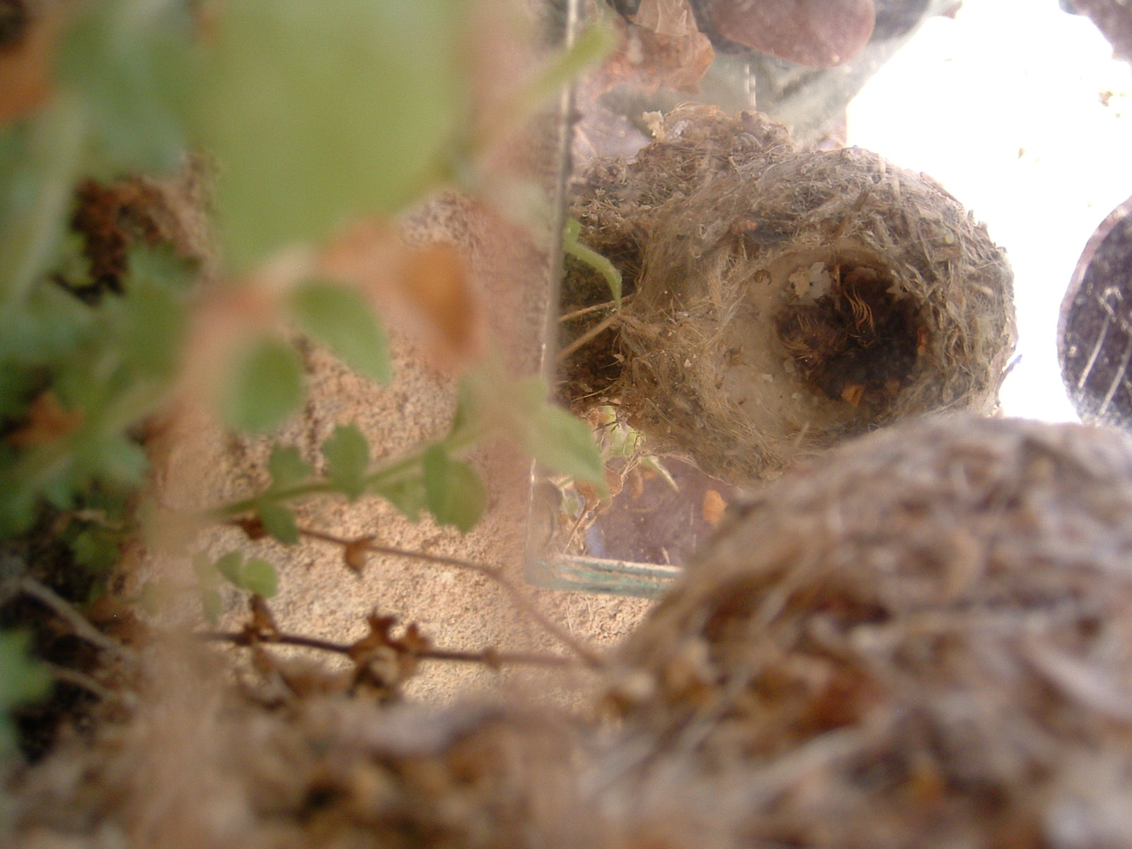
    In the 1990s I was climbing out of a canyon in Utah and took a break under an overhanging rock. A hummingbird started diving at me. It would stop short then retreat and dive again. This vicious bird was threatening to deliver a full force body blow. With the whole 3 ounce body. Oh, it was terrifying. I could only think of one thing that makes birds act so goofy. I looked up and saw a nest hanging from the ceiling. I came back with a mirror and saw 2 chicks, the only ones I've ever seen. I've seen eggs once before. Hummingbird nests are elusive. The bird was acting on instinct, but that's just silly. What can a hummingbird intimidate? Years before that I was in the living room of a house under construction and could see a hummingbird on a high window. I climbed up 2 stories and grabbed him. I took him outside with his tiny head poking out of my fist and threw him in the air. Away he went. He might have stayed on that window until he died. Why did he let me grab him?