Search This Blog

Monday, July 24, 2017

Jarbidge Wilderness Area

The view from Marys River Peak. Jarbidge Peak is in the background. Then Jumbo then Matterhorn then Cougar. Prospect Peak is to the right. Square Top is hidden.

The forest on Copper Mountain. A golf course is harder to walk on.

Fox Lake

Fox Meadow and Fox Creek Peak

Looking north from Jarbidge Peak at the deep canyons. Jarbidge town is in the canyon on the left in the background. Murphy Hot Springs village is in the canyon on the right. The valley in the foreground is upper Jack Creek.

  • The main road to Jarbidge is out of Rogerson, ID. It's 64 miles. The first 47 miles are bumpy pavement to the rim of a deep canyon at Murphy Hot Springs. Then it's graded down into the canyon for 17 miles to town. There are 3 free campgrounds in the canyon right after Murphy Hot Springs, then not much else until Jarbidge. One campround is just before town then some south of town. The main road climbs steeply out of the canyon about 2 miles south of town, but another road stays in the canyon for a mile long stretch with the best campgrounds, all free with restrooms but only creek water. Then the road becomes narrow 4wd with 2 rocky creek crossings about shin deep and ends in a mile at the new Snowslide TH reading N41 49348, W115 24940 el 6800. Campsites and 3 tables are there. A washout caused the TH to be pushed back a half mile from the original TH. Mtn bikes would work on most of the 4wd road and maybe even the first fifth mile of trail since the map shows it's outside the wilderness. The crossings are close together in a section where the road runs in the river channel for a tenth mile and thus are ever shifting. But the rest of the road was easy. Rogerson has a Sinclair and Jarbidge has gas and diesel and also a saloon and small store. Posted July, 2017.

    • GODS POCKET PEAK el 10185 has an elk trail up the NE ridge. Nearly 40 miles in from Rogerson is a sign for Pole Creek. It's a half mile after the Three Creek school. Go 16 miles on that 2wd road to a fork at N41 52280, W115 14420 el 8500. Right goes over a mile to the Slide Creek TH with a shady, free campground. But go left on FR 58284 up along a fence. It's 2 and a half miles of routine 4wd to the end at the Hummingbird Springs TH el 9150. Hike the old road for .7 air mile to a fork. The left one is the shortest. Go on down to 48709, 15198 el 8700 then leave the trail and walk a third mile up a grassy slope to the elk trail at 48709, 15566 el 8900. It goes up the ridge skirting bumps then fades in and out but it's there when you need it. It's an easy walk to the reg at 47409, 17417.  5 and a half hours with about 2000 gain, 500 of it on the way back, never very steep. I wore shorts the whole way. DIVIDE PEAK el 10006 is about a mile and a third south of Gods Pocket Peak and it looked easy. For that I would make a big loop. I would stay on the trail to el 9400 then go up the east ridge to the peak at 46405, 18345. Then I would walk the ridge to Gods Pocket Peak then on back down the NE ridge. I didn't see any brush or crag problems. That might be done in 8 hours. Divide Peak has the best looking  forest because it eluded wildfires. Hummingbird Spring is on the trail at 48633, 15215 el 8650 then next is a pipe spring at 48122, 15972 el 8250 then half a mile beyond that is Cottonwood Creek with a good flow, and it might be the last water. Posted July, 2017.
    • ROBINSON HOLE is a deep section of canyon along the Jarbidge River east fork. A 4wd roads goes along the rim to a viewpoint. Mtn bikes would work. At the end of pavement on the rim just before Murphy Hot Springs is a rim road. But a better road starts 2 miles back at a corral reading N42 02013, W115 18945 el 5700 and soon merges with the other road. Follow that about 6 miles from pavement to a fork at N41 57104, W115 18167 el 6800. On a mtn bike I would try a shortcut by going right to the viewpoint on Cougar Point at N41 56649, W115 19274 el 7000. I stayed left on my 125 for 2 more miles to a 4-way at a gate reading N41 55370, W115 17894 el 7350 then came back down the rim 2 miles to the viewpoint. It's 1100 feet nearly straight down to the river. OHVs go thru the gate and across the canyon then on to Jarbidge. Posted 2017.
    • JARBIDGE PEAK el 10793 via Sawmill Ridge - 4wds can get to el 9300 for an easy ascent. From Murphy Hot Springs, drive north out of the canyon for 11 miles on the main road to 3 forks at N41 53387, W115 22005 el 7930. Stay far right on road #58283 for 2 miles to some camp spots with gushing springs el 8900 at Dave Creek . It's easy 4wd to there, then it's another half mile of rough road to Sawmill Ridge el 9300. The last half mile is for serious 4 wheelers only. No sissies. Walk up the ridge to 50875, 22532 el 10200 where a class 2 stairway goes up thru a cliff. Then stay on the right side of the ridge to avoid stubby trees. Cross to the left side at 50763, 22533 then up to 50731, 22551 where you can see how to drop a little then walk below the trees for about 700 feet and then come back to center. It opens up there for the rest of the way to the summit at 50417, 23415. That hike took me less than 4 hours. Peak 10092 at 51214, 22446 would be a one hour hike and the easiest of the 10000 footers. The roads are shown on the topo except for the part above el 8900. ALTITUDE MINE el 9800 - that's in the gorgeous valley north of the peak. The pack trail on the topo is now OHV trail #18038, but may be blocked. At the 3 forks el 7930, go NW a fifth mile to the trail. It goes to Jack Creek which drains the valley. I rode as far as the first crossing at el 7700. It looked treacherous and I was told there is a shaky bridge farther on. I would park on the trail at N41 52745, W115 22789 el 7650 and walk. It measures out at 3 miles each way and likely has 2 wades or more. It would be 5 miles each way to walk the whole OHV trail. Posted 2017.
    • JARBIDGE PEAK, JUMBO, SQUARE TOP, MATTERHORN - a mine trail goes up to el 10250 on the crest that accesses all the peaks. Use an OHV trail for the Rex Mine  that leaves the campground at N41 50587, W115 25641 el 6500. It's on the topo. Stay on the main OHV trail to el 8200 then walk a tenth mile thru a trench area to a large rock at 50146, 24700 el 8350. The trail is easy to follow from there as it makes long switches on the south side of the west ridge of Jarbidge. Stay right at a fork at el 9600 where there is a puddle known as Teacup Spring. The trail goes on up into the saddle between Jarbidge Peak and Jumbo. Then it goes along the west side of the peaks to the saddle at Matterhorn where it's easy to walk the ridge up. From the summit it's just a matter of picking which west ridge to descend or taking a stab at Cougar. A mtn bike would help for a shuttle. The two hikers who maintain this trail call it the Teacup Trail. Posted 2017.
    • MATTERHORN PEAK el 10838 - the popular route goes up a west ridge from the Jarbidge River Trail at el 7300. I prefer to stay on the trail to el 8400 and circle back to the west ridge. Walk from the Snowslide TH to N41  48372, W115 24383 el 7300. That's where most go up. For the easier route, stay on the trail. Shortly there is a wide crossing at el 7275 where I waded. The remaining crossings were jumpable. Go on to 47297, 22840 el 8400 and go up an open slope (a tenth mile on up the trail is a creekside basecamp area backpackers can use). At el 8900 start curving left to skirt under dense trees. Keep going at a gentle angle to the west ridge where the rest is in view. I hit the west ridge at 47972, 22813 el 9550 then went up almost to the crest and leveled off to stay under crags. The summit is at 48648, 22457. It took me 4 hours to get there. There are 3 options for the return. Use one of the two west ridges, or run the crest to the Teacup Trail. I did the latter and also went up Jarbidge but next time I would do it in reverse.  It took me over 8 hours to go from the TH, over the peaks, then back down the Teacup Trail to the campground. The trail along the crest is on pure rocks. The gain to Matterhorn from the Snowslide TH is 4000, about a third of it is steep. Backpackers would have an easy hike from the basecamp near el 8400 then could move on up to Jarbidge Lake and do more peaks. Posted 2017.
    • MARYS RIVER PEAK el 10570 is the southernmost of the 10000 footers. The Jarbidge River Trail goes to the crest at nearly 10000 then it's a simple hike from there. Start at the Snowslide TH el 6800 and walk the sunny old road to the first creek crossing el 7275. I waded there but the rest were jumpable. An avalanche knocked down trees on 150 feet of the trail at el 7550. It took 5 minutes to get thru.  At el 7700 is a fork where you stay left. The road ends at el 7800 then it's a shady trail. The trail crosses to the left side of the creek at el 8100.  Somewhere around el 9000 was the best spring pouring out next to the trail. It took 3 hours 20 minutes to get to Jarbidge Lake at 46453, 22395 el 9300 which is more like a pond. It's a good basecamp. Stay on the trail up to the crest then on to the summit at 45554, 21684. On the return I dropped straight off the crest to the saddle next to the lake. That took 9 hours with about 4000 gain, but only 400 near the end was steep. It measures out at about 13 or 14 miles. Posted July, 2017.
    • COPPER MOUNTAIN el 9912 is the high point of the Copper Mountains, which is really just one long mountain. Drive south on the main road from Jarbidge for about 10 miles to Coon Creek Summit el 8440. Turn there on a 4wd road that goes to a camp at el 9000. A rough OHV trail goes on to el 9200 then a foot trail goes on up to the ridgetop el 9400. Walk the ridge in a lovely forest to the first saddle at N41 47611, W115 30640 el 9550 then go up to a handy elk trail at 47422, 30876 el 9800 that runs left of center. The rest is in view from there. The Copper BM is at 46256, 31245. I started on the road at el 8600 and the hike took me 4 hours with 2300 gain, over 400 of that on the way back. Not steep. This is a good family hike. Gushing springs were along the 4wd road at el 8900. Posted July, 2017.
    • COON CREEK PEAK el 9500+ is too easy to pass up. Drive south from Jarbidge for about 7 miles to Bear Creek Summit el 8500. Turn left on 4wd for a tenth mile to a rocky hill and park. Walk or mtn bike another half mile of road then keep going up the ridge to the reg at N41 48488, W115 28120. 2 hours, 1000 gain. DEER MOUNTAIN el 8977 is 2 and a half miles north on the divide. 4wd roads go up. The easiest is to drive back toward Jarbidge and turn on FR 58277 at 50246, 27208 el 8000. Go up that and stay left at forks to the top. Driving back any other way involves ultra steep grades. Posted 2017.
    • FOX LAKE, FOX MEADOW - this is a beautiful forested area on the south side of Fox Creek Peak. Go south from Jarbidge for about 14 miles and turn at the sign for Camp Draw TH. It's about half a mile on easy 4wd to the TH el 7650 at the end of the road with a restroom and 2 camps next to the creek. Walk the trail for 2/3 air mile to where it tops out on a ridge el 8400. Go north up the easy ridge on various game trails and over peak 9352 then down to a saddle at N41 46020, W115 25751 el 9020. The lake is less than a mile north, but there is a big ditch in the way. Circle left around it and stay at about the 9000 level. Aim for an elk trail at 46458, 26055 el 9000. It drops down across a minor gully then goes on to 46537, 25889 el 8950 where it drops down to the right then on to the lake at 46712, 25705 el 8850. The meadow is half a mile away at 46756, 25230 el 9050. The meadow and lake had streams flowing out of them, but I forgot my filter so I used a spring at 46851, 25512 el 9000. Hikers without long pants should return the same way.  I took a chance and went down the canyon on the west side of the saddle el 9020. I stayed on the left side of the creekbed to a viewpoint at 45858, 25896 el 8850. It looked good so I went directly down. At el 8100 I moved over to the left bank in the trees and stayed on that side to the trail at 45442, 26853 el 7750. I hit some light brush in that canyon, mainly below el 8000 but easy with long pants. If I had bothered to look at the topo, I might have skirted the west side of peak 9352 then down a ridge. That loop took me 5 and a half hours. There is 1700 easy gain to peak 9352 then not much after that. That's another top notch forest that's easy to walk in. But wait! It could be better. Just keep going over the top of Fox Creek Peak then down the north ridge to a second vehicle at the Snowslide TH. Refer to the hike for that peak. Posted July, 2017.
    • FOX CREEK PEAK el 9555 sits atop the west rim of the Jarbidge River. It's the highest peak in the Fox Creek Range according to peakbagger.com. A horseshoe loop can be done using the 2 north ridges. Take the 4wd road to the Snowslide TH but stop short of it at a bridge el 6700 where Fox Creek comes in. It's the only bridge on the 4wd part. Study the steep ridge to the west because that's the descent route. Walk on up the road a short way then cross the creek at N41 49388, W115 25019 el 6800 then angle to the right up the slope and top out at el 7250. Go up the easy ridge to crags then go along the right side reading 49056,  25136 el 7700 where you can see how elk go back up to the top. Then stay along the left side of crags to a saddle el 7850 where crags end. Three elk were hanging around there. When you see them, you'll know there are no more crags. Now it's easy to go up to the last minor obstacle which is peak 8523. I went up along the right side of it at el 8470 then down to the saddle behind it at 48282, 24922 el 8435. Then it's a pleasant forest up to the reg at 47124, 25142. Placed in 1999 by Macleod and Lilley, it only had 2 entries since.  Next, walk west half a mile to the craggy sister summit. The crags are easily passed on the left where a distant meadow is in view. Go down the ridge to a saddle at 47522, 26093 el 8900 then on to the meadow at 47891, 26204 el 8600. Near there was the only water I saw besides snow. It was a puddle in a creekbed at 47787, 26209 el 8600. From the meadow, walk north at the 8600 level to an elk trail at 48243, 26026 el 8650. Follow that down to a flat ridge el 8550 then go on to an elk trail at 48417, 25823 el 8400. Now just keep going north down the easy ridge to 49642, 25510 el 7440 where you take the final steep ridge down to the bridge. Some fool put up a wilderness sign at el 7100 on that ridge. That took me 7 hours with about 3000 gain, but hardly any of it steep. Some patches of light brush are below the 8000 level and a lovely forest is above that level. Loggers worked near the meadow, more than 50 years ago. I saw a logging road north of the meadow at el 8600. They likely came up the road along Fox Creek, but it's overgrown.  This is a good hike to do before the 10000 footers because you can study the routes. Posted July, 2017.
      The Murphy airstrip.

      The perilous OHV trail into upper Jack Creek where the Altitude Mine is located.

    Thursday, June 29, 2017

    Worthington Mountains, Tempahute Range

      Meeker Peak is on the right, Worthington Peak is far left, then South Worthington to the right of it.

    Leviathan Cave

    Umetco Corp packed up and walked away from a large installation. Or were they vaporized by space aliens?


    A graded road leaves highway 375 at mp LN 11.8 just east of Rachel. It runs north along the west end of the Timpahute Range then along the west side of the Worthington Mtns. It goes around the north tip of the Worthington Mtns then out into the east valley to a  4-way at N37 54239, W115 32311 where it comes back to the mountains and runs south along the east side to the turn for Leviathan Cave. The 4 miles along the east side is high clearance but smooth. From the 4-way, a graded road goes east back to pavement but I don't know the details. Gas stations are at Lund, Ash Fork, and Tonopah. Rachel might have fuel if your mode of travel is a flying saucer. But in that case, English is likely not your language so this info won't help you. Posted 2017.
    • COYOTE BENCHMARK el 7900+ is the high point of Tempiute Mountain which dominates the western Timpahute Range. An easy 4wd road goes into the east saddle el 7300 as the topo shows. Take highway 375 to mp LN 20.1 and turn on a paved road. Go about 8 miles to the 4wd road at N37 39470, W115 36942 el 6050. Follow that for a bit over 2 miles to 38203, 37795 el 6850 where 2 roads switchback to the left. Take the high road for a mile and a quarter to the saddle el 7300. The reg and BM are above at 37522, 38059. It's a 70 minute hike with 600 gain and the first 400 feet goes parabolic. VODA PEAK el 7587 is what I call the interesting peak east of the paved road. Leave the paved road on a faint dirt road at N37 38499, W115 36393 el 6300. That road will end in nearly half a mile then just keep walking SE up the valley in a nice pj forest. Aim for the obvious limestone ridge on the skyline then go up to the reg at 37763, 35195. It was placed by Dan Voda in 2003. He wrote his name on the label of a Walmart peach can then put the label in the can. For the descent, walk NW over the sister summit then down the spine until a cliff gets in the way. Use a ridge on the right at 38025, 35332 el 7300 to get around it then the rest is easy.  3 hours, 1300 gain. You'll never find a more pleasant pj forest to hike in. I consider this the best hike in the range because of pristine conditions. The main road goes on and hits the highway again in 8 or 9 miles, passing some good mine stuff along the way. Posted 2017.  
    • MONTE MOUNTAIN el 7957 is the high point of the Timpahute Range. It's an easy hike from Tunnel Spring. Drive the graded road in from highway 375 a bit over 7 miles and turn on a good road that a car could make if not for a 2 mile stretch with some sandy spots. The reading at that turn is N37 43884, W115 42492. Stay on the main road for 13 miles to the spring el 6550 which had a light flow from a pipe. A faint OHV track branches off about 100 feet before the spring. I was able to ride that for 2/3 mile to the end at a dry spring el 6700 where the peak was in view. I walked cow trails to a creekbed at 39063, 30738 el 6800 and went up that to the 7000 level then up the slope on the right to get on the NW ridge. A cliff band got in the way at el 7450. A class 3 crack goes up the center or there is a chicken route around the left side. The reg is at 38583, 30566. 3 or 4 hours, nearly 1500 gain. Some light brush in the flats. Nice pj forest but cattle have stomped trails all the way to the top searching for forage. Posted June, 2017.
    • MEEKER PEAK el 8768 - the west side caver's route to Leviathan Cave is no longer viable because the road for that is closed at el 5000. So it's either use the west ridge of Meeker or drive all the way around to the east side. The west ridge is scenic and passes by the cave. Drive the graded road for a dozen miles in from highway 375 to a fork near a  corral. Go right for a mile and a third to N37 48521, W115 40079 then go right again on a sandy track to the legal end in a mile el 5000. The west ridge route is obvious. For the unsteepest route, I went up the west ridge almost to peak 7010 then moved left to the rim of a canyon at 49361, 36893 el 6750. I walked the rim to a fork el 6950 where it's easy to cross over to the north side then up the slope to a view of the cave at 49782, 36417 el 8050. Then I went up to the summit block where a class 2 route goes up the west side. The reg is at 49439, 35991. 7 hours, 3800 gain and 1000 of that I consider to be steep. Pleasant terrain and pj forest.  Posted 2017.
    • SOUTH WORTHINGTON el 8881 is what I call the second highest peak about a mile south of Worthington Peak. The west ridge is easy. Turn off the west side road at N37 51080, W115 41743 and follow a smooth road for 4 and a half miles to the end at Wild Horse Spring el 6350, which is a useless well. A 2wd truck might make it. Walk north along the base and start up the west ridge at 53542, 37707 el 6700. It's a broad ridge and easy to zigzag up. Go over to a viewpoint on a cliff edge at 53974, 37281 el 7750 where a cave is in view. Just go up along the cliff top until crags get in the way then go straight up the slope at 53954, 37045 el 8250. It goes up steep for 200 feet and tops out at el 8450. That's the only steep part. Then it's just a stroll to the summit at 53995, 36691. Worthington Peak is only a mile away and looked easy. It wasn't. I walked east from the summit for 120 feet to get down an easy class 3 drop, only to be blocked by another cliff band at el 8600. To get around that, I dropped west to a ramp at 54165, 36786 el 8400 where all the animals get down. Then I used game trails to get back up to el 8450 where it was easy to walk level to 54521, 36611 el 8500 where I stayed along the base of another cliff to get to the last saddle el 8450. Then it was simple to go up to the top of Worthington Peak at 55057, 36693. I descended from there using the west ridge and found some circular fossils at 54897, 37174 el 8050. I angled down to the right to stay on the main ridge then trended SW to hit bottom. It was easy to walk back along the base. It took me 2 and a half hours to the top of South Worthington with 2700 gain, then was on top of Worthington in 6 hours with 700 more gain, then 8 hours and 15 minutes to come back to the start. Next time, it would take closer to 7 hours because I won't have to look for routes thru the cliffs. If there is a next time. Generally easy terrain and a pleasant forest. This is a good way to see a big chunk of this wilderness. Just doing South Worthington would be a 4 hour hike and a good one.  If you just want to do Worthington by this route, go as far as the viewpoint el 7750 then walk a shelf to a point above the cave then go a little more to the ramp el 8400 described above. I didn't do that segment, but it looked obvious as I was descending.      Posted 2017.
    • WORTHINGTON PEAK has a 4wd road to el 7000 which is what most hikers use. Turn off the east side road at N37 57722, W115 33729 and go 1.8 miles to a road going left at 56711, 35048 in a mine area. Go half a mile on that road to a tricky fork and stay left. Then go .8 mile and  go right toward the peak. The road ends in a bit over a mile at 55494, 36171 el 7100 but I would park a tenth mile before that. These roads are easy 4wd but the last half mile is hard on paint. I never hiked this route but I know it circles up to the south side of the summit. I faintly recall hiking up one of the west ridges on my first trip here in 1997. Posted 2017.
    • LEVIATHAN CAVE east route - most use an unmapped road that goes to the 6400 level on the east side. Turn off the east side road at N37 50948, W115 33612 el 5750 and drive a mile and a half to the end on easy 4wd. Hike west up the main canyon and get on a minor ridge at 50356, 35841 el 7050. Follow that up to a cliff at el 7400 and go around the right side and stay out of the creekbed for easier walking to get to the main saddle at 50398, 36145 el 7600. I stopped on the route there, but it apparently goes down the west side to get under crags. It looked like a lot of tedious contouring then up a steep loose slope for 400 feet or so to get thru cliffs. That would be the last obstacle. I looked for a route that stays high, but there isn't one.  I might prefer coming up the west ridge of Meeker. It's more pleasant terrain. Posted 2017.

    Quinn Canyon Range, Grant Range

    Hooper Peak and the Sharp Ranch.

    Quinn Canyon Range high point is far left. The other one I call Quinn Peak. It's the roughest, toughest, meanest peak in the range.

    The road to Cherry Creek Campground is one lane wide. This driver likely tried to dodge some tree branches and ran out of road. The real threat is the blind curves.

    • Gas stations are at Lund, Ash Springs, and Tonopah. A graded  road runs along the east side of the Quinn Canyon and Grant ranges. 2  graded roads depart highway 375 and merge before reaching the northern tip of the Worthington Mtns. I used the one that starts just east of Rachel at mp LN 11.8 and runs along the west side of the Worthington Mtns. About 30 miles from the highway is a major fork reading N37 59349, W115 35404.  Left goes to Pine and Cottonwood creeks. The right fork is the main road running along the east side of the Quinn Canyon Range. The public road to Cherry Creek Campground departs from the east side road at N38 08015, W115 30929. A narrow road goes for 7 miles up canyon then a road goes left a mile to camp. There is a good creek and shady trees. The restroom is a hole in the ground that you dig. The first dispersed camps are about 3 and a half miles in from the east side road. I would check  the road before hauling a trailer in. The east side road continues on to Sunnyside and meets highway 318 at mp NY 18. A shady campround at the wildlife refuge is along the road about 7 miles before the highway . Posted 2017.
    • QUINN CANYON RANGE HIGH POINT el 10185 -  jeeps can go to el 8200 and OHVs can go to 8850 up the east side. Take the 2wd high clearance road up Pine Creek to a fork at N38 07456, W115 39387 el 7200. Right goes 2wd for 4 miles to Cherry Creek Campground. But you want to go left at the fork on 4wd and there's only one road to follow to a mine and camp spot at 07471, 40862 el 8200. OHVs can go on to the end of the road el 8850 on a small plateau. Hike up the open ridge to el 9600 then angle up to craggy peak 10181. It's best to go up to the summit block at 07925, 41770 el 10120 and walk level along the west side cliff base to get past it. The rest is obvious to the reg at 07334, 42507. QUINN PEAK el 10041 is what I call the jagged peak to the north. For that, walk the crest down to the main saddle el 9300 then go up the ridge slightly right of center and that leads you into a notch at 08989, 41112 el 9800. Now drop down to the west losing 200 feet to the second gully on the right at 09054, 41140 el 9600. Start up that on talus but don't stay in it. Before you get boxed in, start moving to the left to the correct gully at 09099, 41089 el 9850. Go up that gully to the summit at 09122, 41044. No sign of humanity. To get back to the road, I walked to 08395, 41266 el 9200 then dropped down to the right to cross the creekbed and walked game trails at el 9000 for the rest. It took me 8 hours, about 4 hours per peak starting from the end of the road el 8850. The gain for the high peak  was about 2000 total and that can be done in shorts. The gain for the other was about 1200 but light brush requires long pants. A tiny stream was flowing near the end of the road at 07939, 40901 el 8500 in mid June with no snow left. Backpackers could use that and camp on the plateau el 8800. The only good camp I saw along Pine Creek is at 06777, 38635 el 6800. Posted 2017.
    • COTTONWOOD CREEK SOUTH FORK - a good road goes up that to a major washout at el 6800. I walked on up along the stream on cow trails for half a mile where the road resumed. It goes up to a cluster of springs shown on the topo at el 7800 but there was just water oozing out of mud stomped by cattle. It looked like there was no vehicle access from Davis Creek either. Quinn BM is one of the peaks here but well defended by brush. Posted 2017. NORTH FORK - a road up that fork goes as far as a ford at el 6750 with a camp spot. The last mile and a quarter is 4wd. An ATV trail continues on the west bank and ends at a spring reading N38 06029, W115 43534 el 8000. Mtn bikes would work for the first mile and a quarter to a water slide. Posted 2017.
    • BADGER GULCH has an ATV trail up to a saddle el 7950 as shown on the topo. Brush prevents hiking up from there. Posted 2017.
    • CHERRY CREEK PEAK el 9151 is what I call the peak NW of Cherry Creek Summit. Drive half a mile west from the summit to a pullout at N38 11268, W115 36915 el 7500 where the whole route is in view. It's a steep slope thru a thin pj forest to the peak at 11863, 37552. 2 and a half hours, 1700 gain. It's very pleasant on top with good views of surrounding peaks. Next time I would try the east ridge as it looks less steep. Posted 2017.
    • CAMPGROUND PEAK el 8407 is what I call the peak a mile and a quarter north of the Cherry Creek Campground. A loop can be done from the campground that includes the best part of the trail. Go up the trail along the creek for over a mile to a main fork in the canyon then go right on cow trails and start up the ridge at N38 10052, W115 38688 el 7100. It's a very pleasant ridge to the summit with a couple of minor dips. The summit is at 10389, 37383. It takes 2 and a half hours to get there with 1300 gain from the trail. Descent time depends on which route you pick. I backed up to 10373, 37596 el 8200 and followed a game trail down to the right and eventually into the bottom of the south canyon which goes down to the trail. Then it was a quarter mile back to the TH. The whole hike took me 4 hours. Another descent option is to go down the east ridge to the road where you stashed a bike at about 10305, 36604 el 7000 then ride 2 and a half miles back. It's a good idea to use wading shoes for the first fifth mile of the trail. Posted 2017.
    • HOOPER PEAK el 9840+ is what I call the lonesome peak on the west rim of Hooper Canyon. Little Cherry Creek makes for long but easy access on an ancient road bed which is now cow trails. Take the trail from the campground along the creek. Wading shoes would help for the first fifth mile.  The trail cuts over to the far left bank at N38 09864, W115 38875 el 7050. The creek soon dries up and  the last water I found was a  spring on the right bank at 10723, 39886 el 7550. That's the only water in the range I didn't filter. The main canyon bends left a quarter mile beyond the spring. Stay in it to the end at a main saddle el 8250+ then go on another third mile and start up a ridge at 11829, 40020 el 8500. Go up to el 9550 then angle to 12092, 40285 el 9650 where the rest is in view. The peak is at 12516, 40199. No sign of humanity. 8 hours, 3200 gain but only 1000 is steep. 11 miles round trip. There was some light brush, mainly in the canyon, but I never used the long pants I carried. Posted June, 2017.
    • HOOPER CANYON is an oddity in that it seems to be insulated from grazing and no ranch has diverted the creek. Drive over from Cherry Creek Campground for a dozen miles and turn at N38 15841, W115 37273. Go about a mile on easy 4wd to a fork. Right goes a third mile to the rim overlooking an ancient homestead. Left is the only road in use to the mouth. Then you have to drop off the rim and walk the old road up the wash. Move to 14538, 38691 for easier walking and soon the creek is flowing. A fence keeps cattle out of the canyon then a quarter mile after that is the narrows where brush blocks travel. I stopped there but the only way forward is the high west bank. Hart in his 1981 book details how he went up Hooper and over to the campground. I might do it in reverse after studying the sat image. It's an easy 1 hour hike to the narrows and back. Some light brush. Posted 2017.
    • PEAK 7746 is NE of Adaven and has an easy 4wd up it with some sharp turns. Drive down canyon from Cherry Creek Campground for 4 and a half miles and turn at N38 07275, W115 34267. Follow the well preserved main road up for 3 and a half miles to the east shoulder el 7600+ of the peak for good views. I didn't think to check for a cell signal. A nearby cliff at 08906, 33881 has a good view of a spring to the north . It's an easy hike to that spring. On the drive out, stop at an OHV track reading 09092, 34479 el 7200. Walk a tenth mile on that to a saddle then drop down canyon to the spring at 09245, 33758 el 6950. It took me nearly 40 minutes to get there with some light brush. The stream enters a mini gorge then soon dries up. I could see that it wouldn't be too hard to keep going on the north bank to get thru the gorge then it would be easy pj forest to a road at the mouth, if a shuttle was set up. Cattle would ruin this but there weren't any that day. Posted June, 2017.
    • DRY PEAK el 10147 is what I call the first 10000 footer north of Cherry Creek Summit. The west ridge is a pleasant route up. Drive 9 and a half miles over from Cherry Creek Campground and turn on 4wd at N38 15210, W115 36069. Go north a quarter mile and turn right up a bench. The road starts getting hard on paint at el 6400. I rode a cycle on up to el 6750 then walked to the end of the track at el 6900. From there, aim for the easiest ridge at 14809, 34082 el 7300 where the trees thin out and it's a cakewalk the rest of the way. At el 9100 some brush gets in the way but it's easy to walk around the left side into the big trees then up to the summit at 14906, 32270. I could see Bordoli Benchmark a mile to the north looked easy, so I went to it and then one more higher peak beyond it. They put the BM there because it's a  treeless crag. Just Dry Peak and back is a 5 hour hike with 3400 gain. The side trip to Bordoli BM took 3 hours. This peak has the best looking forest I saw in either range. Some of the crest north of Dry Peak has burned but was still easy to walk thru because the trees were still upright. Posted 2017.
    • BORDOLI CANYON is what I call the canyon that drains east from Bordoli BM south of Rimrock Canyon. It's as easy as it looks on the map and so far has eluded wildfires. Turn off the east side graded road at N38 13115, W115 25384 and go 2 and a half miles on easy 4wd. Hike up a bench at 14670, 27262 el 6200 for a mile to 14557, 28204 el 6550 then drop to the creekbed and go up canyon in a pleasant pj forest. I wanted to go as far as the big trees that I could see from the crest. The first one is a ponderosa pine at 15168, 29854 el 7350. I went as far as 15339, 30846 el 8050 where the canyon gets cluttered and steep. I could have escaped to either rim and gone on to the crest, but it would be steep. I spent 5 hours with a grade about like RR tracks. It was a nice break from hiking peaks all the time. Posted 2017.
    • TROY PEAK el 11298 is the high point of the Grant Range. Much of the east side burned. Scofield Canyon was the standard route but that road goes bad at el 6300. The road to Brady Spring is easy 4wd to el 8100. Turn off the east side road at N38 17257, W115 20456 and go nearly 3 miles then keep right at a sign for Murphy Spring on road #648. Follow that road to the end on a ridge at the wilderness boundary el 8100 near Brady Spring. You could go up the ridge but the next one north is less steep and less burned. Walk north across a drainage to get on the next ridge that has the overgrown road to the spring. Follow that ridge on up to the saddle on the crest at 19914, 29482 el 10250. The burn area ends at el 9000. Walk an elk trail on the crest to the summit block el 10700. An elk trail goes around the west side where snow lingers into July. I packed my bottles there. Four elk were hanging around nearby. One was asleep. I went over and introduced myself, but he looked at me for a minute then got up and took off. Hmmm. The route up, unless you're a climber, is to drop down the east side losing 300 feet to 19174, 29874 el 10450 then level off and go a tenth mile to a wide gully at 19111, 29905 el 10500. Go up that and it will be obvious how to curve left onto the rim at 19055, 29994 el 10800+. Then it's just a steep ridge to the reg at 19161, 30119. 6 hours, 3800 gain. Hart's 1981 book says the shelter on the summit is from a survey party in 1879. This route has the least burn of any east side route. No brush above 9000 feet, but a lot of cheatgrass and some light brush below that level. The best shady camp on the road in is at 18370, 24440 el 6200. A pipeline is used to send water from Brady Spring down to troughs along that road and the next one south for wildlife, not cattle. All these roads are on the topo. Posted late June, 2017.
    • HEATH BENCHMARK el 9352 is the northernmost major peak accessed from the east side road. The south ridge works.  The east side road makes a major bend to the east at Forest Home, which is an unoccupied farm. A road goes north across it with no signs or locks on the gates, implying public access. OHVs can skirt around the west side. Once past the farm, go to a fork at N38 21792, W115 19558. Left is an OHV trail along an aqueduct. 4wds should go right for about 3 miles then turn north at 22738, 22445 el 6300 and it will soon be for OHVs only. Walk or ride the last mile to the end at el 6550 then keep going to a game trail at 23732, 22696. Follow that north up a valley aiming for a canyon at 24363, 23072 el 6950. Go up canyon a short way then go up a drainage on the right at 24482, 23090 el 7000  which gets you on the south ridge el 7050. Go up the ridge to el 7650 then walk around the left side of crags and into a saddle el 7675 behind the crags. The rest is obvious to the BM at 25622, 23623. 5 hours, 2800 gain for OHVers. 4wds will have an extra easy mile each way. It's a nice pj forest to el 7700 then some bushes are added to the mix requiring long pants. A mega spring where I filled up is near the last turn el 6300 on the drive in.  Just head for the cottonwoods. Beyond the spring, the road is an OHV trail going toward Big Spring. I rode as far as el 6700 where a steep hill killed my traction. Another road branching north going to el 7200 is long gone. The road to Wiregrass Spring and beyond seems to be gone, but the one branching to Teaspoon Spring was in decent shape for 4wds.  Posted 2017.
    • WILHOITES BENCHMARK el 8311 is the high point of the Horse Range, which is a northern extension of the Grant Range. The east ridge is easy thru a pleasant pj forest. Take the graded road running SE out of Currant for nearly 9 miles to a well and stone cabin. Turn left there on easy 4wd for a bit over 7 miles to a faint road forking left el 6640. It may be closed but ends in a fifth mile anyway. Walk the flats and get on high ground at N38 45887, W115 19909 el 6800. Stay on the high ground to the crest at 46398, 21059 el 80500 then go north a fifth mile to the BM at 46554, 21085. 3 hours, 1600 gain. I felt like I deserved some kind of trophy for finding a range high point with no reg. Mtn bikes would work here, but there is no water anywhere. Posted 2017.
    • RAGGED RIDGE HIGH POINT TRAVERSE el 7461 - this is a scenic area at the northern tip of the Grant Range. Take the graded road running SE out of Currant for 5 miles to a wash at N38 41691, W115 24710 el 5550. Stroll up the wash to a right fork at 40172, 24996 el 6250. Stroll up that then get on the right rim at a saddle reading 40396, 25168 el 6500. Go up the ridge to 40588, 25812 el 7350 where the rest is in view. The peak is at 40668, 25910. A 200 foot long knife edge is just before the peak. Not scary, but there might be a chicken route below it. I returned the same way, but saw later I should have gone on past the high point and found a way down for a loop. 4 hours, 2000 gain, not steep. Very pleasant terrain. RED PEAK el 6588 - the east ridge is easy for that one. Walk north up an easy wash at the east base until it opens up and you can see a saddle to go up to. The reg is at N38 42006, W115 24553. That took me 90 minutes with 1000 gain.  Posted 2017.
    • BLUE EAGLE MOUNTAIN el 9561 has an easy route from the east side, but floods chewed up the road coming in by way of Andrews Spring. Even the graded part was 4wd. A 4wd might still be forced in, but it will take all day and a tank of gas. OHVs have no problem. In a 4wd, I would use the Hart route. He went up Box Canyon then down the north ridge. I did that in the 1990s and had nothing harder than class 3. It's certainly more scenic. The road to Box didn't get hit and you get to keep your paint. I don't expect the east side roads to get fixed unless grazing  resumes. Posted 2017.
    • CITY IN THE SKY - the Indians had a village on a flat top el 7990 at Quinn Canyon where  I counted 18 rock rings. Turn off highway 375 at mp LN 4.1 and go about 12 miles to a main fork with a deserted ranch. Go left on a decent road to the mouth of the canyon where floods have created a couple of 4wd spots along a small stream. Go thru the canyon then to an easy 4wd road on the left at N38 01744, W115 50156. Go a mile and a quarter on that to a saddle el 7300 then climb up to the rim. Rings are scattered along the plateau but nothing is on the summit. The biggest ring I saw is at 01535, 51858. The forest is in pristine condition but for one small burn area. It has a ring it too.  PEAK 8868 is a high one nearby that's easy to get at. Turn off the main road at 02132, 50306 and go a mile and a half on easy 4wd to the end el 7550 on the far side of a burn area. It's a shady hike up the ridge to the summit at 02333, 47049. A sea of mahogany blocks further progress. Posted 2019.
    • Ring at City in the Sky


      Huge corral at Quinn Canyon

    Friday, June 9, 2017

    Bull Valley Mountains

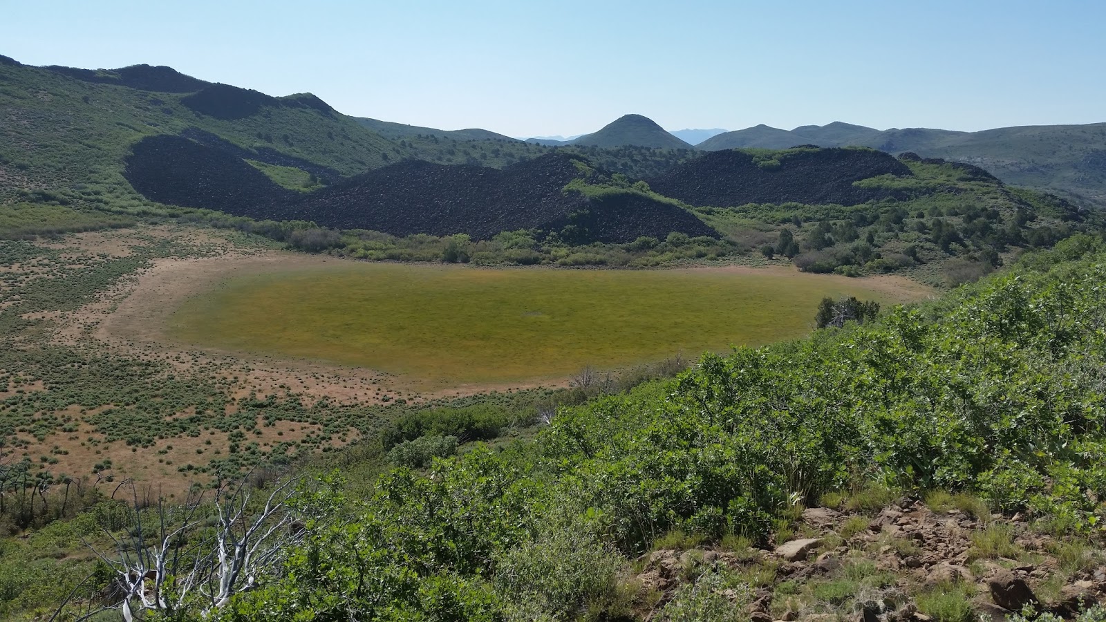
    Crater Meadow

    Jackson Peak and Square Top Mountain are hard to get at.

    Enterprise Lake and Flat Top

    Lost Cave is more like a garage.

    There is not much hiking potential in this range, but a lot of packed dirt roads make for good bike and OHV rides. Pick up a free Dixie forest map at a visitor center before your trip. Enterprise is a good looking town with a supermarket and Family Dollar. The best camping is at Enterprise Lake with one pay campground and several free sites. The best free sites are on the south shore in the pines with a restroom. Cars might have trouble crossing a creek to get there, but it was dry in June. The Pine Creek Trail departs from that camp area but it hits a wall of brush in a mile. You could ride a bike half way. To get to the lake, go west out of town on the main street and follow signs for 10 miles on paved roads. Posted 2017.
    • LOST PEAK el 7516 is the high point of the range. It's a dull peak but the view is outstanding. From the main campground at Enterprise Lake, go SW on FR 003 for 2.3 miles to a fork reading N37 29681, W113 52808. Go left on FR 274 for 3.3 miles to a tiny stream at Lost Spring el 6700. Walk along the right side of the stream on cow trails that drop into the creekbed at 28202, 54199. Go up the creekbed then take a fork at 28327, 54237 el 6900 and follow along that to get on the main ridge el 7000. Next, go up to a game trail at 28484, 54468 el 7300 that skirts a bump then it's a fifth mile to the reg and Hawkins BM. 90 minutes, 800  gain, some light brush. For a loop drive back, stay on FR 274 for 2 more miles then go left on FR 004. That road goes 8 miles down Moody  Wash then Burnt Canyon and on past The Pinnacles to graded FR 006. Then go left for 5 and a half miles back to the lake. All roads are easy 4wd on packed dirt. Posted June, 2017.
    • ENTERPRISE TO VEYO BIKE RIDE - this is a good 27 mile ride for parties coming up from St. George with 2 cars. First, drive to Veyo then go west on Center Street for 2 and a half miles to the river and leave a car there reading N37 20128, W113 43191 el 4000. Then take highway 18 to Enterprise el 5300 and ride west out of town on the main street for 10 miles to Enterprise Lake where pavement ends el 5715. Keep going on FR 006 shown as the Veyo Shoal Creek Rd on the topo. It's the only maintained road to follow south. The road will top out on a divide el 6156 about 7 miles past the lake. Then it's almost entirely downhill for 10 miles to the second car at the river. The last water on the ride is the stream in Cove Wash south of the divide, in June. 2 miles of this will be strenuous uphill. Posted 2017.
    • LOST CAVE BIKE RIDE - a 7 mile loop can be done from Enterprise Lake, mostly on packed dirt. From the main campground el 5750, go SW on FR 003 for a mile and a half to an OHV trail on the left. Follow that to the cave at N37 29481, W113 51767 el 5850. Then stay on the trail past the cave for a mile and a half to graded FR 006 at Grassy Flat. Coast back on that. This is all on the topo. Posted 2017.
    • FLAT TOP and PILOT PEAK are south of Enterprise. Go south out of town on Wolf Pack Drive to end of pavement then stay right on main roads and they will lead you up to the south rim of Flat Top at a tower. It's steep 4wd near the top but not eroded. Turn back at the tower because the rest of the roads are for OHVs and plenty rocky . Pilot Peak is right along the road and routes are obvious. I used 4wd FR 352 at N37 31061, W113 45893 to get to the south side of Pilot. It's decent for a mile then goes to hell. Crater Meadow is what I call a meadow in a depression or shallow crater a half mile south of Pilot. I found a passage thru brush at 30039, 46771 el 6200 to get over the rim then down to the meadow. I walked south out of it on rocky trails then circled back. Pilot and the meadow took me 2 hours, easy. Some light brush. Posted 2017.
    • BIG MOUNTAIN el 7229 has a decent road to the top. Turn off highway 18 at mp 36.1 then go 3 miles to the top. 2wd trucks might make it. And tough mtn bikers. The road  gains 400 feet per mLile. How tough are you? Posted 2017.
      Hawk nest at the lake

    Sunday, June 4, 2017

    Harmony Mountains, Pine Valley Mountains


    Stoddard Mountain on the right and Pot Head far left.

    Grants Peak
    Pick up a free Dixie forest map at a visitor center like the one in Cedar City. The main attraction in the Harmony Mtns is the basin on the south side of Stoddard Mtn that has numerous granite formations. Two trails run thru it. May is the best time to hike before heat and cattle move in and streams dry up.

    • HARMONY MOUNTAINS HIGH POINT el 8380+ - a plateau about 3 miles SE of Stoddard Mtn seems to be the highest point in the range. Two easy 4wd roads go all the way as shown on the topo, but private land at the start has caused detours. From Kanarraville, go north on  the main road for a mile or two and turn west at the sign for Bumblebee Spring Rd. Drive to the end of pavement then just follow the main road up to the plateau el 8000+ then the high point has a tower on it. I saw a fifth wheel trailer at el 7400 on this road. The road is good beyond the high point as far as Dry Lake then gets terrible but ends soon anyway. The other road up is out of New Harmony. Go north from town on a main road into Pace Draw and turn right at N37 30533, W113 19307 el 5650. Go a mile then make a left and start up. Both roads merge at about el 7700. I went up from New Harmony then down the other on a dual sport cycle. This plateau has some nice stands of trees. Posted 2017.
    • STODDARD MOUNTAIN el 8378 appears to be the second highest peak in the Harmony Mountains. The Duncan Spring trail runs along the north side for access. Take highway 56 to mp 43.8  and turn on graded FR 009 at the big sign for Pinto. Go about 1.1 mile to the new TH reading N37 35860, W113 22447 el 6550. Walk the trail to a cow trail at 35153, 21712 el 7100 for the first possibility to ascend thru the big trees. I wanted to see the spring so I stayed on the main trail and found a tiny stream along the spring area. I followed the trail on past the spring to a cow trail at 34629, 21023 el 7350. I weaved thru the brush zone to a faint fork at 34622, 21087 el 7350 and went left to 34594, 21104 el 7400 then on to a clearing at the base of the slope reading 34564, 21140 el 7400. Then I went up the open slope to 34549, 21290 el 7850 then into the big trees at 34481, 21370 el 8100. I soon topped out on the main ridge and came to some minor crags. I went around the right side at 34481, 21485 el 8150 and stayed mostly just below the ridgetop to get to the reg and Page BM at 34595, 21590. For the descent, I started NW on the main ridge but brush made me chicken out and turn around. But looking up from the trail later I could see that there couldn't be too much brush. 4 or 5 hours with about 2000 gain and a lot of light brush to weave thru but not a major factor with long pants. I think you could also get up this peak from Big Hollow Spring. On the other side of FR 009 is a trail that goes for 10 minutes to something interesting. ASPEN SPRING is north of the peak. To get there now you have to drive back north on FR 009 for half a mile and turn on a narrow jeep road best suited for OHVs and mtn bikes. It winds for a mile and a half to the spring in an aspen grove at N37 35677, W113 21002 el 6800. Water was coming out of a pipe. A foot trail goes on but looked abandoned.  No cattle in late May. Posted 2017.
    • STODDARD MOUNTAIN LOOP - the Duncan Spring Trail and Big Hollow Trail can be used to circle the base of the mountain with one mile of off trail to connect them. Take highway 56 to mp 43.8  and turn on graded FR 009 at the big sign for Pinto. Go about 3 and a half miles to a 4wd road on the left reading N37 34622, W113 24470 el 6150. Take that for .7 mile to the TH el 6250. The wide path soon shrinks to a shady foot trail and follows the stream for 2 miles to Big Hollow Spring at el 6800. It was a dry pipe. Follow the trail on past the pipe thru a saddle el 6900 and the trail crosses a little stream at 35221, 22207 el 6800 then gets fuzzy. Pick it up at 35275, 22127 el 6900 then again at 35251, 21870 el 7000. This section needs pruning and more cairns. It goes on another 350 feet to a T at the heavily used Duncan trail. Turn right on that and go 2/3 air mile to another T at a stream. Turn right and go along the stream past Duncan Spring then the trail goes to a saddle el 7500 and starts wrapping around the mountain and tops out at el 7700. It then drops down to another stream at el 7000. Stay on the trail to el 6900 then get off and walk a couple hundred feet to the right to 33800, 22258. Next, drop down into a drainage on the left and that goes a mile to the Big Hollow Trail at 34272, 23087 el 6550. The drainage will start to get brushy but there was always a cow trail thru it. I wore shorts with no problem but had to duck a lot under branches. A stream was flowing and the water line for the pot farm was in this drainage. And one sleeping rattlesnake. Once on the trail again, it's a half hour back to the start. That took me nearly 5 hours with about 1500 gain and rarely steep. SHUTTLE VERSION - with a mtn bike for a shuttle, the loop  can be done without leaving the trail. Drive FR 009 south for a mile or so and turn left on FR 29 at the sign for Grants Ranch. Drive up that for 4 miles to the south Duncan TH reading 32390,  22287 el 6600 and leave a bike. Cars can get here if the road isn't rutted by people driving it wet. Then go back and do the hike but stay on the trail the whole way.  WATER - aside from the streams mentioned, a spur road near the south TH reading 32429, 22767 el 6550 goes a fifth mile to a water pipe.  I'd filter it all. There is no telling when they dry up. Posted early June, 2017.
    • BIG HOLLOW TRAIL (aka Marijuana Trail) - this runs along a stream on the west side of Stoddard Mtn, as the topo shows. Pot Head el 7538 is what I call the highest granite peak on the west rim of the canyon. A loop can be done. Take highway 56 to mp 43.8  and turn on graded FR 009 at the big sign for Pinto. Go about 3 and a half miles to a 4wd road on the left reading N37 34622, W113 24470 el 6150. Take that for .7 mile to the TH el 6250. The wide path soon shrinks to a shady foot trail and follows the stream for 2 miles to Big Hollow Spring at 34910, 22499 el 6800. The stream started drying up as I neared the spring and it was a dry pipe. For the peak, go past the pipe for 100 feet or so then go left on a game trail and double back to bedrock at 34935, 22567 el 6850. On the other side of that is a wide canyon. Go up along that then up bedrock at 35034, 22823 el 7100. Keep going up to the summit at 35045, 22985. It's easy to head back on the rim staying right of big crags then descend an easy canyon at 34580, 23212 el 7150. It goes right down to a pot farm near the trail at 34330, 23110 el 6600. Sorry, it's out of business. Then it's a mile back to the start on the trail. That took me nearly 4 hours with 700 gain to the peak from the trail, no brush. Mtn bikes are allowed on the trail, but I wouldn't go more than a third mile in because after that are too many sharp, rocky crossings. Backpackers might set up in here and take a crack at Stoddard Mtn too. No cattle in late May. Posted 2017.
    • GRANTS PEAK el 7119 is what I call a little granite peak along the road near Grants Ranch. Take highway 56 to mp 43.8  and turn on graded FR 009 at the big sign for Pinto. Go nearly 5 miles to the sign for Grants Ranch at the historic Page Ranch. Turn there on FR 29 and there is a good camp spot in a fifth mile. Keep going for 3 miles to a corral on the right. The easiest route is to go south up a draw on cow trails and circle to the SE side of the peak reading N37 32245, W113 23396 el 6750. Then go straight up the ridge center all the way. Another way is to go directly up from the corral to visible bedrock then keep left around a cliff. The summit block has several routes. It might be possible to go up the spine, or use a ramp on the NW side which is how I came down. Or walk the east side to get up. 90 minutes, 600 gain, nothing harder than 3rd class. This could be combined with a good mtn bike ride. Start riding at the Page Ranch and go on past the peak to the divide, then coast back and do the peak. That's 5 miles each way on packed dirt in a beautiful valley gaining 800 feet. Cars can get to Page Ranch but the Grants Ranch road can get rutted up by people driving it wet. I wouldn't ever take a car over the divide to New Harmony, but I would coast down on a bike to a second car spotted there. This is all on the topo. Posted 2017.
    • PINTO SPRING el 6550 has a good camp area.  Take highway 56 to mp 43.8  and turn on graded FR 009 at the big sign for Pinto. Go about 8 miles to signs for the county line then go left on FR 14 for 4 miles to the end at the spring. That last 4 miles is a good mtn bike ride and that's all there is to do unless you're backpacking. The Summit Trail departs from the spring but it's a boring old road for miles. I walked it to the trail for Rock Spring but that trail is gone. Paradise Spring had a good flow from a pipe. Posted May, 2017.
    • OLD IRONTOWN - turn off highway 56 at mp 41 and go 3 miles on a paved road to a day use area where the ruins are. Posted 2017.
    • IRON MOUNTAIN el 7831 appears to be the high peak in the Antelope Range. A 4 mile dirt road goes to towers on top. Take highway 56 to mp 42.4 then turn north. Cross the RR tracks then stay right at a fork and follow the main road up. It's 2wd until a fork near the top. The left fork soon ends. The right fork is easy 4wd for half a mile to the summit. Wind demolished one tower. Mtn bikes would work for those who can handle the  grade. The huge mines here are mostly abandoned. Some of this is not public land and might get blocked. I can just picture houses being built on the tailings. Posted 2017.
    • BIG POINT el 10024 is the northernmost 10000 footer in the Pine Valley Mtns. A 7 mile trail  goes up Mill Canyon almost to the top. I used FR 11 out of Pinto for 8 miles to a sign for Mill Creek TH. Cars can make it. I followed the trail to N37 24643, W113 23373 el 9400 then deep snow compelled me to start up the left slope. I topped out in a burn area on the rim at 24715, 23095 el 9750. Don't top out any more to the north or the burn area is a headache. I had to walk the edge of the rim to get thru the burn area to the summit at 24843, 22870. 8 hours, 3000 gain. The TH has a good camp spot. Another good camp spot is on the trail at an old boiler reading 26555, 24127 el 8000. From there, the trail gets rougher with more fallen trees until Mill Flat at 25893, 23315 el 8550 where there are nice meadows. There are 30 creek crossings. I stayed dry but the logs I used might be gone so it's best to wait until the snow has melted. The first mile of the trail is outside the wilderness but signs were fuzzy about bikes being allowed. Posted late May, 2017.
    • SIGNAL PEAK el 10365 is the highest peak in the Pine Valley Mtns. A trail goes up from the east as the topo shows and might be the shortest. Use the Silver Reef Rd on the north side of Leeds. It will turn into a graded road then come to a main fork. Stay right on FR 32 to the end at the TH el 6550 and Oak Grove Campground. Cars normally can make it. The trail goes up and over the main ridge then down losing 100 feet on the north side to a sign for Further Water. Go left there then the trail goes over a minor saddle and loses 200 feet then on to the saddle a third mile NW of the peak. The peak is at N37 19175, W113 29533. We got turned back by snow a mile short of the peak. Count on taking 7 or 8 hours with nearly 4500 gain. Posted May 2017.