Search This Blog

Friday, January 20, 2017

Palo Verde Mountains Wilderness

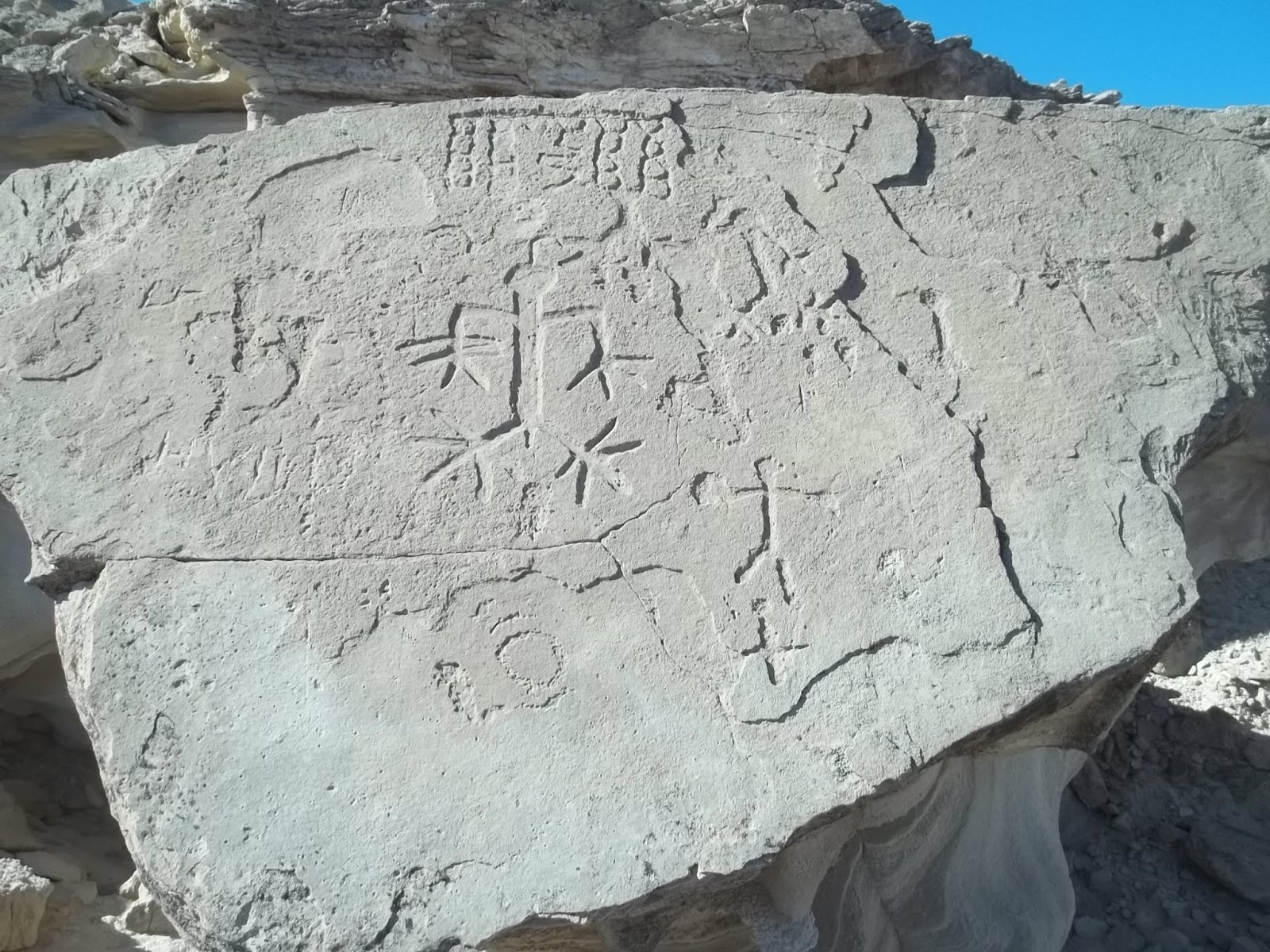
Geoglyph at Tadpole Tank

Thumb Peak

Opal Hill Mine. That bus had 1979 plates.

The Indian trail crossing the range at the south Flat Top, shown upper right.
Palo Verde has gas and a couple of mini marts. Free camping is at the county park 2 miles south of town. Less than a mile south of that is a sign for Cibola Refuge. That road goes half a mile to fee campgrounds. At mp IMP 69 on highway 78  near Walters Camp Rd  is where big RV camp areas start. Posted 2017.
  • PALO VERDE PEAK el 1800 is the high point of the wilderness. Go south from Palo Verde town on 78 for over 5 miles to graded Stallard Rd at mp IMP 75.4. Take that road for 2 and a half miles to the dump. Go along the left side of the dump on easy 4wd. In a third mile is a fork where small rigs can camp. Take the left fork for over 4 miles and start hiking up a little rib at N33 20235, W114 46887 el 700. Head for the main north gully at 19933, 46648 el 1000. Go up that as it bends right and ends at the headwall el 1250. At the wall, go left along the base to the east side of the summit and circle up to the flag at 19766, 46627. No reg. 2 hrs, 1200 gain. Updated 2019.
  • SHARKS TOOTH el 1463 is a crag a half mile south of Palo Verde Peak. A class 2 route goes up the SE gully. Take highway 78 to mp 70.2 and walk to high ground at N33 17599, W114 45435 el 350. Go up to a burro trail at 17907, 46157 el 450. It goes along a wash for .15 air mile then cuts thru a gap to the next wash. Go on up to a shortcut trail on the left bank at 18565, 46513 el 550 then go on to the SE gully at 19074, 46659 el 750. Follow it up to a high saddle then go left to the summit at 19279, 46808. 4 hours with 700 feet of strenuous gain. Burros have trashed all but the last half mile but it's still a pretty good hike. Posted 2019.
  • MILPITAS WASH LOOP DRIVE - a 30+ mile loop can be done around the range with a 4wd and all the major peaks can be climbed on a long weekend. Take highway 78 to mp 68.6 and turn at the sign for Milpitas Wash. Go west for about 4 and a half miles to road #658. That's an easy 4wd road that goes for 3 and a half miles to access the southern Flat Top. Keep going west on the main road another 4 or 5 miles to road #706. That road goes nearly 3 miles and gets closest to the Flat Tops. The Milpitas road goes on to MILL BM on the left reading N33 23934, W114 55328 el 1150. Road #513 goes to the base of it. That's a half hour hike. TADPOLE PEAK el 1520 is what I call the high peak on the east side of the main road. Park at a bend and walk half a mile to a wash at the base reading 23664, 54081 el 850. Go up the wash then climb the ridge at 23467, 53923 el 950 and follow it all the way up to the reg at 23668, 53625. Rocks thin out at el 1100. That's a 2 hour hike. Back on the main road, a geoglyph is on the right at 23844, 54523. An Indian trail runs right by it and on to Tadpole Tank which is another half mile up the road. You could go scuba diving in that. RITT BM is next. Stay on the main road around to the north side of it then hike up a bad road #516 onto the ridgetop then walk on to the BM and reg at 25012, 55031 el 1150. That's a 1 hour hike. The Indian trail comes around the east tip of this little mountain. The main road will morph into the Wiley Well Rd and enter the Mule Mtns LTVA. An unsigned fork is there at 26957, 53560. Turn right and go nearly 2 miles to fork at 27195, 51997. Both go, but left is better. The Opal Hill Mine is a fifth mile on the right fork. Both forks soon merge and the road gets easy on out to Palo Verde town. The turnoff for the Thumb Peak hike is along the way. The road goes thru the front yard of a farm house just before town. Another option is to go south from the farm house for 3 miles to the dump. Then go right on road #569 and that goes to Milpitas Wash. The Lost Mine and Palo Verde Peak hikes are along that road. This loop is on the AAA map, but not the spur roads. Posted 2017.
  • SAGUARO PEAK el 1534 is what I call a jagged peak about 2 miles west of Palo Verde Peak. A class 2 route goes up the west side. Take highway 78 to mp 68.6 and turn at the sign for Milpitas Wash. Go west for about a mile and a half to power lines then keep going another fifth mile and turn on a crude road. Go nearly 2 and a half miles to a wash and park. Walk up the wash using the left bank then go thru a gap at N33 19520, W114 48729 el 800  and go up to a main fork about half a mile before the peak. Go up the left fork to a game trail on the right bank at 20063, 49046 el 900. A lone saguaro can be seen up to the right. Follow the trail to the main west saddle el 1000. From the saddle, go up a  drainage to el 1100 and then head for a narrow gully at 20329, 48971 el 1300. It's easier to pass below the gully at el 1150 then circle back up to it on stable ground. Go up the gully to a notch then go thru the notch and stroll up on easy ground to the SE side of the summit then go up to it. It reads 20316, 48921. For a loop back, go back down the gully and keep going down to the main wash and walk it down to 19626, 49381 el 800 where you exit left. Go across flats to a trail at 19434, 49149 el 800 then the rest is obvious. 3 hours, 800 gain. This is one of the better hikes. It's rocky, but usually not hard to weave thru on foot. The saguaro is the only one I saw in the range. Posted 2017.
  • SOUTH FLAT TOP el 1600 has an easy route up the south ridge.  Take highway 78 to mp IMP 68.6 and turn at the sign for Milpitas Wash. Go 4.4 miles to easy 4wd road #658 reading N33 17779, W114 50827. Take that for 3 and a half miles where rocks spoil the party in a wash el 850. Everything is stopped in another half mile. Walk up the wash to an Indian trail at 21138, 51034 el 1000. I was expecting to find a trail because I saw it at the Lost Mine TH. I knew they had to be cutting across the range to Tadpole Tank. From there it's easy to see how to go up the ridge to the summit. 3 hours with about 500 gain up the ridge. I walked the trail east for a third mile and it vanishes in a wash. Posted 2017.
  • NORTH FLAT TOP el 1500+ sits in the middle of the wilderness. A 4wd road comes in from the south as the topo shows. Take highway 78 to mp IMP 68.6 and turn at the sign for Milpitas Wash. Go 9 miles then turn on road #706 reading N33 20083, W114 53958. A rocky crossing about a mile in is the worst spot on 706, but mtn bikes would work for the remaining road. I never saw a closure on 706 so I kept going nearly 2 more miles to a washout el 850 that stops everything.  It's another half mile on the road to a foundation then the road dips into a wash with a dry well pipe. Keep going a few more feet to a game trail at 21882, 51887  el 950 that goes up a right fork in the wash and into the main saddle el 1000 between the two Flat Tops. Turn left and go up the ridge to the northern Flat Top. The ridge is easier than it looks. An ocotillo garden and carpet of rocks is on top. It's just one layer embedded in light colored soil, not hard to walk on but slow. It takes 20 minutes to walk the half mile across to the northern tip. Someone cleared a circle at 22544, 52088 then it's just another 500 feet to the tip where there's a good rock to sit on. That took me 3 hours with about 500 gain up the peak. I did the south Flat Top as a separate hike up the south ridge because the NW slopes are the most miserable rocky mess I have ever seen, but I found out in 2019 that going up directly from the main saddle isn't loose rock. But the north ridge is another option. From the main saddle el 1000 between the Flat Tops, go down a deer trail then up another one at 22199, 51444 el 1000 that goes up along a drainage then tops out on the north ridge el 1150. That ridge looked OK,  but I kept going along the east base of the peak. I went down from the north ridge to the main wash and walked a trail on the left bank. I came upon a 3 foot deep waterhole at 21795, 50898 el 950. It's best to cross to the trail on the right bank just before reaching the waterhole. I saw a deer there. It was easy to walk along the trail at the base of the peak all the way to the Indian trail on the south side at 21137, 51036 el 950. That trail goes SW along a wash, switching bank to bank. At 20781, 52227 el 800 it dips into the wash then goes about 400 feet then exits on the right bank and soon makes the turn toward Tadpole Tank. It fades out along here but it's easy to walk the flats back to the start. It took me 2 and a half hours to walk that leg of the hike from the main saddle back to the start.  If I hiked up the north Flat Top and came back the Indian trail route, it would take me under 5 hours. Good scenery. Anyone walking back on the Indian trail should not drive more than 2 miles in from the Milpitas Wash road on road #706. The Milpitas Wash road is graded but too soft to risk a 2wd. Posted 2017.
  • FLAT TOPS INDIAN TRAILS LOOP - trails can be used to circle around both Flat Tops. Take highway 78 to mp IMP 68.6 and turn at the sign for Milpitas Wash. Go 9 miles then turn on road #706 reading N33 20083, W114 53958. Drive a mile and a half then walk to a wash at N33 21055, W114 53415 el 750. Go up that then exit left at 21563, 53314 el 800. Then weave thru rocks to a ridge at 22064, 53335 el 850. Go up that for 3/4 mile and a trail starts appearing in a rock field. Walk it to 22525, 52593 el 900 and down a canyon to sleeping circles where it veers right and gets spotty along a major wash. It goes steep up the right bank but it's just as good to stay in the wash then exit on a faint trail at 23458, 51728 el 700 and go on to another trail at 23306, 51293 el 750. Go up a canyon on that and it fades in the creekbed then use the left bank at 23016, 51356 el 750 and walk a smooth channel. When that plays out cross to the right bank where there is a rock arrow. We dropped to a lower bank there then soon came back up to the high bank and kept going up canyon on faint trails bank to bank. At the head of the canyon, the main trail circles to the right to the saddle el 1000 between the Flat Tops for anyone wanting to climb the peaks. To skip them, go left up a game trail at 22199, 51444 el 1000 that goes up along a drainage then tops out at a saddle el 1150 on the north ridge of the southern Flat Top. Go down from the north ridge to the main wash and walk a trail on the left bank. A 3 foot deep waterhole is at 21795, 50898 el 950. It's best to cross to the trail on the right bank just before reaching the waterhole.  It's easy to walk along the trail at the base of the peak all the way to the Indian trail on the south side at 21137, 51036 el 950. That trail goes SW along a rocky wash, switching bank to bank. At 20754, 52307 el 800, it exits on the right bank and soon makes the turn toward Tadpole Tank. It fades out along here but it's easy to walk the flats back to the start. The loop should take 5 hours with hardly any strenous gain. Vic Hanson and I opted to climb the peaks from the main saddle in between. We went up to the north one then came back to the saddle and went directly up from there to the south one and didn't have any backsliding but it goes parabolic. Peakbagger.com shows the south Flat Top at 21720, 51439. We stayed on the main easiest ridge going generally south to get down to the trail. The hike took us 7 hours with 1200 rocky gain added for the peaks. This is the best hike on this page, largely because burros can't make it that far and stink it up. Posted 2019.
  • LITTLE FLAT TOP el 1397 is what I call the smallest of the three. A loop can be done on the east side.  Take highway 78 to mp IMP 75.4 and turn on graded Stallard Rd. Go 2 and a half miles to a dump  then go left on road #569. Go a quarter mile then take a right fork up a wash for over a mile to power lines. Go right along the lines for .4 mile to a major wash at N33 23399, W114 46361. Drive a mile up that then walk because boulders soon block everything. A guzzler is 1.6 air miles up the wash from the lines. Leave the wash there and aim for another wash at 22700, 48261 el 500. Walk the left bank on deer trails and stay on the low ground to 22496, 48703 el 600 where the trail drops into a wash. Go up that and into a fork at 22313, 48971 el 650. That fork leads to an old road in a tenth mile. Walk that into a major wash. The road goes back and forth across it but it pays to stay in the wash. Exit the wash at 21698, 50086 el 850 and follow game trails on the low ground to a minor wash at 21580, 50588 el 1000. Go down that a tenth mile then exit left thru a minor saddle then you're in the wash running along the southern Flat Top. A water hole in the wash at 21795, 50898 el 950 was 2 feet deep that day. A trail runs on down along the wash on the east side of the Little Flat Top for anyone wanting to skip the peak. Vic and I decided to go over the peak. We went up the south ridge at 22091, 51243 el 1100 then soon hit a short, crumbly looking knife edge. I let him go first to test it. I can replace him, but I can't replace me. It turned out to be stable and class 3 or less. We went over the summit then down at 22457, 51225 el 1350 where rocks were thinner. We hit the wash and got on the left bank trail at 22625, 50770 el 800. That is likely an Indian trail because plants growing on it indicate it's too old to be a burro trail, though a few burros have used it. We walked the trail over a mile then we took another trail at 22963, 49543 el 650. That one disappeared in a wash and we got on the right bank at 23010, 48594 el 550 then that fizzled and we got on the right bank again and stayed on the high ground back to the start. That took us about 5 hours with the 450 feet up the peak being the only strenuous gain but the peak can be skipped. By "skipped" I mean bypassed, not hopping on one foot. This is easily the second best hike on this page. Posted 2019.
  • THUMB PEAK el 1375 has an interesting route up the east side. From the town of Palo Verde, go west on Palo Verde Rd for about half a mile to a tricky fork at a farm house. The correct road continues west along the south side of the house and on to the west edge of the fields. Then go right a tenth mile then left up a wash to the top of the bench. Stay on the main road for nearly 6 miles in from the farm fields then go left. The reading there is N33 26599, W114 50164. Go another 2 miles to the end of the legal road el 550 and park. An Indian trail can be seen along the last third mile of the road. That trail can be used to walk along side the road for 20 minutes to Clapp Spring. Then stay on the road (or a trail down to the right of it ) past the spring to a wide valley then go up along the east side of the peak and up the main drainage. Stay on the left side of the drainage until about el 900 then it's  easy to angle up to the right side into a wide gully reading 24324, 51925 el 1100. The rest is obvious. Go up to the end of the gully then up a chute to a wide shelf. Then angle up to the right to top out on the summit ridge reading 24347, 51970 el 1300. Now there is a short stretch of knife edge but it's wide enough to be safe and then it's just a few more feet to the reg on the summit. 3 hours with about 700 gain that matters. Not for the squeamish.  The spring was dry in 2017 even after big rains, but some big potholes were at the base of the peak reading 24401, 51718 el 700. The spring had a puddle in 2009. Mtn bikes would work on the road in except for the wash that climbs onto the bench. Posted 2107.       
  • LOST  MINE LOOP - a mine tucked away on the north side of the range makes a good hike using washed out roads. Take highway 78 to mp IMP 75.4 and turn on graded Stallard Rd. Go 2 and a half miles to a dump  then go left on road #569. Go a quarter mile then take a right fork up a wash for over a mile to power lines. Go left to the next tower where road #568 forks right reading N33 22985, W114 46415. Take that road for a mile to the legal end at a barrier el 500. Mtn bikes would have a mile of wash to deal with to get to the barrier. Everybody drives around the barrier, but that won't help anyone who is hiking the loop. Walk past the barrier a tenth mile where a faint Indian trail forks right. The trail goes to the same place as the road, just better for walking. Follow it into the main wash at 22094, 48106 then use the right bank (which strangely has no trail)  and go on up that along the wash until you meet the road again. The bank starts to get hilly so it's better to walk the wash. Drop in at 22174, 48748. The road goes back and forth across it but it's best to stay in the wash. The wash circles to the south to the mine. Some tunnels, minor structures and a 1940s car are there. These mines are more like caverns with their skylights 100 feet up.  To return, get on a road at the far side of the mine reading 20874, 49517 el 1000. About 200 feet down the road is another major mine on the left bank.The road has a deep trench down the middle then it bottoms out in a wash. It pays to use the left bank at 21438, 48896 el 750. When that fades, get on the right bank where a road goes back to the start. This easy loop of about 8 miles takes 3 or 4 hours. Nice colors. The Indian trail goes on across the range to Tadpole Tank. Posted 2017.
  • SLOT CANYON - a good slot about a third mile long sits right next to highway 78. Drive to N33 18707, W114 44264 then turn up a wash for half a mile to the slot. A left fork has a trail that can be used to walk the south rim and drop in at 18774, 44972 el 300. I went a short way down to a class 3 drop about 8 feet high and pool which is normally dry. One way to make a loop hike is to stay on the south rim trail to a fork at 18604, 45592 el 450. Follow that west across a wash then it turns north and eventually into a deep wash that goes back to the slot. In 2019, we went all the way thru the slot with no rope needed.  Another canyon is at mp 74.5. There is a deep waterhole .7 air mile up that, the deepest I saw in the wilderness. A trail is on the left bank about half way along. Vic Hanson found that water on one of his walks. Updated 2019.
  • RVer's LOOP HIKE - an RV  camp area is on the west side of highway 78 at mp IMP 68.8, right at the junction with Walters Camp Rd. A good loop can be done. Start on the west end on a rough track reading N33 17085, W114 46827 el 450. Walk that west until it fades out in gullies then keep going to the power lines which are on the Old Palo Verde Rd. Walk north on that road and go up a side canyon at 18786, 47345 el 650. Some potholes in this canyon had a lot of water. A trail goes on up east thru the main gap el 800 with some colorful rock then down a wash toward the highway. Exit the wash on the right bank at 18001, 46257 el 500 and into the next wash. Walk along that wash on a left bank trail for a quarter mile then go right on a trail then stay on the low ground for the home stretch. I drifted left to get to some odd bedrock at 17607, 46152 el 400. A trail goes from the upper end of that bedrock back to the start. For the last third mile I got off the trail and walked flatter ground to the left. That took 3 hours, easy. I dreamed this up to kill time waiting for football to start, but it turned out pretty good.  At camp, I could pick up all 4 TV networks. An AT&T tower is in sight, but I couldn't get a decent VZ signal, not even in Palo Verde town. Posted 2017.
  • PEAK 1320 is another hike that can be done from the RV parking areas near mp 69. It's a dominant peak a mile and a half south of Palo Verde Peak. Walk to N33 17307, W114 46647 then on to a wash at 17657, 46246. Use a trail on the left bank and stay on the low ground to a flat at 17900, 46351 el 500. Keep going toward the peak and enter the main east canyon where there is usually a left bank with a trail to walk on until it turns west and steepens. Go up to a shelf on the left at 18459, 46899 el 1150 then circle up the east side to the summit at 18423, 46925. 3 hours with 700 noticeable gain. Posted 2019.
  • MOUNTAIN BIKE RIDE - a jeep road NE of Palo Verde Peak makes a good ride. Take highway 78 to graded Stallard Rd at mp IMP 75.4. Go .4 mile on that to road #207. Ride that a half mile to a fork. The right fork ends in half a mile on a steep hill. The left fork is the better one as it goes easy for nearly 2 miles along an Indian trail. This road is on  the topo. Posted 2017.

    Flat Tops Indian trail


    Sharks Tooth

    Lost  Mine

    That car has a removable roof.

Sunday, January 1, 2017

Piute Mountains Wilderness

Route 66 got hit by a flood in 2016.


The nearest gas would be Amboy, if they're still in business.  And they were in 2026. It won't be cheap. The friendly owner of the Lazy Daisy Ranch said the legal road is running thru his front yard. He grew up there in the 70s and went to the school at Essex. Updated 2026

  • From Essex, go east on Route 66 for 6 and a half miles to BLM road #050. There is a crude gate there made of barbed wire and a sign for Piute Crossing. I took that road and stayed right at forks and circled back to Essex in about 20 miles. The first 3 or 4 miles sustained the most flood damage, but 4wds will have no trouble re-establishing it. The road cuts thru the range and stays in wash bottoms. After 7 miles there is a T where I went right on road #212 to the Lazy Daisy Ranch. The road goes right thru their front yard and so they might block it someday but the ranch is entirely on BLM land. The high point of the range is a short hike from  road #050. Park near a low saddle at N34 43915, W115 06637 el 3300, which is about 6 miles in from the highway. Walk thru and up a long valley then climb up on the left at 44309, 05218 el 3650. Walk burro trails on the ridgetop to the reg at 44747, 04763 el 4150+. That took me under 3 hours with only about 600 or 700 feet of noticeable gain. Some hikers drive closer up the valley. Posted 2017. In 2026, I rode in by way of the ranch and that's the easiest way for 4 wheelers to get at the high point but not great for 2 wheelers due to sand. I put a track on peakbagger showing the driving route. It was easy 4wd all the way thru the range.
  • PIUTE  BENCHMARK, HIGH POINT - I made a good loop up the NE ridge then over the range high point. I parked on the highway at a bridge west of point 771. But first I should have spotted a bike a mile to the SW. I walked to a wash at N34 47388, W115 06484 then just followed the washes on the topo to the south saddle of peak 1186. I went up ridge to the BM then it was obvious how to walk to the range highpoint at the north summit of peak 1276. Then I walked down the NE ridge on a trail and along the east side of peak 1209 then the trail goes NE into a canyon and stays on the right bank for a while. It finally hits the wash then I stayed in it to 45800, 06310 where I walked a trail on the right bank to the road heading north to point 883. I left the road there and on to 46310, 06810 then I saw some shallow pits at 46590, 06916. They run for a third mile to the eighth one at 46796, 07054. So they are either Indian or WW2 training but both seem far fetched. I headed back to the start crossing some gullies because I didn't have a bike spotted. 6 hours, 15 minutes and 11.5 miles with 800 feet noticeable gain. Easy washes and ridges. It can be shortened by spotting a bike 1.7 miles in on the road toward Fenner Spring where hikers start for peak 1276. The descent canyon had a good brittle brush bloom. I put a track on peakbagger. Posted 2026
  • FENNER SPRING INDIAN TRAIL - this trail connects the spring to the river via a saddle NE of Piute BM. I went one way thru the saddle then north and NW back to Rte 66. I left a bike on the higway at a bridge near the 4 on the topo. Then went on west for 3 and a half miles to the road at point 701 cutting thru the range. I parked 1.7 miles in where it gets nasty then walked the wash leading to the spring.  Next to peak 961 is a no trespassing sign in the wash for private land that only runs a fifth mile. But you can go up 50 feet or so toward the peak to get around the private land, but really? See the land ownership map.  I went on to the spring passing some minor petroglyphs then followed a trail toward the saddle to the east. I was on the left bank but better trails were on the right bank. Either way gets to the saddle then on to the trail again at N34 45464, W115 05812. It goes another 400 feet up a ridge then levels off to the left and into a wash. It exits at 45546, 05302 and up thru a saddle and fades. I found it again going up a drainage at 45365, 04830 then levels off to the saddle on the divide. It goes along the left side of a canyon then down a gully at 45438, 04027 and hits a smooth wash. I went down that then the trail goes left at 45284, 03545 and over a saddle and into a wash. I went a tenth mile down the wash then left and found the trail again at 45456, 02978. I left it there then walked the flats north to a wash at 46236, 03511 and up it thru a gap in the range to a wash at 46299, 04255 that took me to my bike. 7 hours, 12.5 miles with maybe 500 noticeable gain. I crossed a lot of minor gullies on the east side after I left the trail but no big deal. I might prefer to reverse this. I put a track on peakbagger under Piute BM. This trail could be used as a return route by going over peak 1276 then the BM. Posted 2026.
  • PEAK 1014 LOOP - this one is north of Piute BM. I parked on Rte 66 at a bridge near the 4 on the topo. I walked up the wash north of peak 988 and then it turns south and led me to peak 1014. I went over the peak to point 943 in a wash and walked the wash back. 3 hours, 40 minutes and 7.7 miles with 200 noticeable gain. Smooth washes and the one north of peak 988 had a good brittle bush bloom. Posted March 2026.
  • WALTER PEAK el 1086 meters is the highest roadless peak in the range north of the interstate. The Mountain Springs Rd goes north from the interstate and the first road on the right is at point 847. Turn there and stay left at forks to the mouth of a canyon that runs along the north side of the peak. I walked up it to the north saddle then up to the summit. I retraced to the saddle then dropped east down canyon to a wash then on to a guzzler on the topo. I then walked the wash south of peak 1013 to get back. 3 hours, 7 miles with 400 noticeable gain. The roads are easy 4wd and ebikeable. Posted 2026


Fenner  Spring. Burros can't read.

The trail to Fenner Spring

Sunday, November 20, 2016

Clipper Mountains Wilderness

Hummingbird Spring

Spot the sheep

Hummingbird Peak

Castle Dome

Fake Rock Spring


Bonanza Spring


  • HUMMINGBIRD PEAK el 3600+ is what I call a rugged peak a mile west of Hummingbird Spring. Take the Essex Rd from Essex for a mile and a half NW to some power lines. Turn SW on an easy 4wd road and go a mile and a half then turn NW and go nearly 4 miles to the end of the road el 2200. Walk up the road remnants for half a mile to the spring. It's in the wash at N34 45200, W115 20642 el 2300. A tub has water with a lot of algae but clear water drips fast out of it. Continue south on the road over a low ridge to the next big wash and a mine camp. Walk up the pleasant wash then climb out at 45204, 21266 el 2550 and walk the high ground toward a main saddle to the right of the peak. A couple of sheep were hanging around here. Soon you have to go back into the wash but get out again at 45437, 21421 el 2700 and follow along the drainage up to the main saddle at 45627, 21602 el 3050. Now just go left up the ridge to the summit at 45491, 21952. 4 hours, 1600 gain, not very steep. Roads to the TH are mtn bikeable. Posted Nov, 2016, 2019.
  • CLIP BENCHMARK el 4500+ and CASTLE DOME el 3280 can be hiked from the Tom Reed mine. Clip BM is the high point and Castle Dome is a mess of crags and spires and also the only named peak in the range. Drive west from Essex on Route 66 for 6 miles to gas road #203. Take that for 3 and a quarter miles to road #149. Take that for a bit over 2 miles to the mine.  About half way to the mine the real road will climb up onto the right bank. It's easy 4wd as far as the mine. Just past the mine, the road makes a hard right and gets tougher. I parked about a mile beyond the mine, near the wilderness boundary and walked a tenth mile to an Indian trail at N34 42413, W115 23675. You can save some 4 wheeling and just use the Indian trail described below  that merges with the one I used. Walk the flats to an obvious gap to the right of Castle Dome. A developed spring, which I call Fake Rock Spring, is in the gap at 42953,  23045. Two troughs had water, one inside a plastic rock. Keep going then an obvious class 2 route goes up Castle Dome, just left of guzzler tanks. Trails go to the guzzler, the Marvin Wood Big Game Guzzler. Then it's simple to go up bedrock to the left. For a wuss route, circle around the east side of the Dome and go up at 43855, 22678. Near the summit a trail goes left to the final ridge. The summit is at 43720, 22736. To get down to the guzzler, walk from the summit to a gully at 43683, 22767 and go 150 feet down it then move right and follow easy terrain down. For Clip BM, drop back down the NE ridge and walk up the main valley south of peak 972. When it shrinks to a deep channel, get on the left bank and walk to a sheep trail at 44326, 23307 el 3150. Walk that down across the channel and be on the trail on the other side at 44392, 23315 el 3200. The trail goes high along the right slope of the canyon and gets fuzzy at one spot. Pick it up again at 44525, 23348 el 3400 and then it soon crosses to the other side and goes up the obvious slopes to the high saddle el 3900. From the saddle, the sheep go left around the first crag then back up to center. Then they stay left of center to 44807, 23596 el 4150 where they go low around the right side of the final crag and then up to the plateau where it's an easy stroll to the reg at 45246, 23013. And they do all that without a GPS! On the return, I cut thru a low gap to a trail at 43968, 23225 el 2900 then walked that down to a main wash. Soon that wash had a trail on the left bank. Finally, I left that wash at 43374, 23048 for the home stretch back. The hike to Clip and back took 6 hours, 10 minutes with less than 2000 feet of noticeable gain. The side trip to Castle Dome takes half an hour with nearly 600 gain. This is one of the best hikes in the Mojave. I put a track on peakbagger in 2026. The gas road goes on and meets the Bonanza Spring road in another mile. Posted Nov, 2016.
  • INDIAN TRAIL - a trail connects Bonanza Spring to Fake Rock Spring then on along the south side of Castle Dome. It can be picked up on the far side of a low ridge along road #149 at N34 41812, W115 23562. It might be best to use a mine trail going over the ridge. Then it goes to 41940, 23466 then 42159, 23414 then 42517, 23377 and on to the spring at 42953, 23045. It goes past the spring to 43126, 22959 then 43201, 22911 then close to Castle Dome at 43286, 22729 Posted 2018, 2019.
  • TOM REED PEAK el 4100 is what I call the twin peak NW of the Tom Reed mine.  Drive west from Essex on Route 66 for 6 miles to gas road #203. Take that for 3 and a quarter miles to road #149. Take that for a bit over 2 miles to the mine.  About half way to the mine the real road will climb up onto the right bank. It's easy 4wd as far as the mine then there are some tricky spots and finally a washout el 2450 about 3/4 mile past the mine. From there, walk the low ground to a gap at N34 42673, W115 24748 el 2600. Go thru to the next big wash to the north. Go up that to a fork at 43156, 25458 el 2800 and keep right. The wash will enter a narrows with a seep at 43423, 25928 el 2950 where tadpoles were hanging on in a pint of water (that had several gallons in 2020). Go on up the wash to a fork el 3250 which is .43 mile before the peak. Take the right fork then go up into a saddle on the right rim at 43952, 26435 el 3600 then follow the ridge up to the peak at 44054, 26764. 4 and a half hours, 1700 gain. Half the gain is in easy washes. Posted March, 2017.   
  • INDIAN PEAK el 3854 is what I call the peak a mile and a half east of Van BM. The Indians likely passed thru the north saddle to connect to the Granite Mtns.  Drive west from Essex on Route 66 for 6 miles to gas road #203. Take that for 3 and a quarter miles to road #149. Take that for a bit over 2 miles to the mine.  About half way to the mine the real road will climb up onto the right bank. It's easy 4wd as far as the mine then there are some tricky spots and finally a washout el 2450 about 3/4 mile past the mine. From there, walk the low ground to a gap at N34 42673, W115 24748 el 2600. Go thru to the next big wash to the north. Go up that to a fork at 43156, 25458 el 2800 and keep right. The wash will enter a narrows with a seep. Keep going until in the wash until directly under a trail at 43497, 26407 el 3250. Go up a steep slope to it and follow it to a saddle with a rock outrcrop. The trail resumes on top of the outcrop and goes into the main saddle el 3380. Then follow a trail up the ridge and to the right into the last saddle. Then it's a matter of going directly up to a cairn on the summit at 43189, 26759. For a loop back, retrace down 50 feet and walk the high main ridge to 43043, 26326 el 3450. A sheep trail goes left from there along a cliff base to a smooth ridge down to the washes you came up. A hole in the sand at 43126, 25590 el 2800 had water and appeared to have been dug out by sheep. That took 4 hours, 13 minutes with about 1000 noticeable gain. The only place I saw an Indian trail for sure is at the mine reading 42122, 24072 but they had to be going over that saddle el 3380. The washes are so easy they didn't need a trail. Posted 2020.
  •  CLIP BENCHMARK via WW2 road -  In 2006, I parked in a south side pullout on I-40 at N34 46846, W115 26253. I walked to the old rd at 46402, 26162 and followed it to the summit ridge then left to the reg. This road, shown on the topo, is the easiest route but dull and risks a ticket. Posted 2016.
  • VAN BENCHMARK el 4000 is the high peak in the west part of the range. From Essex, drive west on Route 66 for a bit over 9 miles to a sign for Danby Rd. Turn north and go 2 and a half miles on easy 4wd to gas road #203. Turn left for .9 mile to road #142. That's the road you want but the first part is a mess. But there's a way around. As the topo shows, it goes west and dips back south toward the gas road. So stay on the gas road for another 1.3 air miles to a hill bypass. Drive that to the northern tip of the hill, then keep going on the road for another 100 feet to line up with the washes. Then drive across the flat for a tenth mile to a wash at N34 40684, W115 26318. Drive the wash to a tricky fork at a dark knoll. Take the right fork and it rubs against the west edge of the knoll then goes on to road #142 reading 41027, 26339.  The road runs west then into a canyon where it soon goes onto the left bank and over into the next major wash. Follow it up to where it forks left out of the wash at 42231, 27690 el 2600. Park there and walk the road into another wash and stay in the wash to a left fork at 42718, 27854 el 2750. Go up the left fork and soon the peak is in view. Walk the obvious main wash to the base of the peak and stay in it as it swings toward the main east saddle. Get on the left bank at 43127, 28095 el 3000. I stayed on the left all the way to the saddle but found another route with better footing. For that route, just stay on the left bank to another bank at 43278, 27978 el 3150. Walk that then climb up to the right on bedrock at 43360, 28002 el 3300. It's easy to go on to the main east saddle el 3500 then go up the ridge on sheep trails. At 43490, 28187 el 3850 is where some minor crags get in the way. I went over but the sheep route stays low on the right side for 200 feet then climbs back up behind the crags. The remaining sheep route to the BM is obvious. The BM is at 43495, 28361. On the return, I retraced down the bedrock then went SE thru a major saddle and walked down a smooth ridge. 3 hours, 1400 gain. The rock and soil are colorful here. I don't know where sheep are getting water. None of this is in the wilderness. The last 3 miles of road are for serious 4 wheelers only. It would only add a couple of hours to walk from the gas road. Some maps show a road going directly in from the gas road, but it's hard to see on the sat image. Posted 2016, 2019. WASH LOOP - an easy hike can be done along the road to Van BM. Start on high ground at 41536, 27161 and follow it to a main canyon in view ahead. Go up the colorful canyon past a couple of minor class 3 falls to a fork at 42400, 26771. Go left and a fall blocks progress but just climb over the left rim to another wash and follow that to a saddle at 42544, 26897. Then it's all downhill back to the start. 100 minutes with hardly any strain and mostly smooth washes. Posted 2020.
  • BONANZA SPRING has been restored by the BLM. From Essex, go a bit over 9 miles west on Route 66 to a sign for Danby Rd. Turn NW on easy 4wd for a bit over 3 miles to the spring. There is also a gas road about 6 miles from Essex that can be used. Tables and a nature trail have been set up. INDIAN TRAILS go north from the spring and can be used for an easy loop hike around peak 869. From the upper parking area, walk 200 feet up an old road then go right on a trail down to a thicket. Walk along the edge to the Indian trail at N34 41151, W115 24305. It goes up to the east rim and splits. One goes north but I took the one going east and it fades in a small wash that feeds into a huge wash. Go up the small wash and stay in the main channel to the north trail at 41482, 24187. Walk it a tenth mile thru a saddle then down to the flats. Leave it and walk to another wash at 41812, 24224. Go up that a quarter mile to a possible petroglyph. Take a left fork there then over a saddle at 41753, 24675 then it's all downhill back to the start. 2 hours with hardly any strain. Posted 2016, 2020.

Sunday, November 13, 2016

Silurian Hills, California


Jakes Cabin was restored by Jake Samland

Three large, unvandalized trucks have gone missing in recent years


                             These "hills" are really jagged peaks infested with mine trails and relics. It takes 4wd to get at any of it.  RVs can park on Silurian Lake at mp SBD 19.6 on highway 127. The lake gets a good VZ signal. Storm Hilary dumped a lot of silt on the lake in 2023 and now deep cracks make it tricky for two wheelers. Updated 2024

  • The 4wd south side road accesses most of the major peaks.  Drive to mp SBD 16.8 on highway 127. Turn on road #D111 and go 3 miles to the old RR. D111 keeps going east. At N35 30039, W116 03316 there is a major junction. Continuing straight to the east dead ends and accesses Silurian Benchmark. Going right at the junction takes you south nearly 6 miles to the big power lines at 26134, 00683. That segment isn't rocky but has a million tiny minor dips. A good road follows the power lines for over 7 miles back to the highway. Update 2022.
  • MOSQUITO PEAK el 3000 is what hikers call the high peak in the western part of the range. Mine trails shown on the topo can be used to make an interesting loop. Drive to mp SBD 16.8 on highway 127. Turn on a 4wd road and go 3 miles to the old RR grade. Go north on that for 350 feet and turn east on D166. Go a mile and a third on a worse road to a T. Then go left and stay right at the next fork to the edge of a wash, about a quarter mile from the T. Hike up the wash and get on a mine road on the right bank at N35 30435, W116 05584 el 1350. Walk that to the end at a private claim el 1600, but not posted. A trail starts up the slope at the end of the road. Follow that up to where it levels off at el 2350. Along the way at el 1900 is a view of the return trail below. Next is a short side trail reading 30705, 05085 el 2350 goes to a car used for a winch. The main trail goes on and gets faint. Turn left to get to a saddle at 30818, 04976 el 2400 where the peak is in view. It's the pointy one. Go thru the saddle and walk level on a trail for 800 feet then veer left up an obvious drainage to get on the easy west ridge at 31069, 05099 and go up to the reg on top. Placed in 1980, it only had a couple of entries. Come back to the saddle el 2400 and go thru then down the drainage. A trail becomes obvious in about a tenth mile. It goes down the drainage then exits and goes down a slope where the return trail is in view. At the bottom, walk washes around to the return trail and be on it at 30311, 04768 el 1600 where it goes thru a saddle and then on .15 mile where it splits. Stay on the low trail going up the drainage on the right bank. The one up high on the left is hard to walk. The low trail goes to a saddle then go left up to the high trail. Follow that down where it seems to go into the wash, but it stays high on the left bank then it's a short way back to the start. The loop took me 3 hours, 15 minutes with nearly 2000 gain. Add more time to look at relics. Posted 2016.  RIGGS PEAK el 2400 is what I call the one nearly a mile to the west. Start from the same parking area and walk north up the main wash to a bedrock ridge at 30796, 05645 el 1600. Go up until it gets steeper then merge into the canyon on the right. Go up that to 30908, 05783 el 2000 where the rest is in view to the south saddle el 2250. The summit is at 31049, 05874. 100 minutes, 800 noticeable gain with a lot of bedrock. Posted 2020.
  • SILURIAN BRIDGE MINES TOUR - these mine trails are a mile NE of the Riggs site as shown on the topo. Drive to mp SBD 16.8 on highway 127. Turn on a 4wd road and go 3 miles to a washout. Go left around that and shortly you come to the old RR grade. Go north on that for 350 feet and turn east on D166. Go a mile to a cabin then go left up a wash to a mine trail at N35 30558, W116 05879 el 1300. I walked the trail past the bridge and on to a tunnel with rails next to a wooden tower. I then walked back along a cliff base to the bridge and found a trail going up along the left side. It goes past a mine on the left and up to a tunnel el 1800. No one had been there in decades. I retraced back down the trail and met the main trail and followed it back to a fork shown on the topo. I went left to a third tunnel then had a short walk back to the start. One or two hours, 500 gain. These miners had a swimming pool above the cabin. Posted 2020.
  • SILURWIND PEAK el 2926 is what hikers call the next major peak east of Mosquito Peak. A loop with a lot of mine relics can be done. Drive to N35 29844, W116 04717 on the south side road. Now turn north for a mile to the end of the road el 1600 but park 100 feet short due to nails and shell casings waiting for tires to come by. Hike up the main wash for a quarter mile to a large ore tower. 400 feet past that on the left bank is a trail that gains 700 feet to a mine, but that's a side trip. 800 feet up the wash past the tower is a trail on the right bank. Follow that along the wash then the trail goes back into the wash after a fall then on to the saddle at the head of the wash. Then go up a ridge at 31285, 04503 el 2150. At a steep section, it's easier to angle left then it tops out el 2650 and the peak is in view at the end of a craggy ridge which is easier than it looks. The reg is at 30936, 03944. Placed in 1973, Macleod and Lilley came in 1980 then I showed up in 2008. Next retrace from the summit for 200 feet to a saddle then go left down a class 2 canyon. Cut over to the right at 30525, 03959 el 2050 for easier walking. A tunnel can be seen down to the left. It's only 20 feet deep. I went over to it and used a trail there to get down to the flats. That loop took me less than 3 hours with 1300 gain. The Mosquito Peak loop can also be done from this same parking area because it goes right by it. Posted 2017.
  • SILURIAN HILLS HIGH POINT el 3738 has a mine trail up the south side to el 3400. Drive the south side road to a wash at N35 29738, W116 03398. Drive up that on smooth gravel for nearly 2 miles to the mouth el 2250 of Owl Canyon. Stroll up the canyon until it opens up then veer left to a road at 29506, 00260 el 2750. Go up that to the trail at 29703, 00292 el 2900 next to a wooden post. It crosses a gully then is easy to follow to mines at el 3400. It's short walk from there to the reg at 30028, 00503. At the summit, a mine road can be seen running along the south rim of Owl Canyon. I walked back on that then down a canyon at 29476, 01524 el 2550. At a huge cairn, I cut over the left rim then down to the mouth of Owl Canyon. That loop took me 3 hours, 10 minutes with 1000 feet of noticeable gain. Some private land is in Owl Canyon but it seems abandoned and not posted. Posted 2017. In 2020, I walked north off the summit down the center of the main ridge and on to Silurian BM. Then I retraced to 30426, 01115 el 3350 where I could follow an easy ridge down to Owl Canyon. At 29826, 01815 el 2250, I crossed a wash and then across some minor drainages to get back to the start. That took 3 and a half hours with about 1000 noticeable gain, easy terrain.  ALTERNATE DRIVE - the road from the SE is mild sand, no rocks. Turn off highway 127 at mp SBD 9.4 and follow along power lines for 9 miles to N36 26694, W115 59309. Turn left there into a wash and go nearly 5 miles to the mine trail. Posted 2018.
  •  SILURIAN BENCHMARK el 3636 - a loop can be done up the easy west ridge then down the north side. Drive the south side road to the major junction at N35 30039, W116 03316. Then go NE up the main wash for 1.3 miles to a road forking up the right bank at the triangle shown on the topo. Walk the right fork to the end at a tunnel in a gully. Go a few feet up the gully then climb right to a trail that ends at white tailings on a ridge just above. Keep going up the ridge to the summit. For the last bit I angled around to the north side for an easy grade. From the summit area there is a trail in view below to the NE at 30795, 01445 el 2900. I went down the NW canyon and cut over to it, but could later see that dropping down a north drainage at 30633, 01203 and then curving down to the left might be better. The trail goes to roads that lead back to the start. 2 hours, 40 minutes with 1400 gain. I had no GPS that day but this is all obvious. The reg, placed by M&L in 1980, needs a jar. Another loop option is to walk from the BM on the high ridge to the range high point. PEAK 1001 meters is to the north of Silurian BM and could be done as a side trip. To do it as a separate hike, drive past the triangle up the main wash for 3/4 mile then walk into the east canyon of the peak. Pick a route up or follow the easy loop I did. I went up the canyon and got on high ground at 31207, 01555 el 2600 then on to the main saddle el 2750. Then I switched back up the easy east slope to 31285, 01750 el 3100 where I could look up and see a good route thru crags to the south summit el 3284. Then I walked the ridge to the north summit and back down to the main saddle. 2 hours, 900 gain. GATORADE PEAK el 3000+ is what I call the next peak to the west. The north ridge is the easy and obvious route. At the summit block, go around the left side to the summit cairn at 30723, 02457. 90 minutes, 700 gain. A glass Gatorade jar was on the north ridge at el 2750. Posted 2018.
  • FANTA MINE TRAIL - an easy loop can be done thru 4 canyons. Park on the south side road and walk to a trail at a mine camp with a thousand cans at N35 30143, W116 03556 el 1750. A Fanta bottle and Coke bottle had survived vandals there. They are the no deposit glass type that came just before plastic. The trail runs NW to the far bank of the main wash then stays left of a dark crag then dips into the wash and immediately climbs out at 30348, 03604 then soon there is a risky segment that has slid out. I went 10 feet higher to skirt that and left cairns but it's only a few feet. The trail goes on into a gully and on thru a saddle with a tall cairn then joins the main wash again. The trail then runs on the right bank to a boring mine at 30723, 03639 el 2350. They built a trail for that? From there, cross the main saddle at 30668, 03496 el 2300 then go north down a canyon for 2/3 mile then cross to the right over a low spot into the next canyon and stroll up that to the head and over the saddle el 2300 then down canyon back to the start. 3 hours, easy grades. SHORT VERSION - just come back from the mine in the main wash and go left around a fall. That might take 90 minutes. Posted 2018, 2022.
  •  NORTH PEAK el 2700 is what I call a peak on the rim of a scenic, high basin at the north end of the range. Leave highway 127 at mp SBD 19.6 and drive across Silurian Lake to an easy 4wd road at N35 32301, W116 10081. Drive nearly four miles to a cabin. Go past the cabin then stay left at one fork and park at a major wash a quarter mile past the cabin. Walk north along the road for a fifth mile to the next major wash reading 32104, 06237 then go up that to a fork at 31969, 05584. Go up the left fork to the end then up the ridge to survey junk on the summit at 32242, 05114. To loop back, circle left around the basin to the far low rim then follow that rim to the left and get in a canyon at 31755, 05129 el 2300. Go on down to falls then angle up on the left side and go thru a saddle 31557,05324 el 2150 then down easy slopes into the canyon that you are parked at. Next use the obvious, smooth low ridge all way to the end and hit the creekbed then out in that. 3 hrs,1500 gain. Nice canyons and a lot of smooth walking. Sheep tracks here indicated one animal scouting for water. It must have come over from the Avawatz that has the only water I know of. Posted 2016.
  • WEST MINE TRAILS LOOP - a good hike on the west side ties together two mine trails. Leave highway 127 at mp SBD 19.6 and drive across Silurian Lake to an easy 4wd road at N35 32301, W116 10081. Go nearly four miles to a cabin and park 300 feet past it next to a mine road cutting up a slope. Follow the road to a mine trail at 31784, 06249 el 1500. Take the trail to some mines at el 1750 where the trail gets fuzzy. From the mines, go up the ridge a short way where the trail can be seen going along the left side of the ridge. It soon fades at a steel marker el 1850. From there, cut across some gullies to get to a saddle at 31581, 06024 el 1850. Go down the drainage on the other side of the saddle to some more mines then walk a road from there to a trail at 31457, 06291 el 1450. Follow that down to a wash then soon a gap on the right leads to the flats then go back to the start. 90 minutes, 600 gain. Posted 2016.  RAILROAD PEAKS is what I call the cluster along the RR grade on the drive in. For the high one, drive back and walk a fifth mile to a trail at 32147,07129. Go west on that to a low saddle then on up the ridge until you see a pothole in the canyon on the left. Get in there and go on up the main creekbed to the reg. Geologists called this Middle Island Peak. 700 gain, 1 hour. More peaks just to the south have trails. From the RR grade, get to a bladed strip at 31364, 07380 el 1000 where there are 3 trails. The left and middle one go to diggings. Take the one far right, next to a tunnel, and climb to a saddle where the trail splits. Stay right on the low trail to the end at a mine. Angle up to the left a few feet into a saddle and then go left around a bump then walk the ridge to the head of the main canyon that has been on your right. The highest peak is to the left. Go along the base of the south side cliffs to a gully at the far end and up that to an easy ridge for the rest. Come back down the main canyon and get on a trail at a fall to get back. 2 hours at most, 500 gain. Less if skipping the peak. These trails are on the topo. Posted 2018, 2022.
    Silurian Lake

    Bottle on Gatorade Peak. It still has some in it. Yum! Leave it in place in case thirsty hikers come by. Gatorade went to plastic in 1998 according to the web.
This rig is dated 1946

Chuck Martin and P. T. Moore? Nope, just two friendly CHP officers who dropped by at Silurian Lake to see how I was doing.


Saturday, September 17, 2016

Mackay, Idaho

Mystery Peak

North Fork Lake

Goats napping at el 10000. They woke up when I moved closer. Lower Cedar Spring is the video below.

Pass Creek cuts a gorge  thru the Lost River Range near Mackay. Use the graded road at mp  101.3 on US 93. It goes into the gorge and there are several creekside campsites scattered along the way with one restroom. Mackay has a good grocery and a laundromat. Idaho Trails  is a website that details all the trails and dirt roads on a topo map for the whole state.
  • BEAR CREEK LAKE el 8800 has a trail all the way. Turn off the Pass Creek Rd at N43 59059, W113 26889 el 6700. Drive along Bear Creek for a mile on easy 4wd to a fork el 7050. The right fork soon ends with no turnaround. Take the left fork for 2/3 mile to the end at the TH el 7300. That last 2/3 mile is rougher but no major obstacles. Mtn bikes would work to the TH but there it gets too steep. It took me 2 hours, 40 minutes to the lake and back, 1500 gain. The lake is at 59567, 30709. A better hike would be one way with no 4wd needed. Leave a car at the turnoff el 6700 on the Pass Creek Rd. Then drive to the pass and go west on a graded road to the Bear Creek Lake upper TH el 8000, just past a group camp. The trail, shown on the topo,  goes over a divide el 9000 then down to Bear Creek where, at el 7950, is the signed spur trail to the lake, not shown on the topo. Mtn bikes are feasible to the divide, but I didn't walk the part of the trail from the divide down to the creek. It's all downhill from the divide to the lower car, so what's the worst that could happen? The spur trail to the lake is not open to bikes but it's too steep anyway. Have some beer in your car to bribe OHVers for a shuttle. They'll do anything for beer. Posted 2016.
  • HIDDEN MOUTH CAVE is a big room with a couple of smaller side rooms. Drive up the Pass Creek Rd thru the gorge and take the first right after it opens up. A 4wd road goes up to the TH which is at N43 57440, W113 26236 el 7000. I rode my cycle there, but in a 4wd I would park 500 feet short of it where the road gets nasty. It's less than 10 minutes to the cave and the trail is steep. Posted 2016.
  • INVISIBLE MOUNTAIN el 11330 has a jeep road to el 7300 on the SW ridge. Use the  graded Bench Rd running south of the peak  to get to BLM road #498 at N43 54138, W113 31073. Go a mile and a half on that road to a fork el 6400 on the west bank of Mahogany Gulch. Left goes to the SW ridge, right goes to the south ridge then on to the SW ridge. At el 7100 is a very steep part, requiring a locking diff,  then it levels off at a sunny camp spot, just short of a radio tower (or maybe it's a movie screen?). The route goes from the radio tower and up around the west side of crags and into the saddle el 8400 on the SW ridge. Hike past the radio tower to a game trail at 56666, 32451 el 7600. Follow that for 350 feet to a clearing, which shows on the topo. Go straight up the clearing to 56760, 32460 where the trail takes a minor dip. Gently angle up along the base of crags to a corner at 56875, 32355 and those are the last coords you really need. From there you just keep going up. I went from there along the base of the crags into the saddle at 56916, 32238 el 8400. Then it was easy going up the ridge at first. When it steepened I drifted right of center to stay under rocks. I hit treeline at 57223, 31656 el 9600. I then zigzagged back to the center of the ridge at el 10100. At el 11000 the ridge drops 40 feet and you cross a neck. Just stay on center and it's class 3. The BM, spelled " INVISABLE ", is at 57980, 30903. 7 hours, 4100 gain. The 300 feet going up into the saddle el 8400 is the steepest with some minor backsliding. There is some light brush below the 7800 level. It might be feasible to walk from the tower into Swauger Gulch and go up that way. Posted August, 2016.
  • JAGGLE BENCHMARK el 10772 has a logging road up Jaggles Canyon to a meadow el 7900. 4wds can make it to el 7000. There is a sign for Elbow Canyon along Pass Creek Rd out in the flats. Turn there and go straight east a mile and a quarter to a fork reading N43 54965, W113 25711. Take the right fork for half a mile to another fork and keep left. Stay on the main road going south and it will swing back to power lines and go on to a gate at 51853, 22545. Turn left there and drive a short way to the mouth of Jaggles Canyon. The road thus far has been high clearance on packed dirt, a mtn bike would work to the mouth only.  The road up the canyon is not eroded but has patches of little rocks, making for a bumpy ride. 4wd might not be needed, but a jeep would barely fit. A camp at 52465, 20925 el 7000 is the end of the line for 4wds and I could see some had been there. I made it another 700 feet on my cycle to el 7150. It's a steep ATV trail beyond there. Hike up the trail to the meadow where the ascent ridge is in view. Cross the meadow and circle left to 52940, 20127 el 8100 where you can look directly up the ridge and see that it's not so tough. Go on up and stay on center all the way to the crest at  53277, 19323 el 10400. I cut left about 100 feet before the top and it got unstable. It's just a stroll to the BM at 53726, 19669 until the last bit which is a class 2 knife edge. A game trail goes up and over. For the descent, I followed that trail down the north side to the first saddle el 10600 then down the drainage on fine scree. BIG MISTAKE ! Stay off the fine scree. It's not deep enough. I used my walking stick for self arrest and got over to the larger scree then had no trouble with sliding. It might work better to go north to the main saddle el 10300 then descend.  At el 9600 it levels off and the rest of the way down is on easy dirt. I walked along the edge of the scree field on game trails and into the forest at 53429, 20152 el 9100 then down thru the trees to the meadow. Starting at el 7150, the loop took me 5 hours with 3700 gain. I was wearing long pants and the few patches of light brush didn't even slow me down. There wasn't a drop of water or snow, but I drank less than a quart. The survey tower on top was still standing. This is a 4 hour hike for an ATV.  Posted August, 2016.
  • SUNSET PEAK el 10693 has an OHV trail to el 8450 on the rim of Mud Lake Canyon. Turn off the Pass Creek Rd at N43 58545, W113 26706 el 6600 and follow  OHV trail #4094 past Mud Lake and up over the divide el 8343. Drop down the other side to Wet Creek Basin and right away a spur trail comes into view that goes up to the rim of the canyon where everything is in view. Step over the fence and stroll up the canyon to the main saddle el 10050 then turn right and mosey on up on easy tundra to the summit at 58562, 22200. 4 hours, 2400 gain, never steep. This peak is so easy, it makes pie look hard. MTN BIKE APPROACH - bikes would want to enter the canyon at a lower point.  Follow #4094 to the first fork which is #4192. Go right on that into the canyon to a fork el 7700. Go left and soon it's a foot trail. I stopped there but it's less than a mile up canyon to join the upper route. ROCKY PEAK el 9600+ is what I call the dramatic peak about a mile and a half SW of Sunset Peak. It's the same approach as above for mtn bikes, but go right at the fork el 7700 in Mud Lake Canyon. I got my cycle to the 8000 level right at a big slab of bedrock. Go up the slope there to the top of the ridge at N43 58344, W113 24532 el 8300+. Then just go up the ridge on elk trails to the summit at 57918, 24043. Some minor crags near the top are easily passed on the right. That's a nice forest hike. That took me 3 hours with 1600 gain.  Posted 2016.
  • WET BENCHMARK el 11309 towers over Bear Creek Lake. A cycle/mtn bike trail goes to el 9000. Take the Pass Creek Rd to the pass and go west on a graded road to the Bear Creek Lake TH, just past a group camp. The reading there is N44 01245, W113 29286 el 8000. I rode a 125 up the trail to a bad spot el 8600 about .8 air mile from the start. With help, I could have walked the cycle past that and then easily rode on to the divide el 9000. Hike up the ridge from the divide using game trails. Just before the ridge tops out, use a trail on the right at N44 00066, W113 30681 that cuts into a saddle el 10400 where the rest is in view. Peak 10800+ is right next to this saddle and would make for a shorter hike. To get at Wet BM, you have to gently lose 500 feet down to the north end of the basin below then easily walk across it and decide which saddle to use for the peak. I went up to the north saddle then had a faint game trail on up to the top, but there was some class 3 rock and a knife edge to deal with. I came down the south saddle and it was class 1. Going up the south saddle would be the easiest but you have to circle over cliffs to get into it, meaning gaining an extra 100 feet. Game trails help a little because there is a guzzler in that saddle. The BM is at N43 59572, W113 32261.  Using the divide el 9000 as the starting point, the hike took me 7 hours with 3300 gain. Easy terrain. The only water I encountered was a few snow patches. A party with 2 cars could make an even better hike by returning via Bear Creek Lake. Just follow the main drainage down from the basin el 10000 to the lake and hit the trail on the east shore at N43 59567, W113 30709 el 8800 then stroll on down to Pass Creek Rd where you spotted a car reading N43 59059, W113 26889 el 6700. Part of the trail from the lake isn't shown on the topo, but everything else is. You can see a lot of this as you're going up. Posted Aug 3, 2016. 
  • LOWER CEDAR CREEK has a maintained trail with bridges to a mega spring. From US 93 at Mackay, take main street for 2.5 miles to a sign for the creek reading N43 54602, W113 34105. Turn there on a gravel road that goes a bit over  4 miles to the TH el 6800. The last 2 miles are high clearance but it's mtn bikeable. It's a mile and a half on a rocky trail to the spring el 7350. There are ruins of a wooden aqueduct built by miners. Posted August, 2018.
  • MOUNT McCALEB el 11682 is not one I hiked, but I rode out to see what access is like.  From US 93 at Mackay, take main street for 2.5 miles to a sign for the Lower Cedar Creek reading N43 54602, W113 34105. Turn there on a gravel road and go 3.7 miles then make a U turn to the left to get on the next level. Then go nearly half a mile to a wooden post at 57634, 34994. Go left there for about 2 miles to where the FS closed the road at the forest boundary on the south slope at 58705, 36810 el 7000. Hikers go up to the west saddle el 10650 then turn to the summit, all class 2. 4wd is needed at a couple of spots for the drive in. This access is all public land. Posted August, 2018.
  • UPPER CEDAR CREEK has a short trail that's useful for anyone camping at Mackay Reservoir. A mtn bike can make it into a more fruitful outing. I would ride to the sign el 6200 at mp 115 on US 93 then go 4 miles up the dirt road to the mouth el 7100 where the foot trail starts. The last 3 miles of road are high clearance. About 5 minutes up the trail are 2 wades then no more. Nearly a mile up is where a left fork is pouring in. I would stop there because the trail gets difficult and fades in brush after another half mile. It's a shady trail but some itchy plants need pruning. Posted August, 2018.